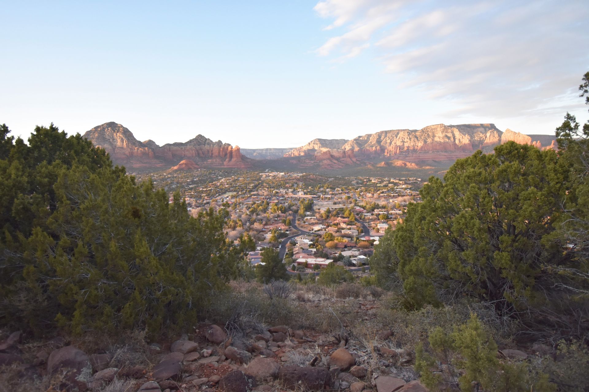
If you enjoy hiking, Sedona is an incredible place to get out on the trails. Within minutes of town, you’ll find hikes that lead to beautiful rock formations and desert landscapes. There are great hikes for all experience levels, and you're pretty much guaranteed incredible views. Even if you are not a hiker, I recommend exploring at least one trail if you’re visiting Sedona.
Sedona receives about three million visitors a year, and for good reason! There are mystical vortexes, delicious food and a whole range of outdoor activities. However, with the influx in people, you’ll also experience traffic, full parking lots and lines for popular photo spots. Therefore, it is important to plan ahead and have back-up plans to make the most of your time in Sedona.
I completed six incredible hikes during my three day trip to Sedona and am sharing all of the information on parking (it’s tough!), terrain and more.
If you are interested in some of the hiking gear I recommend, check out my ultimate day hike packing list!
Please make it a priority to Leave No Trace when exploring the outdoors. This includes leaving nothing behind, respecting wildlife, minimizing campfire impacts, respecting those around you, planning ahead and traveling on durable surfaces. For more details, read about the seven principles at lnt.org.
Tips for Hiking in Sedona
- Stay on the trail and leave no trace while hiking. Be respectful to the environment and do not litter or leave any trace that you were there.
- Parking is difficult at almost every trail. Arrive early (before sunrise) at the popular trails in order to get a parking spot. If possible, carpool with a buddy. Uber and Lyft are available in Sedona but have few drivers and are limited to cellular coverage.
- Sedona launched a shuttle to the popular trailheads in March 2022! This is a great way to avoid the stress of finding a parking spot in the popular areas. The shuttle runs year round from Thursday to Sunday. Plus, the shuttle is free!
- Bring plenty of water! Sedona gets very hot in the summer and has mild but warm temperatures the rest of the year. Make sure to carry a enough water to stay hydrated during your hike.
- Wear hiking boots or shoes with good traction. Many of the hikes listed are very rocky so good shoes are a must. If you’re looking for a new pair, I recommend Merrell as a brand to check out!
- Use Alltrails to find detailed descriptions of hikes and recent reviews of the trails. The premium version lets you download offline maps and ensure you’re on the right path.
- You will need a Red Rock Pass or another interagency pass, which includes the America the Beautiful National Park Pass, for parking at the trailheads in the National Forest. Display your pass in the windshield of your vehicle while you’re on the trails. The Red Rock Pass costs $5 daily, $15 weekly or $20 annually. You can purchase the Red Rock Pass at some of the bigger trailhead parking lots, a number of places in town or online at My Scenic Drives.
When to Visit Sedona
You can’t really go wrong with visiting Sedona anytime of the year. I visited in late February and it was a perfect balance between having amazing weather and slightly beating the crowds that visit in March and April. Spring and fall are the best times to go weather wise, but consider winter if you really want to avoid the crowds.
Sedona in the Spring
Spring is Sedona’s busiest season. Temperatures typically range from 80 degrees to 40 degrees Fahrenheit, making for amazing weather to enjoy the outdoors.
Sedona in the Fall
Autumn is a fabulous time to visit Sedona with temperatures ranging from the 70s to the 40s . You will also get to see some beautiful autumnal colors and experience fall activities like apple picking, hay rides and more.
Sedona in the Summer
The summer heat can be intense in Sedona. The highs are typically above 90 degrees Fahrenheit. Fast-moving thunderstorms are also common in July and August. Despite a few storms, summer is the perfect time to cool off by swimming in places like Slide Rock State Park.
Sedona in the Winter
Winters in Sedona are somewhat mild. There is sometimes snow but it rarely accumulates. The highs are generally in the 50s with lows in the 30s (Fahrenheit). The Red Rocks look beautiful dusted with a little snow and this tends to be the least crowded time of year.
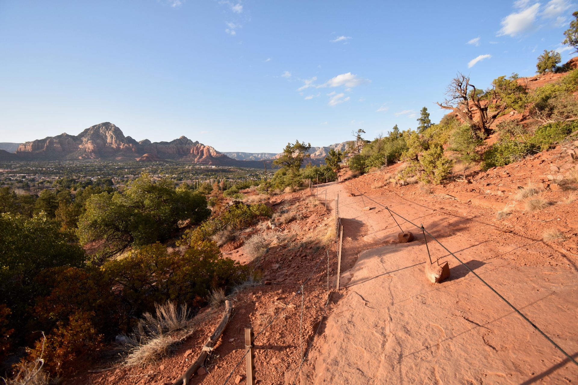
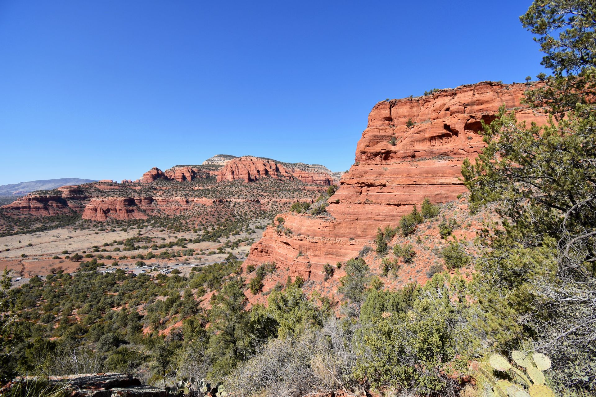
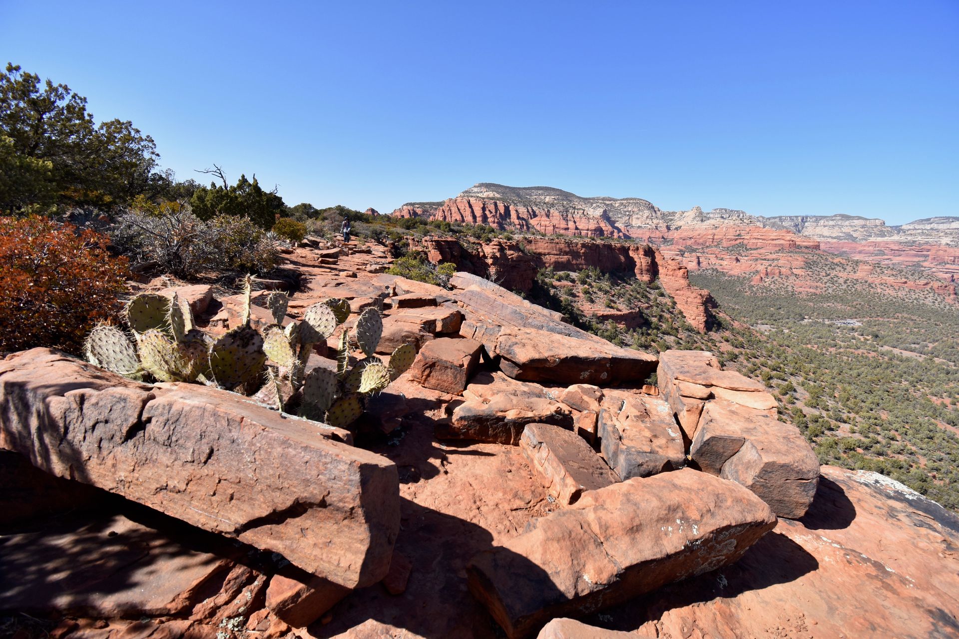
The Best Day Hikes in Sedona
Keep reading for details on the 6 trails that I've done in Sedona and information on the parking options for each one.
Cathedral Rock
- Distance: 1.2 Miles round trip
- Elevation Gain: 652 feet elevation gain
- Difficulty: Moderate - Strenuous
- Restrooms: Located at Trailhead
- Fee: Red Rocks Pass or America the Beautiful Pass displayed for parking. Pay station available at parking lot.
- Shade: None
- Best Time of Day: Sunset
Parking at Cathedral Rock
Parking is very tough at the Cathedral Rock trailhead. There are two small parking lots that have a total of about 40 spots plus about 10 more street parking spots. There are clear signs that you cannot park elsewhere in the neighborhoods nearby.
One alternative parking option is parking at the Sedona United Methodist Church, which is .7 miles down the road from the trailhead. They will ask for a donation and it’s not available on Sundays.
Another option is to take the Baldwin Trail or Templeton Trail and connect over to the Cathedral Rock Trail. The Baldwin Trailhead is a 20 minute drive from the Cathedral Rock Trailhead and has about 40 parking spots. The Baldwin Trail will add 3 miles to the hike. These three miles are flat and have great views.
If you decide to take the Templeton Trail, the trailhead is located at Bell Rock, a seven minute drive from Cathedral Rock. This trail will add five miles to your hike but the miles are flat and easy. These trails also get a lot of bike traffic.
If you don't want to stress about parking, you can take the Sedona Shuttle to reach this trail! It runs year round from Thursday to Sunday between 7AM and 530PM. Plus, it's free.
Details on the Cathedral Rock Trail
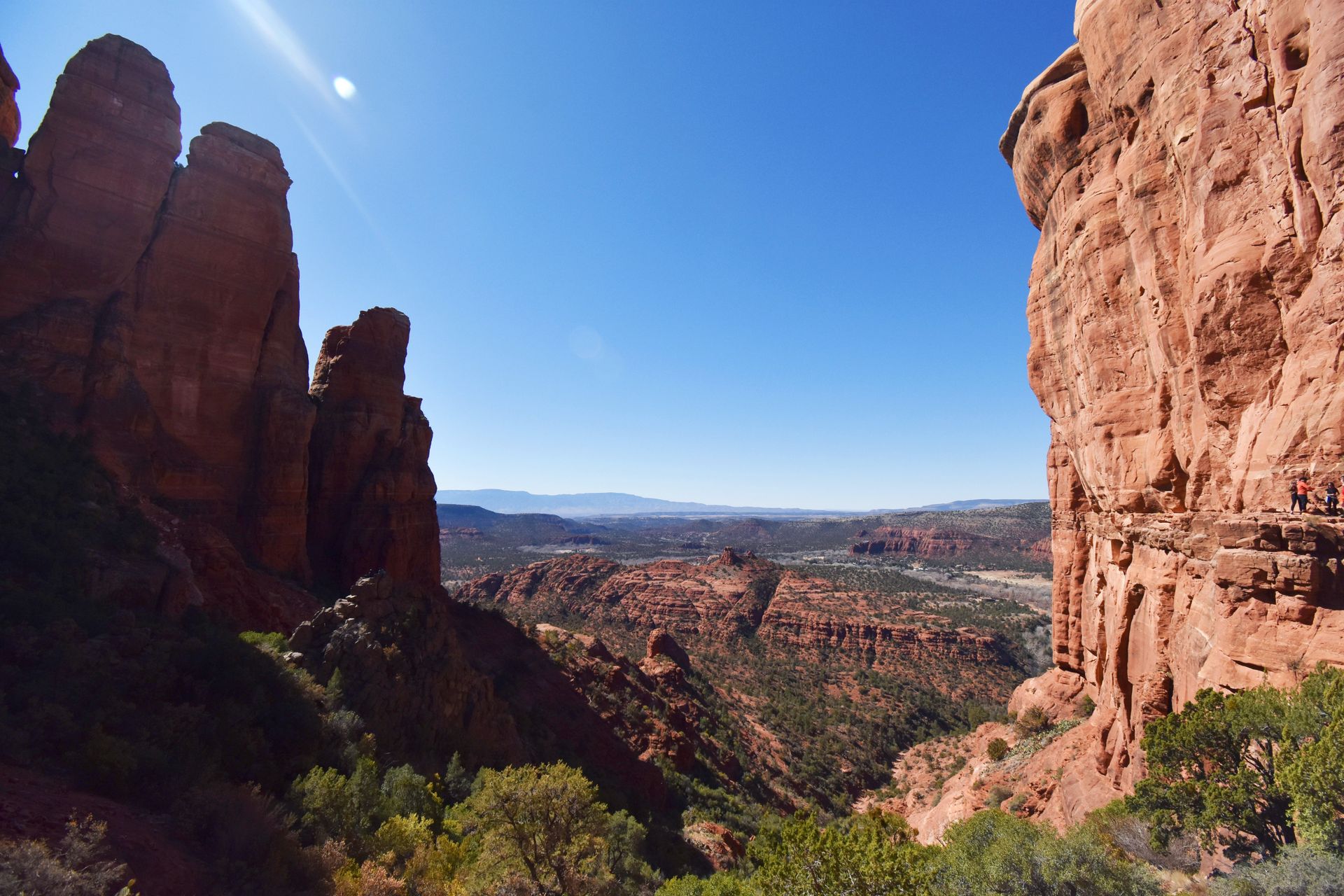
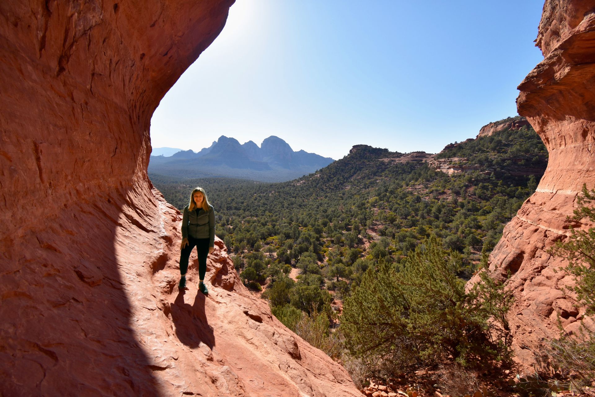
Cathedral Rock is an iconic Sedona hike with expansive views of the red rock valley. The trail is also home to one of the most powerful vortexes in Sedona, so you feel an influx in powerful energy while you’re there.
Don’t let the short distance fool you, the hike is difficult and involves some steep rock scrambling. The views are worth the climb but make sure you are prepared with sturdy shoes, plenty of water and a buddy. I saw some dogs on the trail but proceed with caution if you bring your pup. I think it would be extra difficult for them to climb the steep areas.
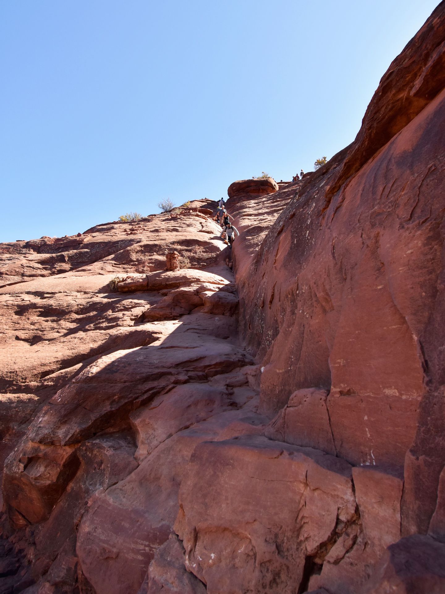
The trail quickly begins its ascend towards the view, with the last quarter mile being the most difficult. You will likely need to use your hands to pull yourself up a couple of times. One thing to look for during your climb is a glimpse of the Chapel of the Holy Cross in the distance. The church blends beautifully into the rocks but you can see it from afar.
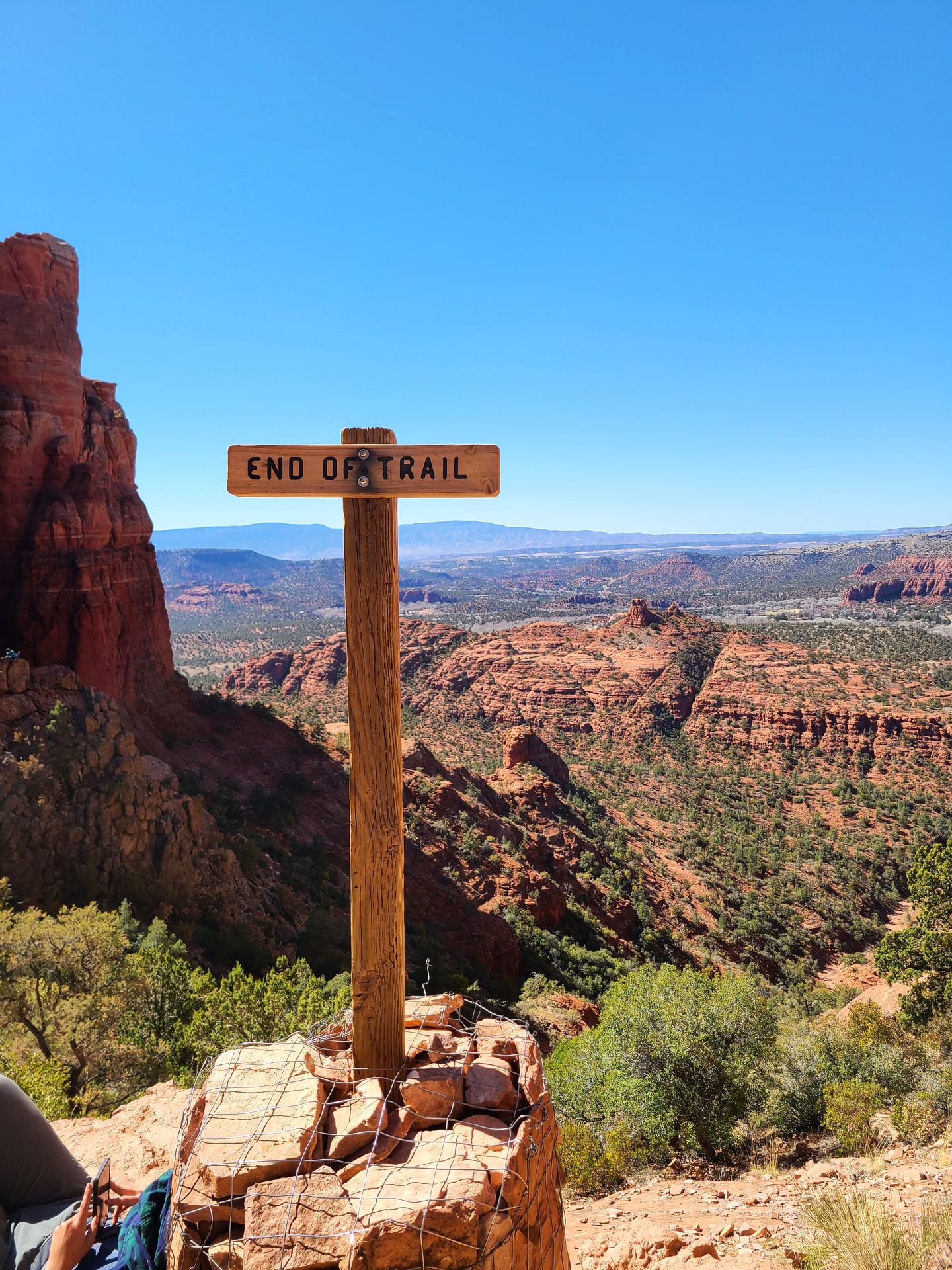
The trail has beautiful views throughout, but when you reach the top, you get to see the opposite side of the valley. It's an amazing feeling to reach the ‘End of Trail’ sign, stand amid the two large rock faces and see for miles.
At the top, there are a few places to sit and get photos from multiple angles. You could spend hours admiring the view but the top gets crowded depending on when you visit.
Sunrise is a great time for the hike to beat the crowds and sunset makes for an absolutely beautiful scene of the rocks and the valley. Cathedral Rock was my favorite hike but also the most difficult hike on this list. Know your limits and be prepared, but I highly recommend this trail if you are able!
Devil's Bridge
- Distance: 4.2 Miles round trip
- Elevation Gain: 564 feet elevation gain,
- Difficulty: Moderate
- Restrooms: Located at Trailhead
- Fee: Red Rocks Pass or America the Beautiful Pass displayed for parking.
- Shade: None
- Best Time of Day: Sunrise
Parking at Devil's Bridge
The parking lot for Devil’s Bridge has about 40 parking spots and fills up quickly. Arrive very early to ensure you get a spot. Luckily, there are many alternative parking options. One alternative is street parking, which begins about a quarter mile away on Boynton Pass Road.
Another great option is to park at the Mezcal Trailhead and then connect across using the Mezcal trail followed by the Chuck Wagon trail to the Devil’s Bridge Trail. This is actually about the same distance as the Devil’s Trailhead parking lot and offers a much more scenic and beautiful hike.
You can also leave your car parked here and go on additional trails, such as the Long Canyon Trail for the Birthing Cave. The only downsides are a lack of restroom and less total parking spots available.
If you have a high clearance vehicle, you can drive off the paved road up to a small parking lot that begins the actual Devil’s Bridge Trail. From here, the hike is less than a mile to reach the rock formation.
Details on the Devil's Bridge Trail
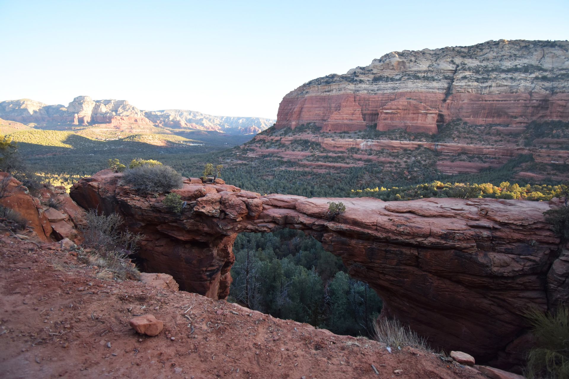
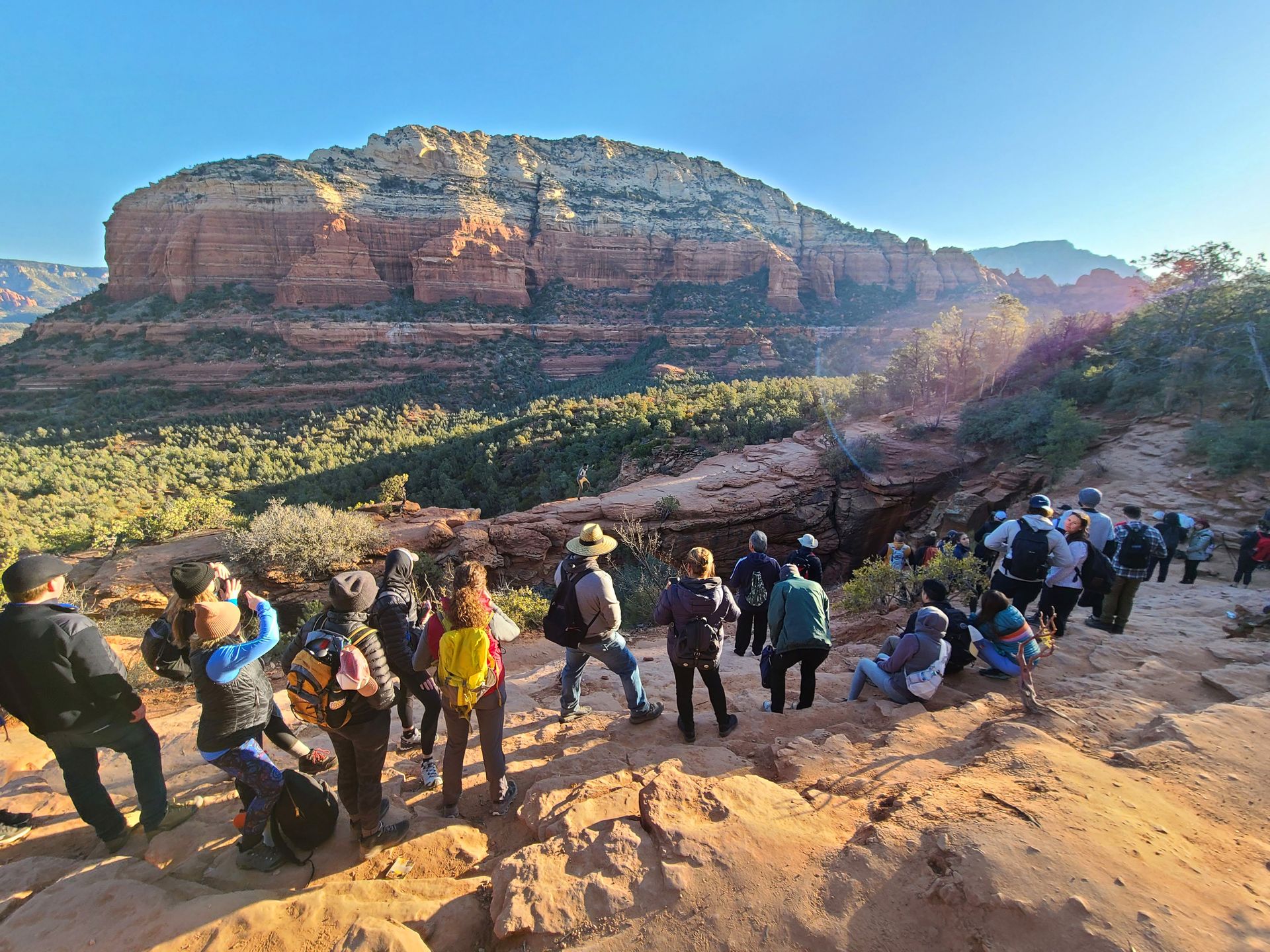
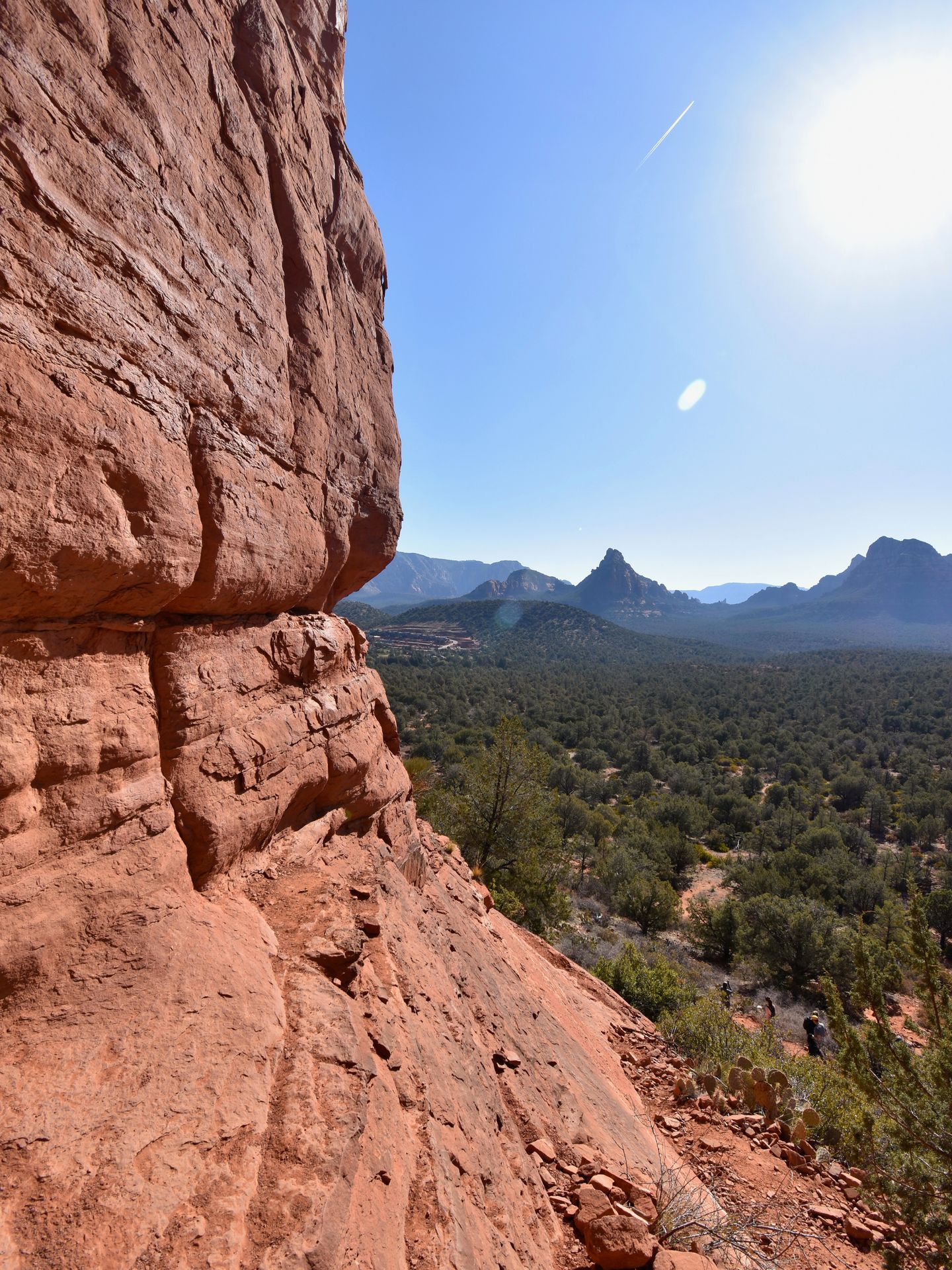
Devil’s Bridge is the most famous hike in Sedona, known for its iconic arch that you can walk upon like a bridge. The formation was created by a wind erosion slowly carving away the rock. This hike is extremely popular so the parking lot fills up quickly and there is usually a long wait to get a photo on the bridge.
If you take the dirt road trail from the Devil’s Bridge parking lot, the trail is about 4.2 miles round trip. You will turn off the road at 1.3 miles (it’s well marked!) and a quarter mile after that, begin a steep climb up to the bridge.
The steep portion of the hike is a half mile and there is some rock scrambling. I found this rock scrambling to be easier than the Cathedral Rock trail, but still a little difficult. Make sure you wear proper hiking shoes so you’ll have a good grip on the rocks.
When I reached the bridge a little before 7:30am, there was already a long line. We waited about 25 minutes to get our turn on the bridge. When you walk across the bridge, it feels wider than it looks from afar. Many people around us were nervous but I felt quite safe. When I left, the line had more than doubled in length.
While Devil’s Bridge is crowded, the views from the top were incredible. It’s definitely an iconic hike that you should at least do once!
Airport View Trail
- Distance: 1.4 Miles Round Trip
- Elevation Gain: 242 Feet
- Difficulty: Easy
- Restrooms: None
- Fee: $3 parking at top airport lot. At Airport Mesa lot, display red rocks pass or America the Beautiful pass
- Shade: None
- Best Time of Day: Sunset
Parking at Airport Mesa
The Airport Mesa itself has a very tiny parking lot with about 9 spots. If you cannot get a spot here, drive up the hill and park at the Sedona Airport. The airport has a large gravel lot with $3 parking. The Airport View Trail connects this parking lot with the Airport Mesa so it isn’t a huge deal from which side you begin.
Details on the Airport Mesa Trail
The Airport Mesa is a domed orange rock that you can climb for 360 views of Sedona and the surrounding valley. To get to the top, it is a very short trail with a railing at times. This is one of the most powerful vortexes in Sedona, so you may feel an intense energy or see others practicing yoga and meditation.
The Airport View Trail connects the mesa with the Sedona Airport Scenic lookout and has beautiful views throughout. It is .7 miles each way and gets a bit rocky and narrow at times.
At the top of the hill, the scenic lookout is across the street. The lookout offers an amazing vantage point of Sedona and is a great place to watch the sunset. It also has some telescopes you can use for magnified views. However, if you do visit at sunset expect large crowds.
Another option for trails here is the 3.2 miles Airport Loop Trail. This trail does a larger loop around the airport and passes the Airport Mesa. The Airport View Trail goes through the middle of the loop. The loop trail has amazing views and a variety of rocky landscape throughout the journey.
Soldier's Pass
- Distance: 4.7 Miles
- Elevation Gain: 830 Feet
- Difficulty: Moderate
- Restrooms: At Brins Mesa Trailhead, not at Soldier's Pass parking lot
- Fee: Red Rocks Pass or America the Beautiful Pass displayed for parking
- Shade: Partial
- Best Time of Day: Sunrise
Parking at Soldier's Pass
The actual parking lot for the Soldier’s Pass Trail is only open from 8am - 6pm. This parking lot is located in a residential area and only has about 15 parking spots. A line of cars typically starts waiting before 8am.
However, I’ve heard that police sometimes ask the cars to leave, forcing people to continue to circle the neighborhood. All this to say that getting a parking spot here is difficult and will take some luck.
Luckily, there are alternative options. I parked at the Jordan Trailhead on W Park Ridge Road. The area where I parked only had three spots but if you continue down the road there is a large parking lot for the Brins Mesa Trail. We were worried about our sedan on the rocky road but later saw that other sedans had made it just fine.
To get to this area, you’ll need to drive back through Sedona. It is a 15 minute drive from the Soldier’s Pass lot if you decide to switch after not finding a spot.
To connect to Soldier's Pass, take the Cibola Pass Trail from the Brins Mesa parking lot (or if you park where I did, the Jordan Trail and then the Cibola Pass Trail). The Cibola Pass trail adds a little over a mile round trip to the hike. The trail is easy and has wonderful views of the surrounding rocks.
Alternatively, you can park on the street near West Sedona School and walk 1.5 miles to the trailhead. Be careful to ensure you park in a legal spot, the neighborhood immediately surrounding the trailhead does not allow parking and it is strictly enforced.
If you don't want to stress about parking, you can take the Sedona Shuttle to reach this trail! It runs year round from Thursday to Sunday between 7AM and 530PM. Plus, it's free.
Details on the Soldier's Pass Trail
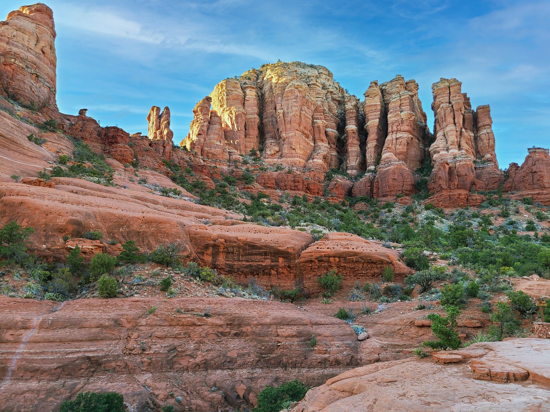
The Soldier’s Pass Trail was another one of my favorite hikes in Sedona. The trail is 4.7 miles long and has several points of interest. I began the hike at around 7am from Jordan Trail and was just ahead of the crowd of people who began from the parking lot at 8.
When I got to the caves around 8:30am, there were only a couple of other hikers already at the cave. While we were exploring the caves, about 20 people arrived who had begun the hike when the parking lot opened, so getting an early start really improved the experience.
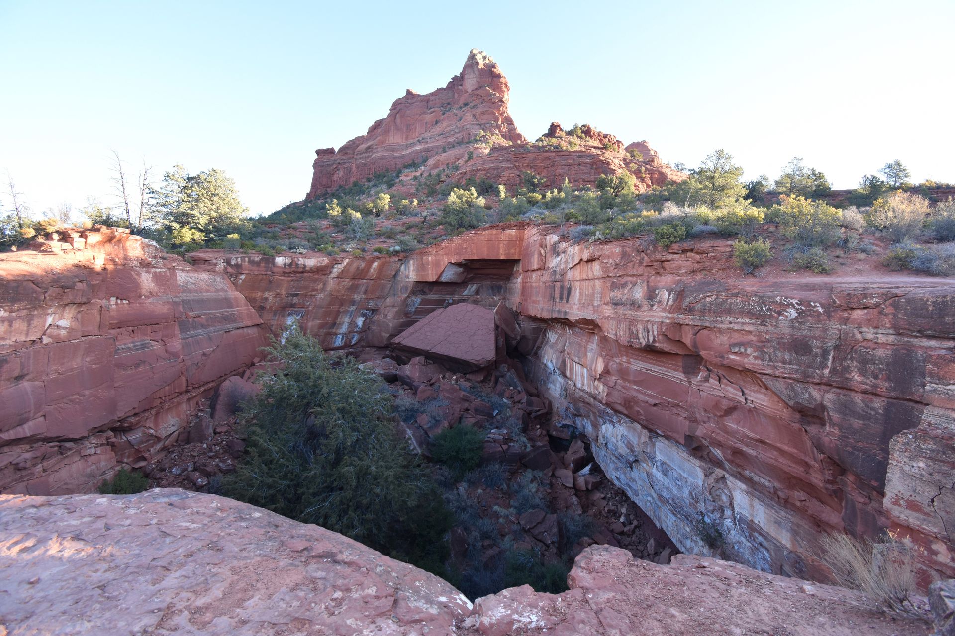
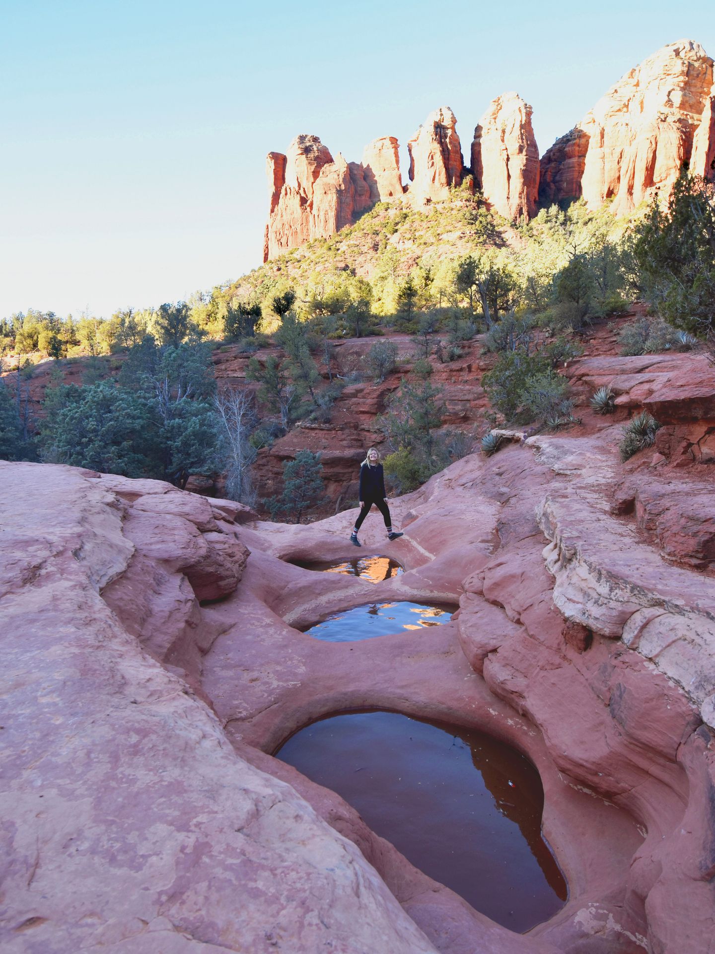
First, a quarter mile from the Soldier’s Pass Trailhead, you’ll go by the Devil’s Kitchen Sinkhole, 50 feet deep and 150-90 feet wide natural sinkhole. It was first recorded collapsing in the 1880’s and then more collapses enlarged the hole in 1989 and 1995. Experts predict there will be more wall collapses in the future, so be careful when visiting.
About a half mile into the trail on the left are the Seven Sacred Pools, seven pools that were naturally carved into the sandstone by a seasonal stream. The pools are an important water source for the wildlife in the area. This is a popular destination that can also be reached by jeeps so be prepared to wait for photos.
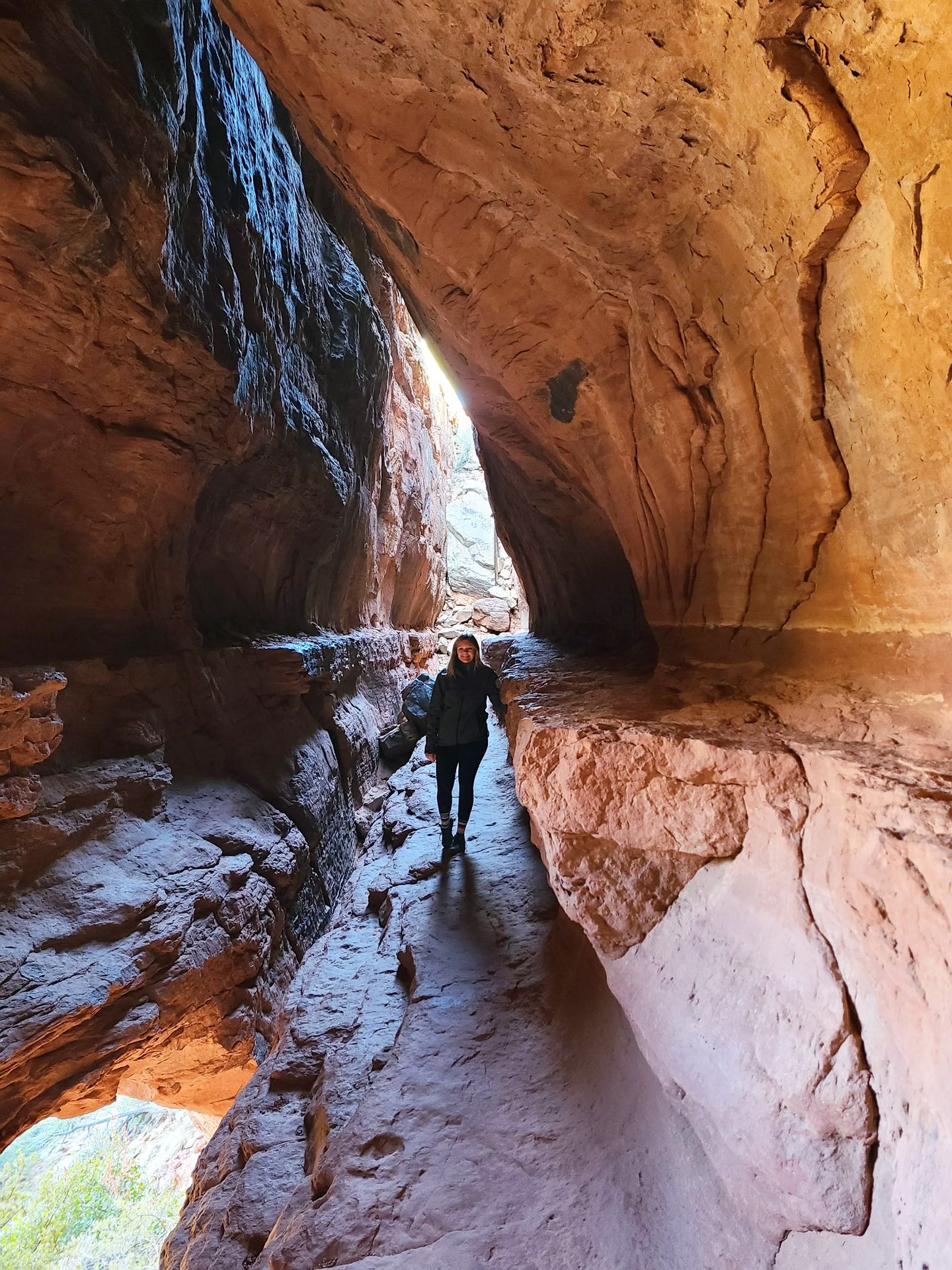
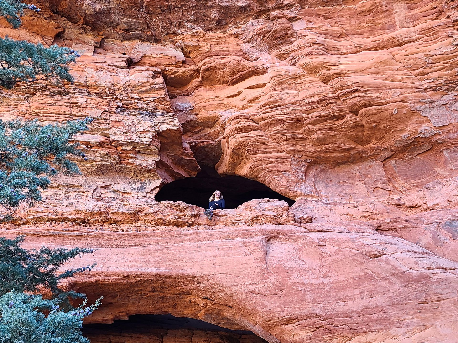
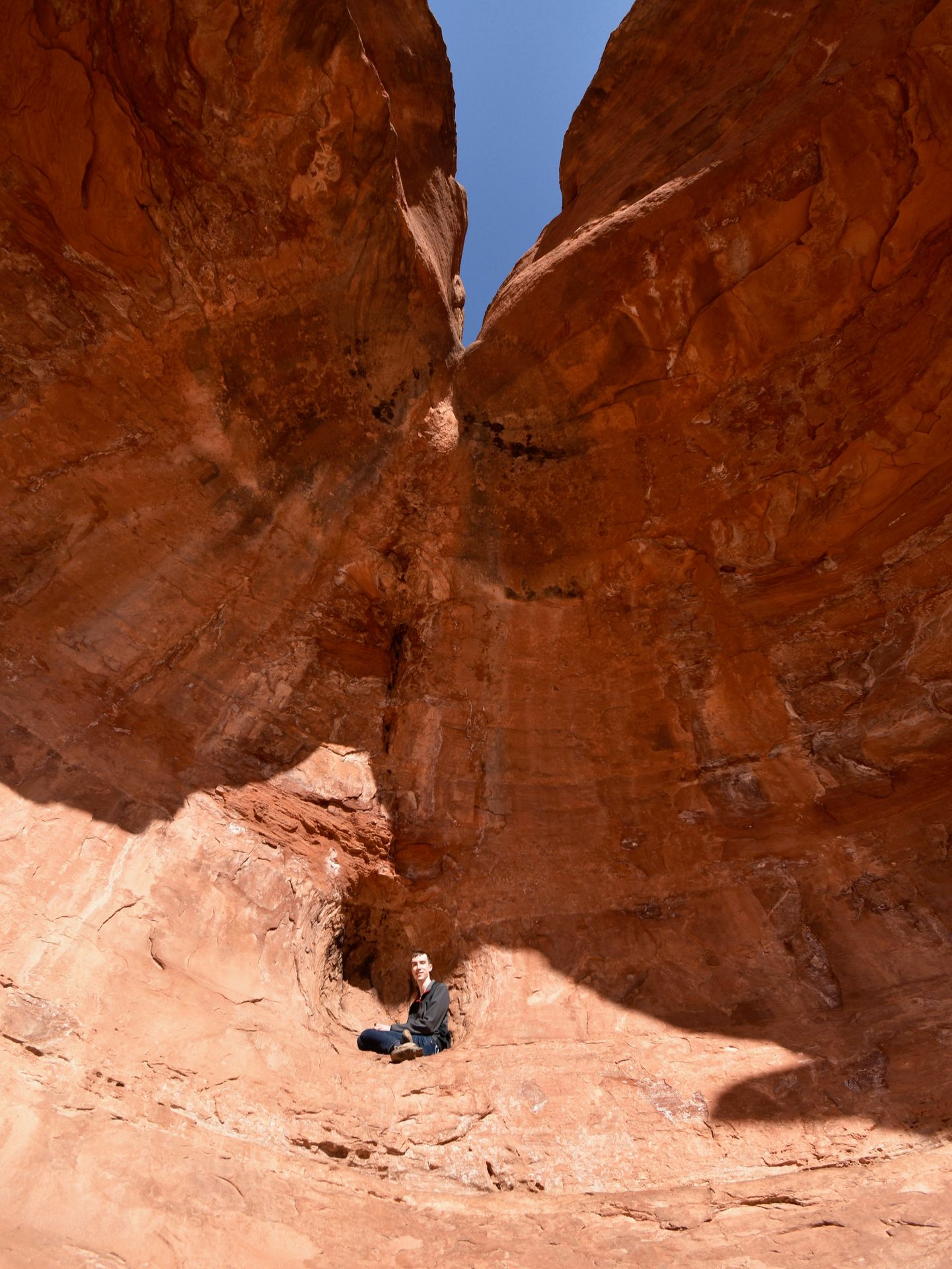
A mile and a half into the trail, you will start to see a series of caves in the distance. There is a fork in the trail that you should take to reach them. There are sometimes sticks across the path at this fork, use AllTrails to make sure you don’t miss it.
As you ascend up into the caves, you will see multiple caves in the rock faces. There is an area that you can climb up into the cave and explore, with views looking out at the valley. Be warned that the climb up into the cave is difficult with huge steps in between the rocks. I definitely struggled but made it.
After the fork for the caves, the trail continues for another mile. We turned back in the interest of time, but beautiful red rock views continue throughout.
Another thing you should be prepared for here is high winds. Since the trail is between two mountains, there are often heavy gusts funneling through the canyon. The wind was intense when I visited in February and I would have been much more comfortable with gloves and a scarf.
Doe Mountain
- Distance: 1.5 Miles
- Elevation Gain: 492 Elevation
- Difficulty: Moderate
- Restrooms: At Trailhead
- Fee: Red Rocks Pass or America the Beautiful Pass displayed for parking. Pay station available at parking lot.
- Shade: None
- Best Time of Day: Sunrise
Parking at Doe Mountain
Park at the Doe Mountain trailhead, which has a decent sized parking lot and some street parking. I did not have much trouble getting a parking spot on a Saturday afternoon. This parking lot is shared with Bear Mountain trail, a more difficult 4.9 mile hike.
Details on the Doe Mountain Trail
Doe Mountain was the least crowded hike I completed (by far!) and still had incredible views. The trail is just 1.5 miles and ascends up to the large flat top of Doe Mountain. The climb is steep with a few switchbacks and a bit of rock scrambling as you arrive at the top.
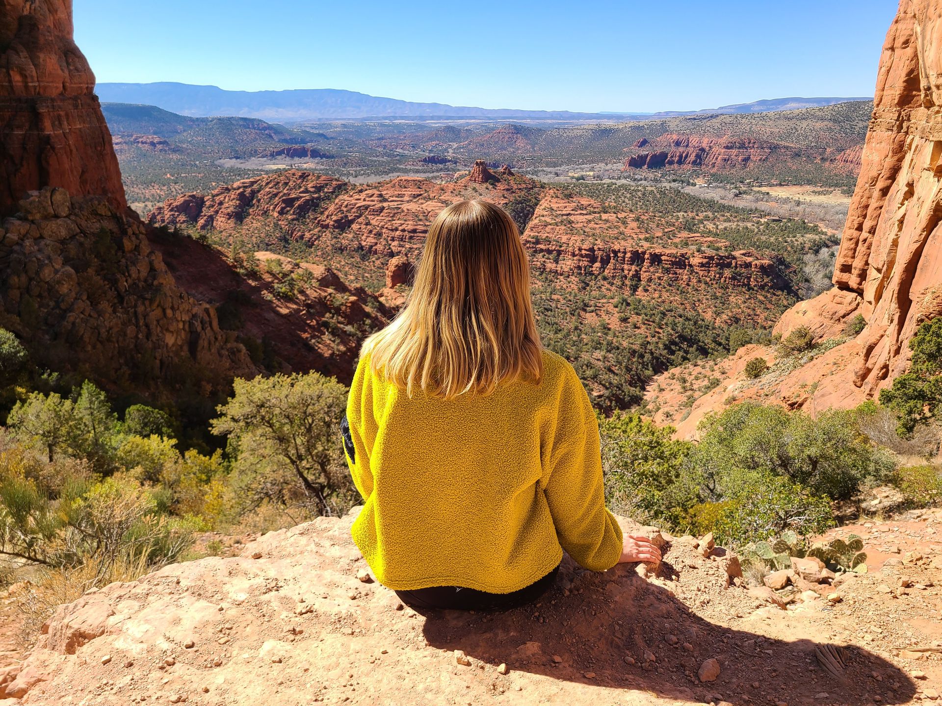
The views at the top are incredible. There is a huge amount of space to spread out and explore. When you first reach the top, you will have views of the Red Rock Valley looking in the direction of Devil’s Bridge.
If you keep walking towards the southeast, you will turn the corner of the mountain and see views of the city of Sedona. It is the perfect place to pack a picnic and enjoy amazing views while you eat.
If you do this hike at sunrise, you will have a great vantage point to watch the hot air balloons fly over the valley before you.
Birthing Cave
- Distance: 2 Miles
- Elevation Gain: 240 Feet Elevation Gain
- Difficulty: Moderate
- Restrooms: None
- Fee: Red Rocks Pass or America the Beautiful Pass displayed for parking
- Shade: Little
- Best Time of Day: Early to beat the crowds
Parking at Birthing Cave
The closest parking option is at the Long Canyon Trailhead. There you will find a limited number of spots here on both sides of the road. Alternatively, you can park at the Mescal Trailhead and take the Mescal Connector Trail. As mentioned above, you can park here for Devil’s Bridge as well! The connector trail is easy but does get a little narrow at times and is a popular route for bikers.
Details on the Birthing Cave Trail
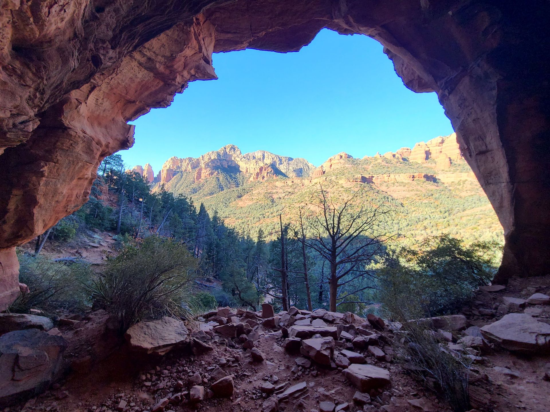
The Birthing Cave is a round cave nestled into a cliff that visitors can climb into for incredible views. The trail is two miles roundtrip. About .6 miles into the trail, there is a log that to the left that you’ll need to step over to get to the cave. After that, it will be less than a half mile until you arrive.
The trail is flat until the very end, when there is a steep climb into the cave. The climb is a little treacherous because there is slippery sand and cacti bordering the path. It is doable but take your time!
From the cave, there are amazing views looking out at the valley and the Red Rocks in the distance. If you’d like to get a photo sitting on the inside of the cave in front of the view, make sure you have shoes with good traction to navigate the edge of the cave walls. To get a photo looking out at the view with the entire cave in frame, you can climb up into a crevice in the back. Bring a wide angle lens if you have one!
This is a short and relatively easy hike that is in close proximity to other popular hikes, making it a good add on to your day. However, it was harder to enjoy and take photos with the group of the people in the cave, so go early if you want to have it to yourself.
More Hiking Trails in Sedona
These are the hikes highest on my list for my next visit to Sedona!
Bell Rock
The Bell Rock trail is 1.1 miles and another one of the powerful Sedona vortexes. It’s an iconic rock formation and a short hike with rewarding views. Many western films were shot here!
Fay Canyon Trail
Fay Canyon is a 2.6 mile, easy walk through a canyon that features a waterfall. It’s great for kids or anyone looking for hikes that are less strenuous.
Boynton Canyon Trail
The Boynton Canyon Trail is 6.1 miles, one of the powerful vortexes and is where you’ll find the popular “subway” tunnel cave (it looks like a subway platform).
Other Things To Do in Sedona
While I think the best thing to do in Sedona is hiking, there is so much more to do! Check out my three day itinerary of Sedona for recommendations on food, accommodations and other activities.
Final Thoughts
Sedona is a magical place that is full of gorgeous hiking trails and incredible views. Whether you are spending several days there or are passing through, be sure to treat this area with the respect that it deserves.
For more Southwest outdoor destinations, check out these blogs:
- How to Spend 3 Days in Sedona, AZ
- How to Spend 2 Days in Zion National Park
- An Epic Utah Mighty Five Road Trip
- How to Spend 3 Days in Moab, UT
- The Best Outdoorsy Things To Do in Tucson, AZ
- A Guide to Visiting Saguaro National Park, AZ
- A Guide to Visiting Petrified Forest, AZ
- The Best Things To Do in Kanab, UT
Thanks for Reading!


Let's stay in touch!
Join the Lost with Lydia email list to get monthly travel guides and tips!