If you're wondering about the best things to do in the Wichita Mountains, keep reading! This stunning and underrated region is an amazing getaway if you're looking for outdoor adventure.
The Wichita Mountains Wildlife Refuge makes up an area of over 50,000 acres in Southwestern Oklahoma. The region protects bison, longhorn cattle, elk, and other wildlife and is a popular place for outdoor recreation.
The Wichita Mountain range is over 500 million years old and has been enjoyed by people for centuries. It was officially established as a forest reserve and then a game preserve in the early 1900s, making it one of the earliest wildlife refuges in the US.
By just driving around the refuge, you will almost certainly see a lot of bison and Texas longhorn cattle. If you spend enough time, you may also see elk, prairie dogs, snakes, and other wildlife. Some of the refuge areas are only for wildlife, but a large portion of it is available for outdoor recreation such as hiking and rock climbing.
The Wichita Mountains make for an amazing weekend trip from Dallas or Oklahoma City! It is located 3 and a half hours from Dallas and an hour and a half from Oklahoma City.
The preserve is free to enter and open year-round. If you visit, be sure to plan by downloading offline maps, bringing plenty of food and water, and other necessities, such as services and cell reception are limited in this area.
Other things to note are that the speed limit is low when driving through the refuge. Be sure to obey the speed to protect wildlife and to avoid getting a ticket, as speeds are strictly enforced. In addition, this area is susceptible to wildfire. If you are camping, be sure that you know the current fire restrictions and follow the rules accordingly.
Finally, check the Wichita Mountain Wildlife Refuge Facebook page for current conditions. They sometimes close the preserve for controlled hunting and keep the Facebook page more up to date than the Forest Service website.
Please make it a priority to Leave No Trace when exploring the outdoors. This includes leaving nothing behind, respecting wildlife, minimizing campfire impacts, respecting those around you, planning ahead and traveling on durable surfaces. For more details, read about the seven principles at lnt.org.
When to Visit the Wichita Mountains
Temperatures in the Wichita Mountains can be hot in the summer but are not unbearable if you’re used to heat. Summer highs are typically in the 90’s°F and lows are in the 60’s°F.
The spring and fall months are the best time to visit, with average temperatures of highs in the 70’s°F and lows in the 40’s°F. I visited in late October and had nice weather.
In the winter, snow is uncommon but typically occurs a couple of times a year. Average lows are in the 20’s°F and highs are in the 40’s°F and 50’s°F.
Where to Stay near the Wichita Mountains
Camping in the Wichita Mountains
The main camping area in the wildlife refuge is the Doris Campground, which has both electric and non-electric campsites. The campground is located next to Quanah Parker Lake and will give you close access to many of the trails in the area.
If you like camping, I would recommend staying here for a peaceful weekend where you can disconnect and enjoy the scenery. Note that there is no cell service here and you should book ahead of time at peak times.
Hotels in Lawton/Ft Sill
Lawton/ Ft Sill is the closest city to the wildlife refuge and offers a variety of chain hotel options for any budget. I have stayed at the Hilton Garden Inn and thought it was very comfortable and nice. The town is about a 30 minute drive from the refuge.
Cabins in Medicine Park
Medicine Park is a charming small town located just outside of the Wichita Mountains. It has a population of fewer than 500 people and is located on the banks of Lake Lawtonka. It is a wonderful place to rent a cabin for a couple of nights and be close to both outdoor recreation and local restaurants. You can find a variety of cabins on Airbnb, Booking.com, or Medicine Park Rentals.
Hiking in the Wichita Mountains
Below are the hikes that I did and the ones on my list for next time. If you have AllTrails Plus, this is a good place to make sure offline maps are downloaded. Some of the trails throughout the refuge are not well marked. Also be prepared with plenty of water, sun protection, and the rest of the ten essentials.
Forty Foot Hole
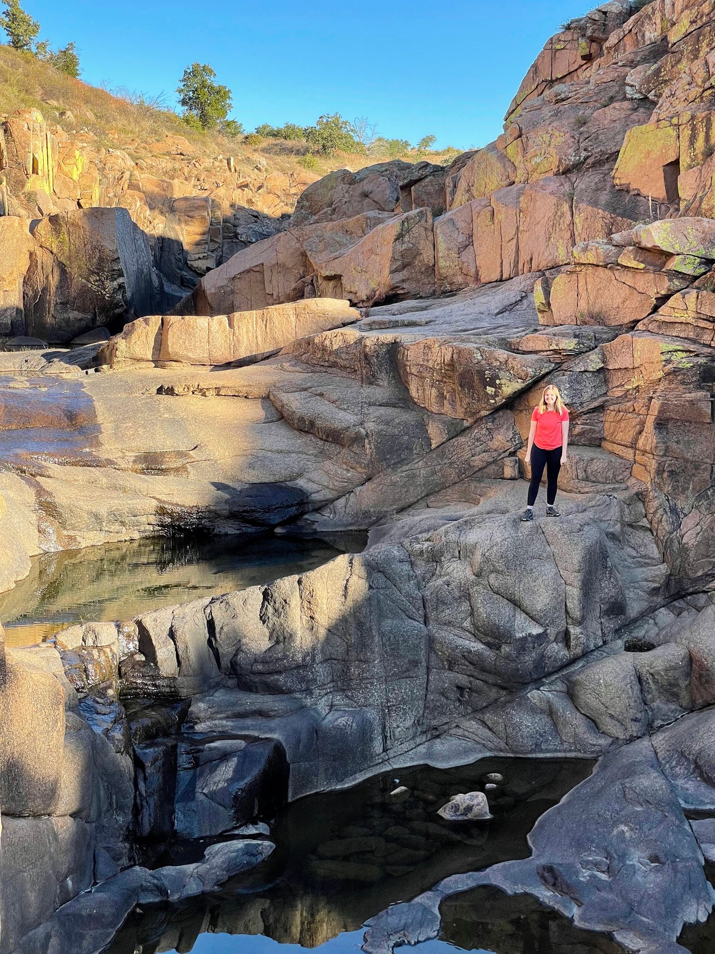
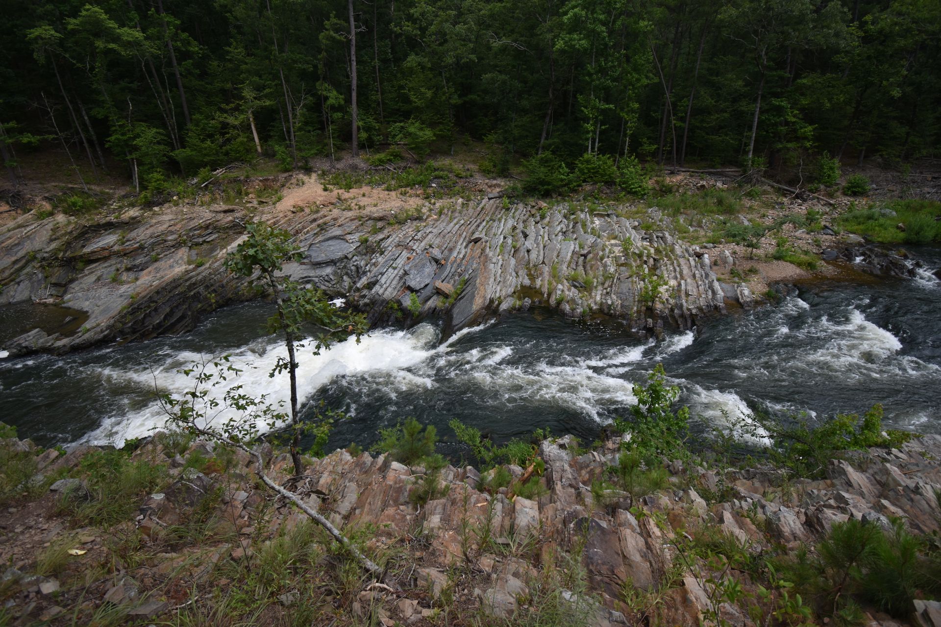
This might be the prettiest place in Oklahoma! The 40 Foot Hole Trail is a 1.4 mile that leads to a canyon carved by West Cache Creek. The trail has 154 feet of elevation gain and is rated easy. It follows the rim of the canyon and the walls get further on the trail.
Along the way, look across the canyon and up onto the hill for the chance to see wildlife. I saw several bison and longhorn off in the distance. When you reach the “hole,” there is a place to climb down into the canyon. This is the most difficult part of the trail and involves some rock scrambling.
When you are on the floor of the canyon, you can enjoy views of the creek trickling down the rocks and potentially see a waterfall during certain times of the year. The canyon is beautiful in all directions and a fascinating place to explore. If you only have time for one or two hikes, this one provides a lot of bang for its buck in terms of length and beauty.
I started the trail around 8:30 AM and had it to myself until I was on my way back. Go early if you want solitude because the trail can get crowded. There are restrooms and picnic tables at the parking area and you might even see longhorn grazing among the picnic area. Be sure to stay aware of your surroundings.
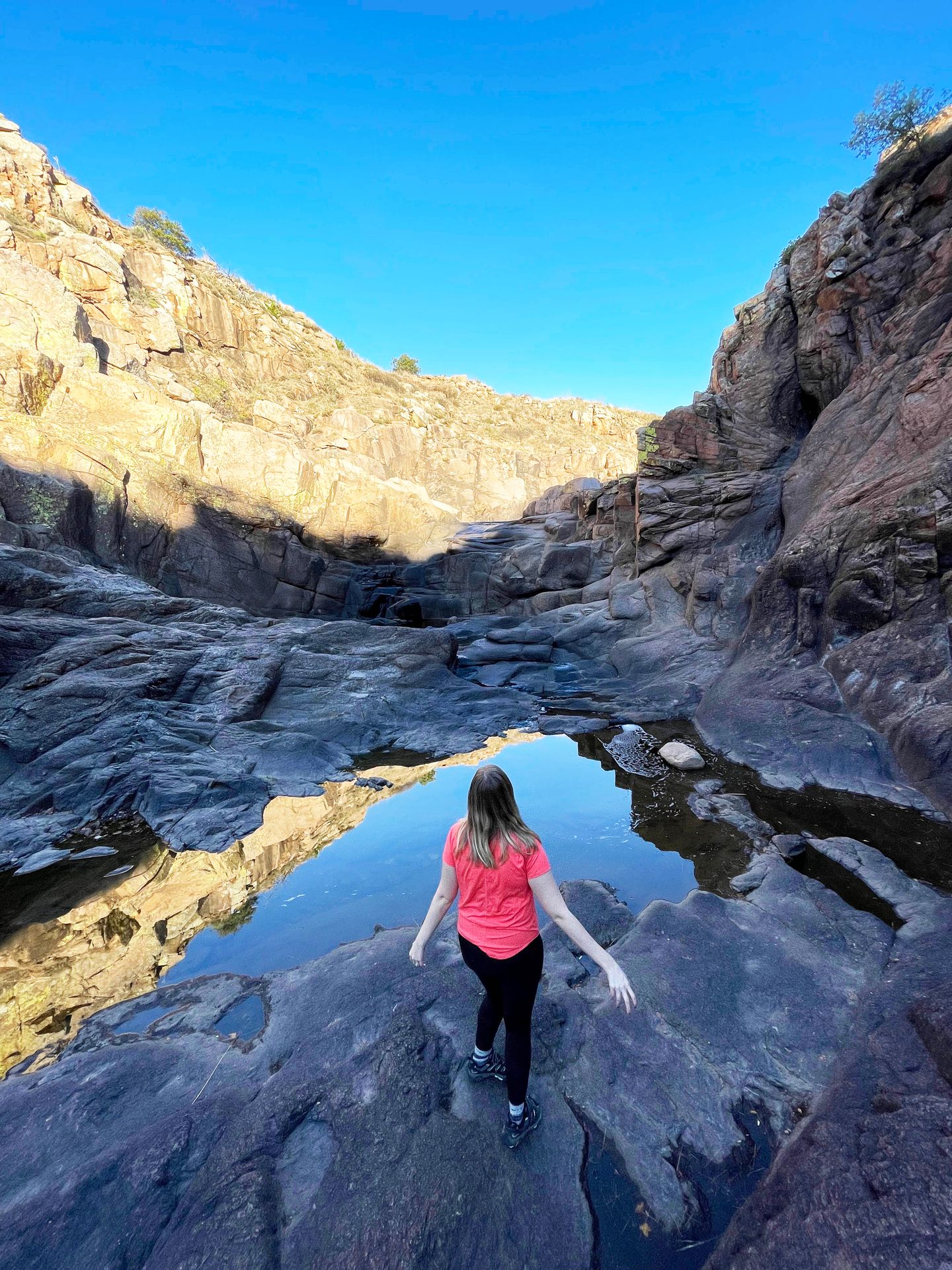
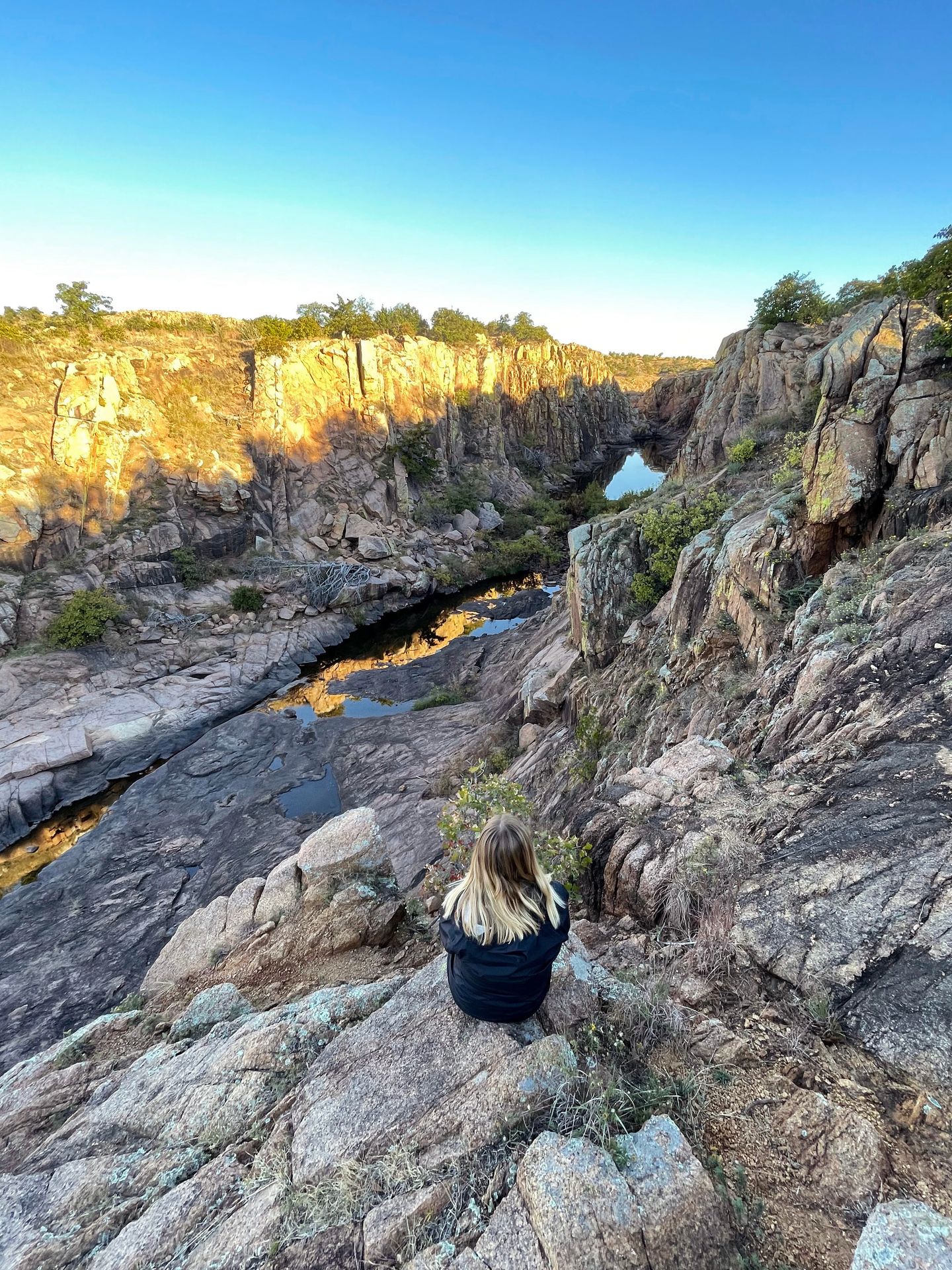
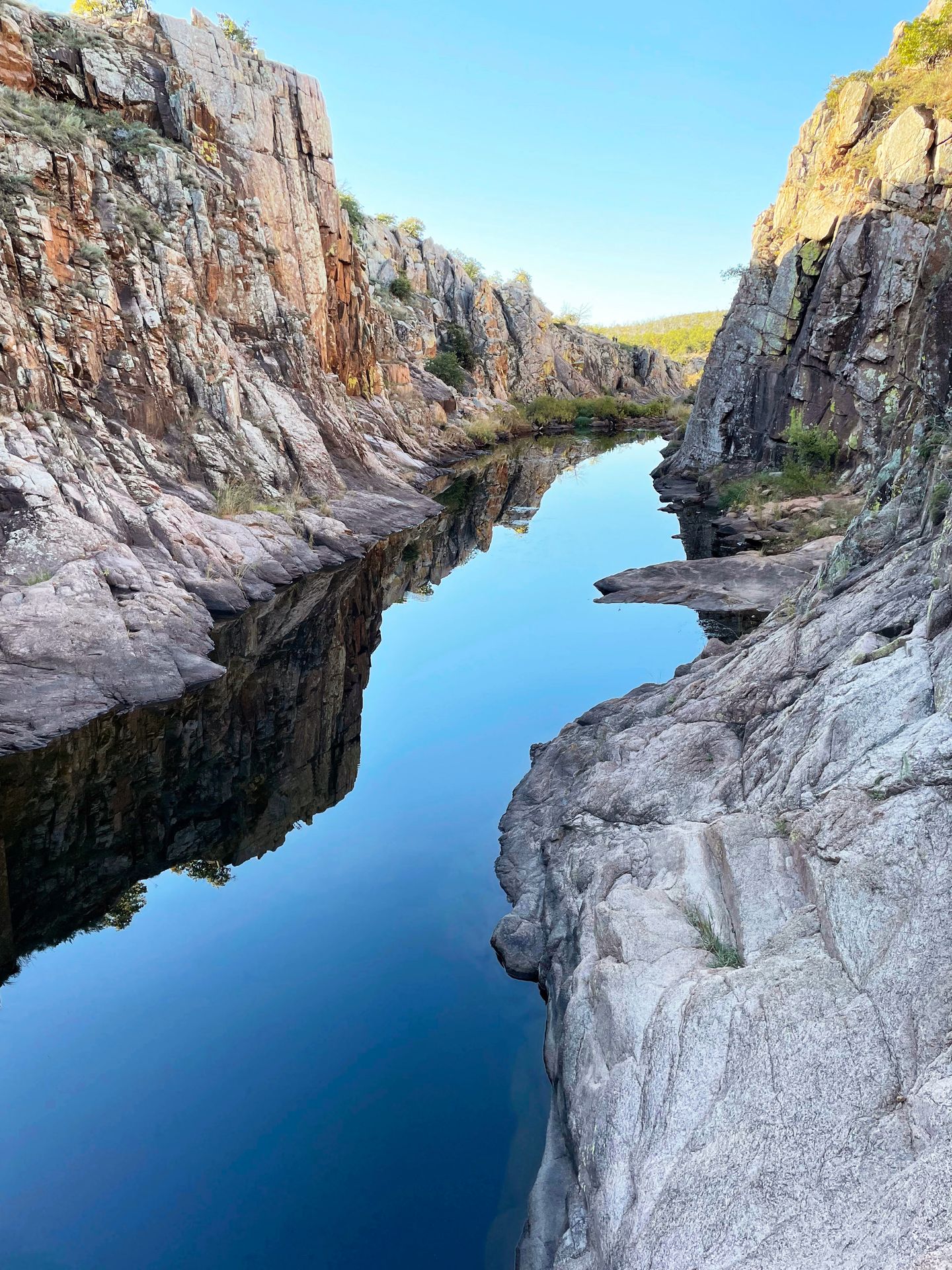
The Narrows
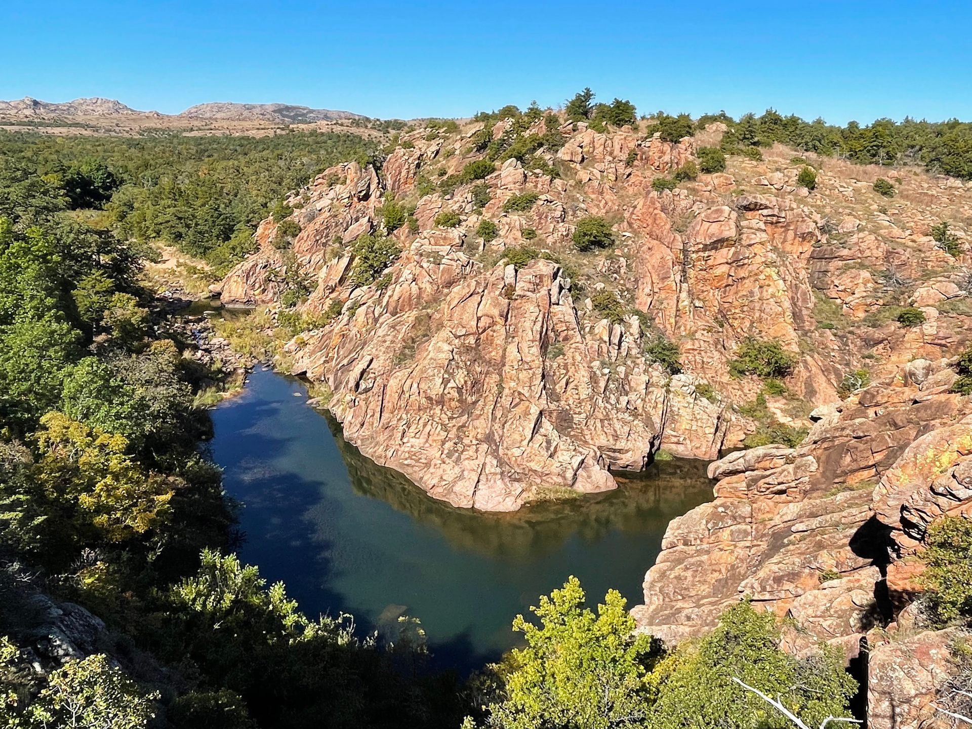
The Narrows is a 2.7 mile trail that begins right down the road from the Forty Foot Hole trail. The trail is rated moderate and has 262 feet of elevation gain. The path follows along a rocky creek bed and provides amazing views of the canyon walls carved by West Cache Creek. The trail will mostly follow along the water, but about a half-mile in there is a viewpoint with an amazing view of a bend in the river down below.
This trail is stunning and worth doing! Note that the parking lot is a bit small and there are restrooms at the trailhead.
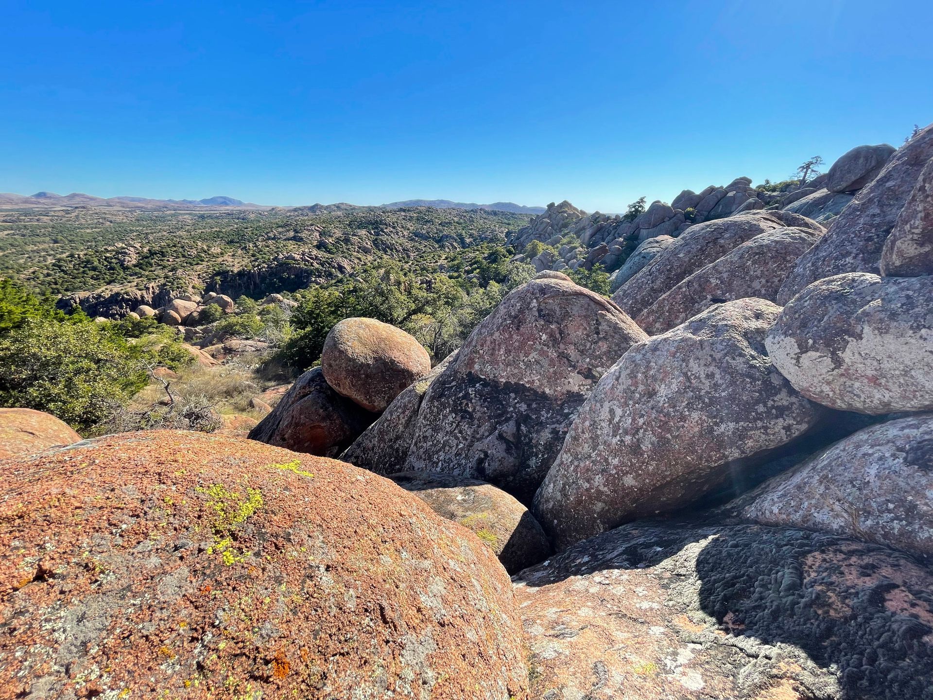
Eagle Mountain
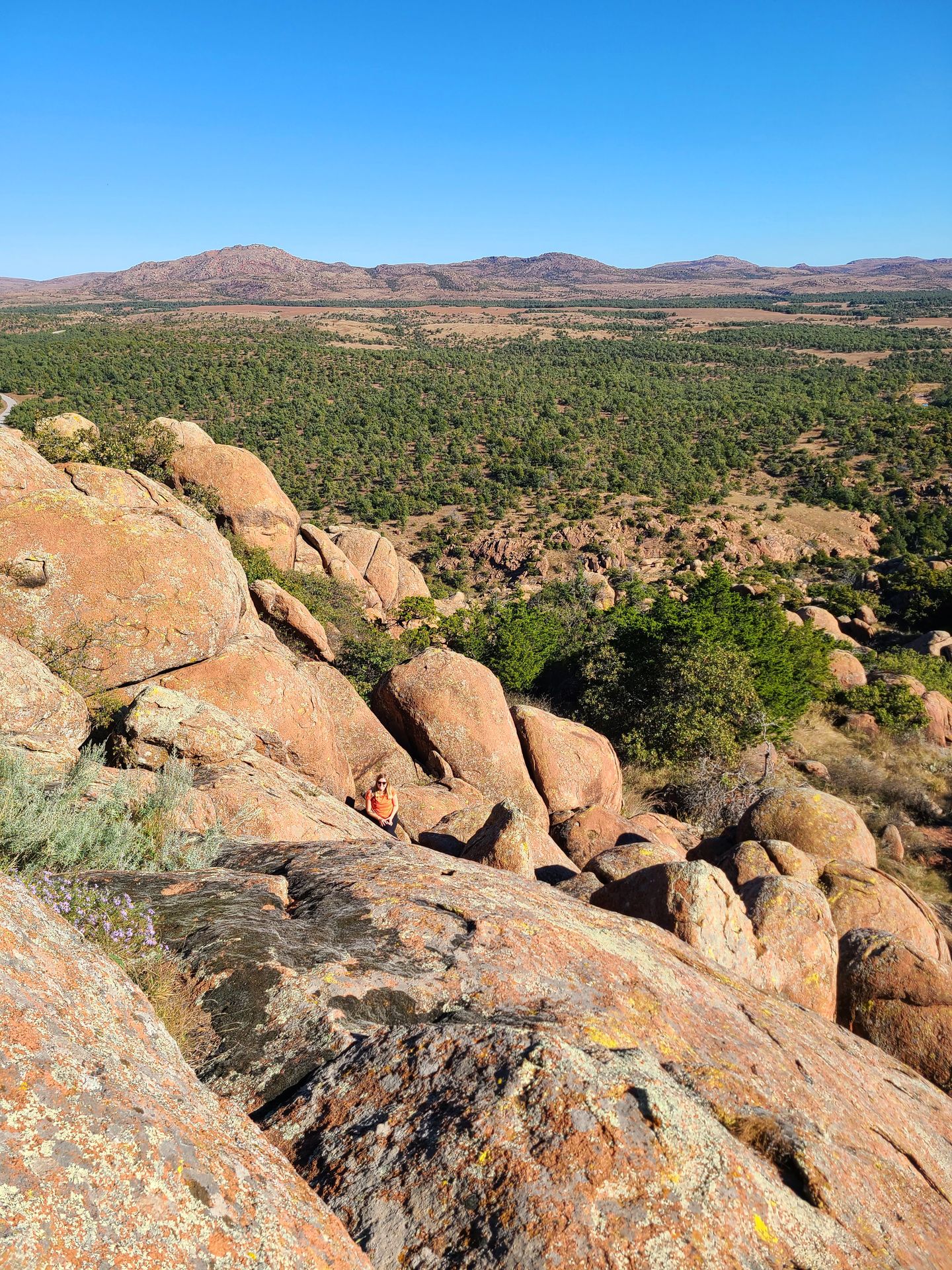
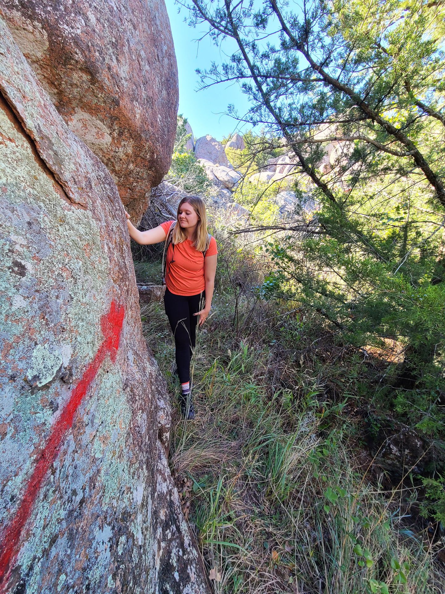
The Eagle Mountain Trail is quite an adventure. The trail is difficult to navigate, involves a lot of rock scrambling and it can be easy to get lost. Use caution and only attempt if you are an experienced hiker.
The trail begins from the Boulder cabin (the same starting point as The Narrows) and you will quickly follow a fork in the trail to the right. You will cross a creek and then take a narrow forested trail that leads up the mountain. As you ascend the mountain, look for red arrows painted onto the rocks. They are sometimes spread out and difficult to find but do your best to follow them. When we were almost to the end of the trail based on the AllTrails map, the red arrows disappeared and the trail turned into giant boulders that became much more difficult to climb.
If you are comfortable continuing, you can climb over a few of the boulders for a 360 view of the opposite side of the mountain. Do your best to keep close track of the way that you came up because the trail is difficult to find to make your way back down. I didn’t find the views to be quite worth the trouble of following this trail, but it’s a great one if you are the adventurous type who wants to get off the beaten path a bit.
If you want to hike to Eagle Mountain, wear long pants and sleeves (there are a lot of overgrown areas), download offline maps, go with a friend or tell someone where you’ll be, allow extra time in case you get lost, and keep close track of the way you came up.
Other Trails
I didn’t have time for these trails, but they’re next on my list!
- Elk Mountain: 2.3 miles, 570 feet of elevation gain, and rated moderate.
- Charon’s Garden: There are two ways to get to the top and one is more difficult than the other. The easier way is 4.7 miles, 459 feet of elevation gain, and rated moderate.
- Bison Trail: 6.1 miles, 416 feet of elevation gain, and rated moderate.
- Little Baldy: 0.8 miles, 157 feet of elevation gain, and rated moderate.
Non-hiking Activities in the Wichita Mountains
Mount Scott
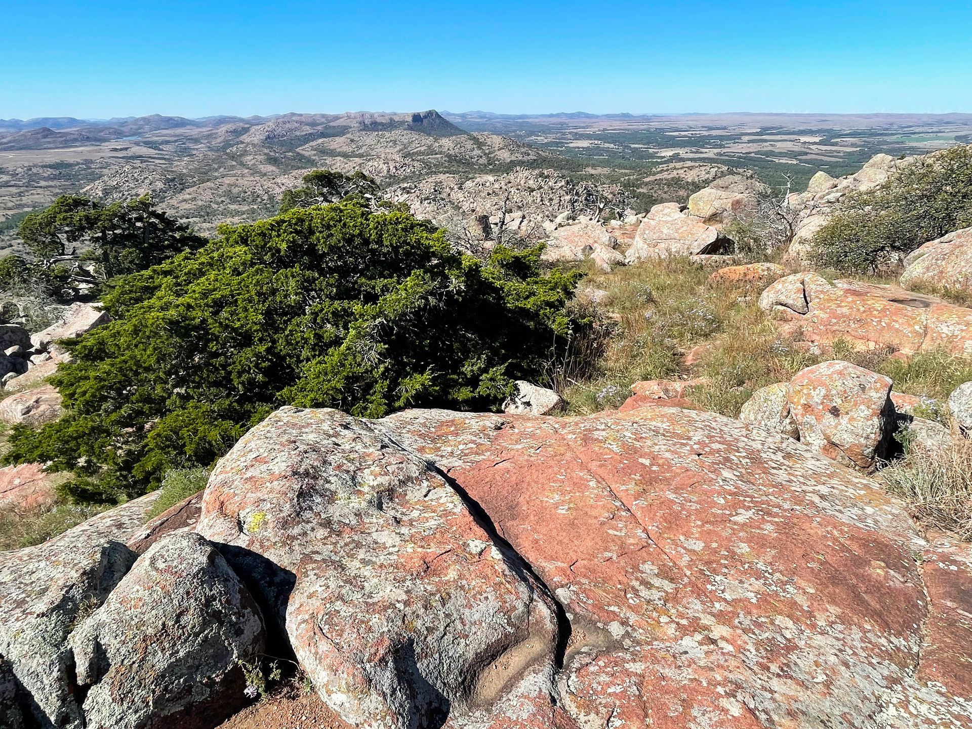
The drive to the top of Mount Scott is a must while you are in the Wichita Mountains. Mount Scott reaches an elevation of 2,464 feet and is the second highest peak in the area. The viewing area at the top offers incredible views with no hiking required.
To reach the mountain, take the windy but beautiful drive to the top. Be sure to check the hours ahead of time because the road closes to cars on Friday, Saturday, and Sunday mornings to allow for hikers and runners to use the road without cars.
When you reach the top, there are 360 views of the nearby mountains, Lake Lawtonka, farmland, and more. You can explore each side of the mountain and climb over boulders, or just stay on the paved sidewalk. This is a popular place for photography and there is a pretty large parking lot at the top.
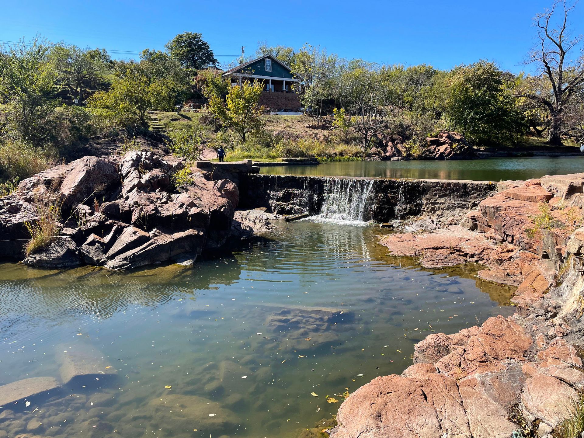
Quanah Parker Dam and Lake
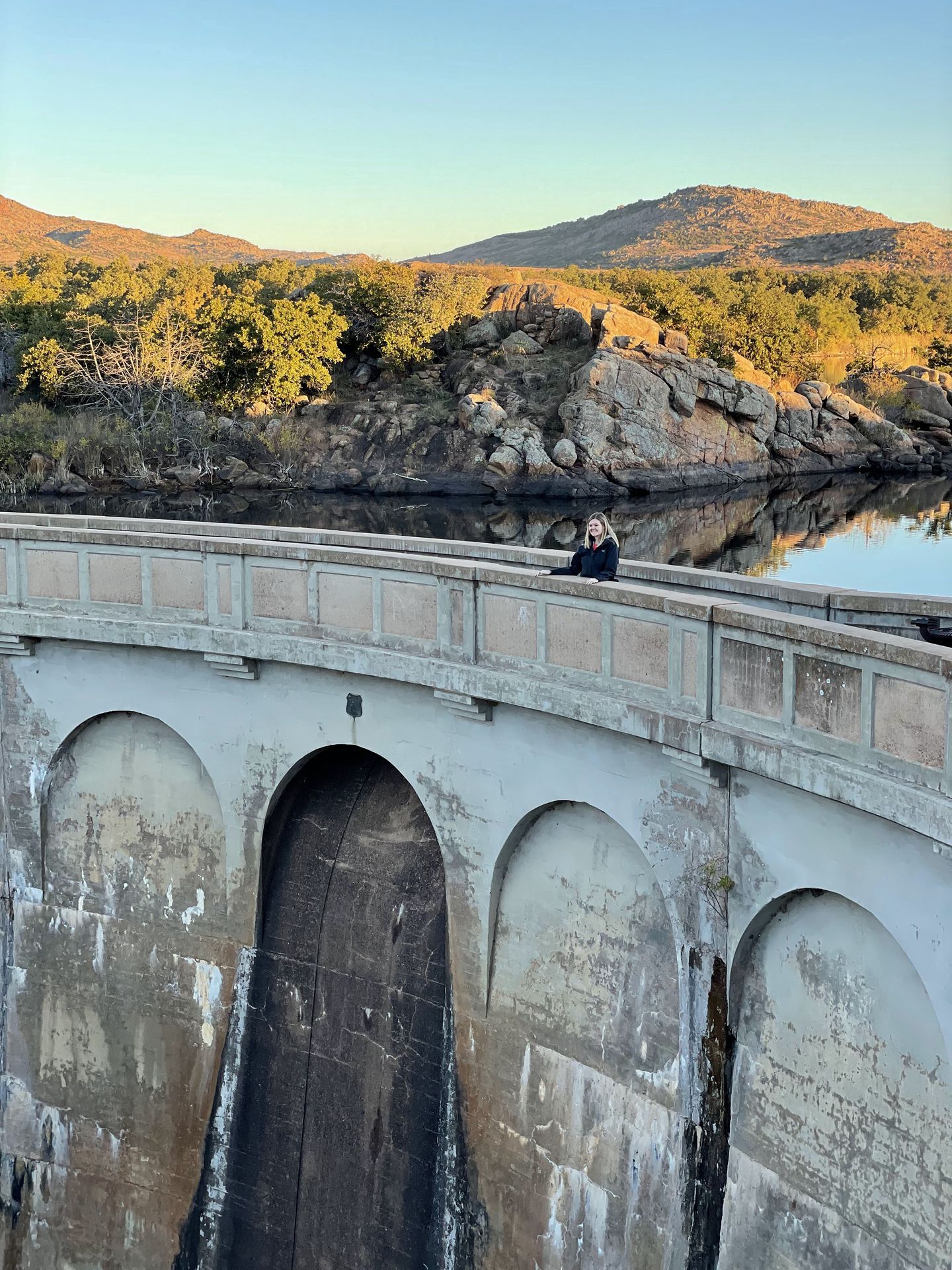
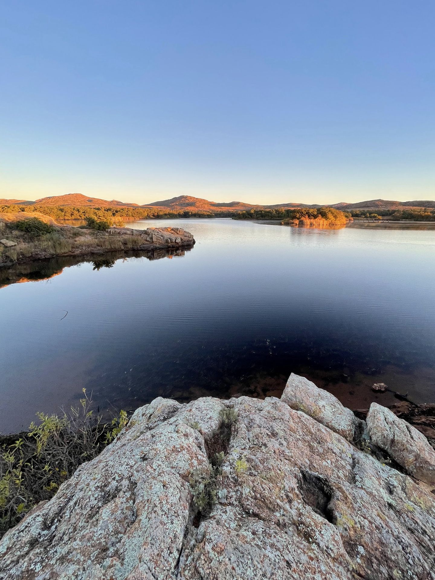
The Quanah Parker Dam is an interesting bit of architecture that was built in 1936. It also marks the beginning of the Little Baldy trail. You can walk across the dam and enjoy views of the lake. If the conditions are right, you can see a beautiful reflection of the mountains on Quanah Parker Lake.
Prairie Dog Town
There is a prairie dog town in the wildlife refuge that is worth a quick stop. It is located right off of OK-49 and you can see several prairie dog burrows from the viewing area. They are so cute and interesting to watch! Just make sure not to feed them.
Visit Medicine Park
Medicine Park is a great place to have a meal, a treat, or a drink after a day of hiking. The town is known as America’s cobblestone community due to the abundance of cobblestones found in the area and you’ll see the stones used in most of the structures around the town.
The town was established in the early 1900s as a resort town and attracted many outlaws and bootleggers during the 1920s. Today, it is a vibrant community that has several restaurants, food trucks, and bars.
I enjoyed ice cream from Cobblestone Creamery and would love to eat at Riverside Cafe during my next visit. In the summertime, many people come to swim on Bath Lake.
Nearby the Wichita Mountains
Quartz Mountain State Park
Quartz Mountain State Park is located about an hour west of the Wichita Mountains and is another beautiful place for hiking. Quartz Mountain offers an ATV riding area, a lake for boating, hiking trails, rock climbing, and more. It’s a great place to combine with a trip to the Wichita Mountains if you have enough time.
Final Thoughts
I hope this Wichita Mountains guide helps you plan an epic trip to the area. Whether you're taking a day trip from Dallas or camping as a weekend getaway, this is a beautiful area full of great trails and wildlife. It's an underrated gem that deserves a visit.
For more Oklahoma travel ideas, check out these blogs:
A Guide to Visiting Beavers Bend
A Two Day Itinerary for Oklahoma City
Thanks for Reading!


Let's stay in touch!
Join the Lost with Lydia email list to get monthly travel guides and tips!