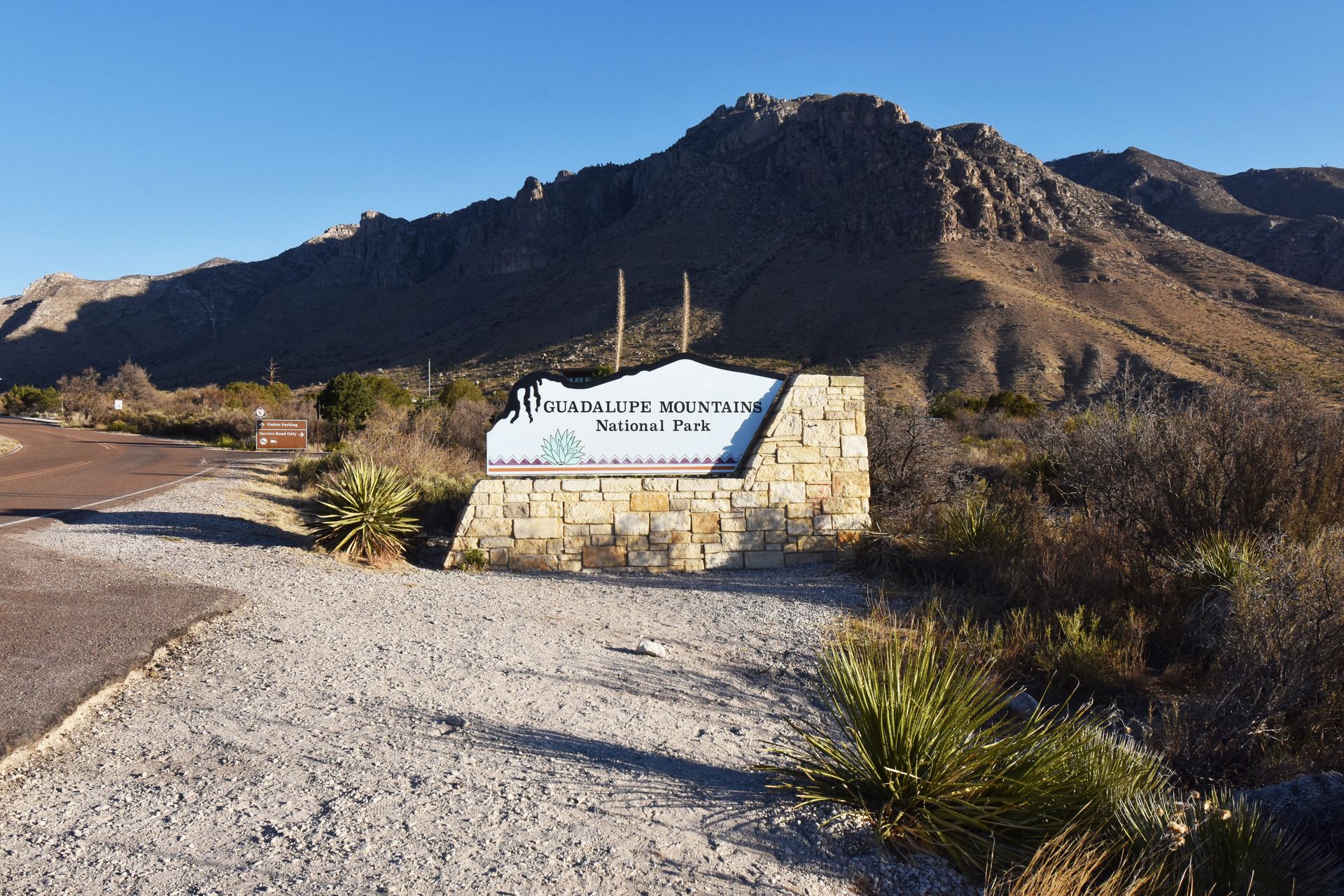
Guadalupe Mountains National Park is one of the less crowded national parks: it receives less than 200,000 visitors a year. This makes this mountain range an epic place to escape the crowds and enjoy some mountain therapy.
The park is sits on the Texas and New Mexico border and is known for its mountains that stand over 3,000 feet above the Chihuahuan Desert. The park is home to the tallest peak in Texas (Guadalupe Peak) and is home to the iconic El Capitan Cliff, which is 1,000 feet tall. While the mountains are the star, the park is also home to sand dunes, the fossils of an ancient reef and miles of backcountry areas.
The Guadalupe Mountains are essentially in the middle of nowhere, located 2 hours from El Paso and 45-55 miles from the nearest gas station. The area surrounding the park is not super built up for tourism, so be prepared by bringing your own food and water, saving offline maps and arriving with a full tank of gas.
With the right prepation, this is an amazing and underrated national park. This is based on my visit to this Texas national park in the Spring of 2021.
Please make it a priority to Leave No Trace when exploring the outdoors. This includes leaving nothing behind, respecting wildlife, minimizing campfire impacts, respecting those around you, planning ahead and traveling on durable surfaces. For more details, read about the seven principles at lnt.org.
Tips for Visiting Guadalupe Mountains National Park
-
It costs $10 per person to enter the the Guadalupe Mountains. If you'll be visiting multiple national parks over the course of a year, I always recommend getting the America the Beautiful pass. There is no entry gate in the park so you’ll pay for your entry at the visitor center or at a permit station in the parking lot if the visitor center is closed.
-
Before traveling to Guadalupe Mountains, save clocks for both Mountain Time and Central Time. The park is right on the border of the two time zones and my phone kept switching back and forth. There is a Verizon cell tower very close to the Pine Creek Visitor Center, providing good cell service inside of the park and while driving nearby.
-
The Guadalupe Mountains region is quite remote so it is important to be prepared with a full tank of gas and other necessities. From the Pine Springs Visitor Center, the nearest gas stations are in Carlsbad (55 miles away) and Van Horn (65 miles away). Dell City is listed on the National Park website as having gas 45 miles away, but I found it to be unreliable. Read on to the “Where to Stay” section for more information about the gas in Dell City.
-
When I hiked Guadalupe Peak on a Saturday in late April, the parking lot closest to the trailhead filled up by 7:45AM. Arrive early to secure a parking spot.
-
Be sure to carry enough water during any hike, especially if hiking to Guadalupe Peak. It is recommended to bring one liter of water for every two hours that you are hiking.
-
Food is also limited around the Guadalupe Mountains. Be sure to pack snacks and food for meals in case restaurants are closed.
-
As with visiting any outdoor destination, please follow the Leave No Trace principles. Stay on the trail, pack out all trash, take nothing and leave nothing behind.
Getting Around Guadalupe Mountains National Park
There are five entrances to Guadalupe Mountains National Park: Pine Springs Canyon, the Frijole Ranch, McKittrick Canyon, Dog Canyon and the Salt Basin Dunes. The two hikes that I will go in detail on are in the Pine Springs Canyon area, which is also where you will find the main visitor center.
The Frijole Ranch is a cultural museum located very close to the Pine Springs Visitor Center. The museum tells of the history of the mountain range settlement from Native Americans to early ranchers. You can also take the 2.3 mile Smith Spring trail from this location.
McKittrick Canyon is an amazing place to hike during October and November to see fall foliage. The park website has a fall color report in October and November so that you can keep up to date with the changing colors in the autumn months.
From McKittrick Canyon, you can hike the McKittrick Canyon Trail, visit the McKittrick Canyon Visitor Center and take a short nature trail. If you visit McKittrick Canyon, be sure to check what time the gates open and close since it’s for day use only.
From April to October, the gates are open from 8:00AM - 6:00PM, and from November to March, they are open 8:00AM - 4:30PM. There is also a small visitor center at the McKittrick Canyon area and a short and flat nature trail to enjoy.
The Dog Canyon area is at the north end of the park and is very secluded. A limited number of campsites and some day hikes are available. It’s a great area to visit if you are looking for solitude.
The Salt Basin Dunes is another day use area near Dell City. Here you can find bright-white gypsum sand dunes. To get here, you’ll need to take an unpaved clay road for about 8 miles and then hike another mile to arrive at the dunes. Note that the road becomes dangerously slippery if wet.
When To Visit Guadalupe Mountain National Park
Winter and Spring
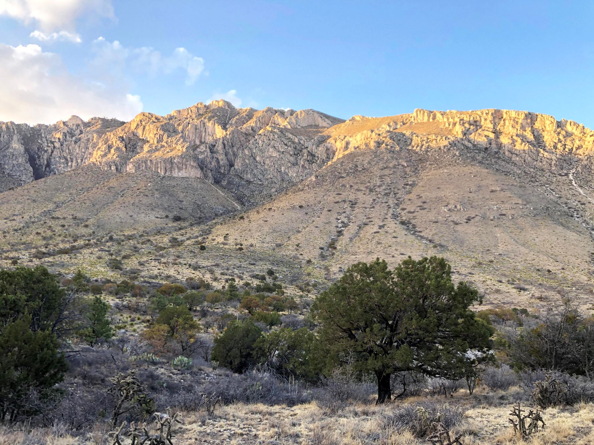
The winter and spring months bring high winds to the Guadalupe Mountains. Spring is the windiest time and with gusts that can exceed 70 miles per hour. I visited in late April and was lucky to not experience too much wind. There were wind advisories in the days prior and following my trip, but it wasn’t bad the days I hiked.
The winter months commonly bring some snow. In December, temperatures average a low of 33 and a high of 56.
Summer and Fall
The Guadalupe Mountains see average highs of 88 in June and July, with lows in the 60’s. The best time to visit Guadalupe Mountains is the fall, where you’ll see beautiful fall foliage and experience mild temperatures. Peak fall foliage is typically around the last two weeks of October.
How to Get to Guadalupe Mountains National Park
The closest major city and airport to the Guadalupe Mountains is El Paso. This is where I started my trip. From El Paso, it is a 2 hour drive to the Pine Springs Visitor Center in Guadalupe Mountains.
If you are driving, Guadalupe Mountains is 5 hours from Albuquerque, 8 hours from Dallas and 8 hours from Phoenix.
The Best Hikes in Guadalupe Mountain National Park
Hiking is the best thing to do in Guadalupe Mountains National Park. Below are details on the two hikes I did in the park, Guadalupe Peak and Devil’s hall, plus a couple of other day hikes that you should consider!
Guadalupe Peak Trail
8.4 miles out & back trail.
2,952 feet elevation gain.
Limited parking is available at the trailhead, more parking is available at the Pine Springs Visitor Center which adds about a mile to the hike.
Bathrooms at trailhead.
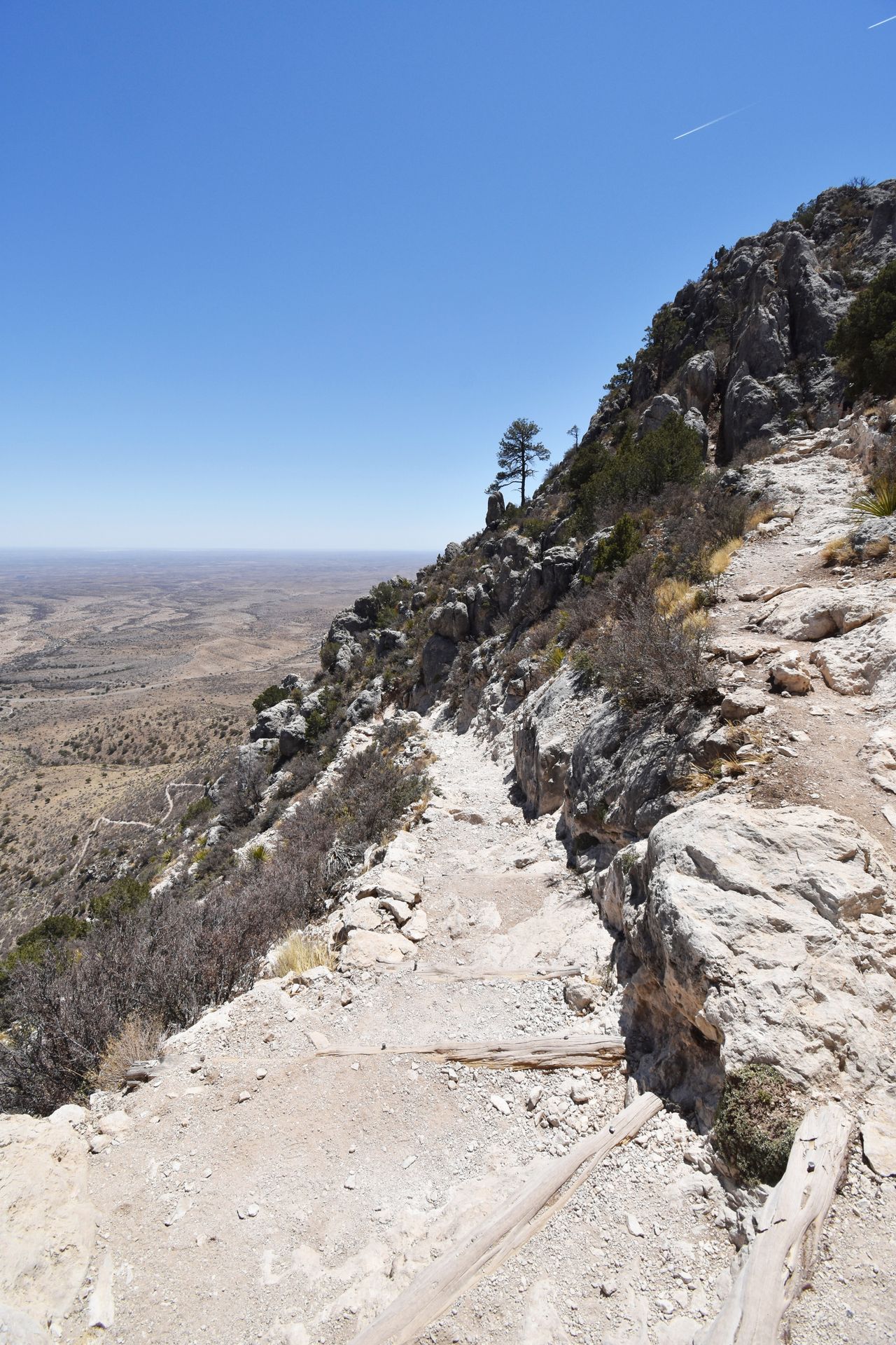
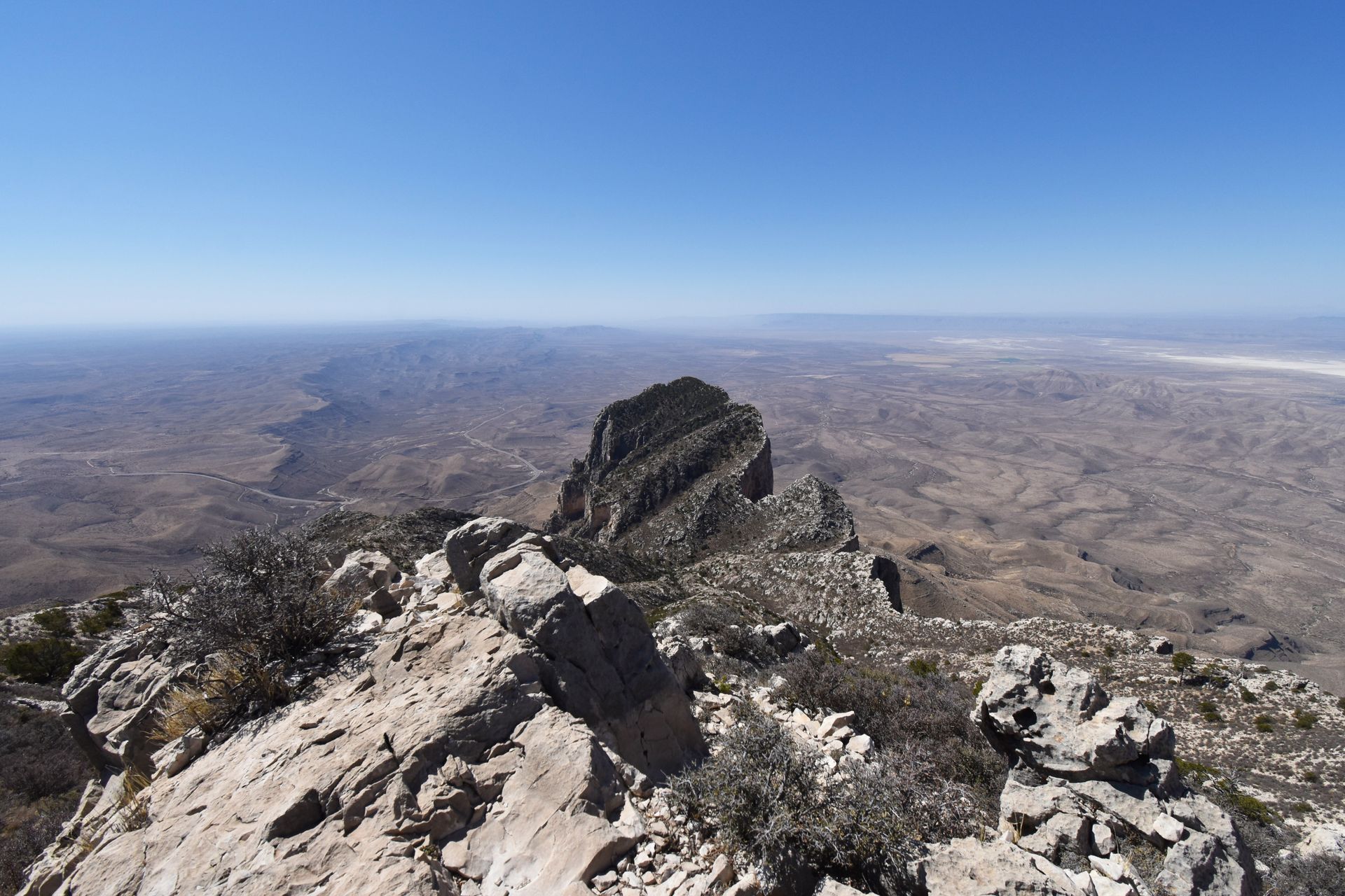
Guadalupe Mountains National Park is home to the tallest peak in Texas: Guadalupe Peak. Hiking Guadalupe Peak is no walk in the park. The hike to the top of Texas is 8.4 miles out-and-back.
This hike is difficult but highly rewarding. It is a grueling and steep climb, but there is nothing too technical about the trail. Hikers of most abilities are able to do it if they allow plenty of time, take breaks and come prepared with a lot of water, snacks and good shoes.
When you arrive at the trail, there is a small parking lot right next to the trailhead. This lot will fill up quickly during peak times, but you can also park at the visitor center, which adds an easy half mile (each way) to the hike.
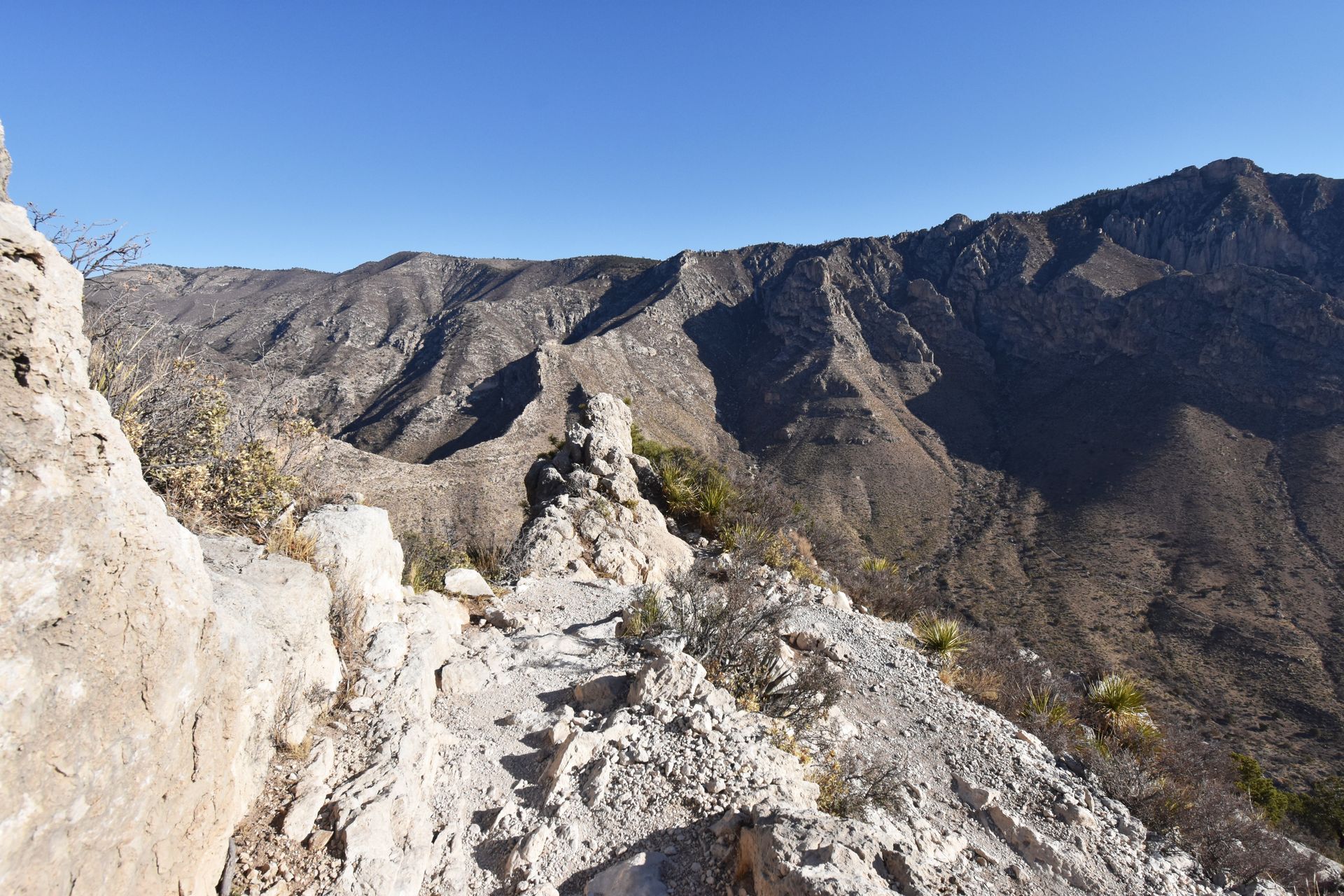
As you begin this hike, the switchbacks start almost right away. The first mile and a half is the steepest portion, but the hike continues to be steep throughout the climb. As you ascend up the many switchbacks, you may notice some ‘desire paths’ that could provide shortcuts. Please do not take these as they contribute to erosion on the mountainside.
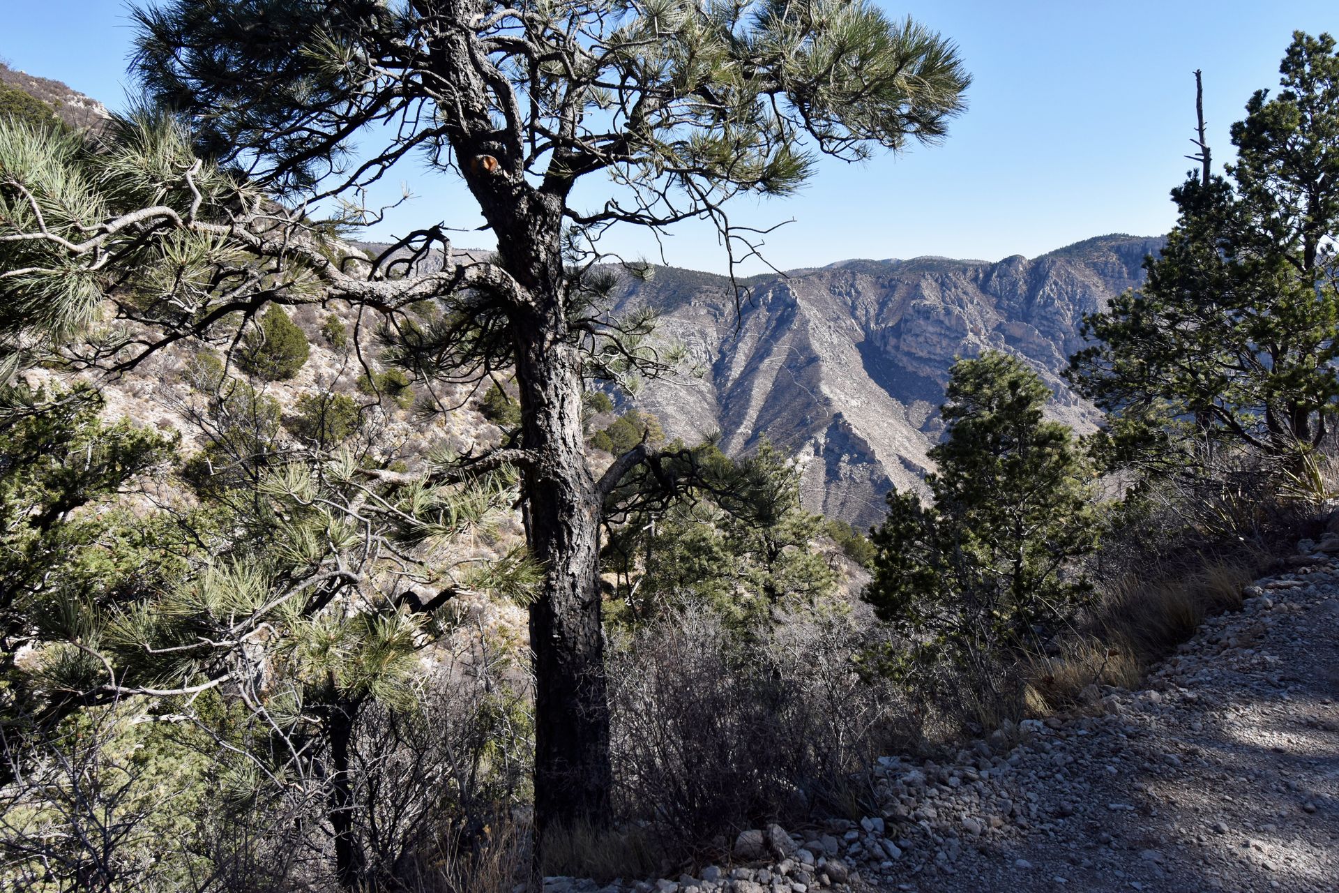
About halfway through the climb, you’ll reach the treeline and come across a small forest. This is also when you reach the opposite side of the first cliff and the hike becomes a bit more shaded.
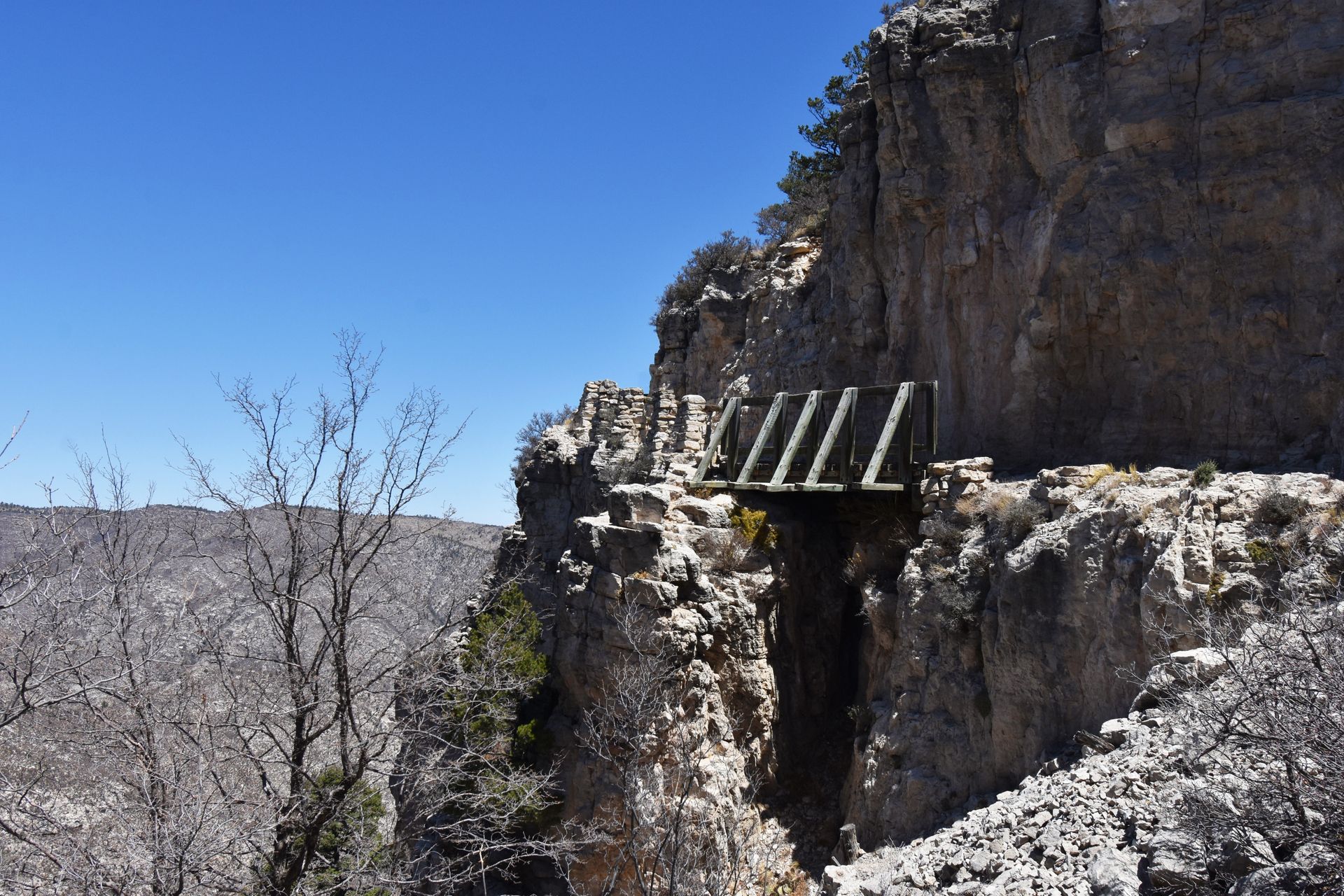
As you continue to the peak, a wooden bridge means that you’re almost there. The last tiny bit to the top has the most rock scrambling of the entire trail. You’ll have a step over some rocks but it’s doable.
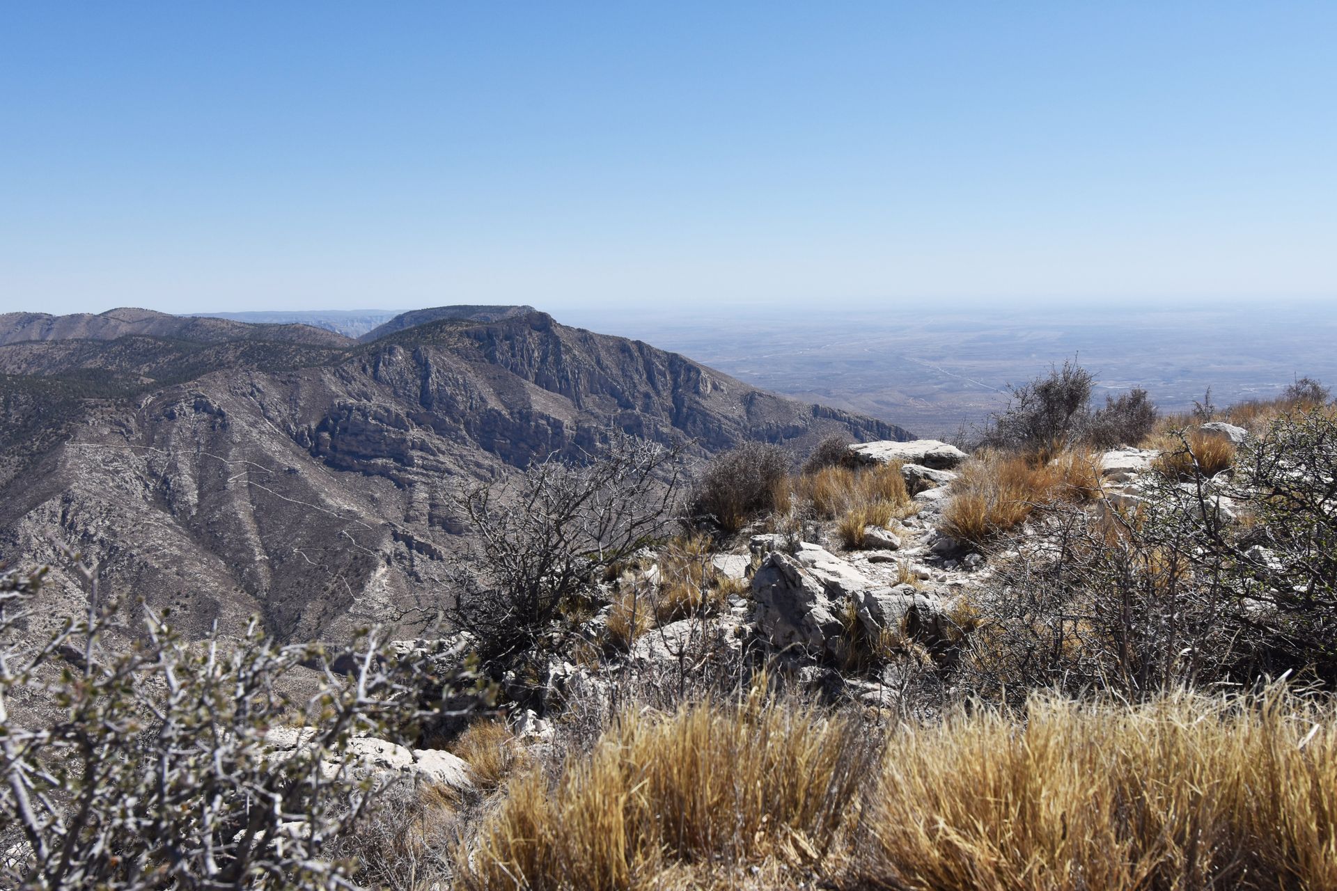
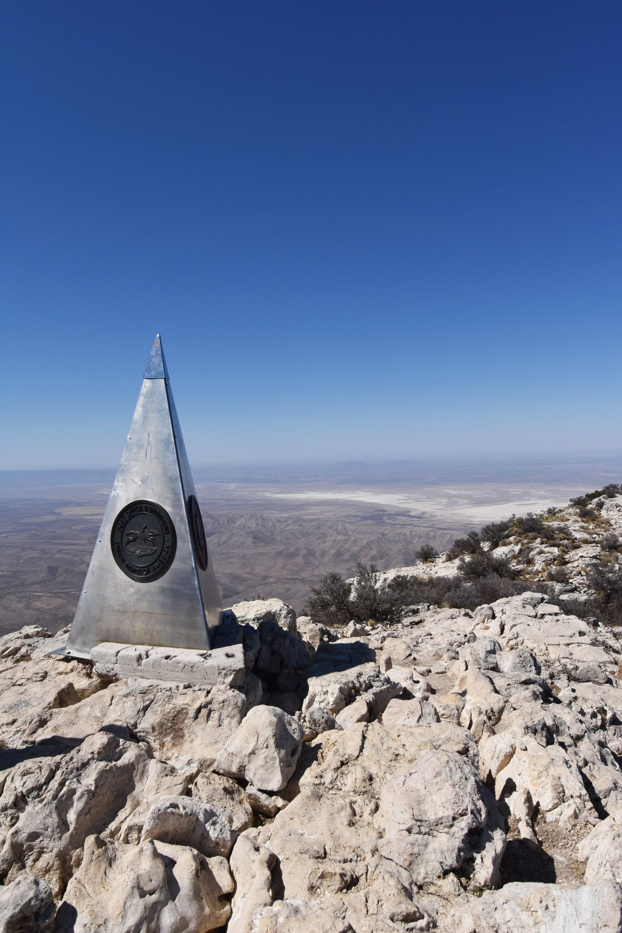
The views continue to improve as you climb but the view from the top is incredible. There are 360 views of the Guadalupe Mountains, El Capitan Mountain and miles of flat farmland as far as you can see.
At the top of the peak, you’ll see a stainless steel pyramid. This pyramid was placed by American Airlines in 1958, commemorating the 100th anniversary of a nearby Stagecoach route. There is also a U.S. Postal service tribute and a Boy Scouts of America logo on the structure.
The peak allows plenty of space to spread out. Bring a packed lunch or a treat to enjoy at the top, you’ve earned it!
I took a long break at the top of Guadalupe Peak. With that and more breaks throughout, the entire hike took me just under 7 hours.
Devil’s Hall Trail
3.6 miles out & back trail.
577 feet elevation gain.
Limited parking is available at the trailhead, more parking is available at the Pine Springs Visitor Center which adds about a mile to the hike.
Bathrooms at trailhead.
The Devil’s Hall Trail is 3.6 miles round trip and an absolutely beautiful trail. The first half of the hike is well maintained with a slight but steady incline.
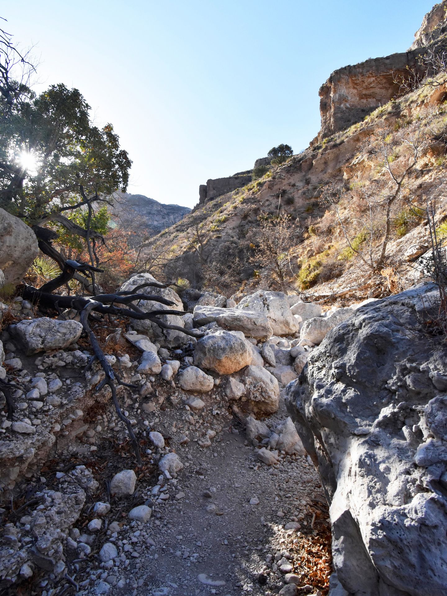
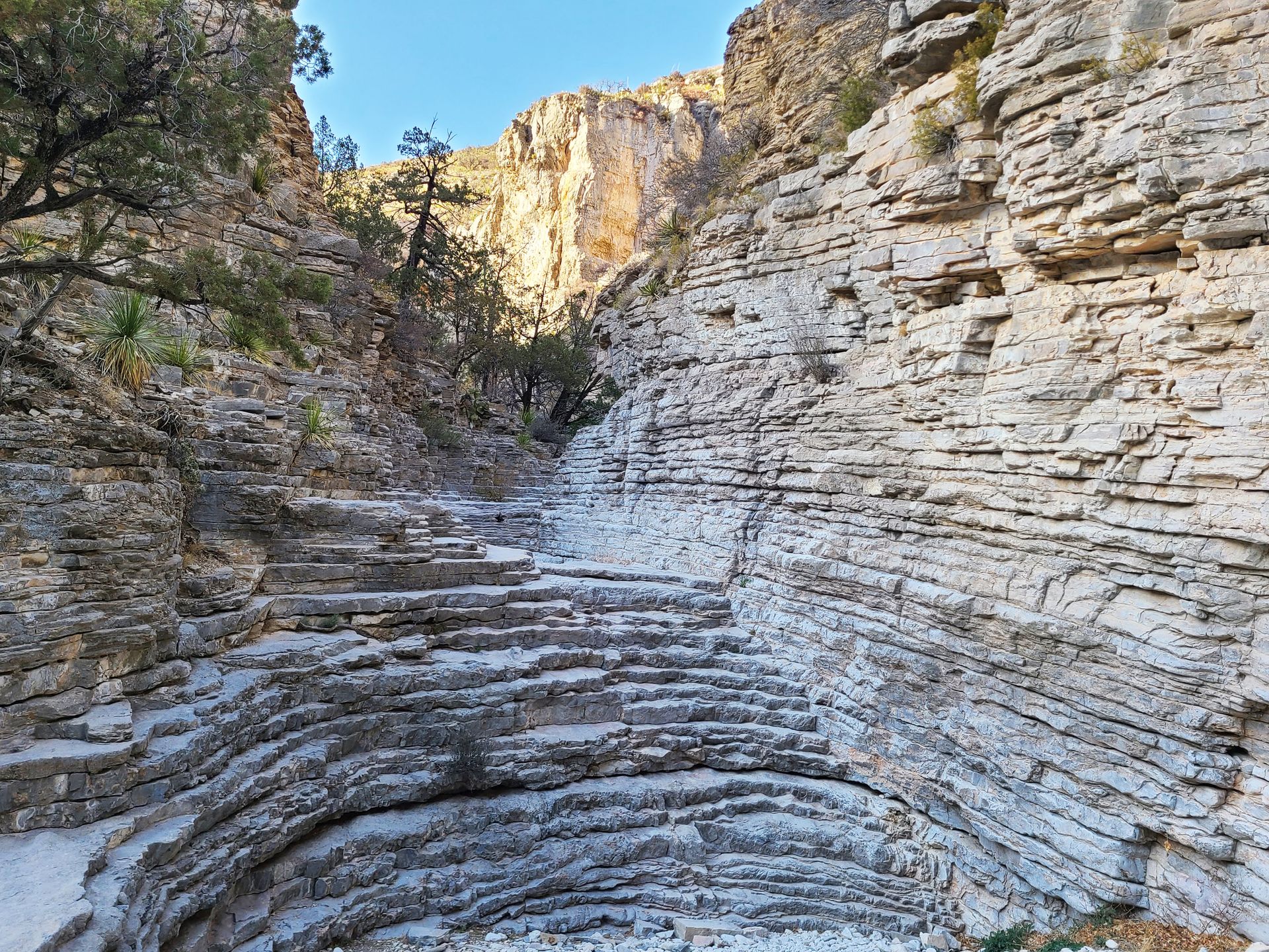
After about a mile, you will enter into a wash where you’ll climb over a series of white boulders. The boulders are mostly white and smooth, making a beautiful contrast against the surrounding forest and cliffs. The rocks are not overly difficult to traverse.
As you approach the end, you’ll see a natural staircase across the path. The rocks making up the staircase are smooth and a little slippery so you’ll want to make sure you’re wearing shoes with good traction for climbing.
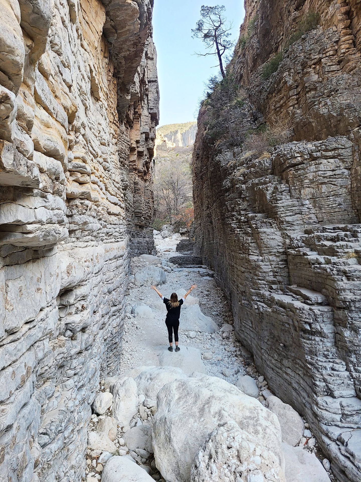
Just after hiking up the staircase, the trail turns to the right and passes between 100 foot limestone walls forming a natural hallway. Walk down the Devil’s Hall and take in the surrounding views.
I really enjoyed the unique landscape of this trail and I had it all to myself when I hiked it just before sunset. As I approached the parking lot, I saw a large group of deer near the trail as a finale.
Other Guadalupe Mountain Day Hikes
McKittrick Canyon Trail
McKittrick Canyon is a beautiful place to hike in the fall and is known for impressive fall foliage. The hike into McKittrick Canyon starts out flat and begins to ascend a few miles into the trail.
There are multiple points of interest to see along the trail: The Pratt Lodge - a historic stone structure, The Grotto - a cavern with stalagmites and stalactites and The Notch - a fantastic viewpoint of the mountains. Hiking to and from the Notch is about 9 miles. If you visit McKittrick Canyon, be sure to check what time the gates open and close as the hours are limited.
Smith Spring Trail
The Smith Spring Trail begins at the Frijole Ranch museum. The trail is 2.3 miles and has 387 feet of elevation gain. At the high point of the trail, there is a beautiful spring and a tiny waterfall. This hike also does not see a lot of crowds so it’s great if you’re looking for seclusion.
Where to Stay at Guadalupe Mountains National Park
My Experience Staying in Dell City, Texas
I stayed in an Airbnb in Dell City during my trip to the Guadalupe Mountains. While everything worked out okay, staying here was more challenging than I expected.
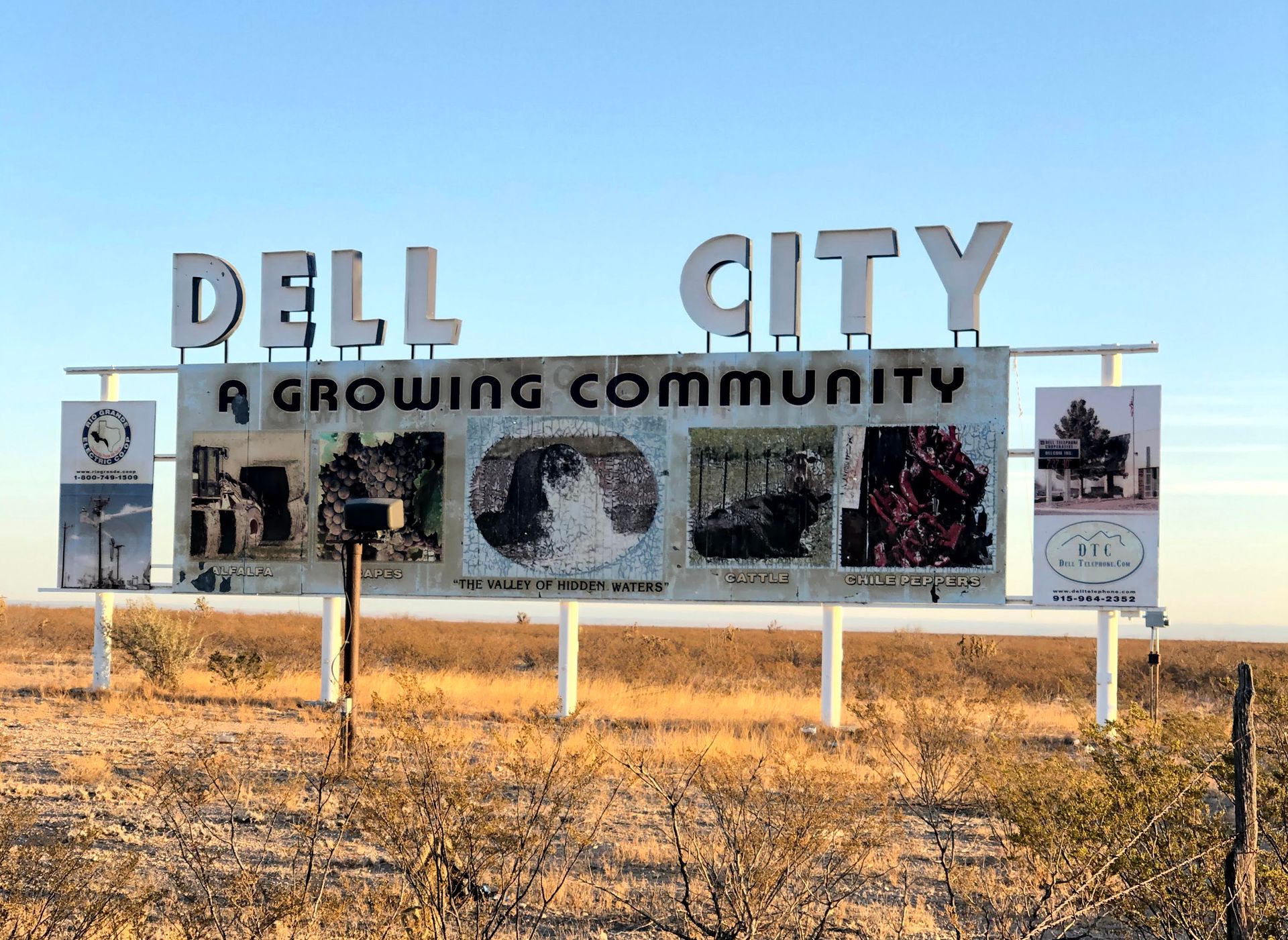
Dell City is a small farming town with a population of 220 and is located 40 minutes from the Pine Springs Visitor Center. The Airbnb is inside of a former roadside motel. It was a nice basic room.
While the room was alright, it was difficult to get what we needed in Dell City. The big issue was gas. There are only 2 gas stations in Dell City. The one located closer to the highway is Firebird Fuel. When I visited, it was completely out of regular gas and had no attendant. We later learned that it had been out of gas for at least a week.
The second gas station, Dell Valley Oil - Gas Station, has limited hours and you cannot pump the gas when it's closed. We arrived after it had closed on a Saturday afternoon. Luckily, the door had a piece of paper that said “Call Sonny if after hours.” We did and Sonny arrived quickly to our rescue and turned on the gas. However, he said we were lucky because he was about to leave town.
There are a couple of restaurants in Dell City but unfortunately they all had very limited hours. We had shelf stable grocery items, but were hoping to get a hot meal for dinner both nights. The only place that remained open for dinner was the Dell City Mercantile convenience store, where we were able to get a vegetable pizza from their pizza oven.
Cell service in Dell City was spotty. I had basically no service on Verizon but T-Mobile worked very slowly. AT&T is known to work the best here. Overall, Dell City has a lot of potential but really did not feel well equipped for visitors. Below is where I recommend staying instead.
Hotels in Carlsbad
In my opinion, staying at a hotel in Carlsbad, New Mexico is the easiest and most reliable option for hotels near Guadalupe Mountains National Park. There are several options for hotels and Airbnbs in Carlsbad for every budget. The distance between the town of Carlsbad and the Pine Springs Visitor Center is one hour.
Guadalupe Mountains Camping
If you are able, camping inside of the park is another great option for visiting. There are 20 tent and 20 RV sites available in the Pine Springs Campground and all are first come, first served.
The park does not have electric hookups, showers or a dump station. Tent camping is also available in the Dog Canyon area of the park on a first come, first serve basis. Keep in mind that it is a two hour drive from Dog Canyon to the Pine Springs Visitor Center.
There are also many options for backpacking and camping out in the Guadalupe Mountains if you are an experienced hiker and backpacker looking to do multi-day hikes.
Staying in Van Horn
If you are combining your trip to the Guadalupe Mountains with a road trip to Marfa and Big Bend, Van Horn is a great city to stay, located an hour south of the Pine Springs Visitor Center. There are multiple hotel chains available here and it's directly in between the cute town of Marfa and the Guadalupe Mountains.
More Things To Do Near Guadalupe Mountains National Park
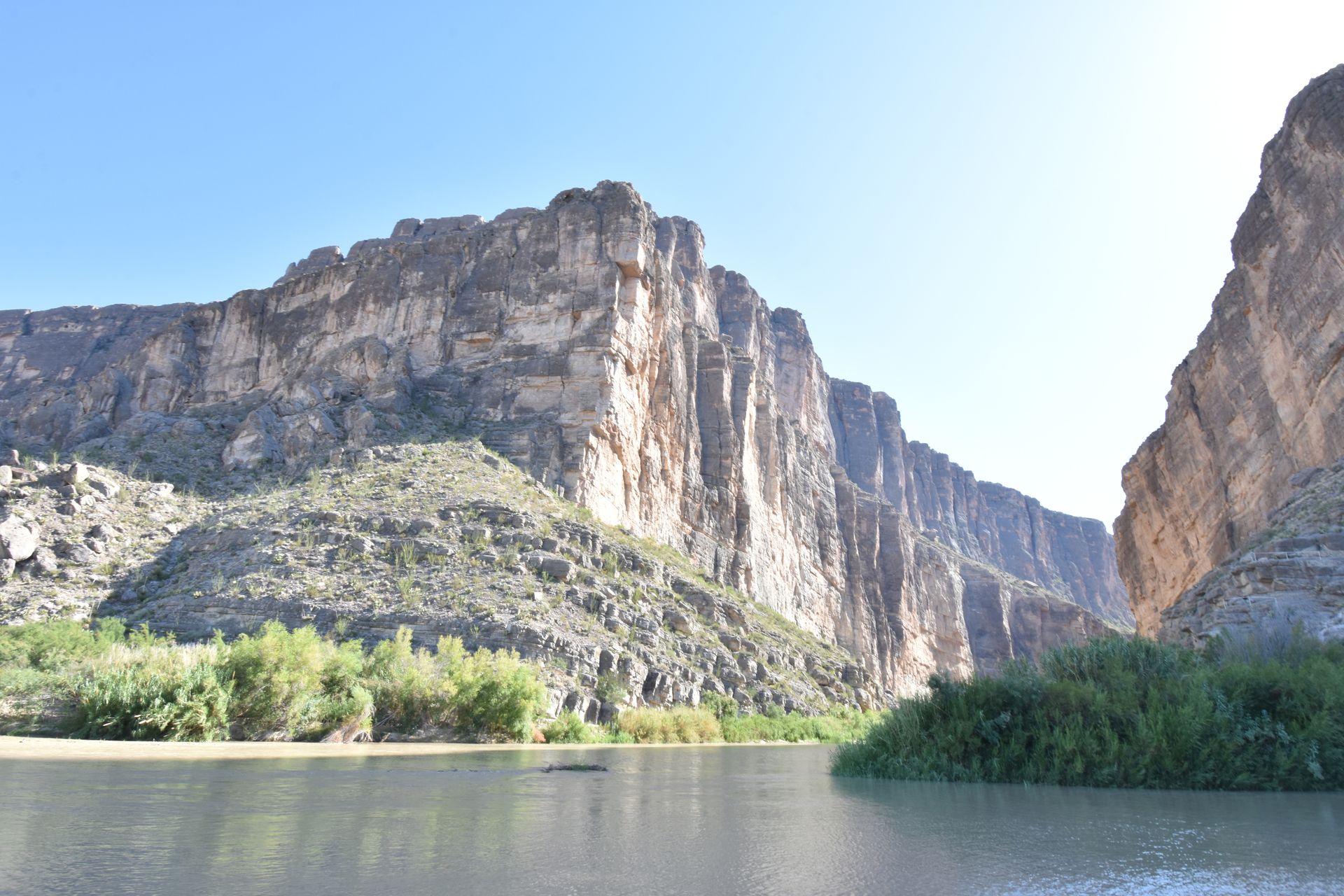
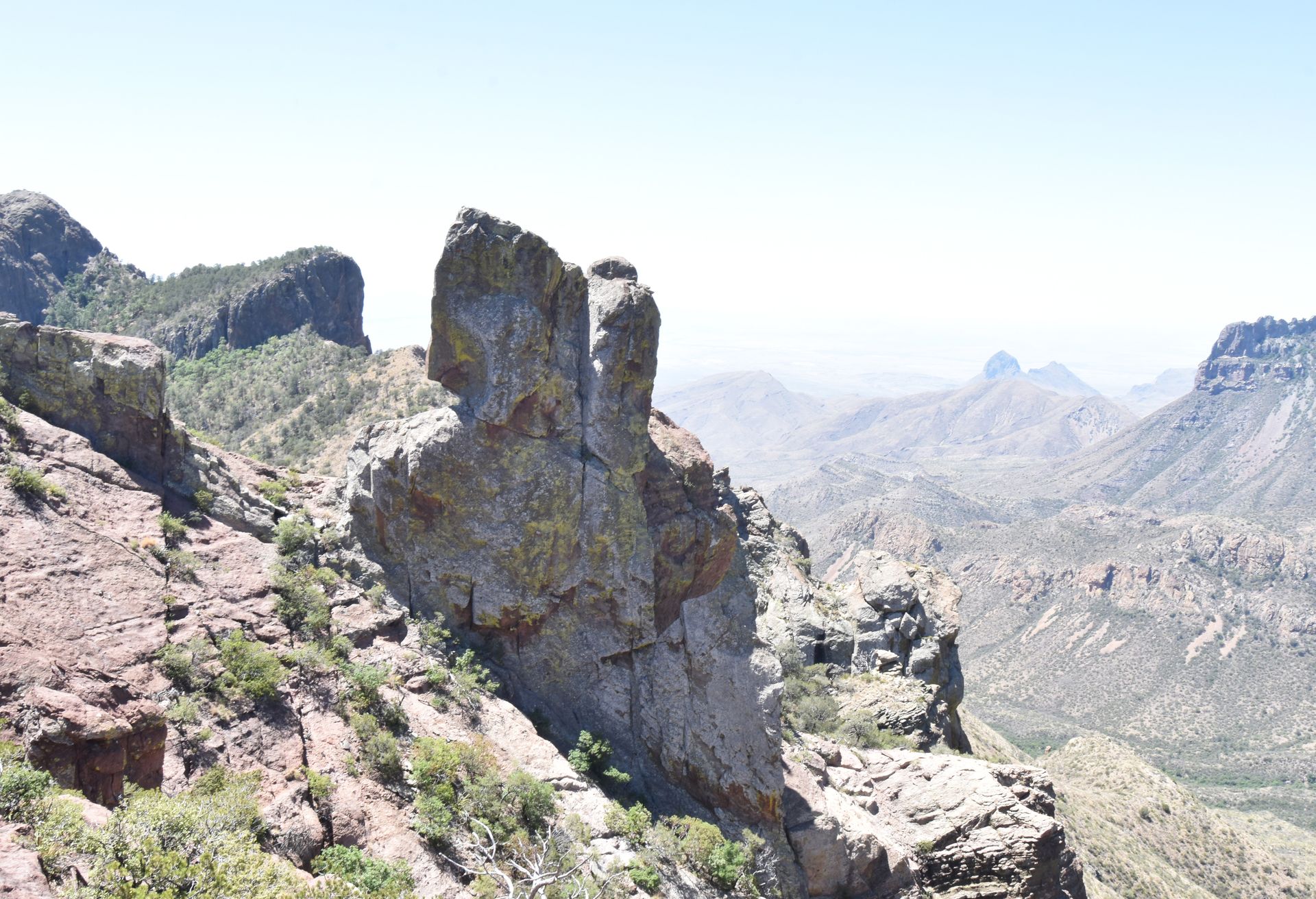
You can combine a road trip to the Guadalupe Mountains with some other incredible National Parks if you have enough time. Texas’ only other national park, Big Bend, is located about 4 hours away. Along the way, I recommend stopping at Davis Mountains State Park, Marfa and Big Bend Ranch State Park. Read about my trip to Marfa and Big Bend in this article!
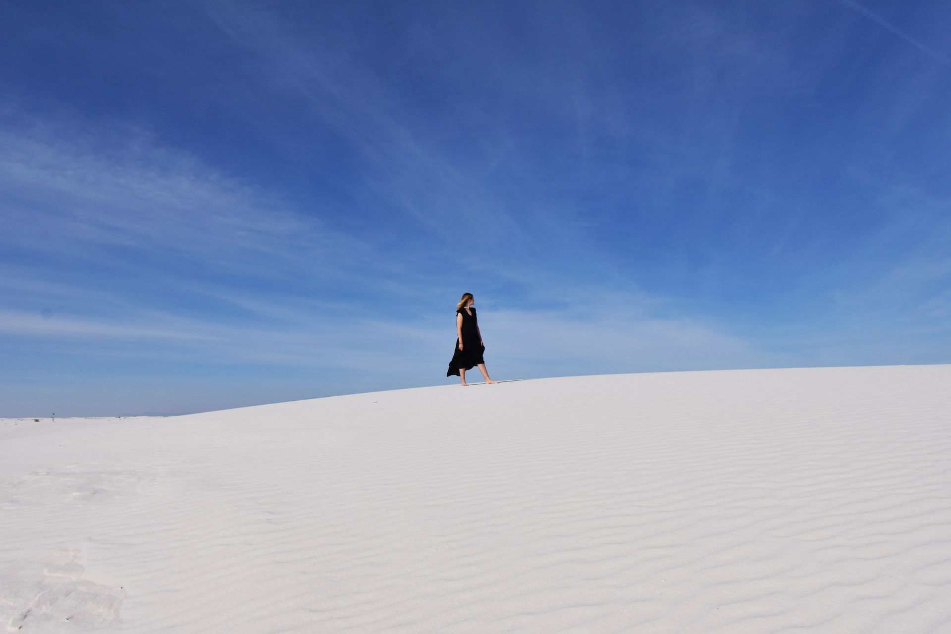
Guadalupe Mountains is also very close to Carlsbad Caverns National Park, an impressive underground cave. Also in New Mexico a few hours away, White Sands National Park is a beautiful and unique place to visit. Read about the best things to do in White Sands in this blog post.
Final Thoughts
I hope this guide helps you plan an epic road trip to the Guadalupe Mountains, which is an epic area of West Texas. From mountain views to canyons to sand dunes, this unique park has a lot to offer and is great for hikers.
For More US national park guides, check out these blogs:
- The Best Things To Do in White Sands National Park
- How to Spend 2 Days in Death Valley National Park
- How to Spend 2 Days in Rocky Mountain National Park
- An Epic Itinerary to Visit Utah's Mighty Five
- The Perfect Badlands and Black Hills South Dakota Road Trip
- How to Spend One Day in Redwood National Park
- How to Spend 2 Days in Olympic National Park
- How to Spend 3 Days in Acadia National Park
- The Best Things To Do in Cuyahoga Valley National Park
- A Guide to Visiting Indiana Dunes
- How to Spend One Day in Theodore Roosevelt National Park
Thanks for Reading!


Let's stay in touch!
Join the Lost with Lydia email list to get monthly travel guides and tips!