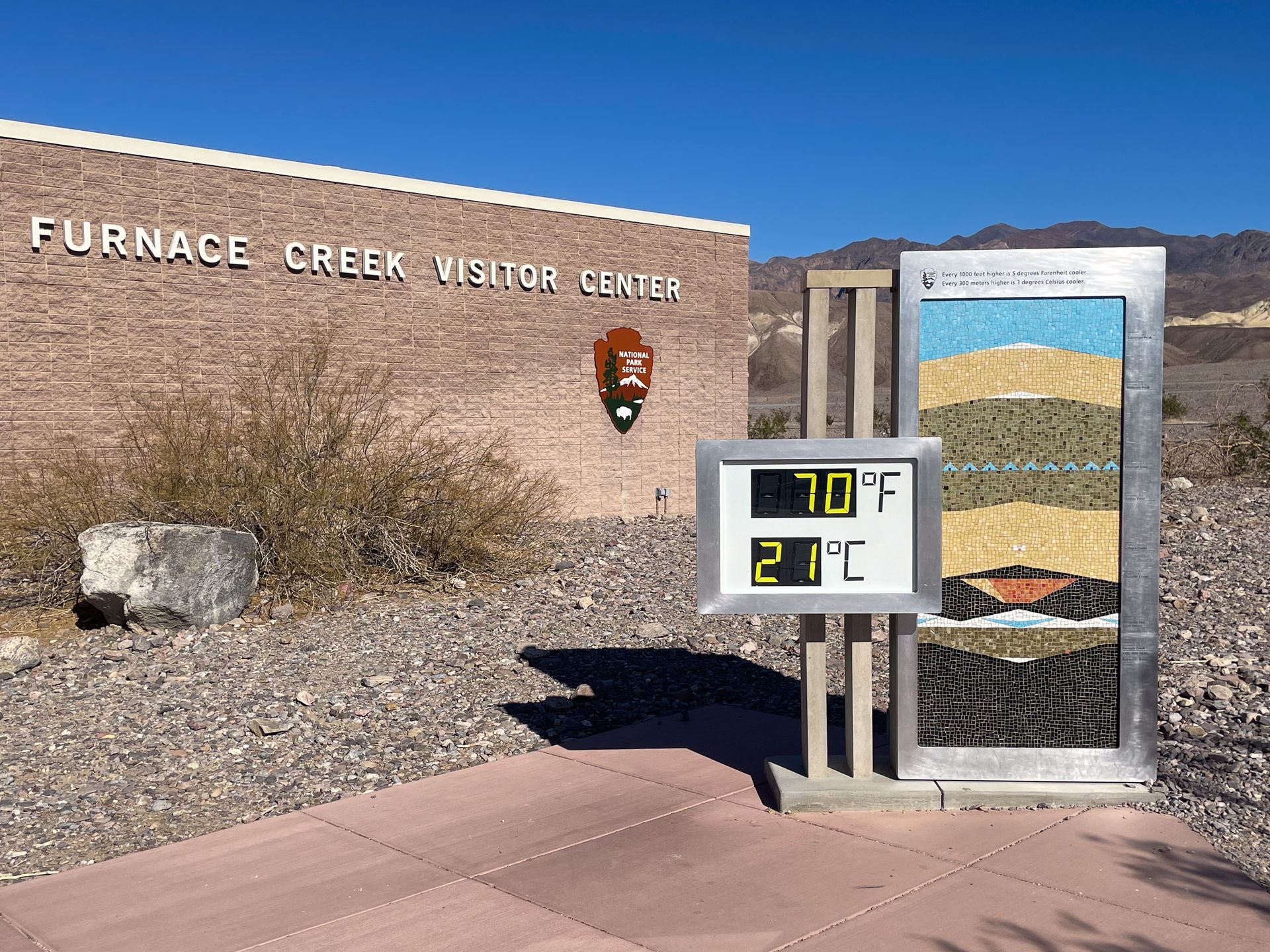
“Hottest, driest and lowest” is a motto that you’re sure to see repeated as you travel through Death Valley National Park in California. Not only is this park the lowest place in North America, it’s also home to the hottest outdoor temperature ever recorded. The recording was made in Furnace Creek in 1913 and was 134°F/ 56.67°C.
The park is full of both extreme temperatures and unique landscapes. In just a couple of days, you can see sand dunes, salt flats, mountains, slot canyons and more. It’s a unique and colorful place that is sure to fascinate and amaze you.
This article includes all of the best things to do in Death Valley if you only have 2 days. Plus, everything on this itinerary is typically accessible by any vehicle. This is based on my experience visiting Death Valley in January 2023.
When to Visit Death Valley
Death Valley experiences extreme heat in the summer months and you should avoid visiting between May and September unless you’re limiting yourself to the mountainous portion of the park. Unfortunately, many visitors underestimate the intense heat and it can be deadly. If you do visit in the summer, bring plenty of water (and have extra in your car), watch for signs of heat stroke and avoid hiking in low elevations. If you do hike in the desert area, be off the trails by 10AM.
The best time of year to visit Death Valley is between October and April. I visited in January and thought it was perfect - it was warm during the day and cold at night.
Read about the best national parks to visit in the winter
Where to Stay in Death Valley
Death Valley is a very large and remote park, so it's most convenient to stay inside of the park.
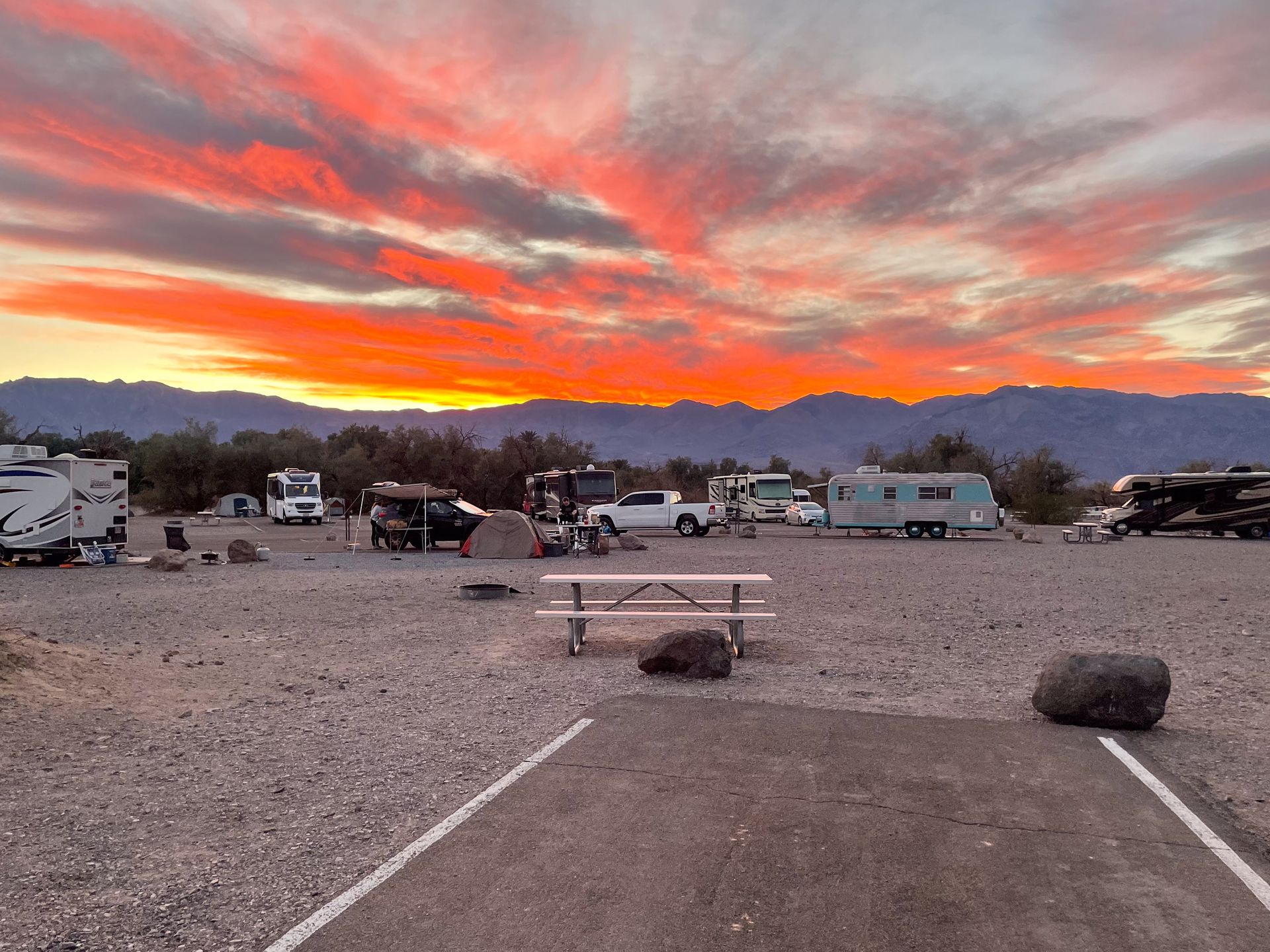
There are 4 different inns within the park, and a few different campgrounds as well. To be the most centrally located for this itinerary, you should stay near the Furnace Creek area. There you can stay at The Inn at Death Valley or The Ranch at Death Valley.
Also not too far from the main areas of the park, you can stay at the Stovepipe Wells Village.
I stayed at the Furnace Creek Campground and thought it was the perfect location. The campground has water and hookups at some sites, but it does not have showers.
Outside the park, Pahrump and Beatty Nevada are two of the cloest small towns, and they each have a few different hotels to choose from.
How to Get To Death Valley
The closest major city to Death Valley is Las Vegas. From Las Vegas, it’s a little over two hours to reach the park. The most direct entrance from Las Vegas is to pass through Death Valley Junction and then take CA-190. However, you can also enter on Daylight Pass Road if you’re interested in spending time in Beatty.
Tip: Check the national park website for any road closures before traveling to the park!
If you drive from Los Angeles, it will take about 4 and a half hours, and you’ll enter through Panamint Springs on the West side of the park.
How many days do I need in Death Valley?
Many visitors take a day trip to Death Valley and you can certainly see most of the main attractions in the park in one day. However, if you like hiking, I recommend spending two full days so that you can explore more and enjoy some of the beautiful hiking trails.
If you are not visiting with a 4wd, high clearance vehicle, I think 2 days is the perfect amount of time. If you do have a 4wd vehicle, you can easily spend much longer exploring the more remote areas of the park. (Just make sure to do your research!)
Things To Know Before Visiting Death Valley National Park
-
Please make sure to leave no trace during your visit to Death Valley. That includes packing out all of your trash, planning ahead, following rules on campfires, never feeding or approaching wildlife and respecting those around you.
-
The entrance to Death Valley costs $30 per vehicle and is valid for 7 days. If you’ll be visiting multiple national parks over the course of a year, you’ll save money by purchasing the America the Beautiful Pass. This will grant you entry into all US national parks for $80!
-
Death Valley is very remote. You should download offline maps ahead of time and expect to not have service. You should also fill up on gas before entering the park. There is a gas station inside of the park, but it’s very expensive. Finally, I recommend bringing in your own food and water.
-
Everything on this itinerary can be done with any vehicle (although a couple roads to the trailheads are unpaved). A lot of other areas of the park are only accessible to high clearance, 4wd vehicles. Be sure to check the types of roads you’ll be traveling on before venturing out.
-
As I mentioned in the intro, Death Valley has some of the hottest temperatures on earth. Therefore, it is not advised to hike in the desert portion of the park after 10AM in the summer months. In fact, it’s not really advised to visit at all between May and September.
-
Either the entire park or certain portions have closed multiple times over the past few years due to flood damage. Be sure to check the national park website for current road closures before your trip.
Death Valley Two Day Itinerary
Keep reading to learn how to spend two days at Death Valley National Park.
Day One
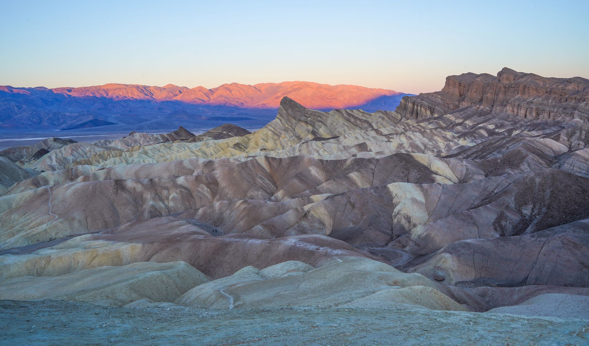
Watch the Sunrise at Zabriskie Point
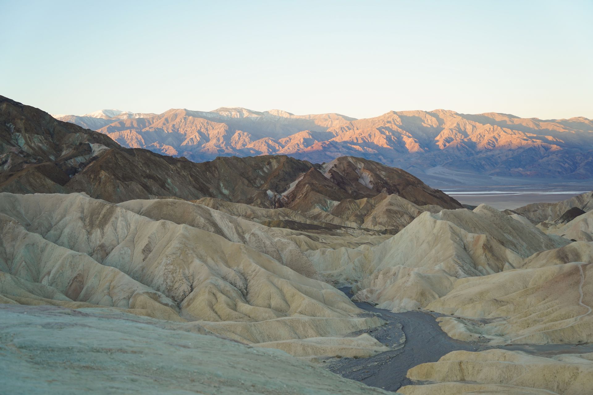
Start your day with sunrise at the iconic Zabriskie Point! This stunning viewpoint features hills of badlands with the Panamint Mountains in the distance. Be sure to stick around after sunrise and admire the pink glow on the mountains.
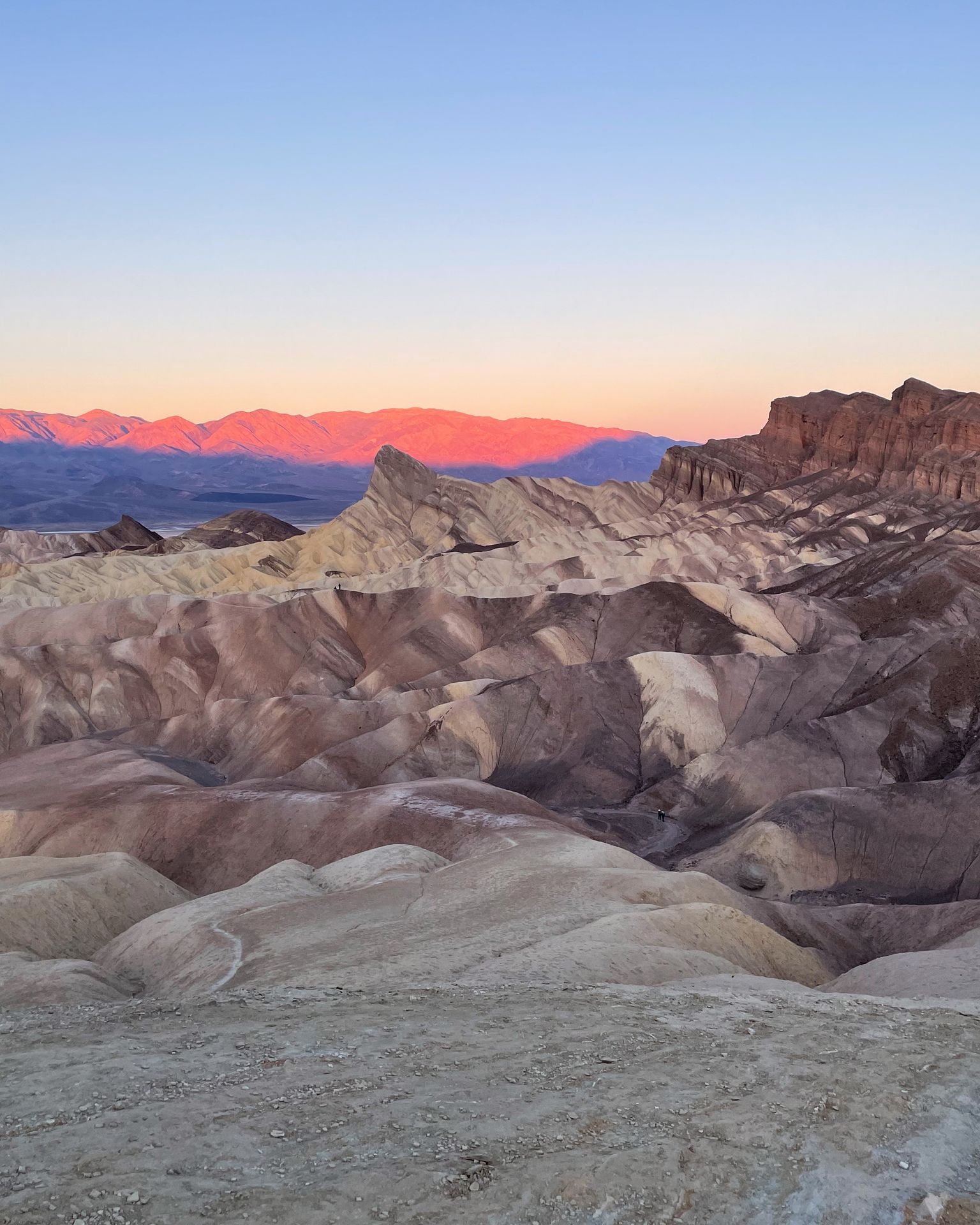
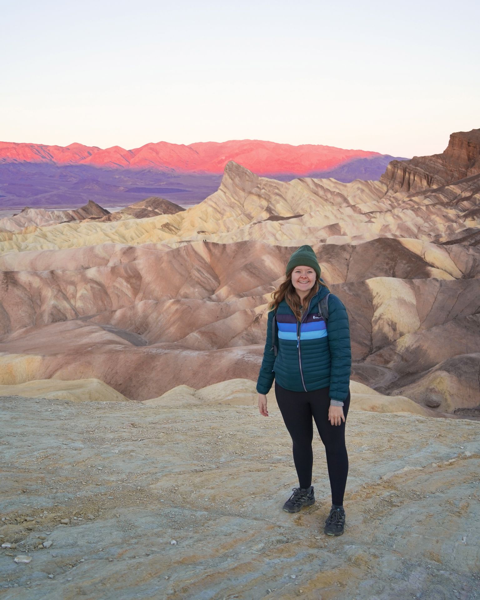
To reach the main viewpoint, there is a short, paved uphill trail. You can also hike a bit out into the badlands to get a bit closer with fewer crowds.
Even if you don’t make it for sunrise, this is a beautiful spot that I think is a must-see in Death Valley National Park.
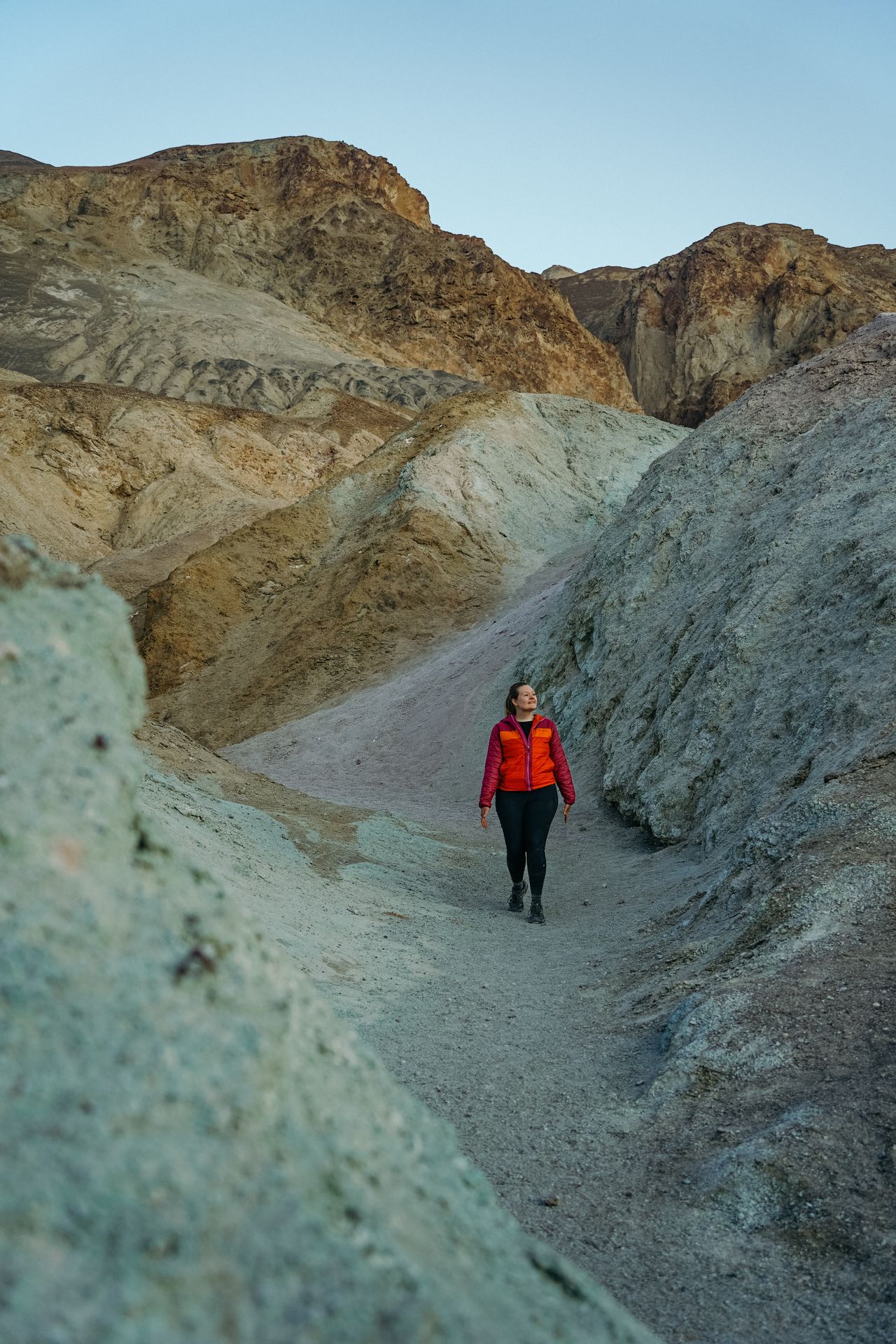
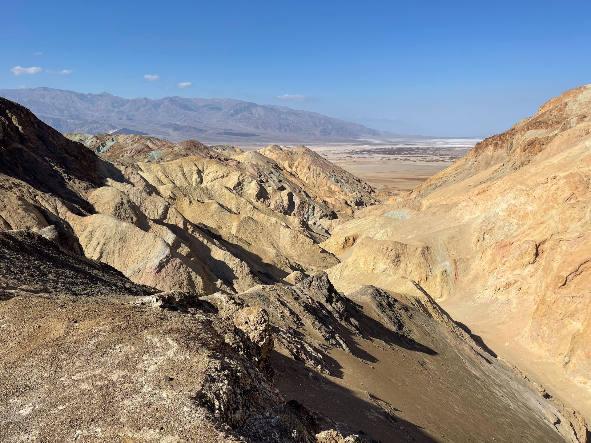
Hike the Gower Gulch and Golden Cathedral Loop
From Zabriskie Point, there are some wonderful hiking trails to choose from. I recommend the Gower Gulch and Golden Cathedral Loop in order to get a great variety that includes a golden canyon, colorful badlands and plenty of views along the way.
I went counterclockwise, which I think is slightly easier due to the steepness. But either way is acceptable. The loop is 6.4 miles, has a little over 1,000 feet of elevation gain and is rated moderate. You can also add on another mile by hiking into the Red Cathedral.
Overall, the hike has some gradual ups and downs and includes a bit of rock scrambling, but nothing too difficult. My favorite part was the Gower Gulch, which includes some narrow, rocky areas and colorful red and green rocks. The Golden Canyon portion of the trail was also really neat.
I also saw very few other people on this trail early in the morning. This is a fantastic hiking trail to include your Death Valley itinerary.
Admire the Views from Above at Dante’s View
Dante’s View is a viewpoint perched 5,575 ft above Badwater Basin. This spot provides an expansive view of the large valley that makes up the park. You’ll be able to see Badwater Basin and mountains in the distance.
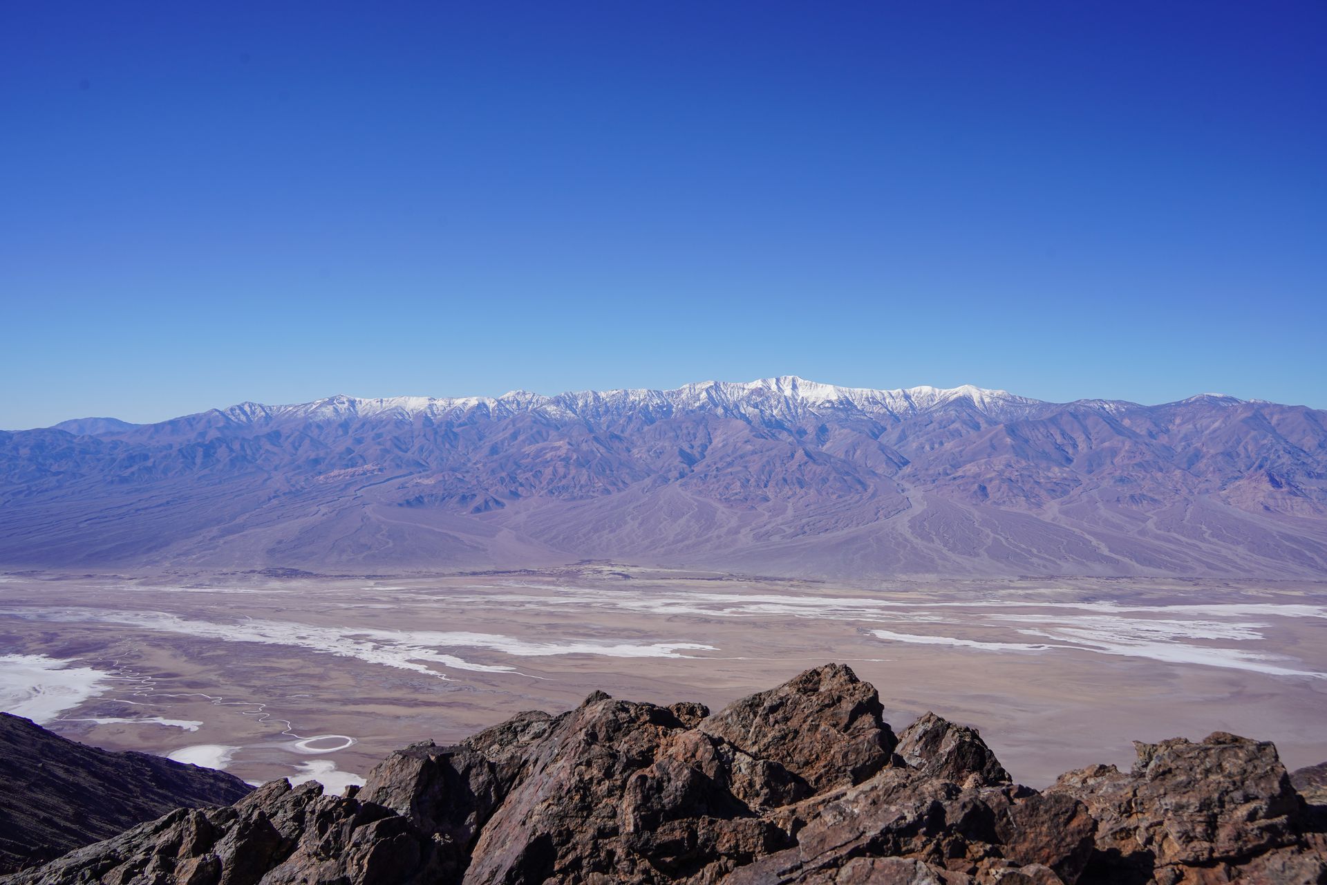
The drive to reach Dante’s View is curvy with some steep sections. The final portion of the drive reaches a 13% grade and has hairpin turns. Vehicles longer than 25 feet cannot make the drive. We felt our ears pop due to the change in elevation!
When you reach the top, there is a great view right from the parking lot. However, you’ll likely want to take the ridge trail a little ways to get a closer look. The trail is a little bit steep and rocky, but you can go as far as you’d like. The recommended trail is about 1 mile round trip.
If you have time and are up for a challenge, there is a longer trail (8.7 miles and rated hard) to Mt. Perry that begins here.
Whether you just take a look at the viewpoint or do some hiking, this provides a unique perspective of the park.
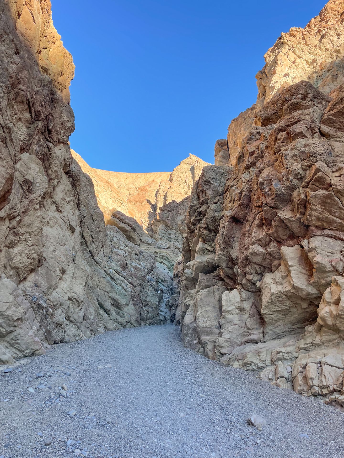
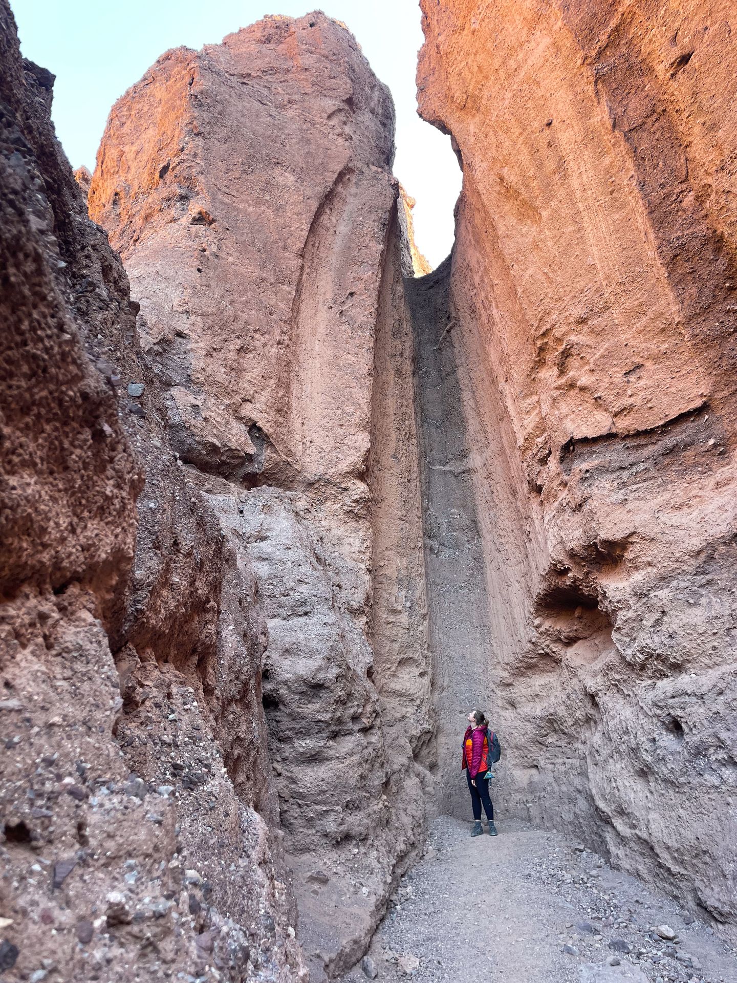
Hike Mosaic Canyon
For a unique canyon hike, head over to Mosaic Canyon for a fun trail that gets narrow and scrambly at times. The out-and-back trail is 3.4 miles with 964 feet of elevation gain, and rated moderate. Note that the road to reach this trail is unpaved, but it is typically accessible by a sedan.
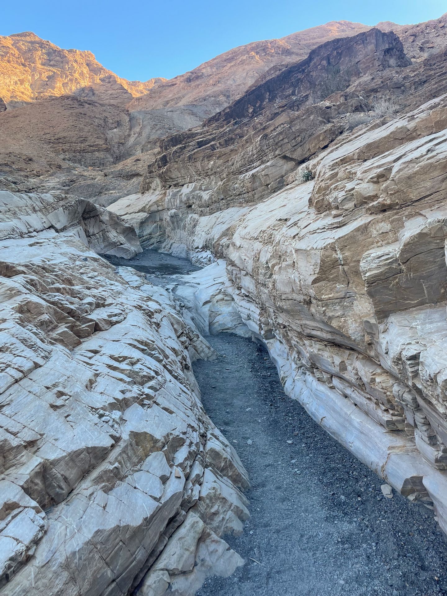
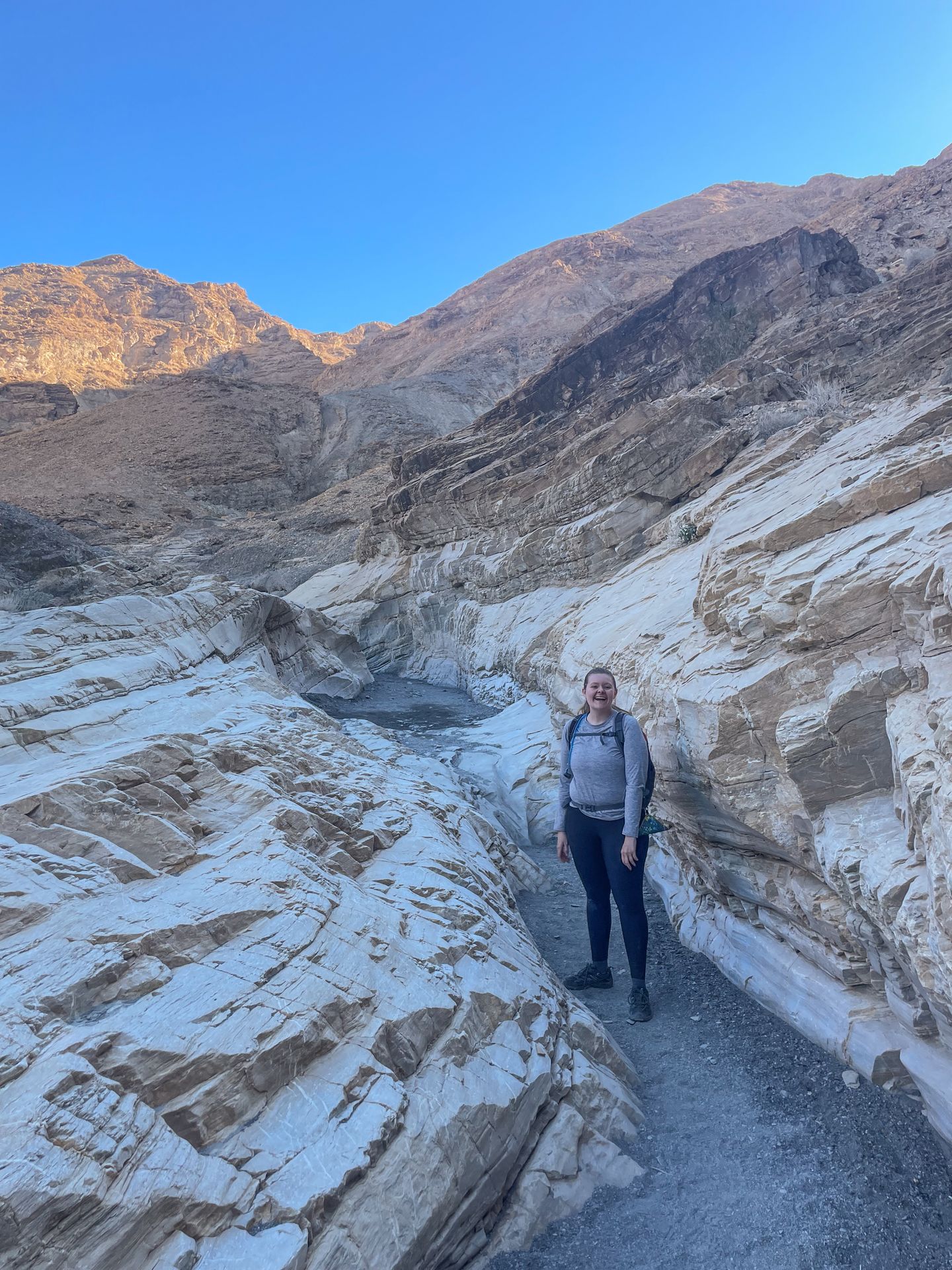
As you climb up into the canyon, you’ll get to enjoy a narrow and white section of the canyon right away. Soon you’ll reach an area where the canyon gets much wider, before entering into a narrow section again. The trail starts to get a lot more difficult about halfway through. At this point, you’ll need to scale a tall wall and navigate several areas of slick rock scrambling. I was hiking solo, so I turned back slightly early when the path became unclear.
Overall, this is a great trail, but it was more challenging than I expected. Luckily, you can get some of the best views in the first mile of the trail, so just keep going as long as you’re comfortable.
Watch the Sunset at Mesquite Flat Sand Dunes
The Mesquite Flat Sand Dunes is one of the few places within the park where conditions have collided to create an expansive dunefield between the mountains. There is no official trail through the dunes, so you can explore them as you wish. However, try not to trample vegetation and keep an eye out for animal habitats.
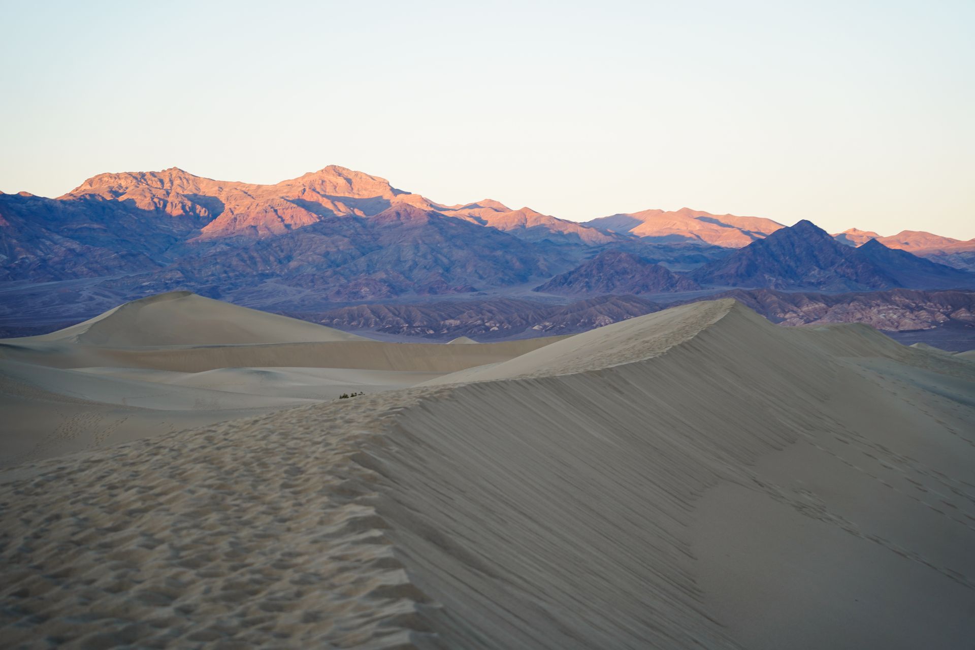
I recommend visiting in the hour leading up to sunset to enjoy dramatic, long shadows and the change of colors on the surrounding mountains.
If you’d like to climb to the tallest dune, it’s about 2 miles round trip.
Day Two
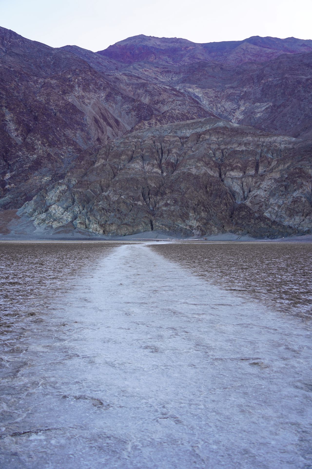
Get an Early Start at Badwater Basin
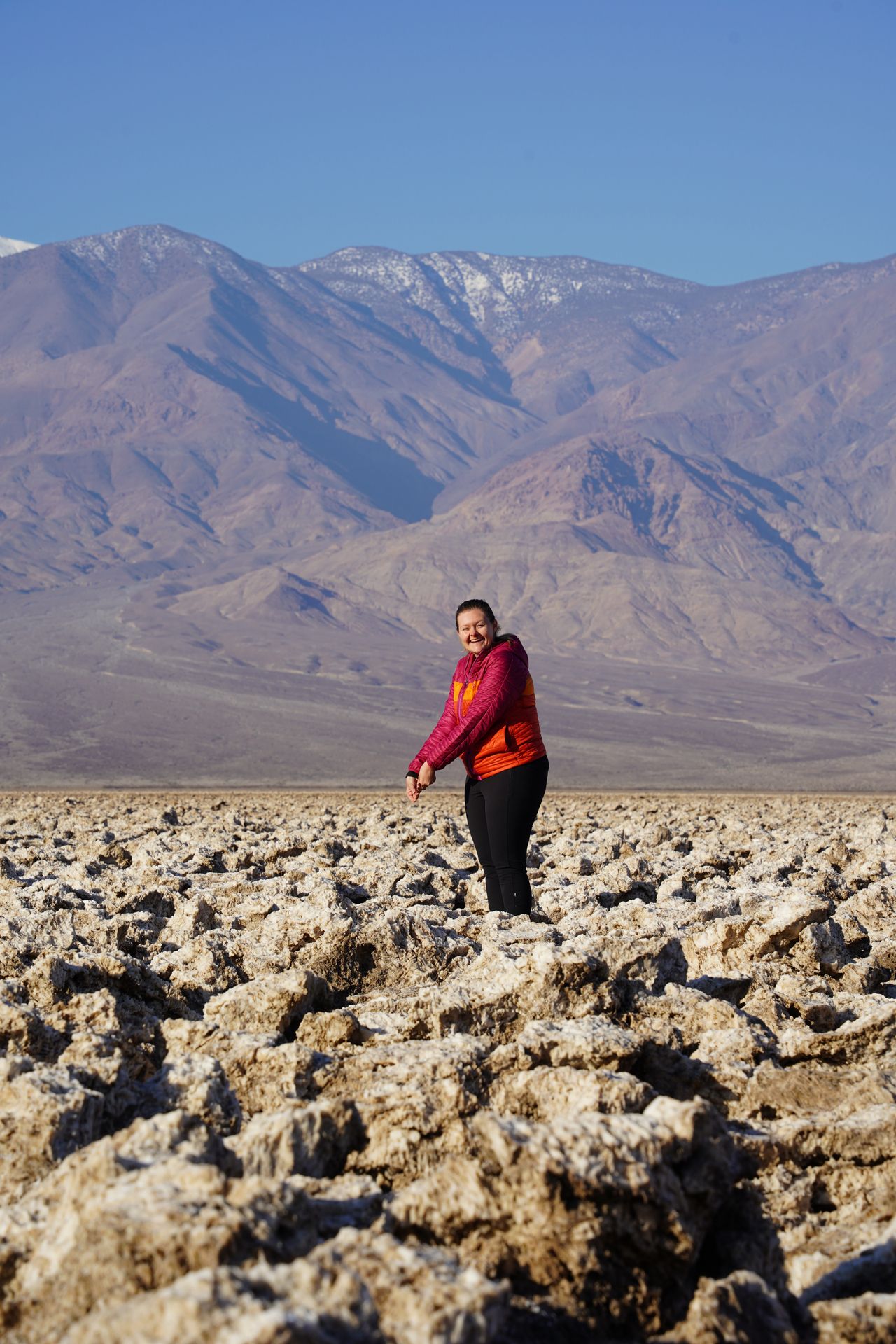
Start your second day in the park with a sunrise at the lowest place in North America: Badwater Basin. This salt flat area is 282 feet below sea level.
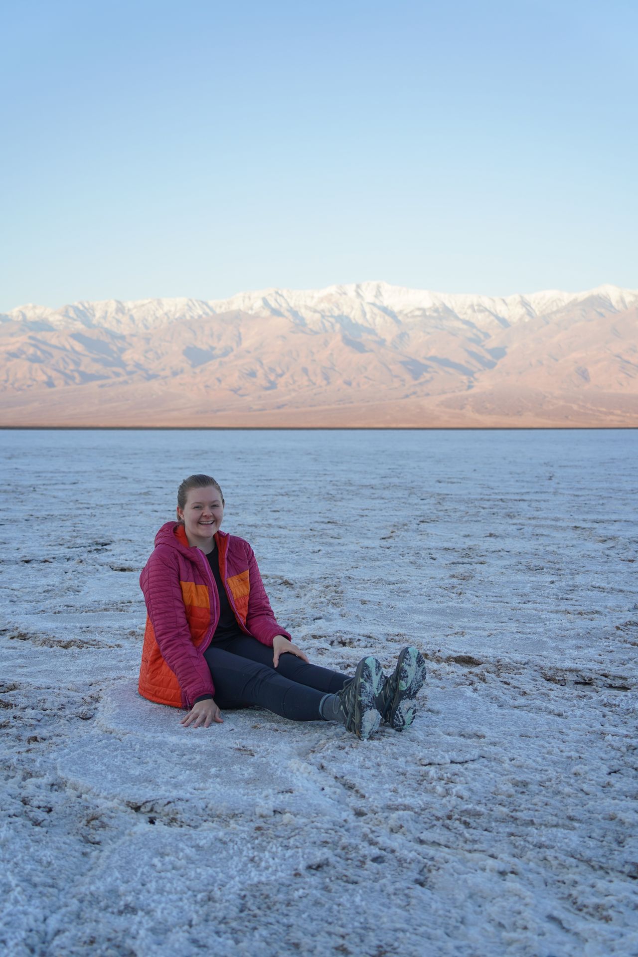
This salt flat area received its name when an early surveyor’s mules refused to drink the water here. Turns out, the water is very high in salinity.
There is a boardwalk right next to the parking lot, and then a flat and smooth path to reach the salt flats. The trail is 1.9 miles round trip. When you reach the main salt flat area, you’ll notice that the salt flats are flat and smooth, instead of the rough (but still neat) patches that surround the trail.
As you hike out to the flats, be sure to turn around and look for the ‘Sea Level’ sign on the mountain face. This will give you perspective for how far below sea level you currently are.
At sunrise, you’ll get to enjoy a pink glow on the mountains and much fewer crowds than during the day. Whether you go for sunrise or not, this is a must-see spot for a trip to Death Valley.
Check out Devil’s Golf Course
The quick and unique spot is one of my favorite places in Death Valley! This area of salt formations is full of wild and intricate shapes that were formed by erosion from wind and rain. The road to reach the area is unpaved, but is typically accessible by sedans. No hiking is required and you can park right next to the salt formations.
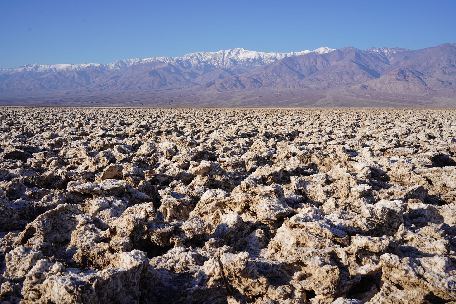
What surprised me about this spot is that the salt formations were hard, jagged and very uneven. If you attempt to walk out into the salt formations, be sure to watch your step. The terrain is tough to navigate and I saw someone fall.
Tip: Listen for tiny pops - this is the sound of billions of salt crystals bursting in the heat!
Hike the Natural Bridge Trail
The Natural Bridge Trail is a short hike that leads to a beautiful natural bridge formation. You’ll walk up the wash of a canyon and reach the arch in about a half mile. If you continue a little further, you’ll get to see areas of dried up falls and experience the canyon getting a little more narrow. The entire trail is 1.4 miles with 449 feet of elevation gain.
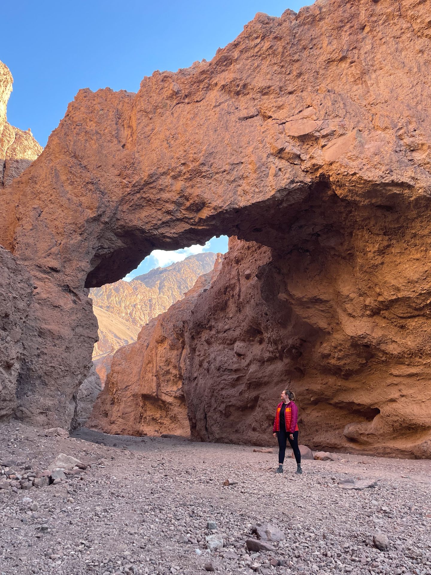
You’ll need to take an unpaved road up a hill to reach this trail. Any car should be able to make it, but this was probably the bumpiest road I took during my time in Death Valley.
Overall, this is a great family-friendly trail to include in your Death Valley itinerary!
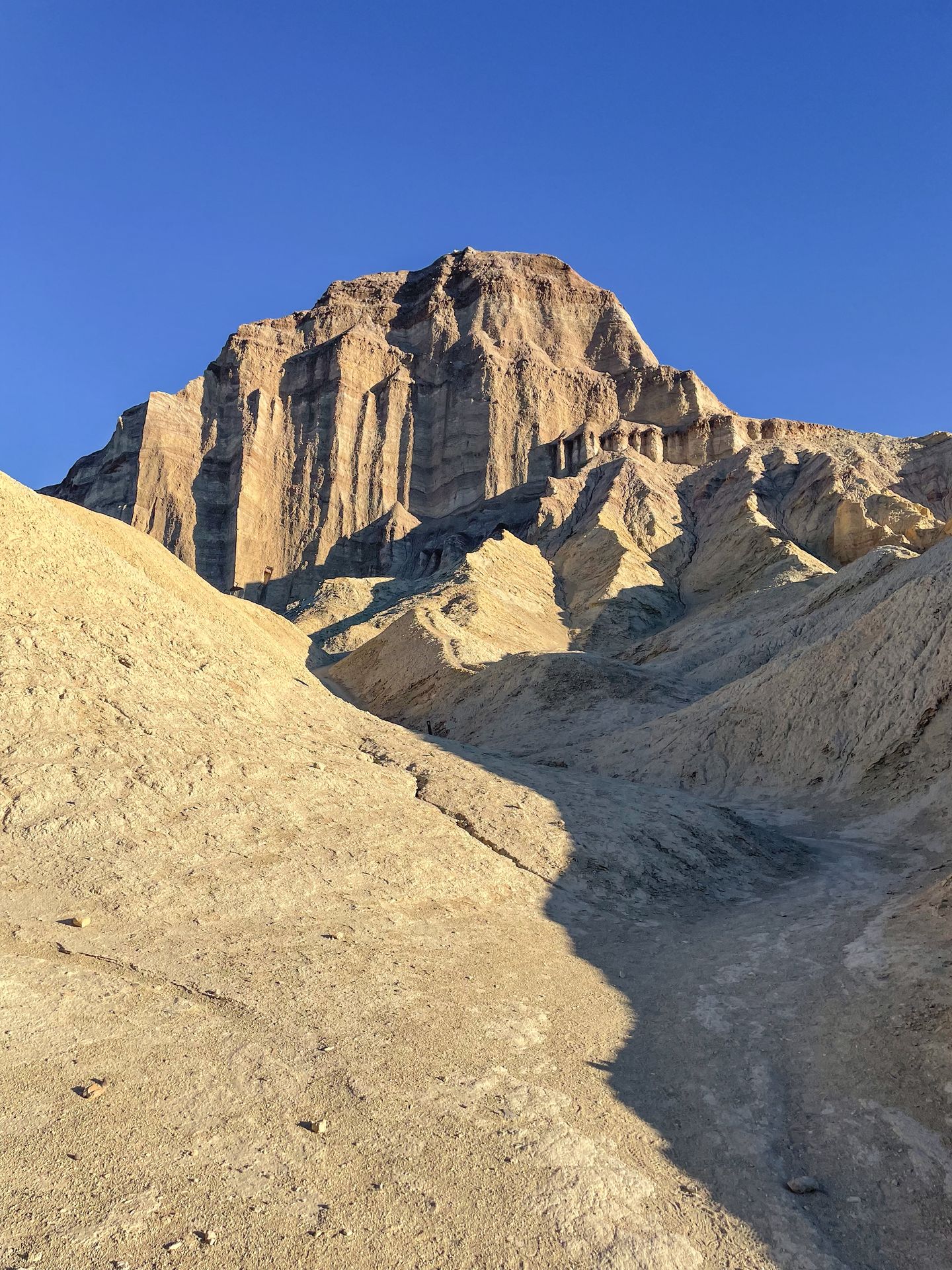
Hike Desolation Canyon
Desolation Canyon is one of my favorite trails on this itinerary! It’s an underrated trail that will once again lead you into a canyon. The park map noted this as a 4x4 road, but it seemed outdated. The road was very short and smooth for me.
There is not clear signage on where to go to begin this trail. You’ll really want to have the AllTrails map downloaded for offline usage so that you know which direction to go in. The trail comes in at 3.6 miles and 784 feet of elevation gain.
When you find the canyon opening, you’ll be hiking in and up as the canyon narrows. There is a bit of rock scrambling along the way, including one area that involved climbing a tall wall.
As you get close to the end, you can hike up a steep area for fantastic views of the surrounding area. You can gaze down at the canyon you just hiked through, see a glimpse of the colorful rocks on Artist’s Drive and admire the valley of the park.
This fun and unique trail is a great one if you’re looking for a less crowded trail and don’t mind a bit of route finding.
Check out Harmony Borax Works
If you enjoy learning about history, it’s worth a quick stop at the Harmony Borax Works. This is a former plant that harvested ore in the early 1880’s. The borax produced here was then transported through the use of large mule teams, and the romantic image of a “20-mule team” still exists today.
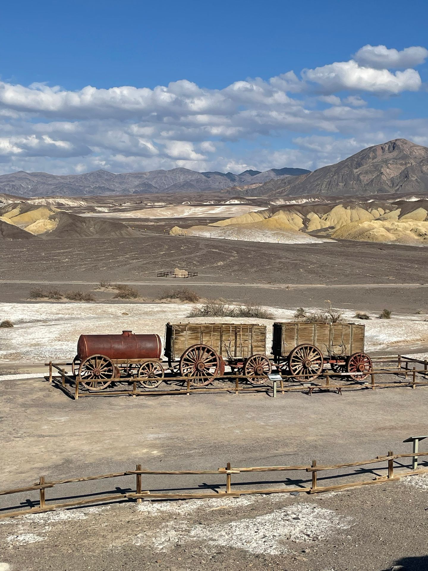
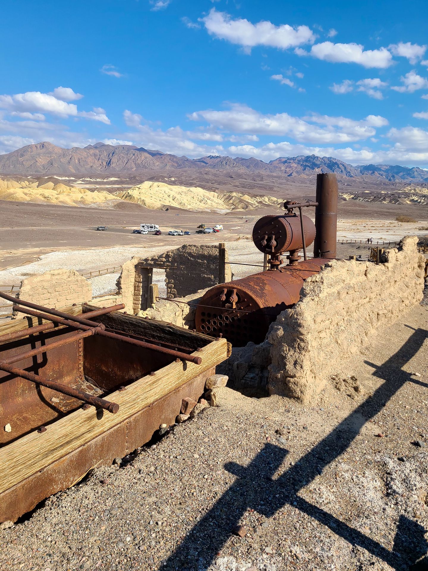
There are some helpful interpretive signs here to learn about the history of borax in Death Valley. There is also a recurring ranger-led talk about the history here, check the calendar if you’re interested!
Visit the Borax Museum and Ice Cream Parlor
If you have enough time, head over to The Ranch at Death Valley to visit the Borax Museum and the Ice Cream Parlor.


The Borax Museum is quite small, but there are several artifacts around the yard to look at. It’s a nice place to take a quick walk.
The Ice Cream Parlor is decorated with vintage decor, and there are several ice cream flavor options along with shakes and sundaes. They also have other food such as burgers. The prices are expensive, but there are few other options in a remote area. The ice cream is refreshing on a warm day!
Watch the Sunset from Artists’ Drive
I saved this iconic Death Valley site for last so that you could see it around sunset! Golden hour and sunset is a great time to visit because you’ll get to enjoy interesting shadows and changing light that enhances some of the colors.
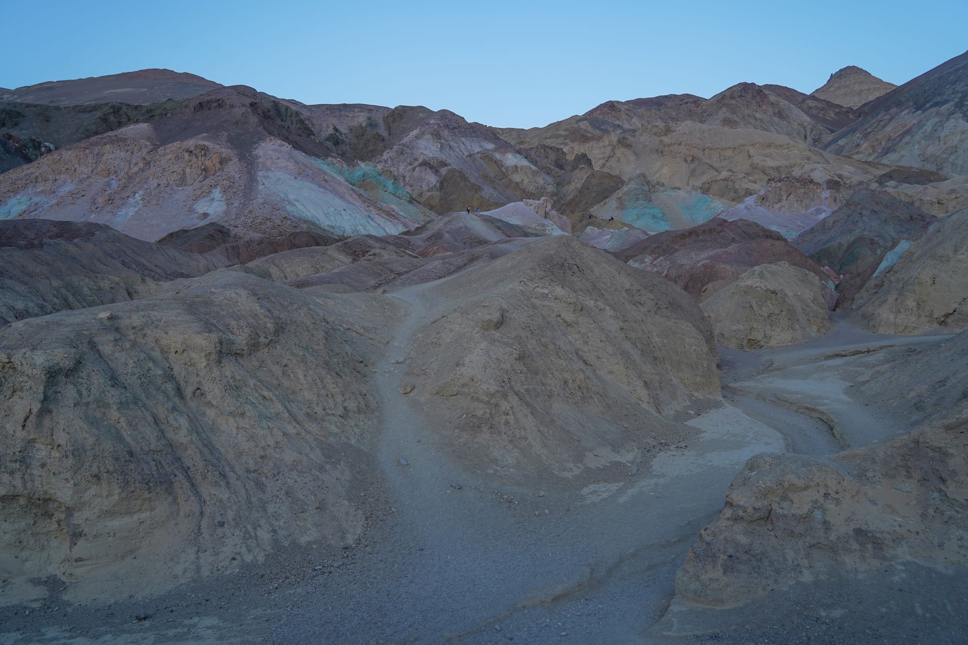
Artists’ Drive is a 9-mile scenic drive that will lead you past colorful hills formed by volcanic deposits. The drive is one-way and you cannot drive a vehicle over 25 feet long due to some steep areas and sharp turns.
There are two main viewpoints to stop at during the drive - the Artist’s Palette Overlook and Artist’s Palette. The Artist’s Palette Overlook is right at the beginning of the drive, and it’s about a quarter mile to reach the viewpoint. It’s worth a quick walk to get a higher viewpoint of the colorful, eroded hills.
As you continue the drive, don’t miss out on exploring Artist’s Palette. This is the most colorful area of the drive, and you can explore among the hills on foot. There is a whole spectrum of colors here, including blue, red, orange, pink and green.
The rest of the drive after Artist’s Palette is also colorful and beautiful. This is definitely a highlight of a trip to Death Valley.
More Things To Do in Death Valley and Nearby
-
Darwin Falls: A waterfall in the desert! The hike to reach the waterfall is 1.9 miles and you’ll need to drive an unpaved road. The road is typically passable for sedans, but may require 4x4 and high clearance at times.
-
The Racetrack: This area is home to a unique phenomenon - rocks that move on their own! A 4x4, high clearance vehicle is required to reach this spot. However, you can also go on a tour with Farabee Jeeps so that you don’t have to worry about navigating the roads yourself!
-
Ubehebe Crater: This large, volcanic crater is 600 feet deep and half a mile across. You can enjoy the view from the parking lot or hike along the rim, or to the bottom (and back up). Unfortunately, the road to reach this site was closed during my visit.
-
Rhyolite Ghost Town: Rhyolite was founded in the early 1900’s after the discovery of quartz in the area. By 1916, the town was abandoned after all of the mines shut down. Today, you can walk around and see the remnants of the town. It is located 35 miles from the Furnace Creek Visitor Center on your way to Beatty, NV.
-
Goldwell Open Air Museum: These giant, outdoor sculptures are right next to the Rhyolite Ghost Town and a unique site to behold.
-
Ash Meadows National Wildlife Refuge: Who knew there would be wetlands right outside of such a dry desert? The Ash Meadows National Wildlife Refuge is home to a desert oasis and you can explore the area via boardwalk trails.
Final Thoughts
From salt flats to mountains to canyons to sand dunes, I hope you’ve caught a glimpse of how special Death Valley National Park is. I hope this weekend itinerary helps you plan the perfect trip to Death Valley. It’s a stunning park whether you are visiting for hiking, or just to see the sights.
For more National Park Guides, see these blogs:
- The Best National Parks to Visit in the Winter
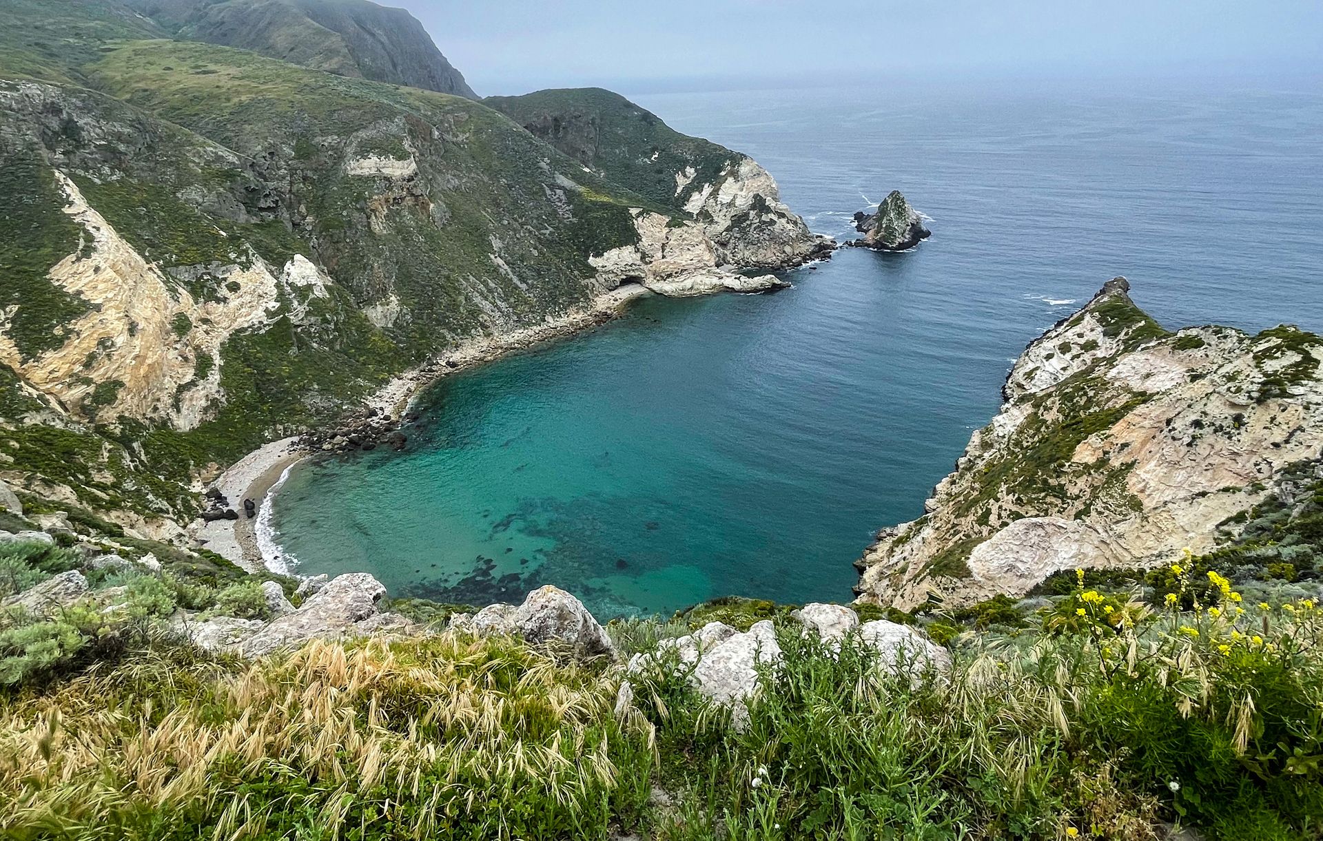
- How to Spend 2 Days in the Channel Islands
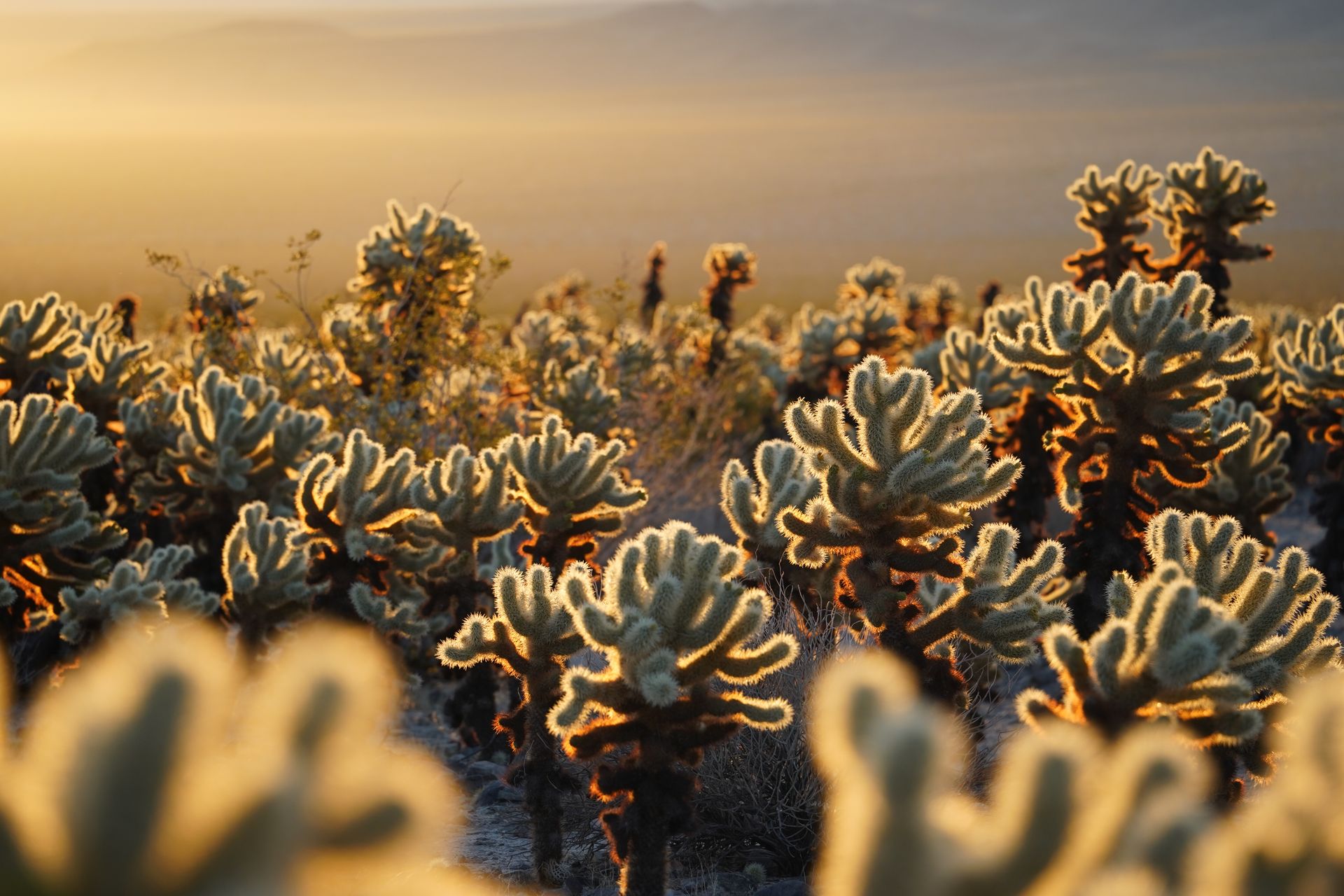
- How to Spend 2 Days in Joshua Tree
- How to Spend 3 Days in Sequoia and Kings Canyon National Parks
- The Perfect Redwood National Park Itinerary
- How to Spend 2 Days in Zion National Park
- An Epic Road Trip Itinerary for the Utah Mighty 5
- The Best Things To Do in Bryce Canyon
- How to Spend One Day in Capitol Reef
- The Perfect Itinerary for Saguaro National Park
Thanks for Reading!


Let's stay in touch!
Join the Lost with Lydia email list to get monthly travel guides and tips!