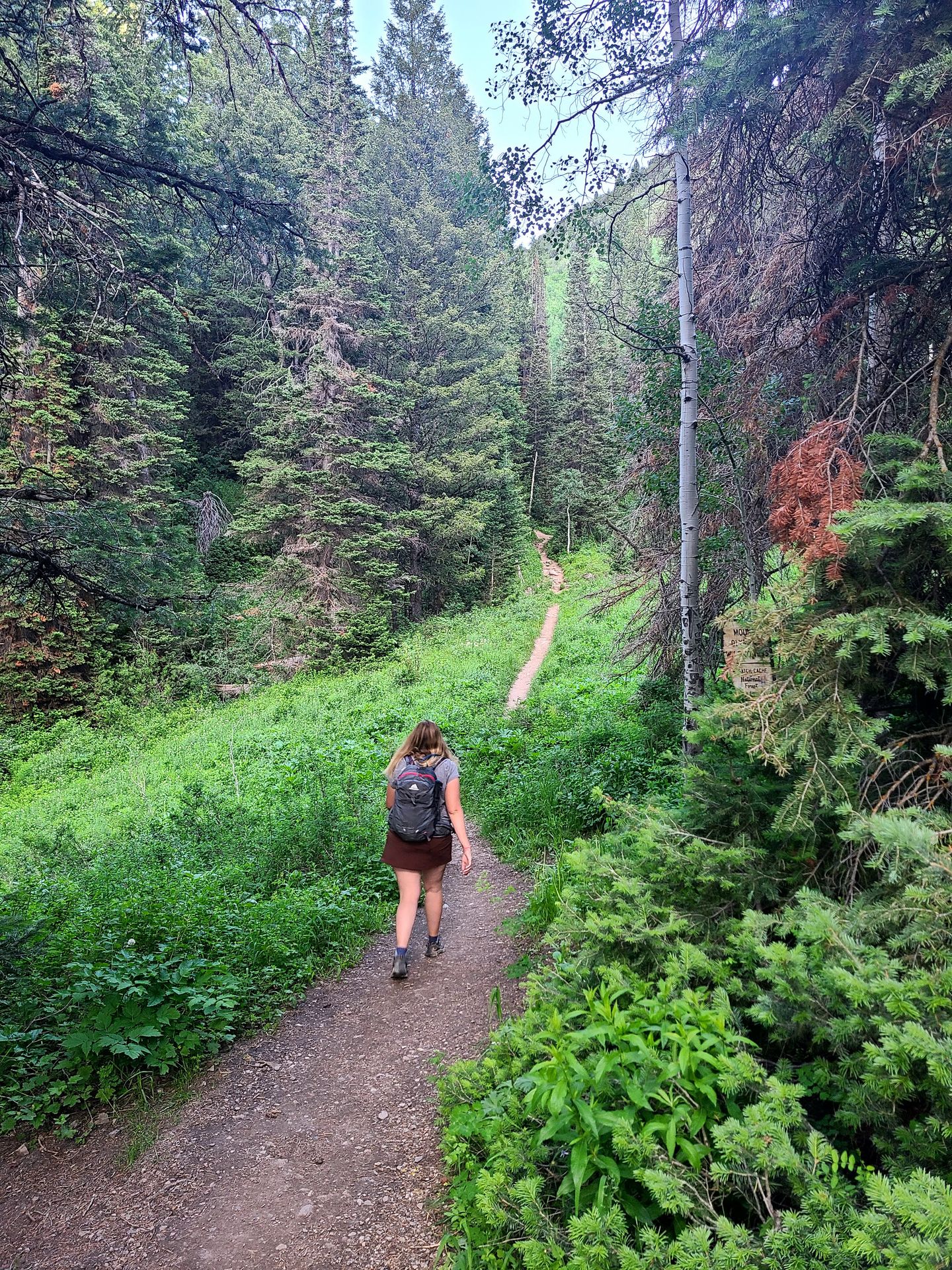
Are you looking for the best hiking trails near Salt Lake City? Salt Lake City has a huge variety of hiking trails within an hour's drive. In only minutes, you can reach trails that will lead you to waterfalls, alpine lakes, mountain peaks and more.
There are so many beautiful hiking areas near SLC. You can explore Antelope Island State Park, the Cottonwood Canyons, the Uinta Mountains, American Fork Canyon and more. The trails in this guide range from easy to hard and are based on my experience hiking near Salt Lake City in the spring and summer.
If you are new to hiking, check out my guide for getting started hiking! I offer tips on what to bring, how to prepare and more.
Pro Tip: If you’re new to hiking, AllTrails is a great tool to use for navigation, recent trail reviews and more. If you do a lot of hiking, I highly recommend paying for AllTrails Plus to access offline maps and the “Lifeline” feature, which allows you to send your location to a trusted friend or family member.
Safety: I highly recommend wearing hiking shoes with traction and bringing the ‘10 essentials’ on any hike. It’s better to be over prepared than underprepared! I also carry the Garmin InReach Messenger, which can be used to call for help in an emergency where there is no service.
Leave No Trace: Please make sure to always leave no trace, no matter what trail you’re on! The principles of leave no trace are:
- Pack out all of your trash (including food scraps)
- Do not feed or approach wildlife
- Travel on durable surfaces (for example - walk through the mud instead of around so not to widen the trail)
- Respect those around you (keep your volume down)
- Respect the local rules for building fires
- Leave what you find (please do not collect rocks or anything else)
Things To Know About Hiking Near Salt Lake City:
- Unfortunately, there are so many trees in the mountains near Salt Lake that have been destroyed by carvings. Carving into a tree leaves it open to diseases and pests. Please never leave your mark on a tree or on anything in nature. For more information on how to properly respect the outdoors, learn the 7 principles of leaving no trace at lnt.org.
- Many trails in the Salt Lake City area are very buggy in the summer months. Be sure to bring your insect repellant. My favorite bug spray is Ranger Ready because it uses picaridin instead of DEET and actually smells good.
- Many of these trails are in watershed areas feeding the city and do not allow dogs. Be sure to check ahead of time.
- Always check trail conditions before heading out. These tips and photos are based on visiting in the summer. Many of these trails will have snowy conditions and potential avalanche danger during the winter and spring.
13 of The Best Hiking Trails Near Salt Lake City
Trails are listed in order of length.
Ensign Peak
- 0.8 miles
- Rated easy
- 374 feet of elevation gain
- 10 minutes from Salt Lake City
- Free
- Dogs allowed on leash
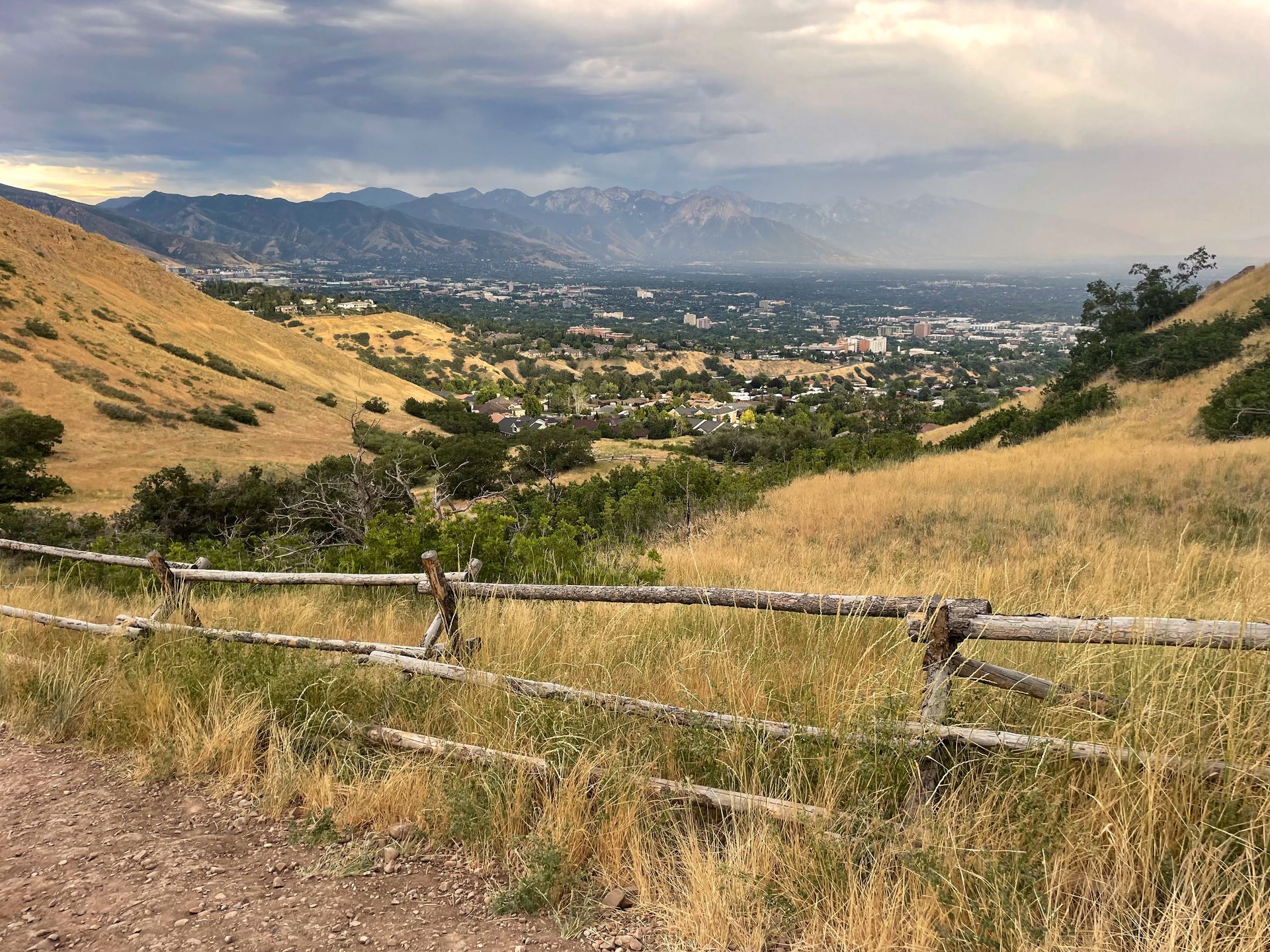
Ensign Peak is a short trail in Salt Lake City that leads to city views. It’s a great place to watch the sunset and one of the best easy hikes in Salt Lake City.
You’ll park in a neighborhood and walk up a hill for this trail. If you are unable to make it to the top, there is a closer viewpoint a very short walk from the street that also has some nice views.
As you climb to the top, the trail is a bit steep but short. You will mostly be hiking over dirt and a few rocks. At the top, there is a tower and signage with history of the park. You’ll have a great view of the city, the airport, the Great Salt Lake and some of the surrounding mountains.
This is a great short trail to add to your Salt Lake City itinerary.
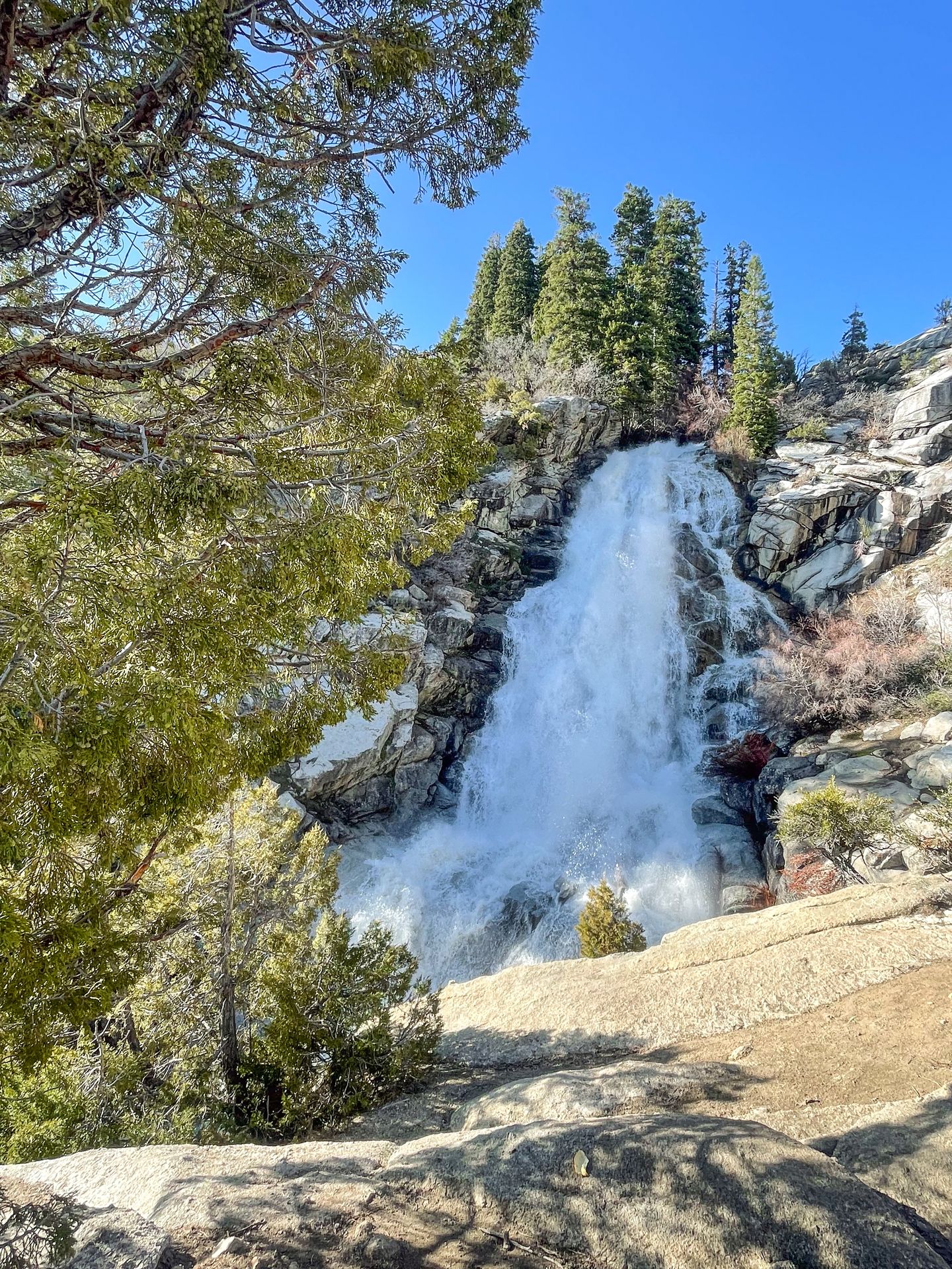
Gloria Falls
- 2.2 miles
- Rated easy
- 534 feet of elevation gain
- 30 minutes from Salt Lake City
- Free
- No dogs allowed
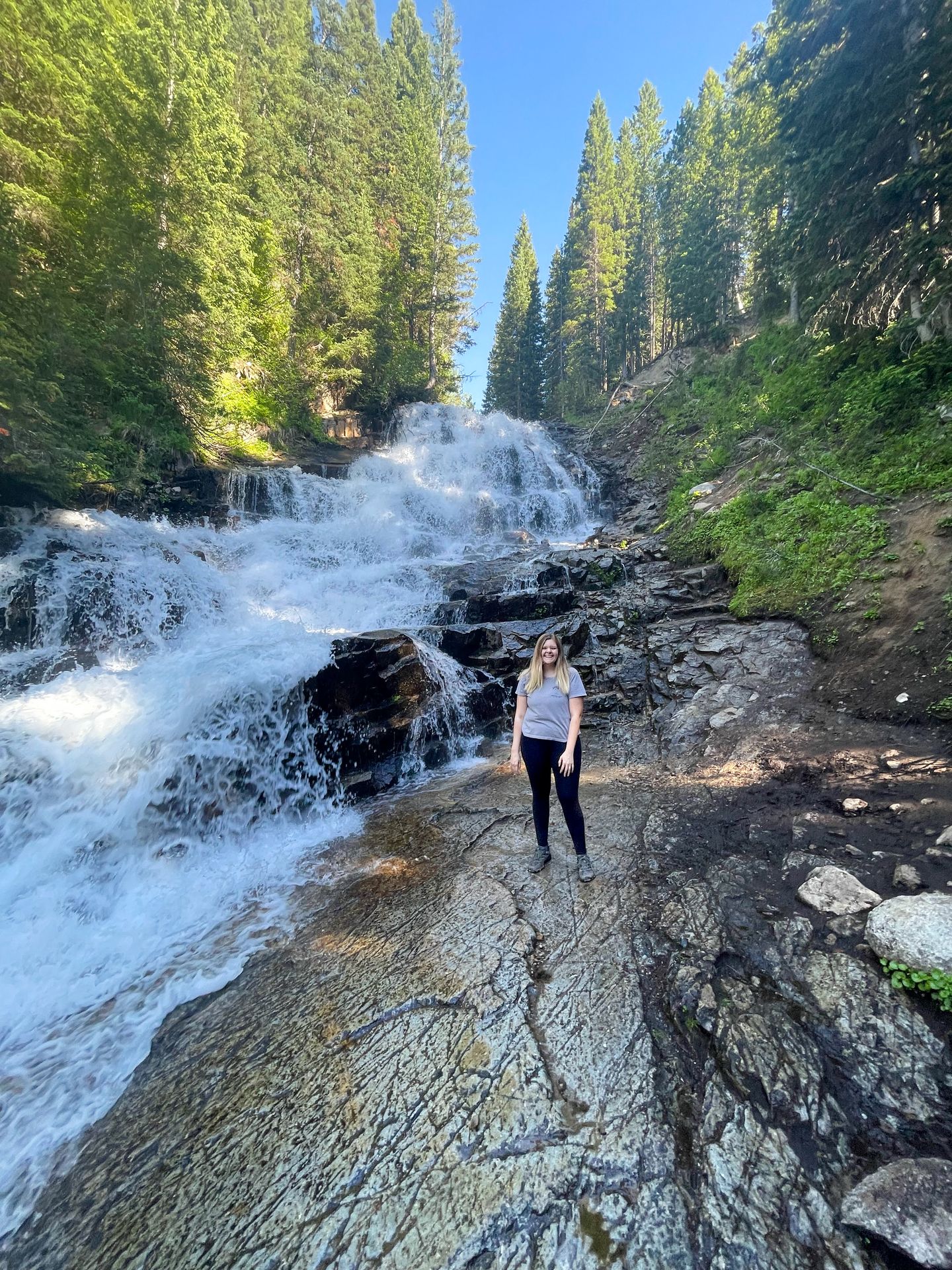
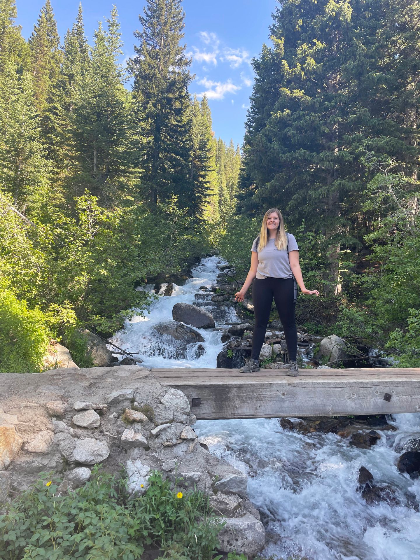
Gloria Falls is a popular trail leading to a beautiful waterfall and stair step down rocks. The trail starts out wide with a gradual incline up to the falls. Along the way, there are some great views of the surrounding mountains.
One mile into the trail, you’ll cross a bridge over the White Pine Fork River. The crossing has a great view of the river and valley.
Right after the bridge, the trail gets confusing to follow. You will turn left and travel on a dirt path alongside the stream to reach the falls. There seems to be a few different desire-paths and no clear official way, but its not hard to keep your bearings with the river nearby.
I recommend following the AllTrails map closely and going the way that seems easiest. Expect that you may encounter some mud, climb over some tree roots and traverse some steep areas. While it is still doable for most, I would say this area makes the trail more moderate than easy.
When you reach the falls, you can get close and watch the water cascade down the rocks. If you continue a bit further on the trail, you can also see a view of falls from the top.
Gloria Falls is a great family friendly trail near Salt Lake City and offers a beautiful payoff for a short journey.
In addition to Gloria Falls, it’s worth a quick stop at nearby Lisa Falls. The trail to this waterfall is only about a quarter mile and you’ll get to enjoy another small waterfall.
Donut Falls
- 2.3 miles from closest lot
- Rated easy
- 538 feet of elevation gain
- 40 minutes from Salt Lake City
- Free
- No dogs allowed
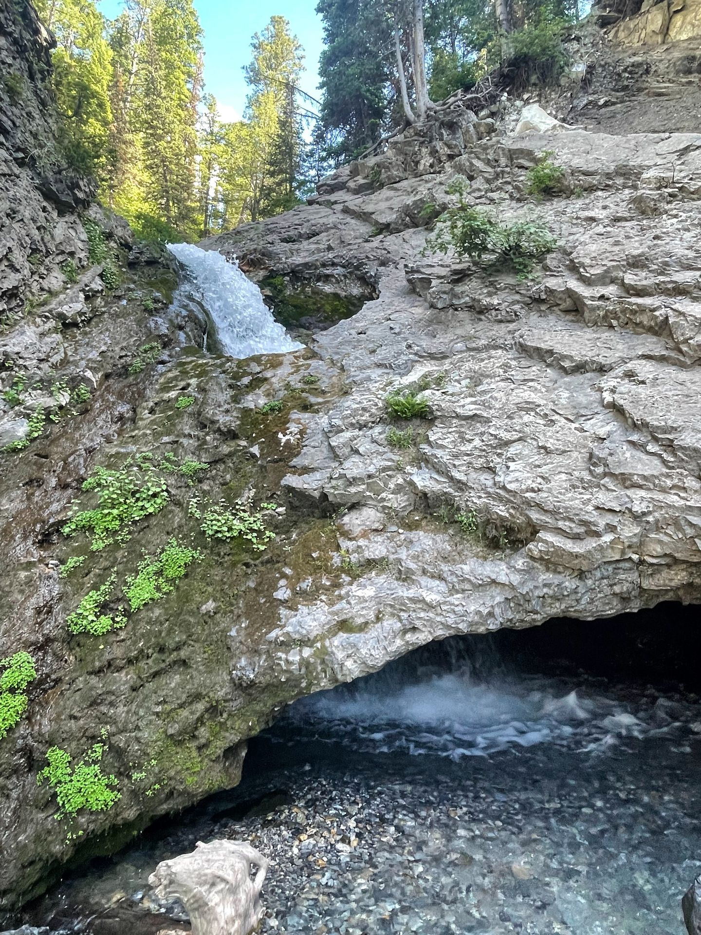
Donut Falls is certainly one of the most unique waterfalls near Salt Lake City. This mostly easy trail leads to a waterfall that cascades through a donut-shaped rock and into a cave!
There are two different parking lots for the trail. The closest lot can fill up or can be closed during winter weather. If you need to park at the further lot, right next to the main road, it adds an easy 2 miles to the hike.
The first part of the trail is wide and travels through the woods with a gradual hill. You will get to enjoy some shade from the trees.
About a half mile from the closest parking lot, you will reach a point where you have to climb down next to the creek. There is a rope to help you out, but you’ll be climbing down a rock scramble that will involve some big steps.
Next, you will follow the river a short distance to the falls. Depending on the water levels, your feet may get wet as you navigate the river. You can choose to cross (there are rocks you can use, but they may or may not stop you from getting wet) or stay on the same side.
When you reach the waterfall, you can see the “donut” area several feet up from ground level. It is a bit hard to see without getting up close. To reach it, you can scramble past the hazard sign and up the waterfall.
The scramble difficulty can vary depending on time of year and water levels, but it involves climbing over big rocks that can be slippery with sand and water. You also will likely get your feet wet. I would definitely consider the scramble moderate and not easy, so consider your ability if you add this optional scramble to your hike
When you reach the donut falls, you get a great view of the feature and can even go inside of the cave and see the waterfall up close. Just watch your step and be prepared for cold water.
This hike can get super crowded, so go during non-peak times to avoid some of the crowds.
Living Room Lookout Trail
- 2.4 miles
- Rated moderate
- 928 feet of elevation gain
- 15 minutes from Salt Lake City
- Free
- Dogs allowed on leash
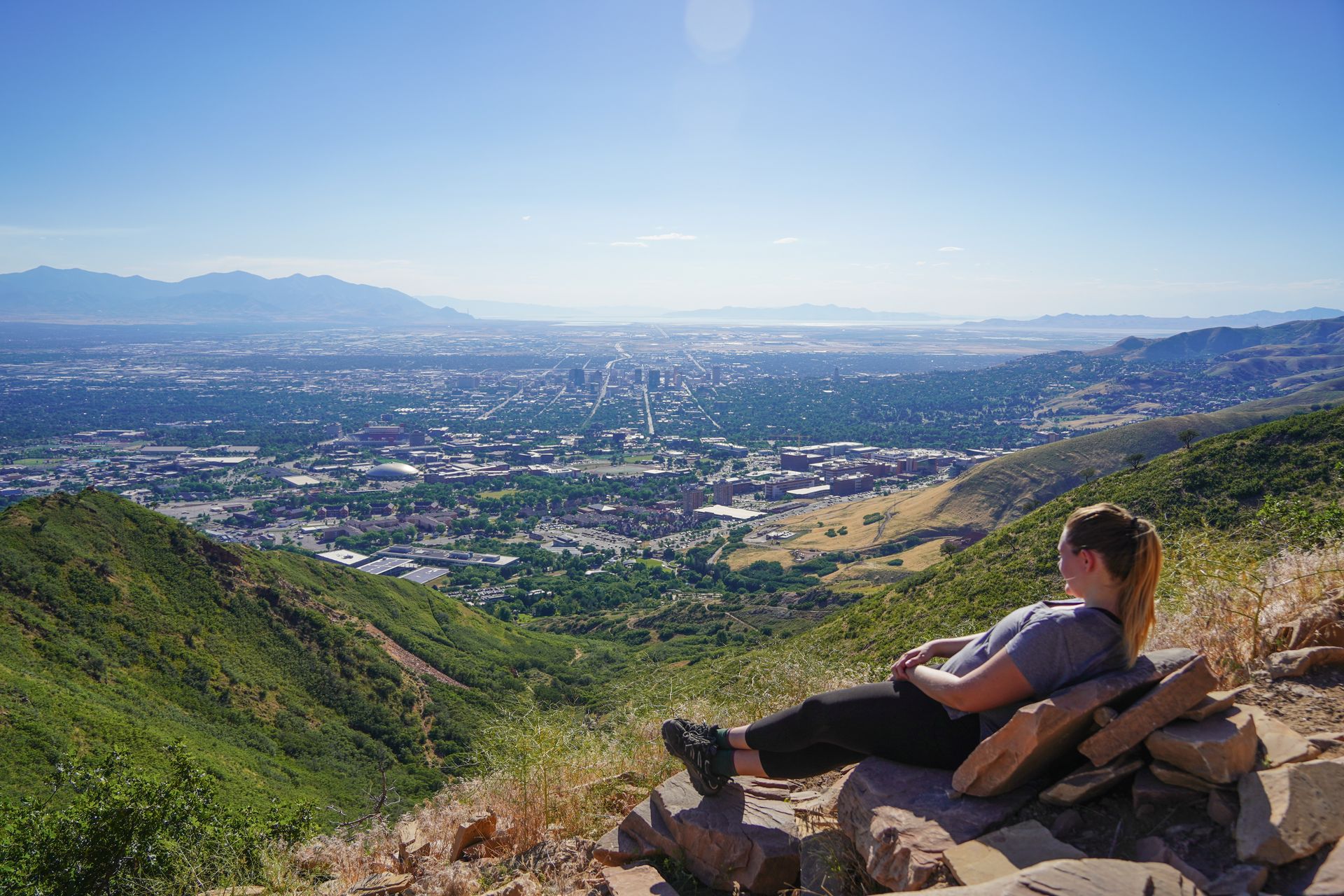
The Living Room Trail is a wonderful place for hiking in SLC. It is located right on the edge of Salt Lake City and offers city views with unique rocks. The trail begins in a forested area and you may encounter a few areas of overgrowth.
After about a quarter mile, you’ll start climbing the mountain. There is very little shade, so be sure to wear sunscreen and bring plenty of the water.
The trail is also quite steep and has a few sections of loose rocks.
The further you climb, the more views of Salt Lake City you’ll get to see . When you reach the top, you’ll find a collection of rocks that have been arranged like a living room. There are multiple “chairs” and several rocks that you can sit on. It’s a great place to watch the sunset or have a snack.
In addition to this trail, there are more trails in the area that you could add on for a longer hike. This is a great way to get a viewpoint of the city and a workout.
Primrose Overlook
- 3.1 miles
- Rated moderate
- 787 feet of elevation gain
- 1 hour and 10 minutes from Salt Lake City
- $6 for a 1-3 day pass in American Fork Canyon. Free with the America the Beautiful Pass
- Dogs allowed
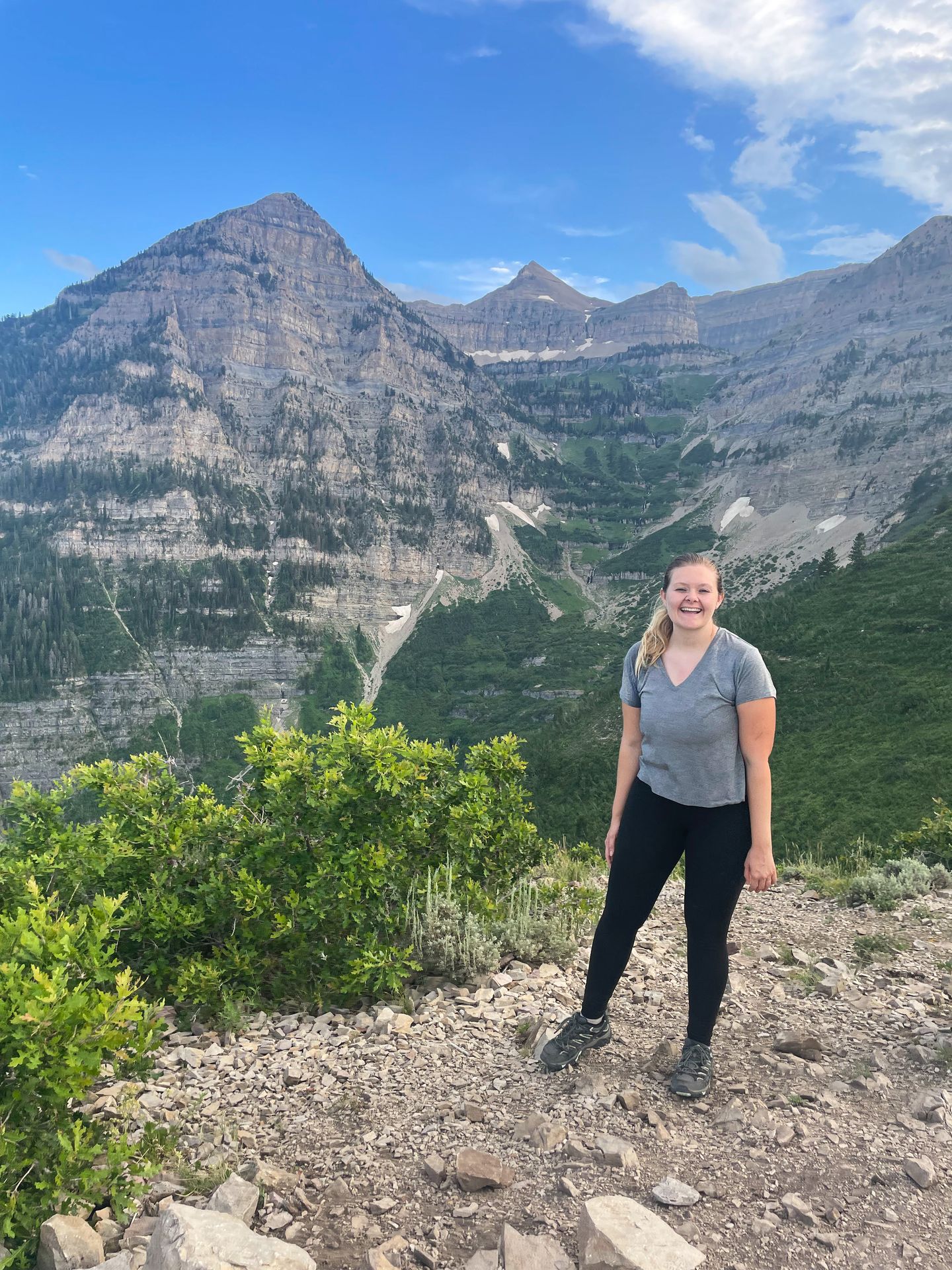
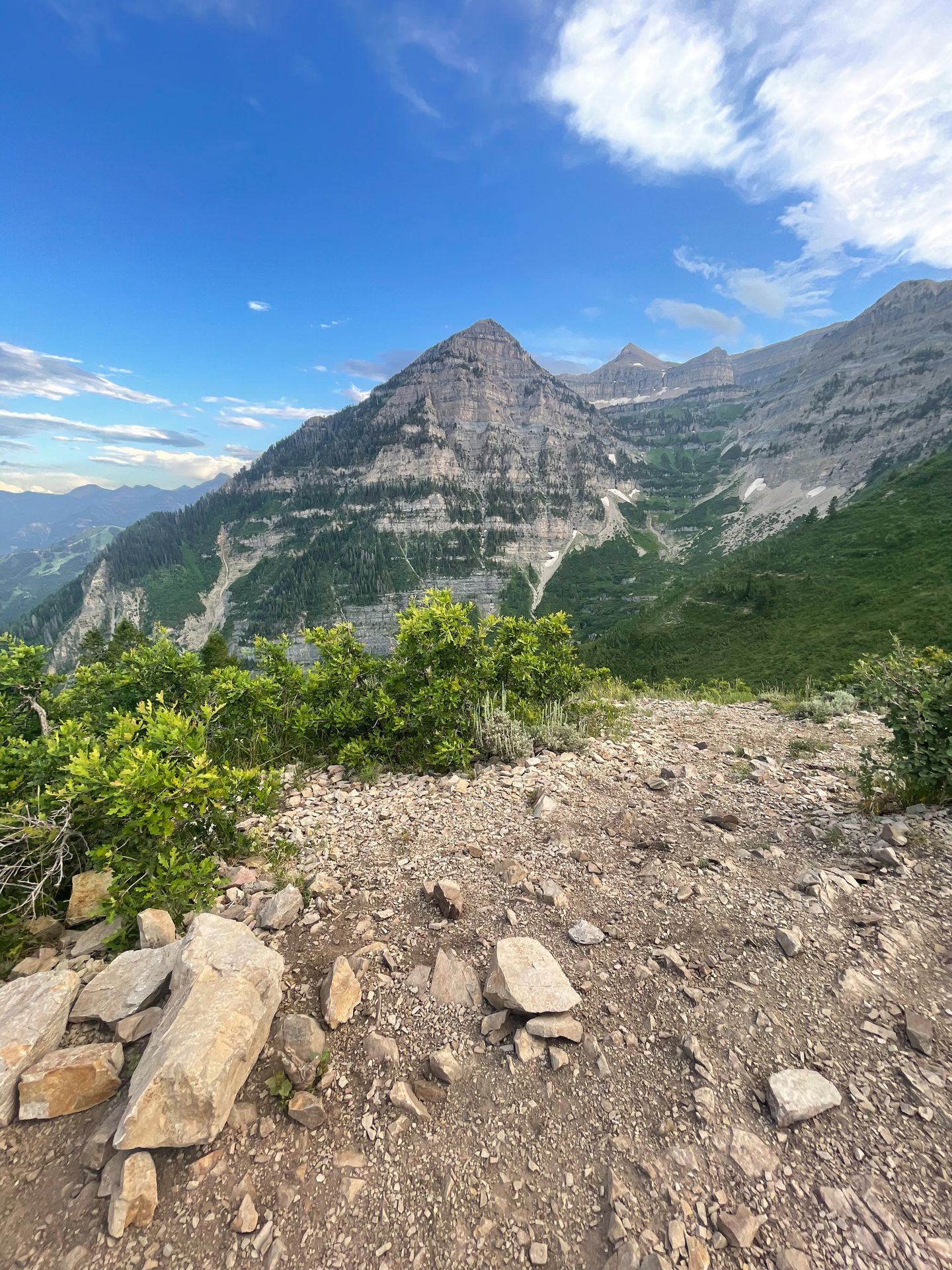
The Primrose Overlook is another trail that has a short climb with an incredible payoff. The trail is in the American Fork Canyon, so you’ll need to pay an entry fee or display your America the Beautiful Pass hanging from your windshield.
The trail goes in and out of forests and valleys on your way up to the overlook. There are many beautiful aspen trees and the area was so green when I hiked in the summer.
The final half mile of the trail has the steepest climb, but it doesn’t last long. As you reach the end, you emerge out of the woods and are presented with an incredible view of the mountain peaks right across a valley.
At the top, you’ll have a clear view of Mt Timpanogos, Timpanogos Falls and the surrounding peaks and valleys.
This trail has an incredible view for a relatively short and easy journey. While it is the furthest away from Salt Lake City on this list, it is very much worth the drive.
Circle All Peak
- 3.2 miles
- Rated hard
- 1,541 feet of elevation gain
- 30 minutes from Salt Lake City
- Free
- No dogs allowed
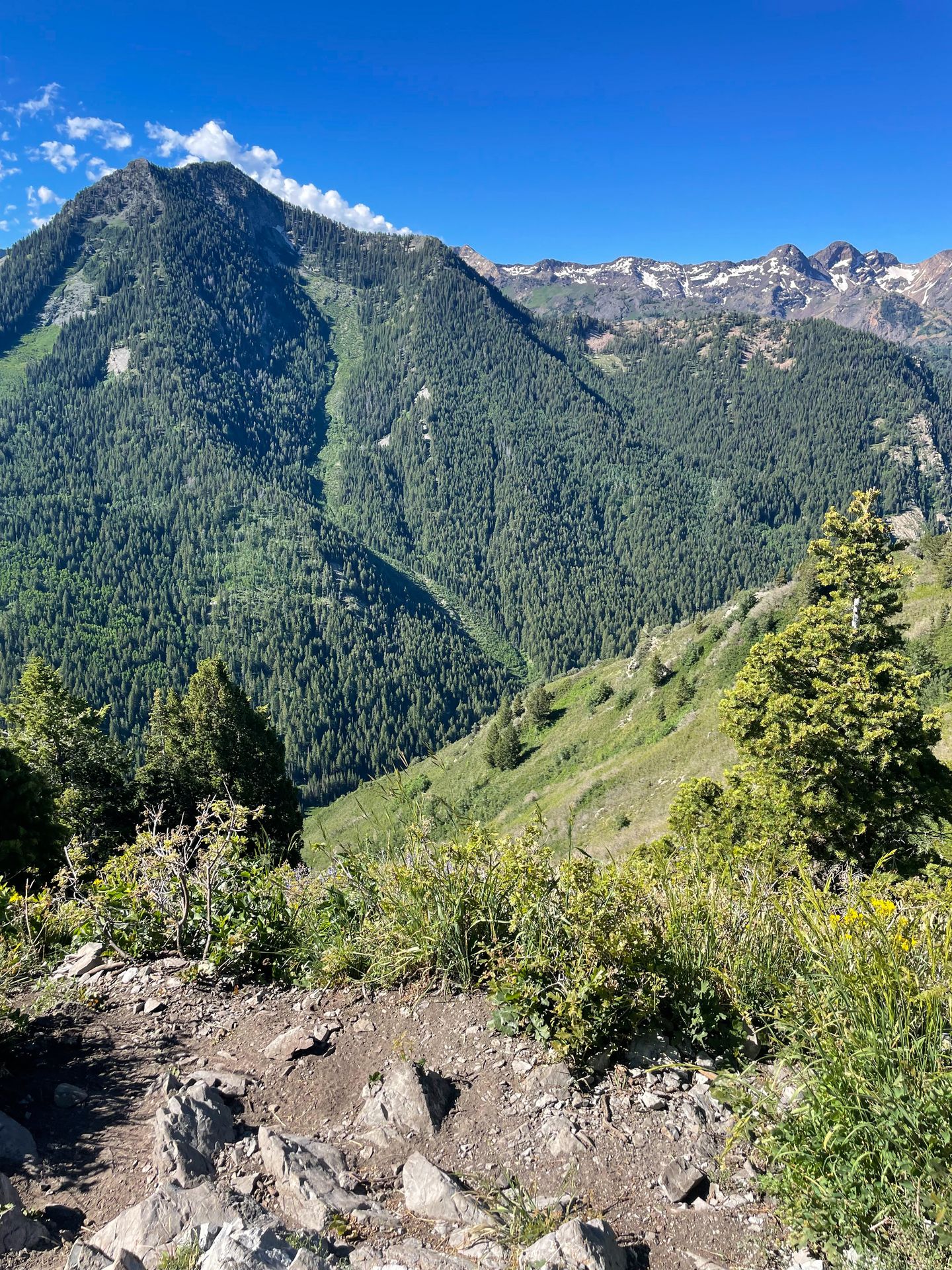
Circle All Peak is a short but difficult hike that leads to an incredible viewpoint. You will begin by walking along a river and quickly start to ascend up a steep hill.
The trail is beautiful and full of greenery in the summer. There are wildflowers, an easy river crossing and beautiful aspen trees.
When you reach the switchbacks, the trail levels out a bit, but there are more steep sections to come at the end.
Like others in the area, the bugs were very annoying on this trail during the summer. Be sure to bring your bug spray.
When you reach the peak, you’ll be rewarded with amazing mountain views. You’ll have a view of Kessler Views and several more peaks in the area. There is not a ton of space at the top, but enough to sit down and have a snack.
This trail is great if you’re looking for a workout that will lead you to some incredible views in a short distance.
Stewart Falls
- 3.6 miles
- Rated moderate
- 646 feet of elevation gain
- 1 hour from Salt Lake City
- $6 for a 1-3 day pass in American Fork Canyon. Free with the America the Beautiful Pass
- Dogs allowed
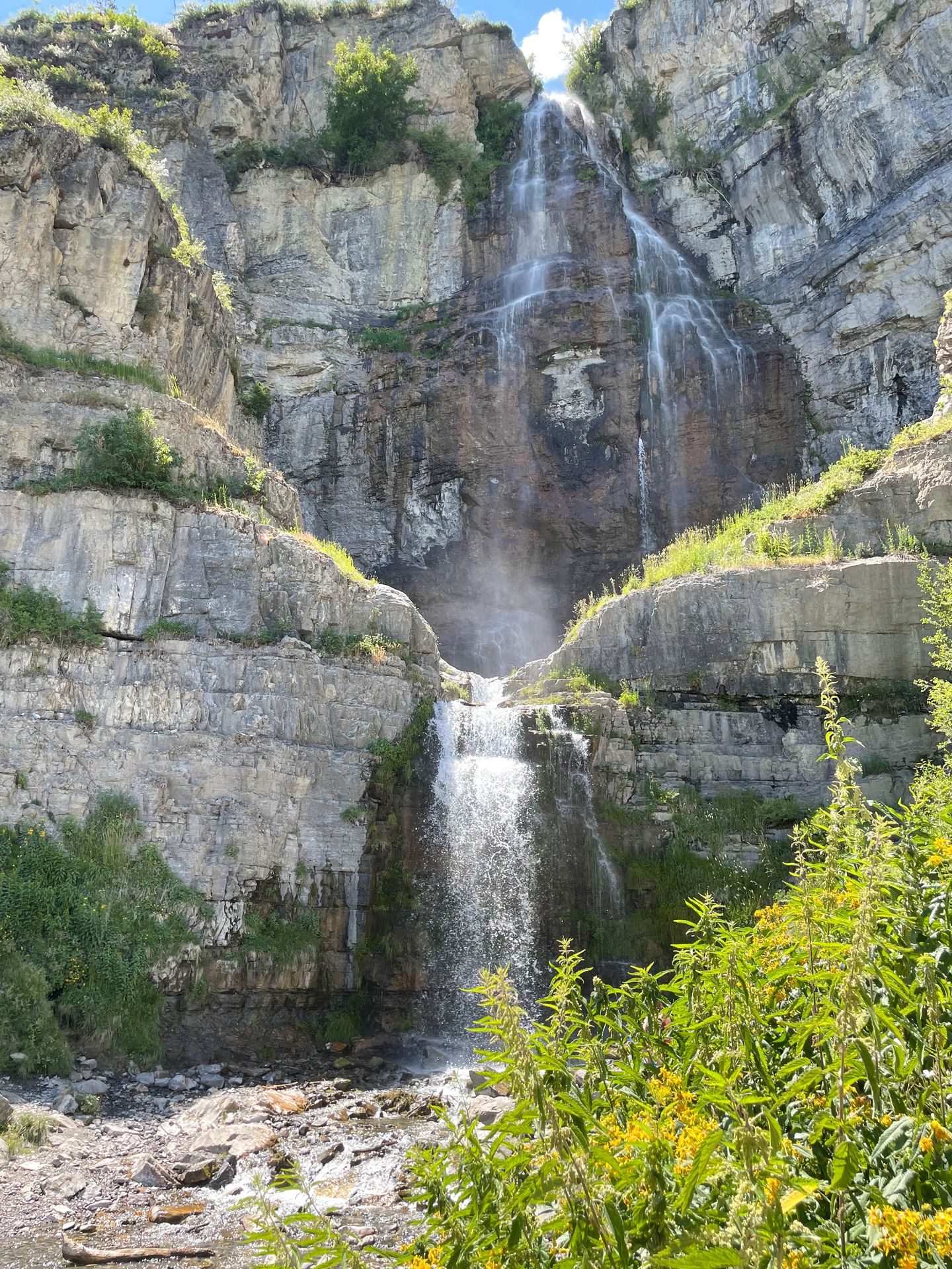
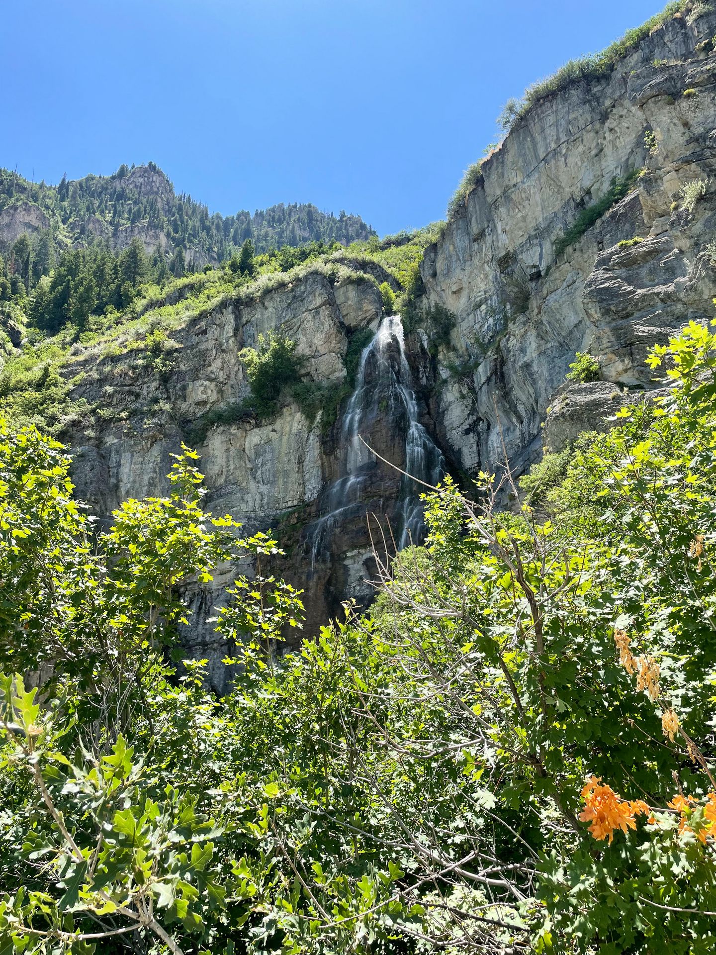
Stewart Falls is a popular and beautiful two tier waterfall that is 200 feet tall. Like Primrose Overlook, it is located in the American Fork Canyon and requires a fee (but your America the Beautiful Pass will work if you have one).
There are a couple different ways to get to Stewart Falls. I followed the #56 Stewart Cascade trail, which tends to be the most popular.
Depending on when you visit, expect the trail to be crowded with families and kids.
You will climb in elevation for the first half of the hike, then descend to reach the waterfall. The trail is a mix of shade and sun. There is a lot of forested area with some views along the way.
One part that I didn’t enjoy was hearing a loud pool party from the Aspen Grove BYU hotel and camp. You can hear the camp activities for a portion of the trail.
When you reach the waterfall, its height and beauty are impressive. There was even a much narrower waterfall falling next to it while I was there. Beyond the waterfall, you can look out into the valley and take in the views.
This is a beautiful trail, but I recommend going during off hours to avoid the crowds.
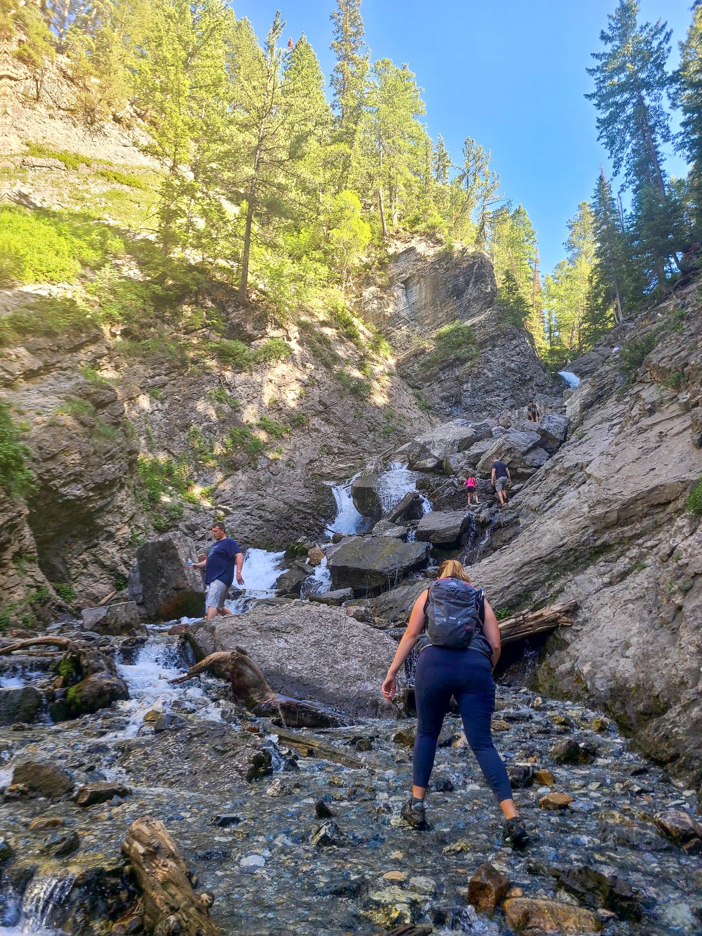
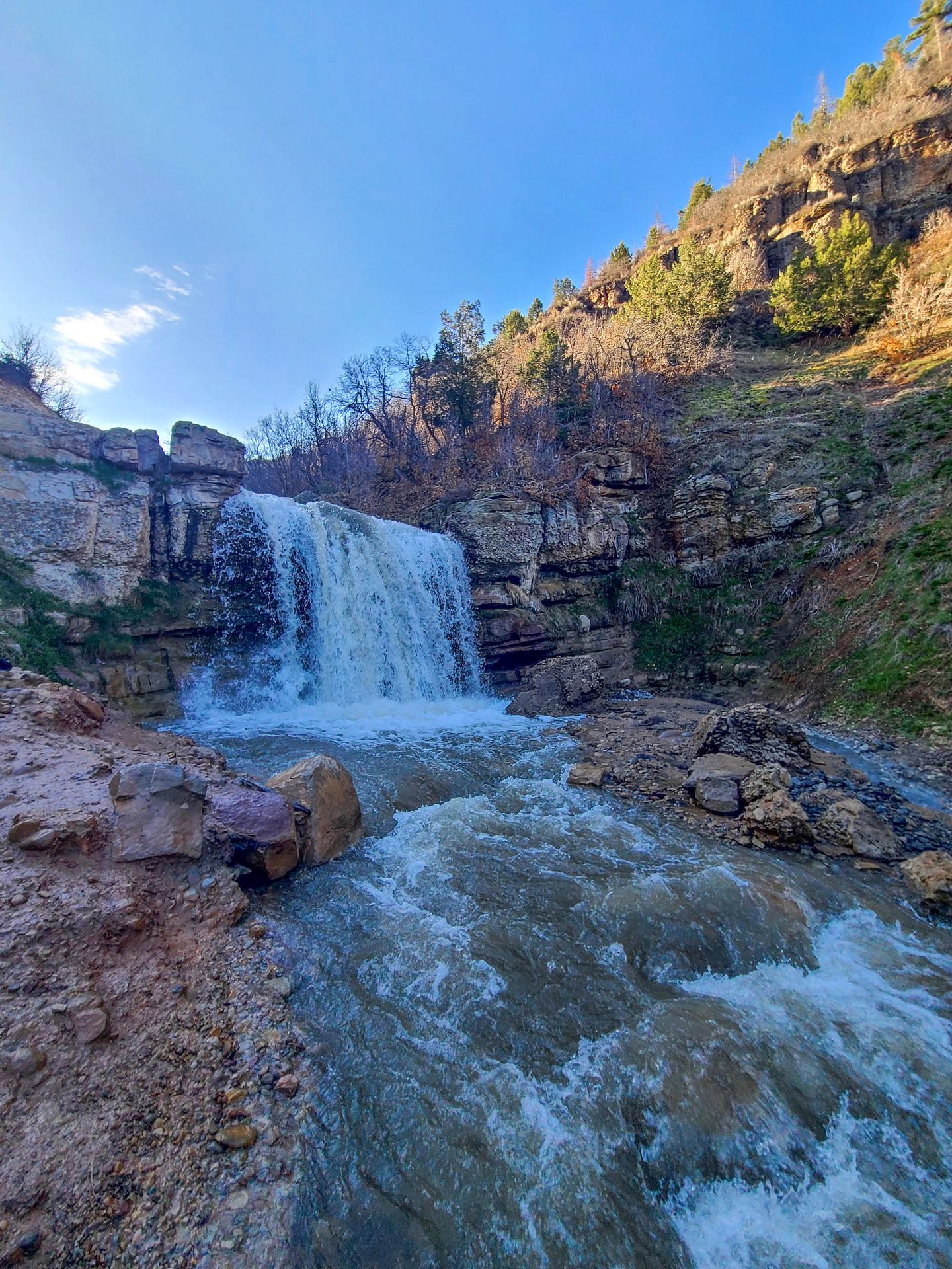
Horsetail Falls via Deer Creek and Dry Creek Trail
- 4.2 miles
- Rated hard
- 1,653 feet of elevation gain
- 45 minutes from Salt Lake City
- Free
- Dogs allowed
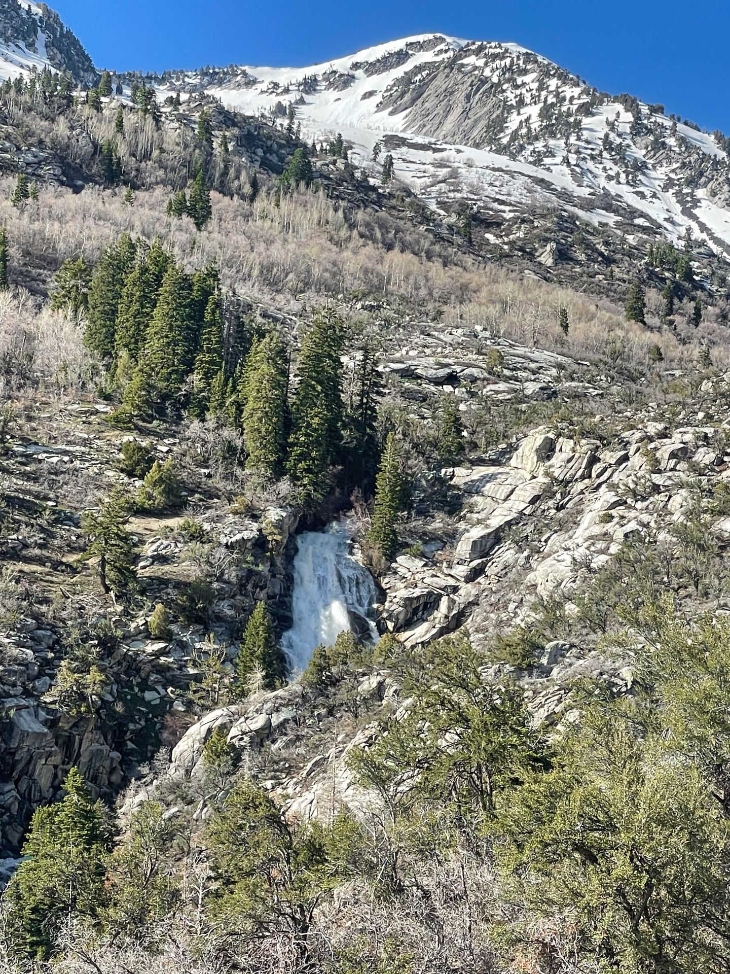
Horsetail Falls is a beautiful, rushing waterfall near Salt Lake City. It’s beautiful year round, but especially amazing in the spring when the water is flowing hard. Along with the epic waterfall, the trail also offers some nice views of the valley below.
The hike to reach the waterfall is quite steep. It also includes a couple of stream crossings, but there are typically logs you can use to cross. Waterproof shoes are very helpful, as your feet will probably get wet.
As you approach the waterfall at the end, there is a short scramble. Sometimes there is a rope, but it wasn’t there when I went. The scramble is doable for most, but be sure to take your time. This hike is a work out, but very rewarding if you love chasing waterfalls!
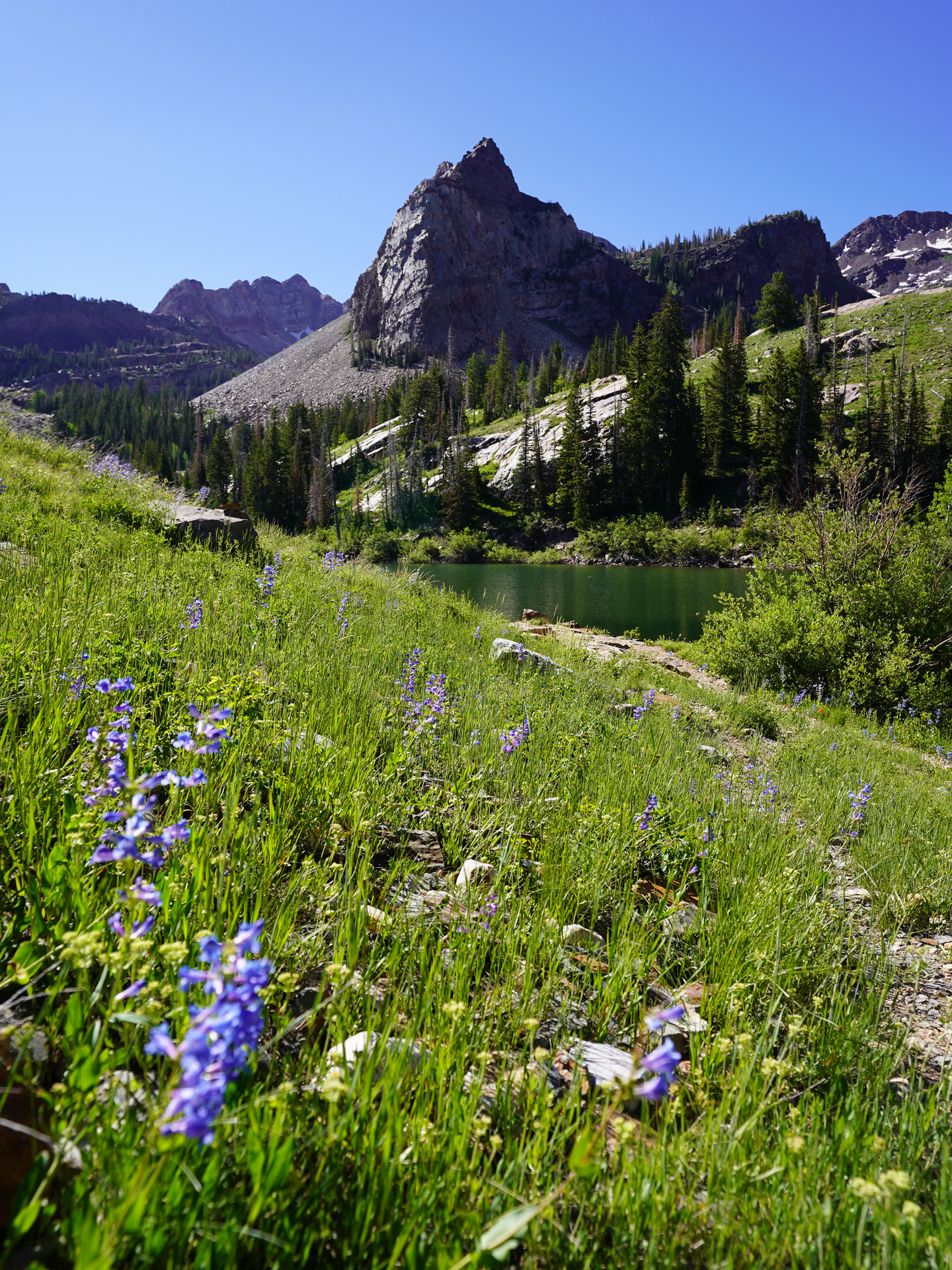
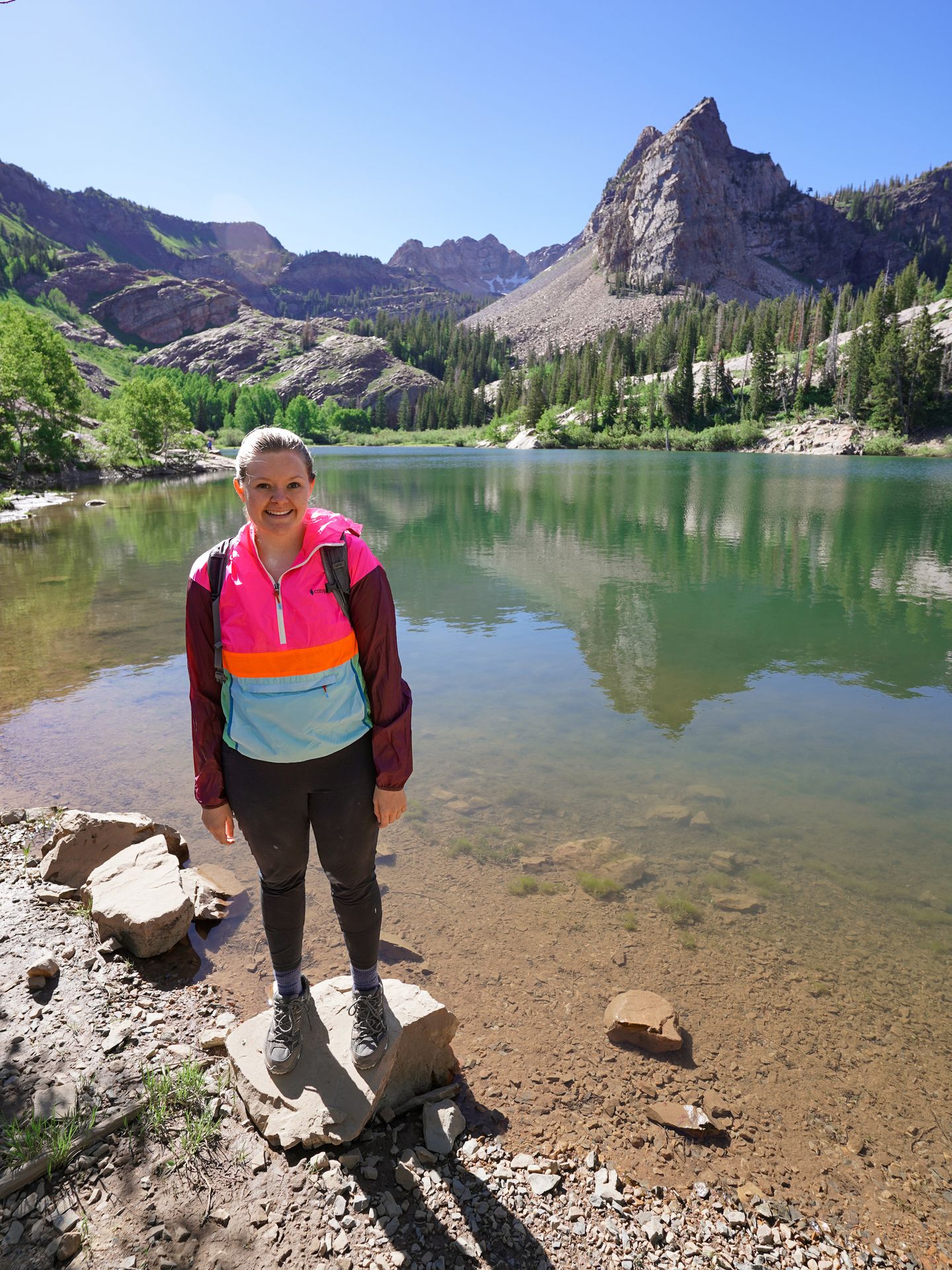
Cecret Lake from Albion Base
- 4.5 miles
- Rated moderate
- 1,213 feet of elevation gain
- 40 minutes from Salt Lake City
- Free
- No dogs allowed
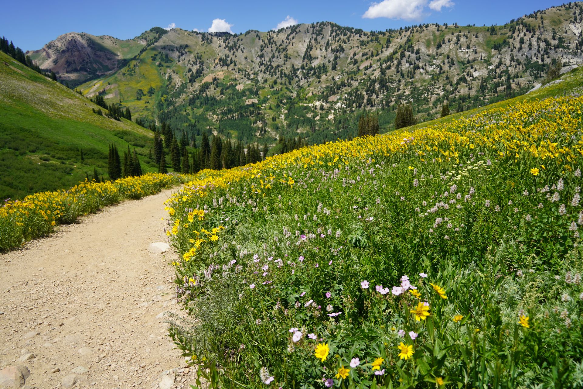
Cecret Lake is a beautiful lake nestled among the ski resorts of Alta, Utah. While you might ski here in the winter, this area is well known for its impressive wildflower display in the summer.
Wildflowers are generally at peak in late July and early August and are best seen in the Albion Basin. I recommend following this route because it takes you through the Albion Meadows and then up to Cecret Lake.
The wildflowers are absolutely stunning. You will get to see fields of yellow, white and pink flowers with a backdrop of mountains covered in green. These were definitely some of the most beautiful flowers I’ve ever seen.
The trails for the Albion Meadows and Cecret Lake connect, but you can also drive to a closer parking lot if you only want to see Cecret Lake. The trail up to Cecret Lake includes some minor rock scrambling and has incredible views of the surrounding mountains.
The color of Cecret Lake can depend on the time of year and recent rainfall. It was a green color when I visited. The lake has a beautiful mountain backdrop behind it.
This is a very popular area so expect crowds, especially during peak wildflower season. But it is so worth it to explore this beautiful area.
Fifth Water Hot Springs
- 4.5 miles
- Rated moderate
- 636 feet of elevation gain
- 1 hour, 15 minutes from Salt Lake City
- Free
- Dogs allowed
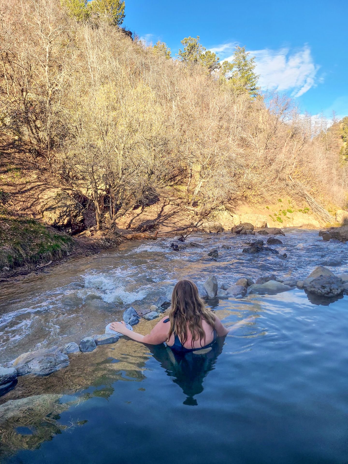
Fifth Water Hot Springs is one of the most popular hiking trails near Salt Lake City! A moderate trail along a river will lead you out to hot spring pools sitting right along a rushing river and a waterfall. It’s a fun place to soak in the warm water and take in your surroundings.
However, this trail gets extremely crowded. I highly recommend visiting at sunrise on a weekday if you want to avoid the crowds. Plus, the parking lot fills up quickly and parking on the street is discouraged and subject to ticketing.
The road to reach the trailhead is closed during the winter months. While it’s closed, you can hike in on the road, which adds about 3 more miles. I’m guessing this also reduces the crowds!
Please make sure to pack out all of your trash when you visit. Better yet, bring a trash bag and take anything you see with you, as unfortunately a lot of things get left behind.
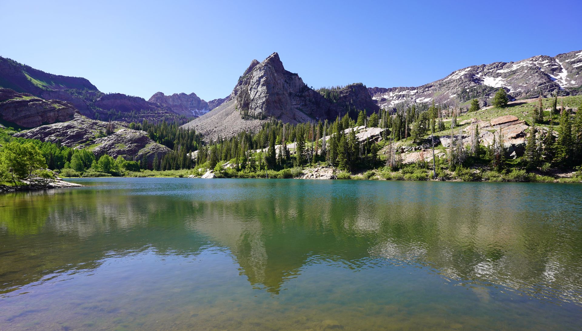
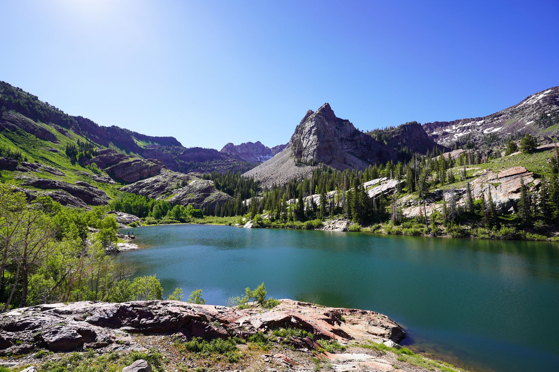
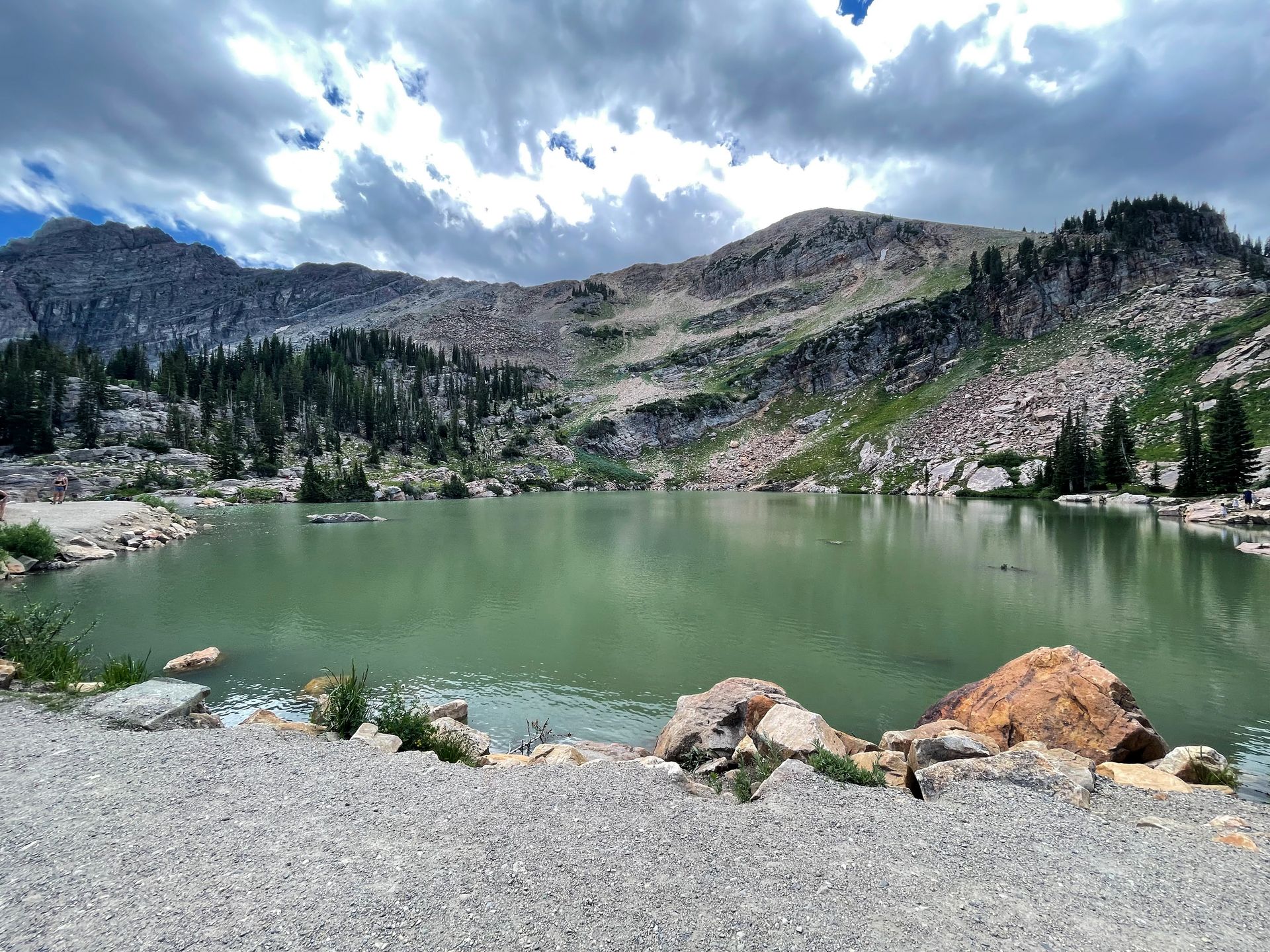
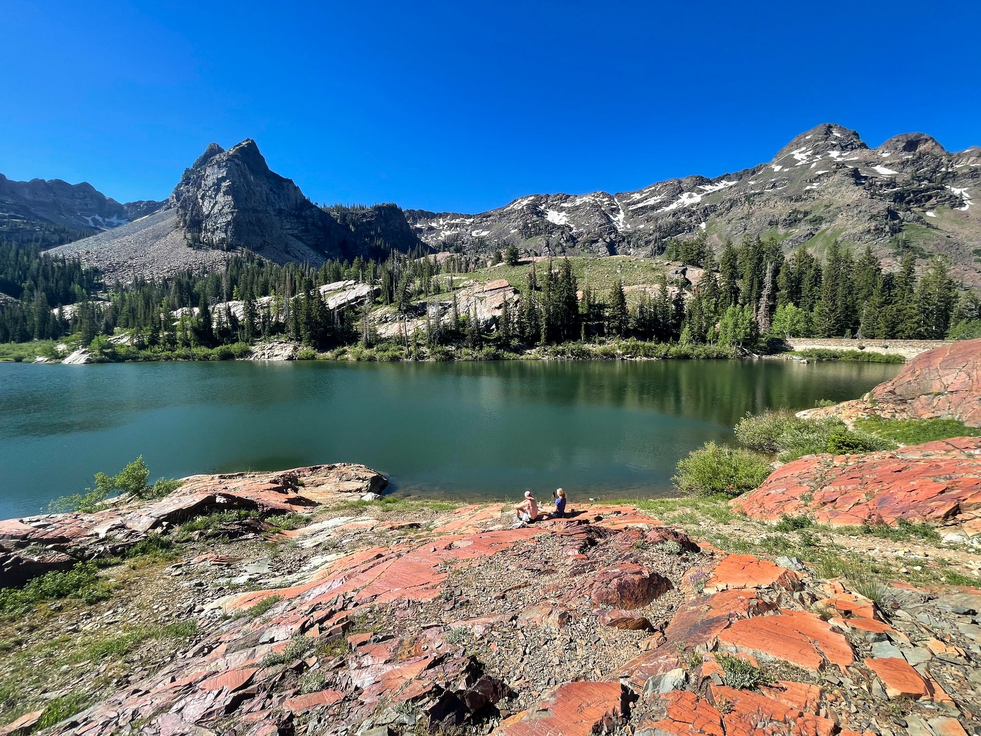
Lake Blanche
- 6.8 miles
- Rated hard
- 2,808 feet of elevation gain
- 30 minutes from Salt Lake City
- Free
- No dogs allowed
Lake Blanche is an iconic hike near Salt Lake City that leads to a gorgeous alpine lake framed by mountains. This trail is quite steep and can get very crowded, but is definitely worth doing.
The main park lot for Lake Blanche is small and fills up early. It was already full when I arrived at 6:30AM. However, there are plenty more parking spaces available along the road near the trailhead.
The first quarter of a mile is a paved path along the river, and then you will turn right to start climbing the trail up to the lake.
The trail weaves in and out of forested areas, so there is some shade. If you start early in the morning, you’ll have the shade of the canyon on your way up!
The trail is steadily steep throughout. It is sometimes narrow, but not so narrow that it is uncomfortable to pass. There are a few areas along the climb where you can enjoy views of the valley next to you.
This trail was also very buggy in the summer, be sure to bring bug spray.
When you reach the top, you are welcomed with an incredible view of the lake with the mountain behind it. Lake Blanche is surrounded by rocks and there are a lot of different areas to explore. Depending on which direction you choose, there is a little bit of rock scrambling involved.
There is a lot of space to spread out and enjoy a packed lunch within view of the water. In addition to the lake views, you can also take in the views of the valley down below.
Note that while it may look inviting, swimming is not allowed in Lake Blanche. The area is a protected watershed.
When you reach the lake, you don’t have to stop there. There is a trail that goes all the way around Lake Blanche and you can hike to two other lakes right next to Lake Blanche. Just be aware that the trail around Lake Blanche is a bit difficult to follow and involves a river crossing.
Overall, the trail to Lake Blanche is steep but not technically difficult. Of course, it depends on your hiking abilities, but I wouldn’t let the hard rating scare you. Allow yourself plenty of time and bring plenty of water to enjoy this rewarding trail.
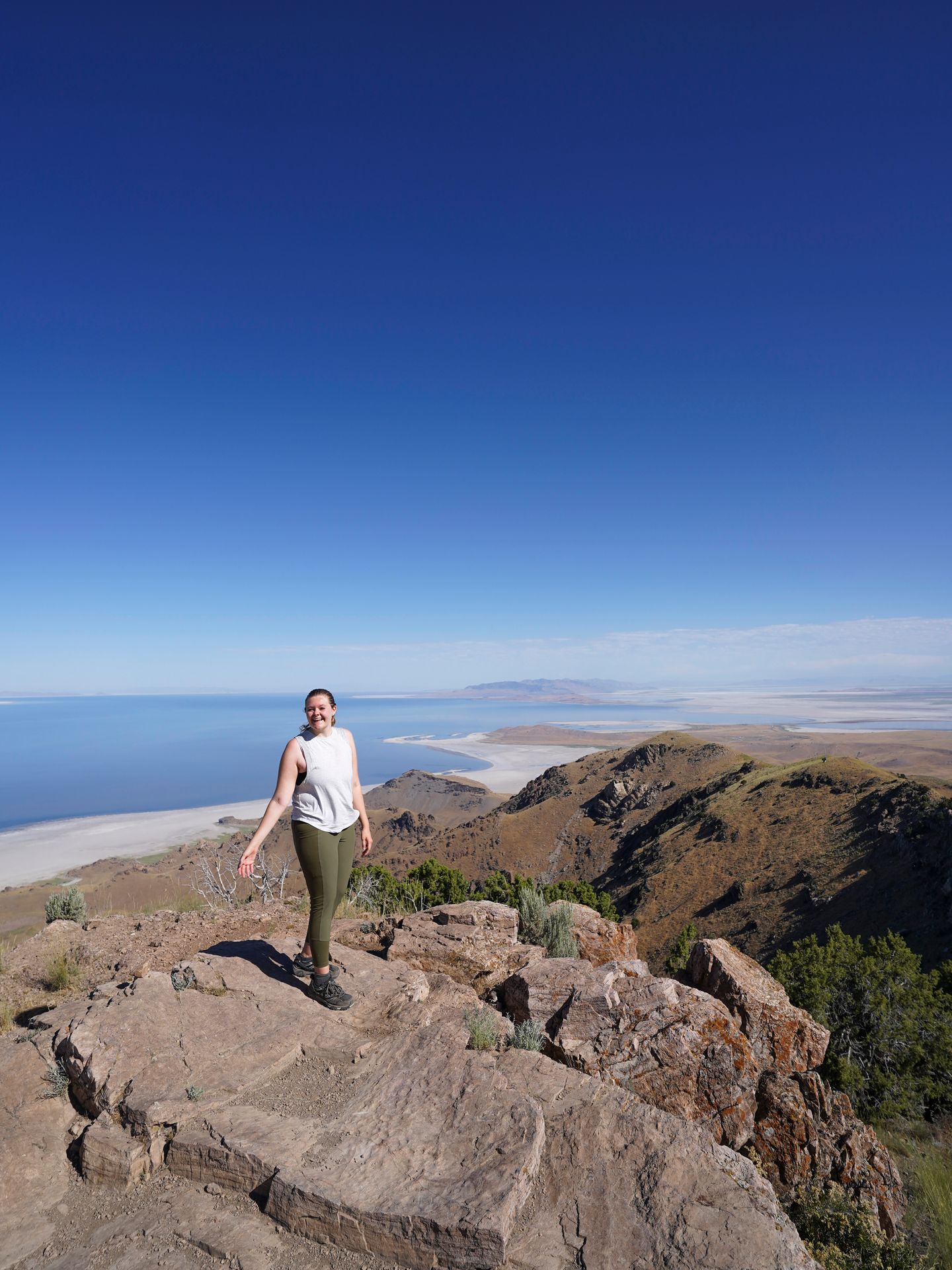
Frary Peak
- 6.9 miles
- Rated hard
- 2,335 feet of elevation gain
- 1 hour from Salt Lake City
- $15 entry fee per vehicle
- Dogs welcome on leash
Frary Peak is the highest point on Antelope Island and offers incredible views. There is no restroom at the trailhead, but there is one just down the hill from where the trail begins.
I completed this hike in the summer and started before 8AM to beat the heat. The trail has very little shade so it gets very hot in the summer. The trail is also pretty steep throughout the entire journey.
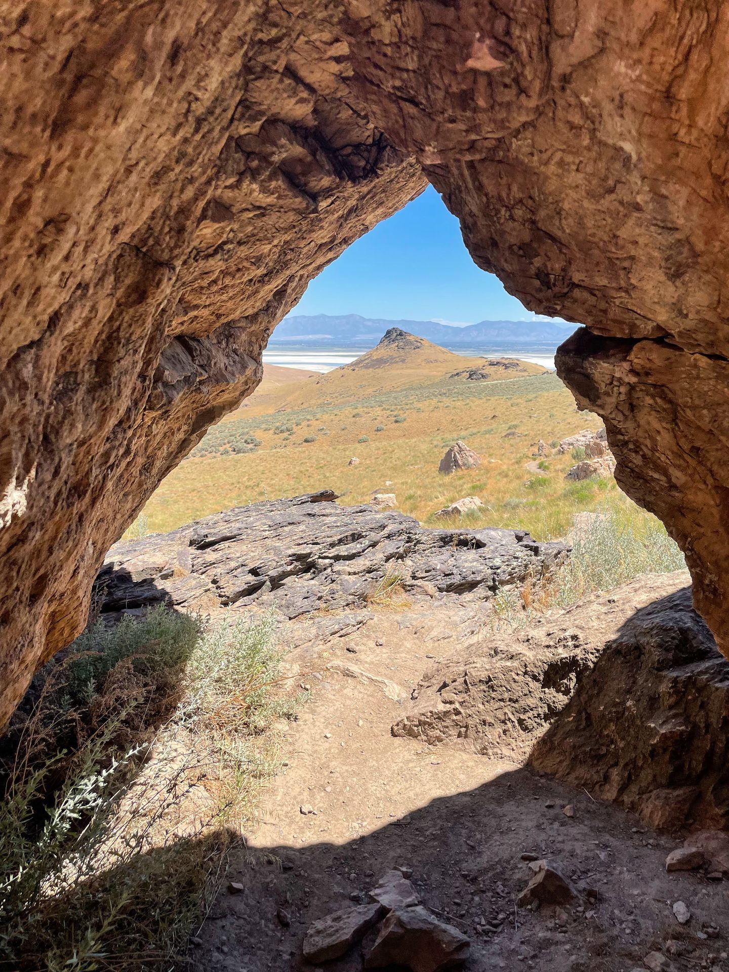
You will pass by many desert plants and enjoy views of the surrounding entire valley as you climb up higher and higher. I loved one area where the trail takes you around and under some large boulders. It was beautiful to look back through a rock arch at the views of the island.
Note that there are definitely some false peaks along the way. Keep an eye on your AllTrails map to make sure you don’t get your hopes up.
While I didn’t see any, it is possible to encounter bison on this trail. A herd lives on the island and roams freely. Be sure to keep a wide distance if you do come across one.
When you are almost to the top, you’ll pass a radio tower. It is not obvious, but the trail leads to the right and descends the mountain a bit before reaching the final peak. This final stretch has a bit of scrambling and some narrow areas.
It is so rewarding to reach the top and be treated with 360 views of the entire island. You’ll have an incredible view of the Great Salt Lake and the surrounding mountains on Antelope Island.
There is a rock face where you have a little bit of space to spread out and enjoy a snack. There is an old, cracked sign, a geological marker and a geocache box where you can sign your name.
There were very few other people on this trail and I was so blown away by the views. I highly recommend Frary Peak if you’re looking for a more challenging hike near Salt Lake City.
Sardine Peak Ogden Outlook Trail
- 8.6 miles
- Rated moderate
- 1,528 feet of elevation gain
- 50 minutes from Salt Lake City
- Free
- Dogs allowed
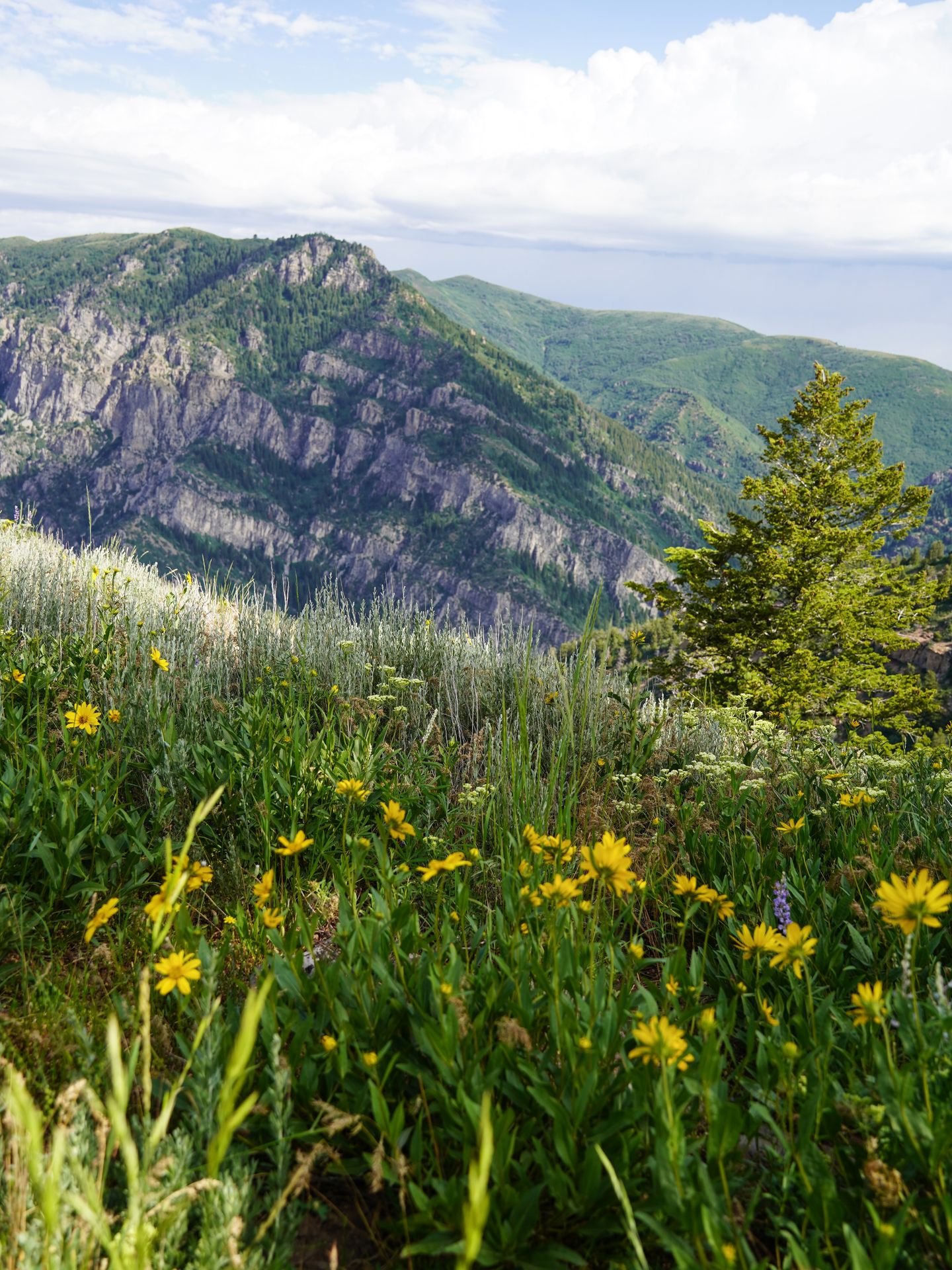
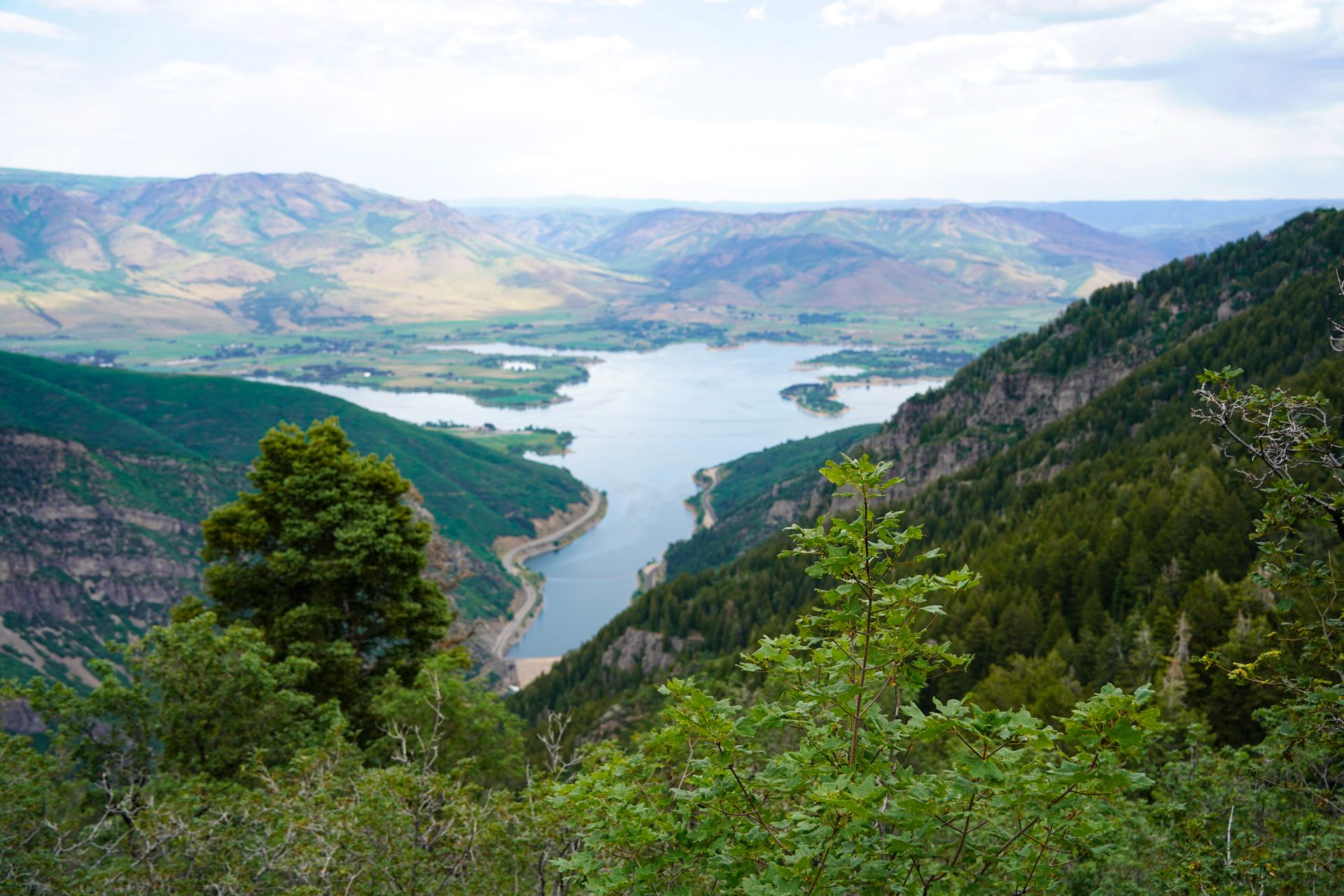
The Sardine Peak Ogden Outlook trail has a great variety of amazing views, unique features, wildflowers and forests. This trail is popular for biking, so be prepared to share the trail along the way.
The trail is a loop that I took clockwise. It has steady elevation and has good opportunities for shade as you go through the forests.
The first viewpoint is the Ogden Overlook, which offers a fantastic view of the canyon down below. There is also a bench at this overlook if you’re in need of a break.
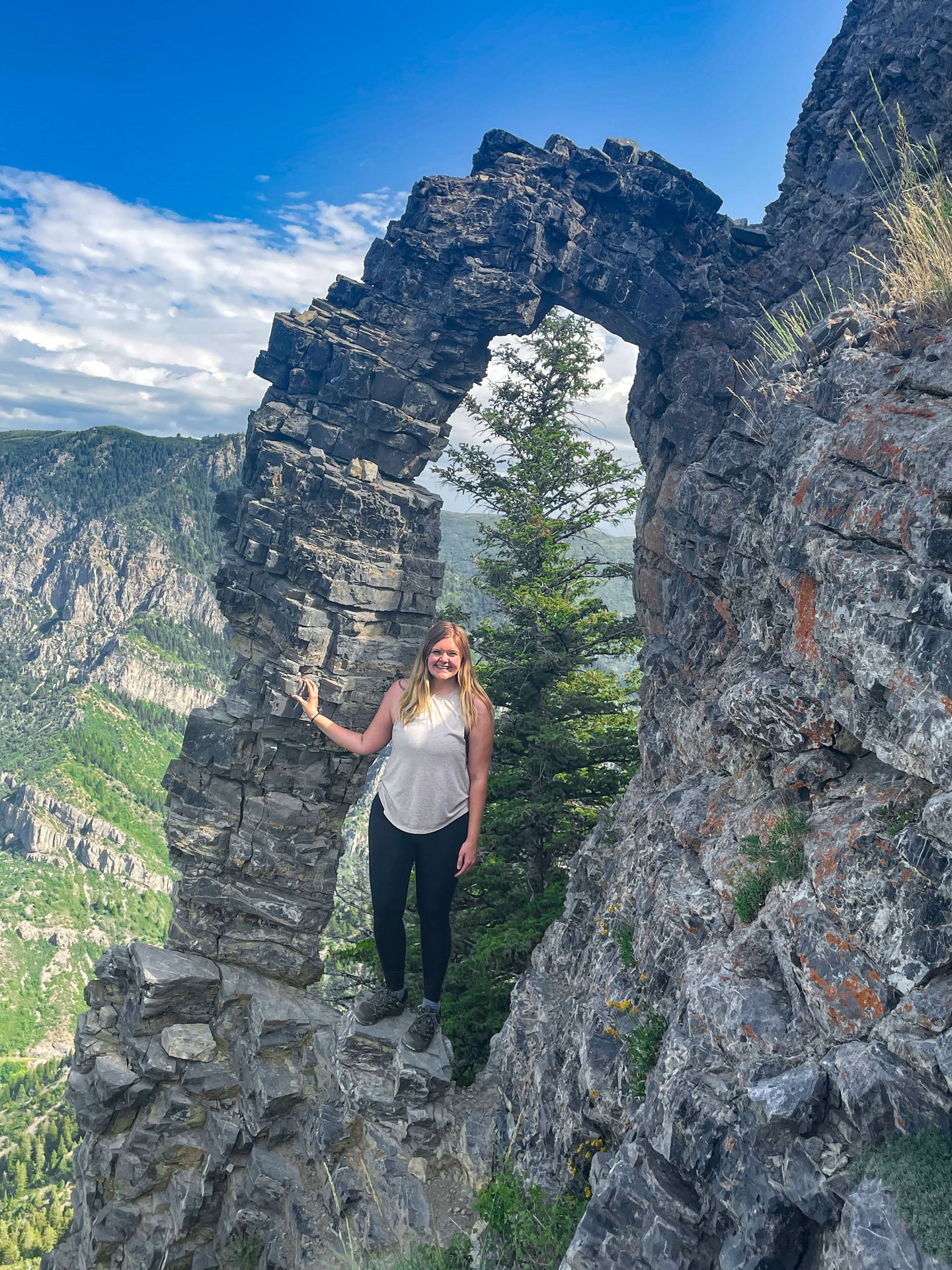
Continuing on, there is a very unique, unmarked feature right off the trail: an arch! You will find it 1.3 miles from the Ogden Canyon Overlook if you’re walking clockwise. Look for an overlook with a beautiful view. At the overlook, look for a desire-path to the left. Take the short but steep path down and around to the right, and you’ll see the arch.
The arch sticks out of a cliff and is made up of layers of stacked rocks. It is probably only about 15 tall. It’s a beautiful sight and worth the quick detour.
After the arch, you’ll soon reach a junction for Sardine Peak. We skipped it as I’ve heard the view at the top is mostly covered with trees.
Soon after, you’ll get a great view of the Pineview Reservoir from the trail. As you ascend down from the loop, there are several switchbacks without much shade. This is a great opportunity to see wildflowers in the summer months. The last mile or so of the trail is mostly flat.
This a great hike near Salt Lake City if you're looking for a longer loop trail with variety!
Final Thoughts
I hope this guide gives you a taste of the beauty of Northern Utah and Salt Lake City! While southern Utah tends to get all the love, Northern Utah is an underrated gem that has SO many epic trails nearby. Next time you consider a Utah trip, don't skip out on this area.
For more information on visiting Utah, check out some of my other guides:
- 3 Day Itinerary for Salt Lake City (and nearby)
- How to Spend 3 Days in Moab
- Two Days in Zion National Park
- The Top Things to do in Bryce Canyon
- How to Spend One Day in Capitol Reef National Park
- The Best Things To Do in Kanab, Utah
Thanks for Reading!


Let's stay in touch!
Join the Lost with Lydia email list to get monthly travel guides and tips!