Arkansas has many beautiful hiking destinations throughout the state. Whether you are interested in exploring state parks or in going more ‘off-the-beaten path’ in national forests, there is a trail for every type of hiker.
Most of these trails are rated moderate and all are under 6 miles. If you are new to hiking, take a look at my best beginner hiker tips or my day hike packing list!
Arkansas State Parks
Arkansas is full of some beautiful state parks with free entry. Each park offers well maintained trails and facilities.
Mount Nebo State Park
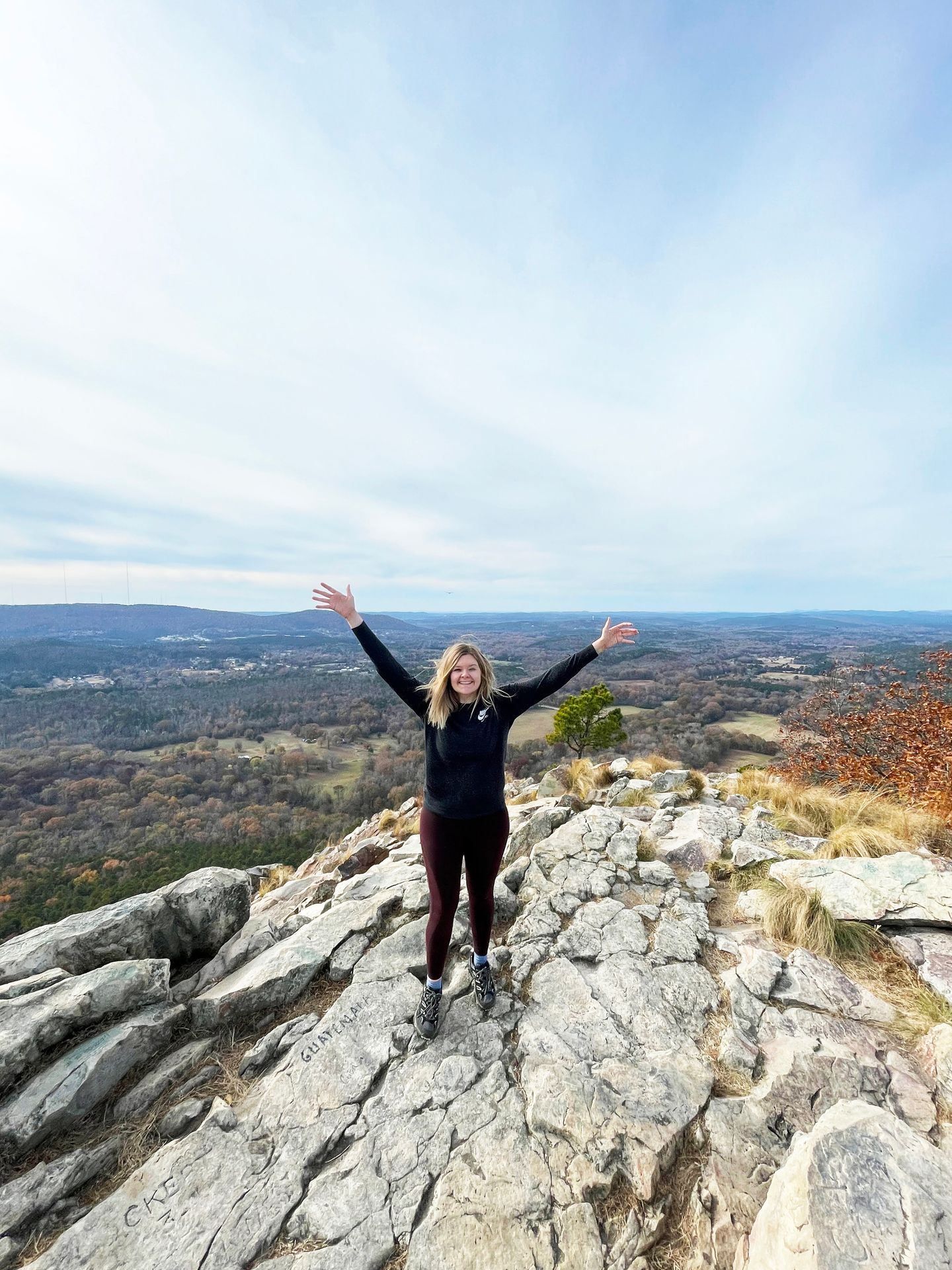
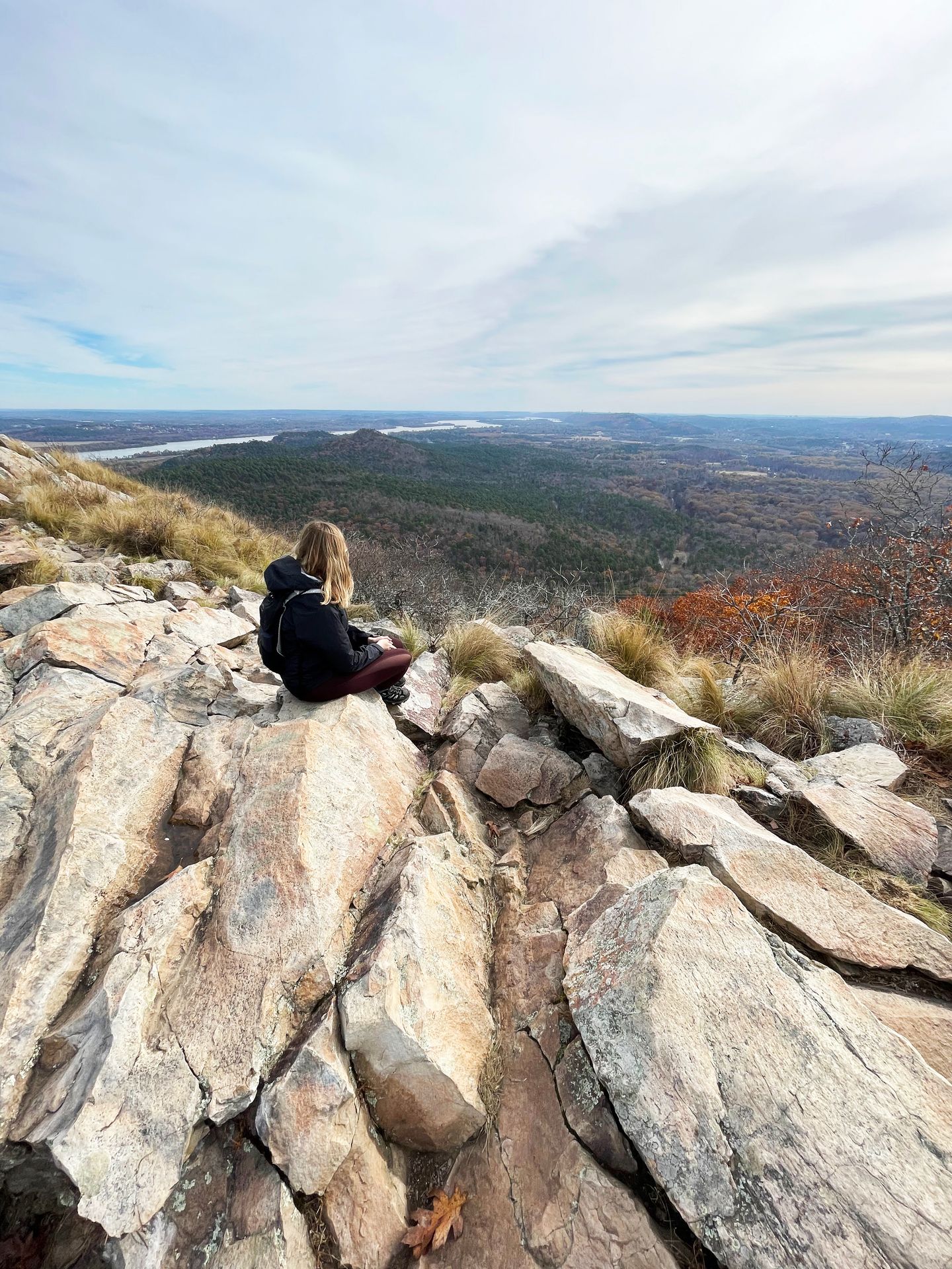
Mount Nebo is a beautiful park that offers amazing views in all directions. The mountain is small enough that you can hike around the entire rim in just a couple hours. The park also features campgrounds, a pool and a visitor center with essentials.
Note that there is only one road that leads up to the park and it’s quite steep. Campers or RVs must be less than 24 feet long to make the bends. You may want to avoid the road if there is ice. The Mount Nebo Visitor Center sells some snacks and has restrooms, but there are no other restaurants on the mountain.
Mount Nebo Rim Trail
- 3.6 miles.
- 344 feet of elevation gain.
- Rated moderate.
- Loop.
Mount Nebo State Park offers incredible views of the Arkansas River Valley and a hike around the rim trail is the best way to take in all the views.
The trail is 3.6 miles long with multiple entry/exit points along the way. You will hike past several overlooks where you can climb on interesting rocks for higher viewpoints. The hike is full of variety and includes shaded rocky areas, hiking right behind residential homes and views in every direction.
If you are unable to hike, you can also drive to many of the viewpoints. The most popular views are Sunrise and Sunset Points, located on opposite ends of the park.
Pinnacle Mountain State Park
Pinnacle Mountain is conveniently located near Little Rock and is most known for the hike to the Pinnacle Mountain Summit. The park also offers miles of mountain biking trails.
Summit Trail
- 1.5 miles.
- 700 feet of elevation gain.
- Rated hard.
- Out and back
This hike is for you if you like rock scrambling! The Pinnacle Mountain Summit Trail offers incredible views just minutes from Little Rock. To reach the summit, there are two trail options.
The west side is a bit easier and has many stone steps and switchbacks coming up.
The east side involves a lot more rock scrambling and you will be climbing over some large boulders on your way up.
On both sides, the trails are about 1.5 miles with about 700 feet of elevation gain. When you reach the top, you’ll be rewarded with amazing 360 degree views of the Arkansas River and the surrounding area.
There is also a loop trail around the base of the mountain, so you can hike up one side, hike down the other and take the loop back to your car.
Petit Jean State Park
Petit Jean was Arkansas’ first state park and is full of so much beauty. The park has a 95 foot waterfall, caves, scenic overlooks and many beautiful rock formations. If you are looking for a park with a lot of variety, Petit Jean is a great choice!
Petit Jean has campgrounds, cabins and a lodge for visitors and is a great place to stay for at least one night.
Seven Hollows
- 5 miles.
- 603 feet of elevation gain.
- Rated moderate.
- Loop.
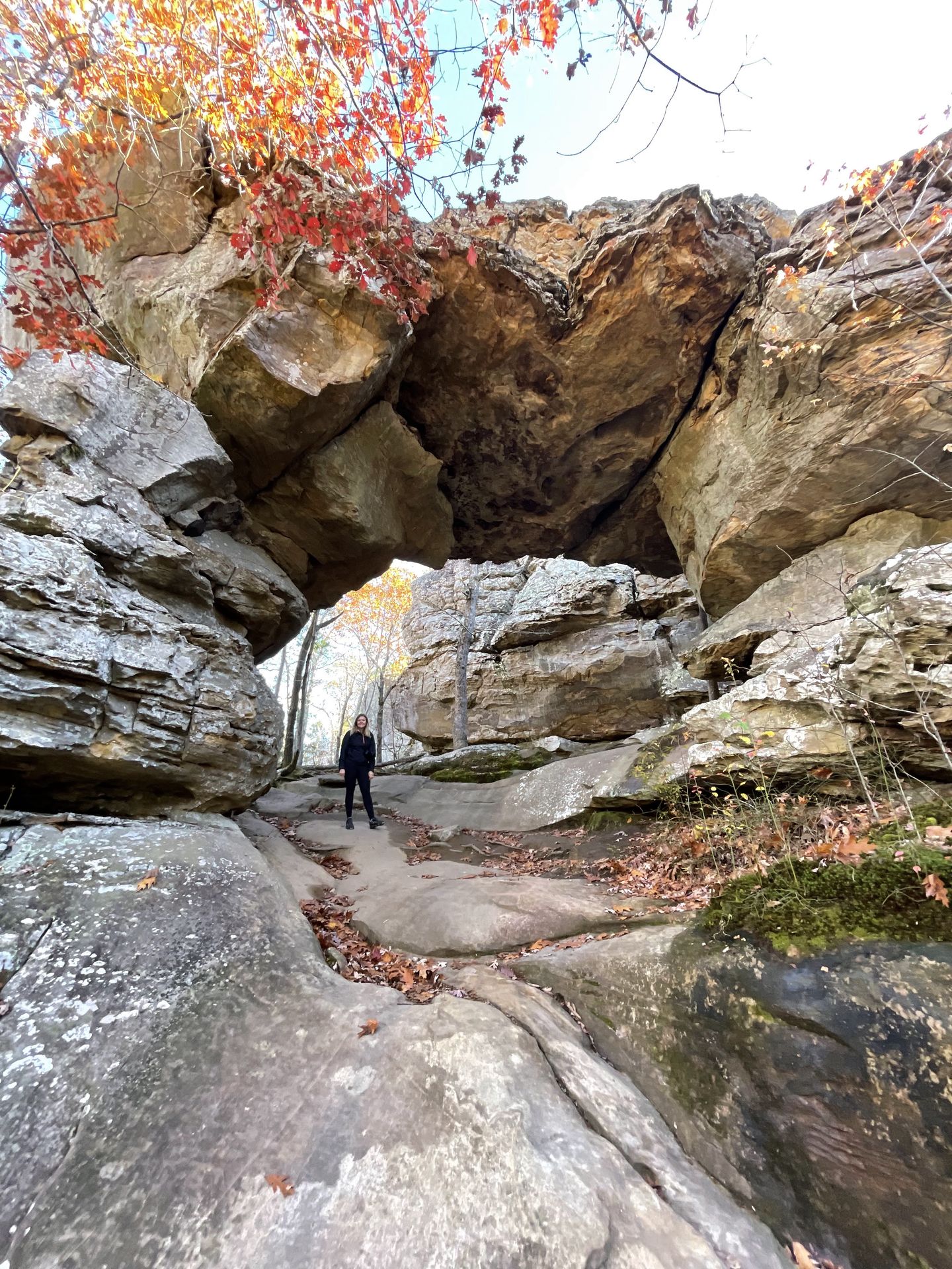
The Seven Hollows Trail in Petit Jean is a 5 mile loop where you’ll get the opportunity to see caves, an impressive natural arch, a beautiful grotto and giant rocks throughout. The trail is mostly shaded as you wind through the forest past interesting rocks.
The grotto is the main focal point of the trail and located about halfway around the loop on a spur trail with a bit of rock scrambling. This is the most difficult portion of the hike. Overall, the trail is full of interesting things to see and is a great family friendly adventure to hike while you’re in Petit Jean.
There is no restroom at the parking lot, but you can find them nearby at Mather Lodge.
Cedar Falls
- 1.9 miles.
- 367 feet of elevation gain.
- Rated Moderate.
- Out and back.
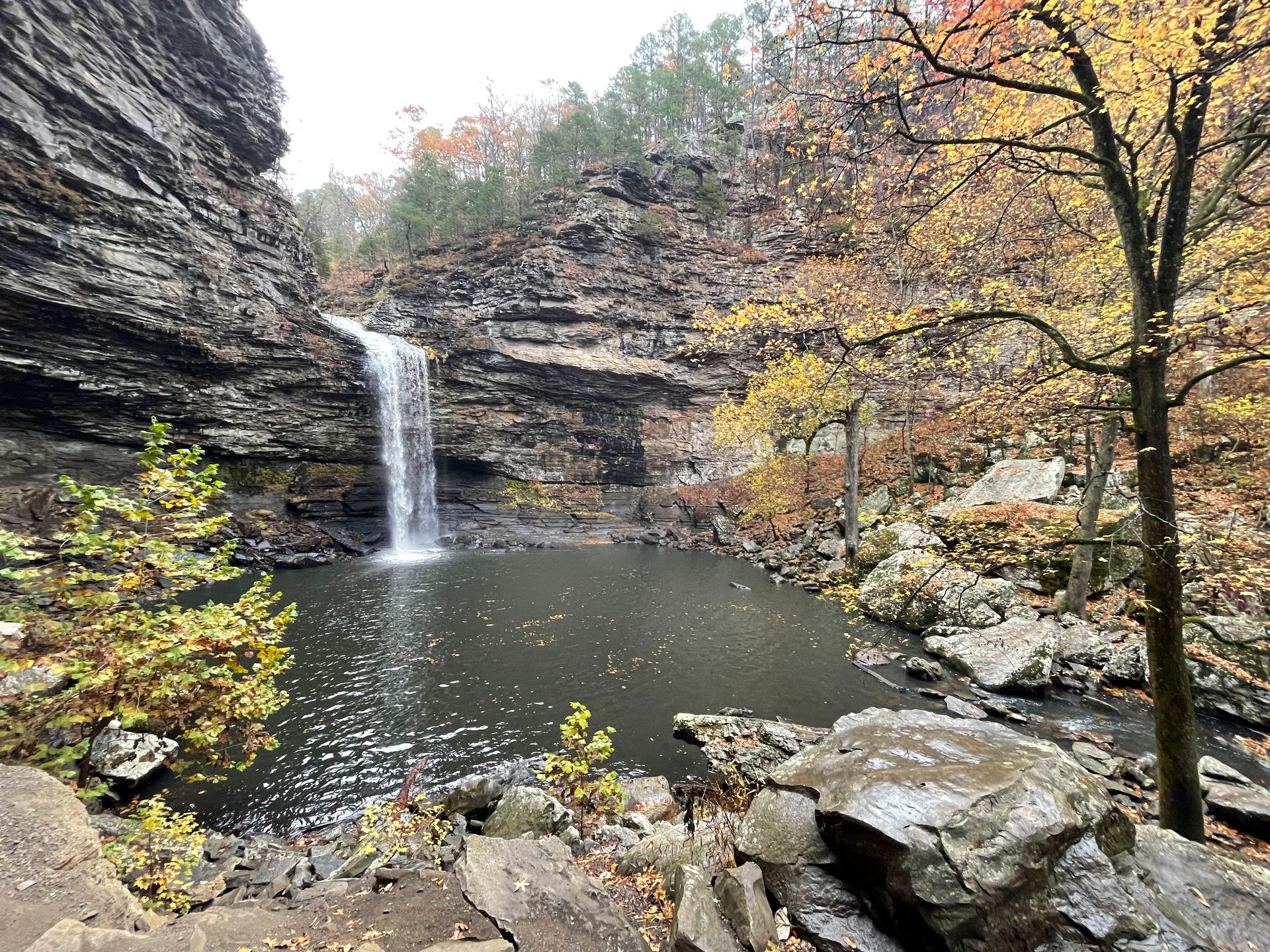
Cedar Falls is a 95 foot waterfall and it’s the most famous thing to see in Petit Jean. The easiest way to see the waterfall is from the viewpoint.
However, you can also hike to the base of the waterfall on a 2 mile trail. The trail begins with switchbacks as you lose elevation to reach the river level. This portion has a bit of rock scrambling so make sure you’re prepared.
When you reach the river, you’ll cross a bridge and turn right. Then you’ll follow along the trail about a half mile until you reach the falls. The base of the waterfall has some boulders you can climb on to get a bit closer and a small hill where you can get a higher viewpoint.
The trail begins at the Mather Lodge and there are additional connected trails that you can add on as well.
Other Things To See in Petit Jean:
- Bear Cave: 0.25 miles and rated easy. Incredible rock formations and worth a quick stop.
- Rock House: 0.25 miles and rated easy. Leads to a large cave with pictographs inside.
- Red Bluffs Scenic Drive: Stop at the Mary Ann Richter Overlook and the CCC Overlook on a one way around near the Rock House trail.
- Cedar Falls Overlook: Be sure to make a quick stop and walk the boardwalk to see the waterfall from above.
- Stout’s Overlook: This overlook is located outside of the main park area and offers a great view of the Arkansas River.
- Palisades Overlook: This overlook is worth a quick stop near the Seven Hollows Trail.
Mount Magazine State Park
Mount Magazine is not the best park in terms of hiking trails, but the views that you can drive to are absolutely incredible. Be sure to drive the Overlook Dr, visit the lodge and take in as many views as you can while visiting.
Signal Hill
- 1.8 miles.
- 259 feet of elevation gain.
- Loop.
- Rated Moderate.
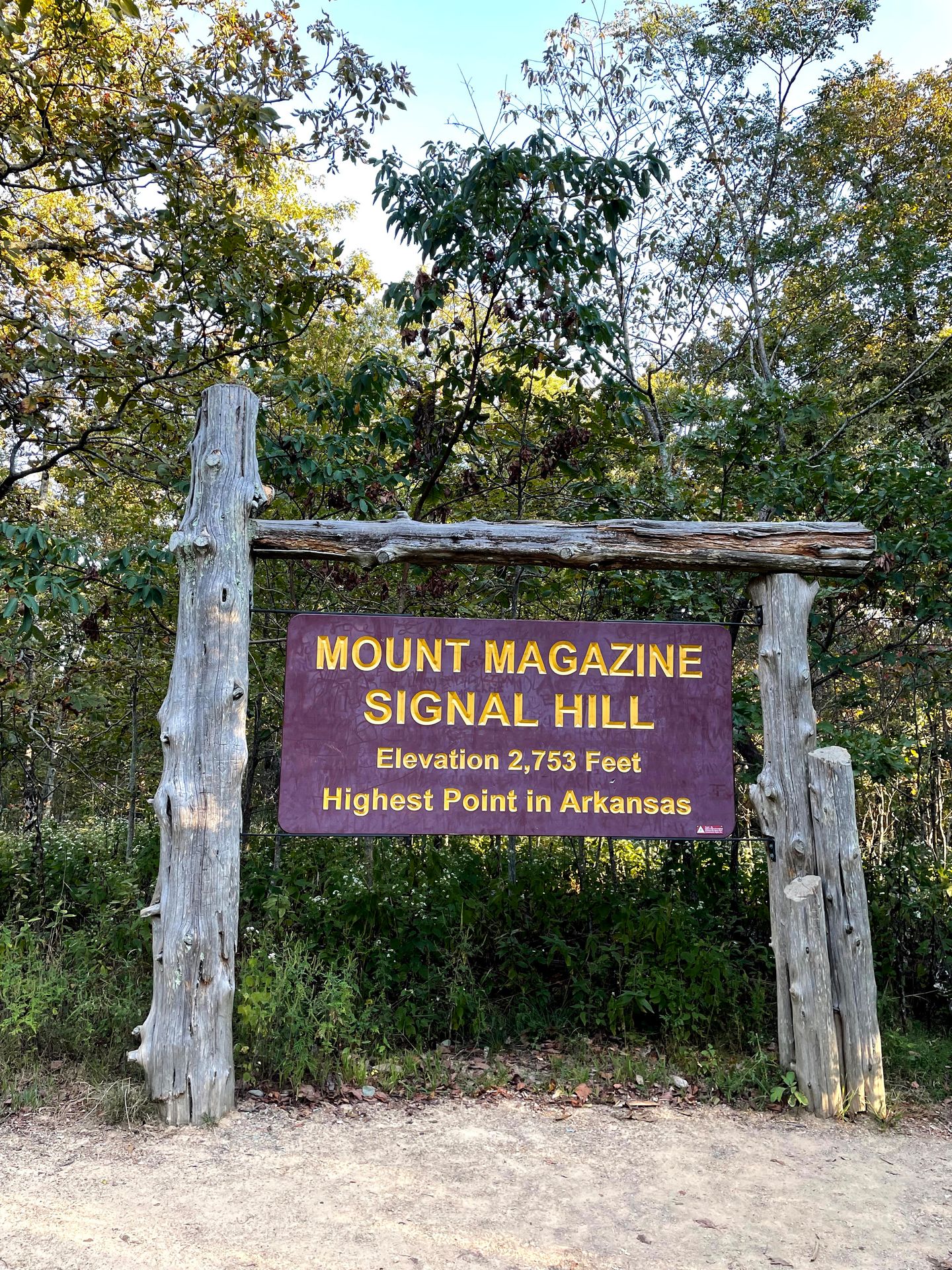
The Signal Hill trail will lead you to the highest point in Arkansas! Even though Mount Magazine has some incredible views, this trail is all in the forest and has no views of the surrounding area.
The hike is a peaceful forested walk and leads to an area with signage and a bench from the Highpointers Foundation. There is also a mailbox logbook where you can sign your name. As long as you do not expect views, this is a nice quick trail if you are interested in visiting state high points.
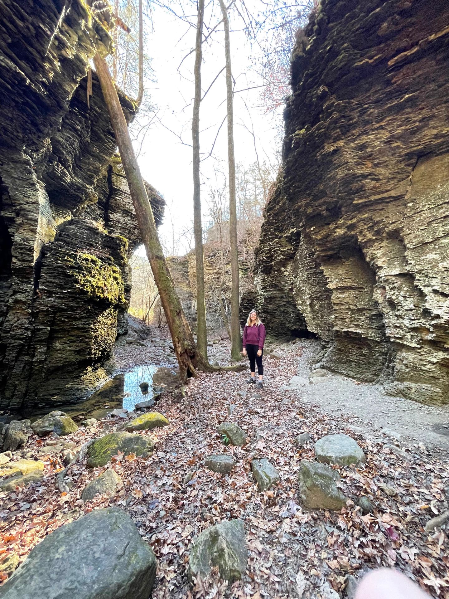
Devil's Den State Park
Devil’s Den is a beautiful west Arkansas park that is home to approximately 60 crevice caves. Legend has it that outlaws used these caves as hideouts in the mid 1800’s. The park has some of the intact structures built by the CCC in the US and is a great park to camp and hike.
Devil's Den Trail
- 1.6 miles.
- 209 feet of elevation gain.
- Rated moderate.
- Loop.
The 1.6 mile Devil’s Den Trail is a great place to enjoy waterfalls, caves and many other interesting geological features. Be prepared for some steep, rocky areas and uneven stairs. You can begin the trail from either the visitor center at a couple other areas of the park.
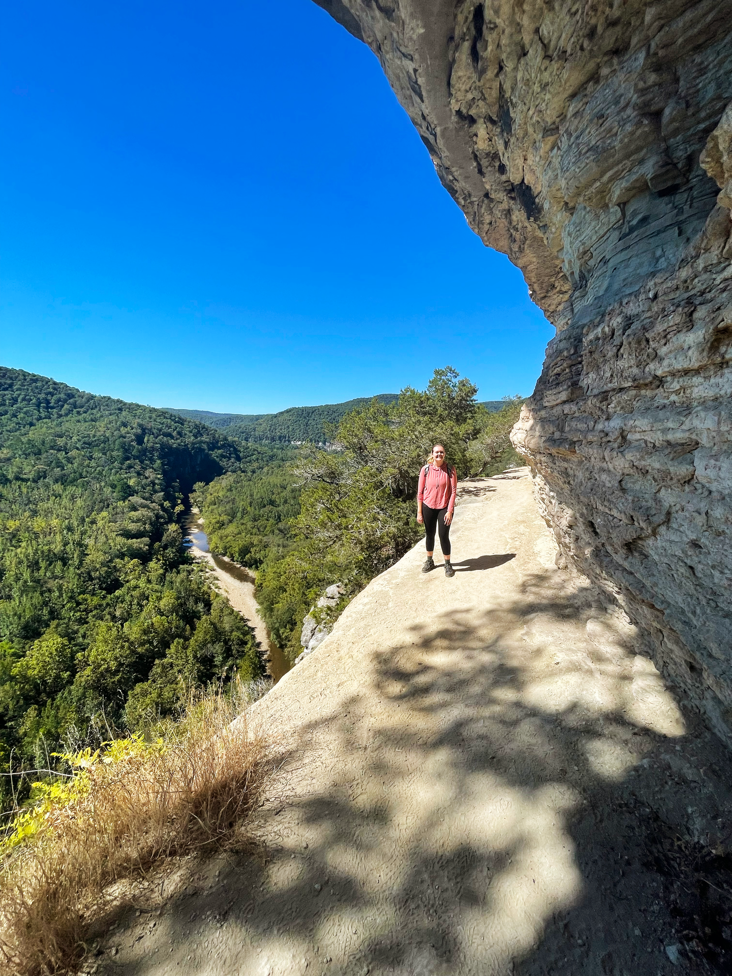
Yellow Rock Trail
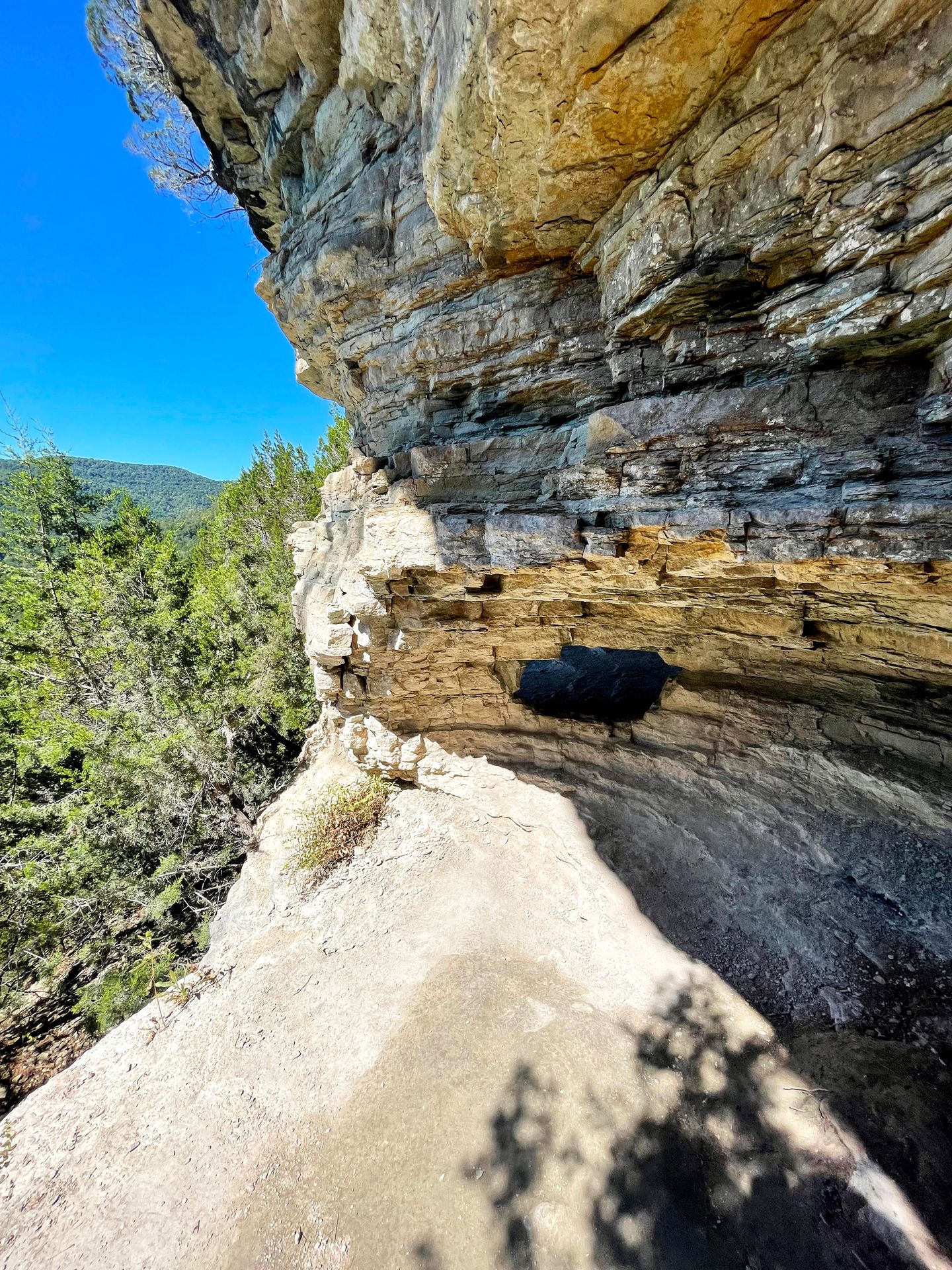
The Yellow Rock Trail is 3.1 miles and leads to an amazing view of the Lee Creek Valley. On your way to the overlook, you’ll pass some beautiful rock formations and Cedar Glades (openings in the forest).
When you reach Yellow rock, you’ll enjoy panoramic views from 300 feet above the valley. You can begin the trail at the CCC Scenic Overlook in addition to the Yellow Rock Trailhead.
Devil's Den is a great park to combine with a visit to Bentonville, Arkansas! Bentonville is a popular mountain biking destination and a fun city.
Ozark National Forest
The Ozark National Forest covers 1.2 million acres, mostly covering the Ozark mountains in northern Arkansas. Arkansas is also home to the St. Francis National Forest, which covers 22,600 acres in eastern Arkansas, and the two are often referred to together.
One of the most famous places to visit in Ozark National Forest is Blanchard Springs Caverns, where you can tour a beautiful cave. In addition, there are endless trails, camping opportunities and natural beauty to enjoy throughout the national forest.
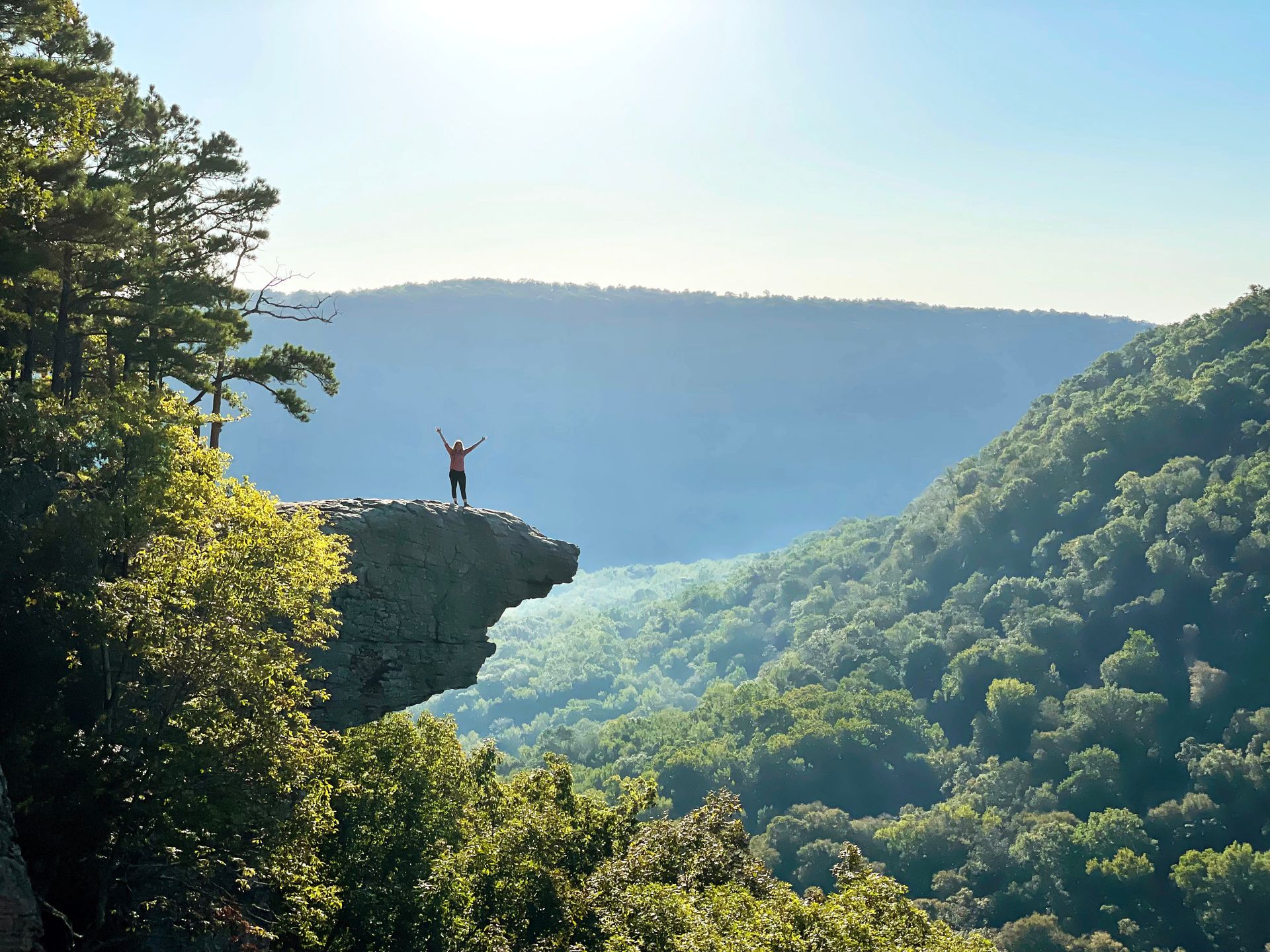
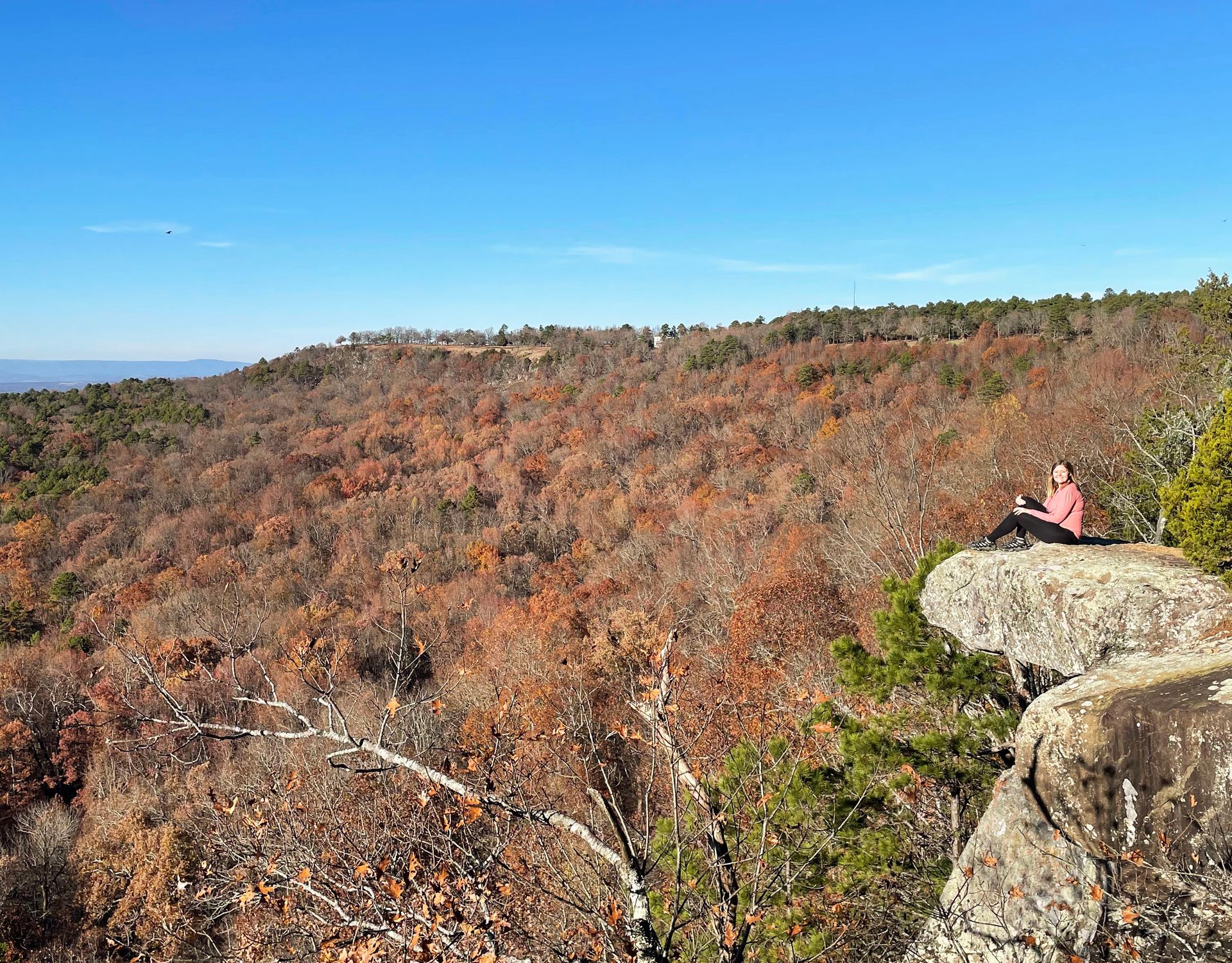
Whitaker Point/ Hawksbill Crag
- 2.9 miles.
- 413 feet of elevation gain.
- Rated moderate.
- Out and back.
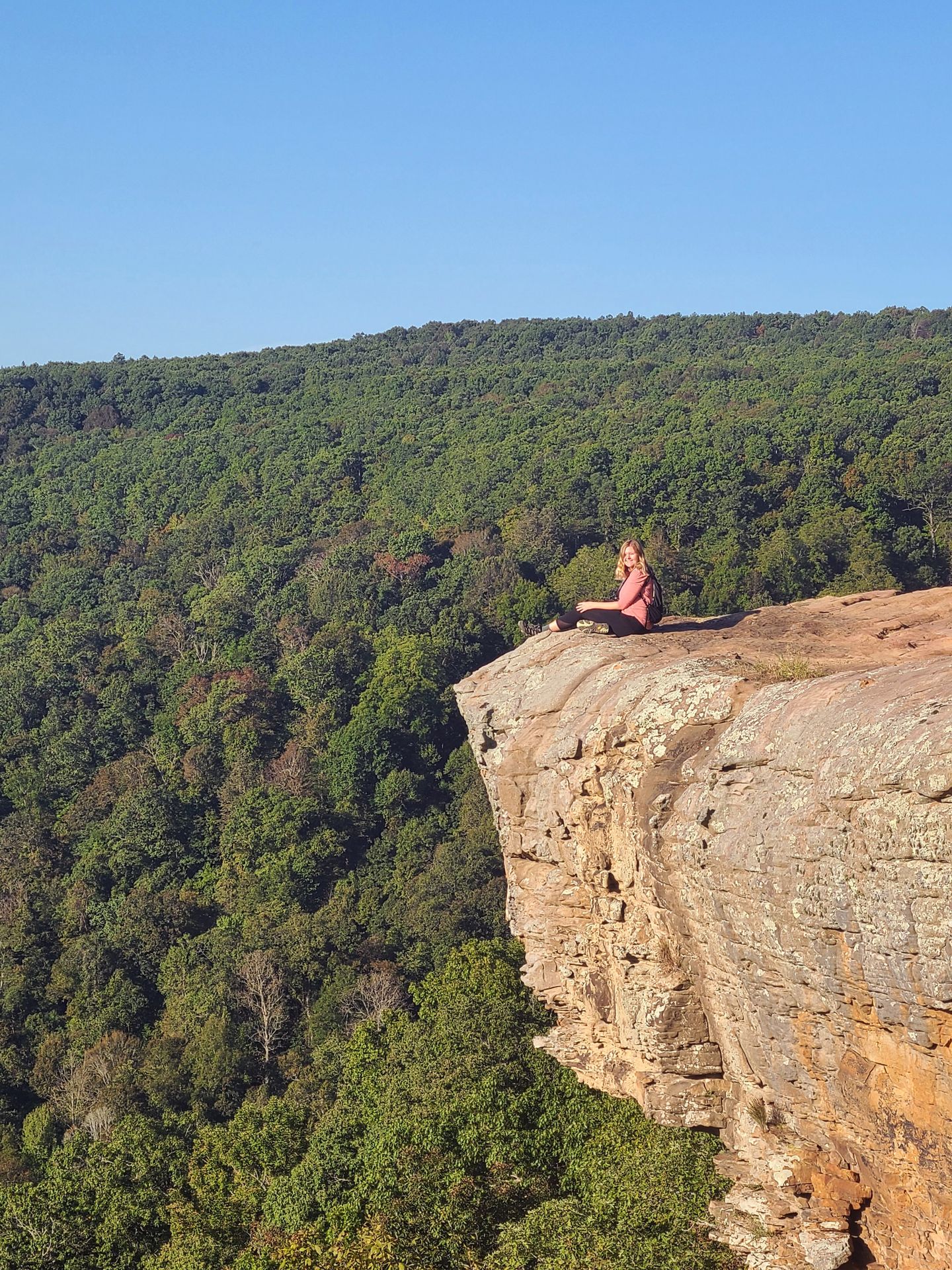
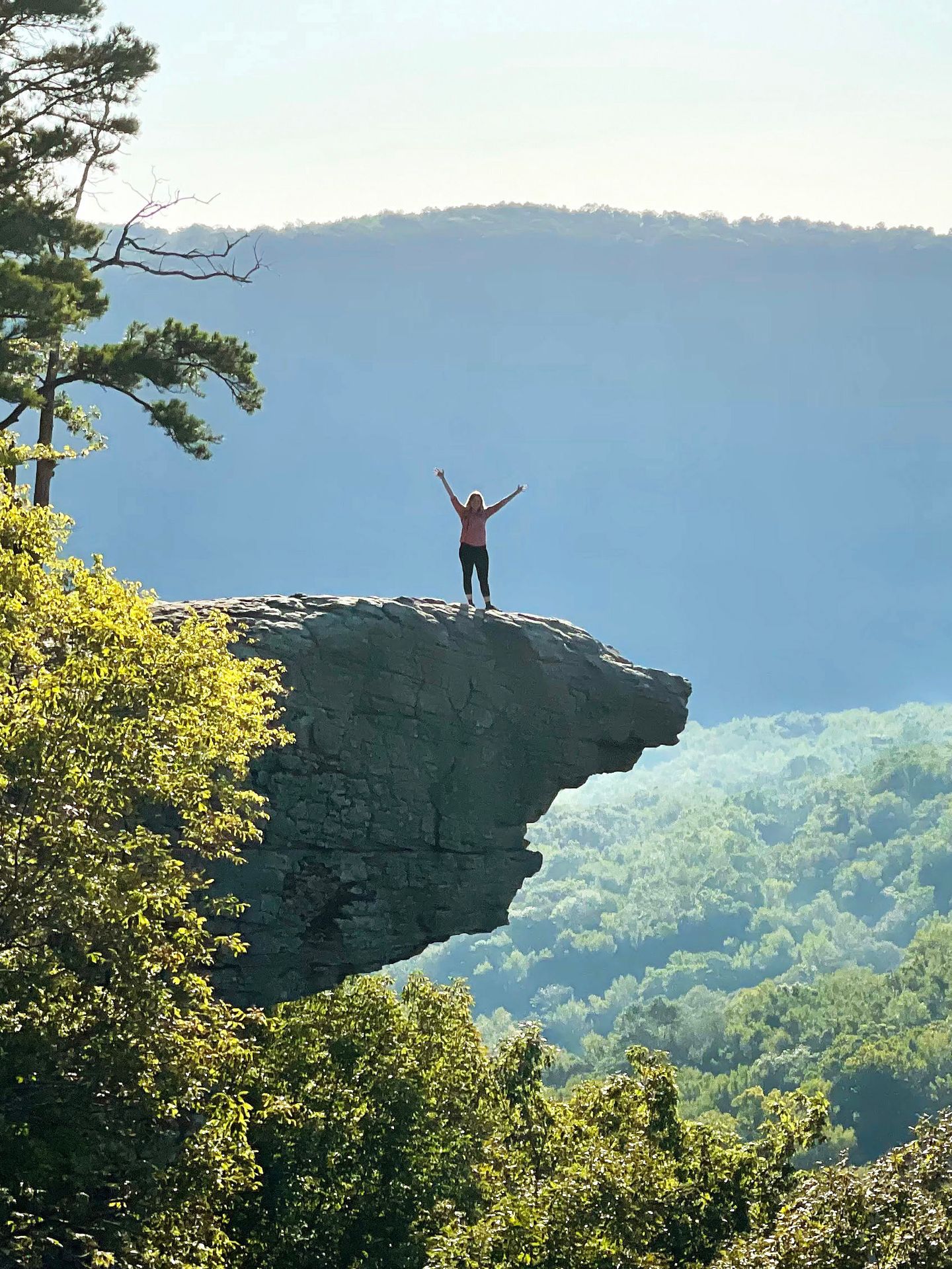
Whitaker Point is one of the most iconic trails in Arkansas for good reason. The moderate 2.9 mile trail leads to a rock face that projects out into the valley out of nowhere.
To reach the trail, you can drive up Co Road 5 from either the north or the south. The road is unpaved and bumpy, but should be doable for any vehicle if you enter from the south. From the north, the road is much more steep and you should have 4 wheel drive.
When you reach the trailhead, there are few markings. Look for a boulder with a national forest service logo next to the trailhead marking. The Google maps pin for the trailhead also is pretty accurate.
Note that parking is very limited here so you should aim to arrive early or during off hours to get a parking spot. I started the trail at roughly 7:45AM and there were 5 cars in the parking area when I arrived.
Most of the visitors were hiking back from sunrise so I only had to share the views with one other group. When I was hiking back, the trail was getting busy. Also be prepared before you arrive, there’s no cell service or restrooms at the trailhead.
Be prepared for a line to take a photo on the rock if you visit during a popular time. The best place to take a photo is about 40 feet from the rock, so it takes some time to switch photographers. Be polite and patient with others and consider offering to take a strangers photo to speed things along!
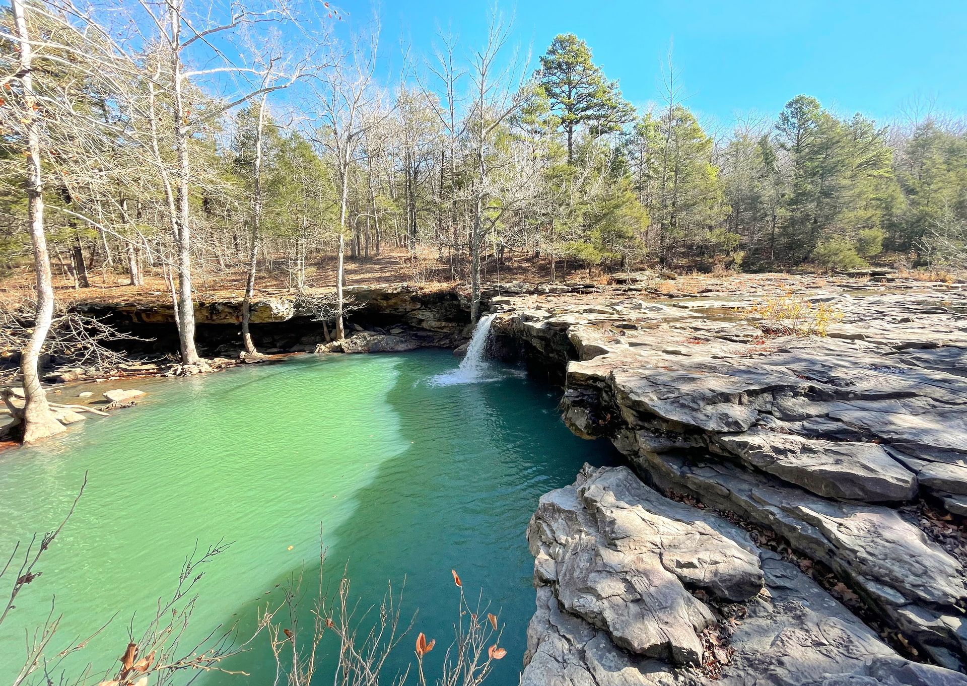
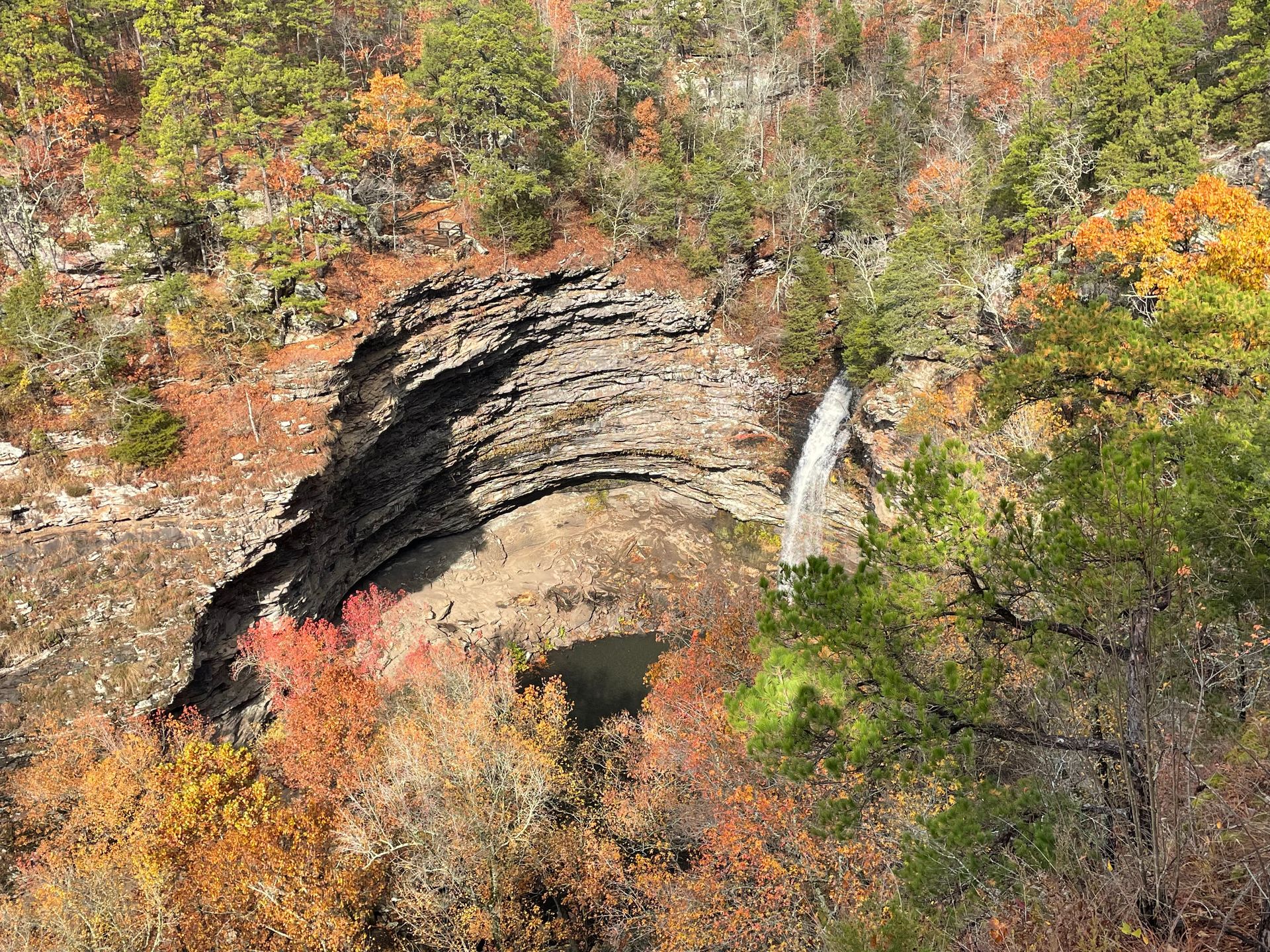
Pedestal Rocks
- 4.5 miles.
- 580 feet of elevation gain.
- Rated moderate.
- Loop.
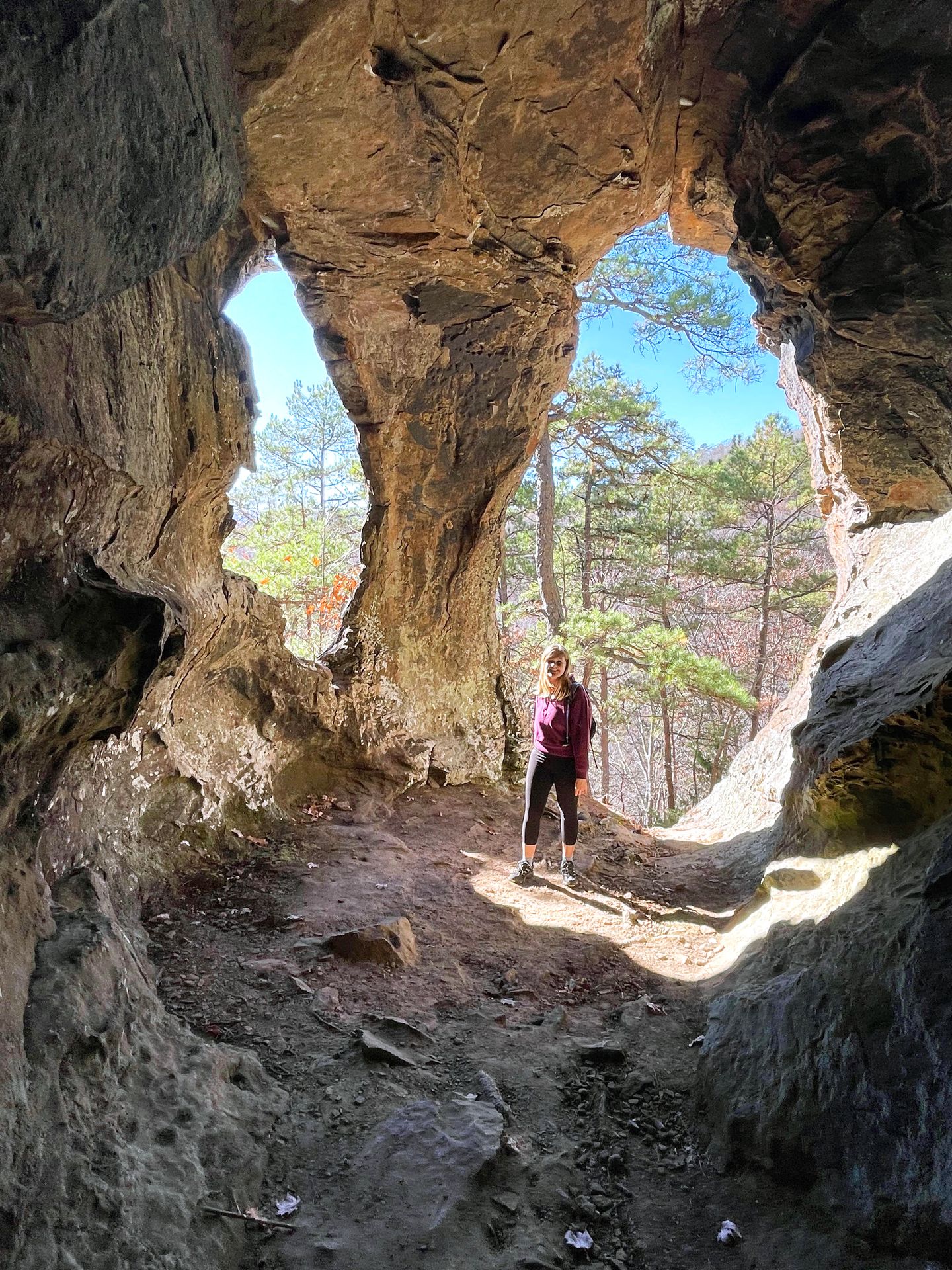
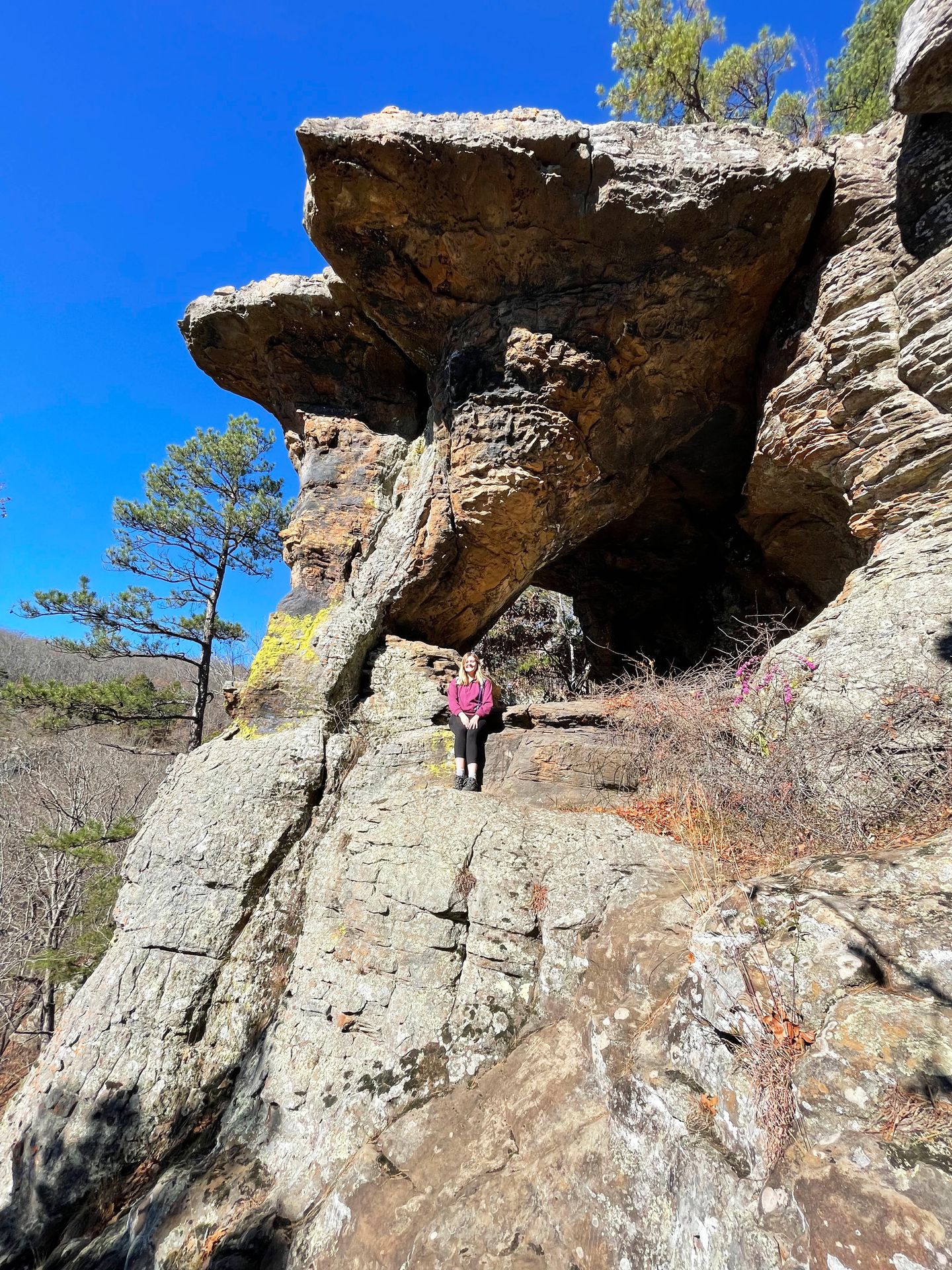
The Pedestal Rocks and King’s Bluff trail area has two short loop trails with interesting rock formations and great views.
The Pedestal Rock portion of the trail is 2.5 miles and will lead you to some amazing rocks that look like giant pedestals. You will first see them from above, but you can also climb down below and explore the caves and see rock arches from below. The trail also has some beautiful views that you can see between the trees.
The King’s Bluff loop is 1.9 miles and includes a waterfall (that will flow more after recent rain) and more great views. Both trails are wonderful and family friendly. There is limited parking but the trailhead was not crowded during my visit. There is also a pit toilet and a picnic table in the parking area. I had cell service on Verizon at the trailhead.
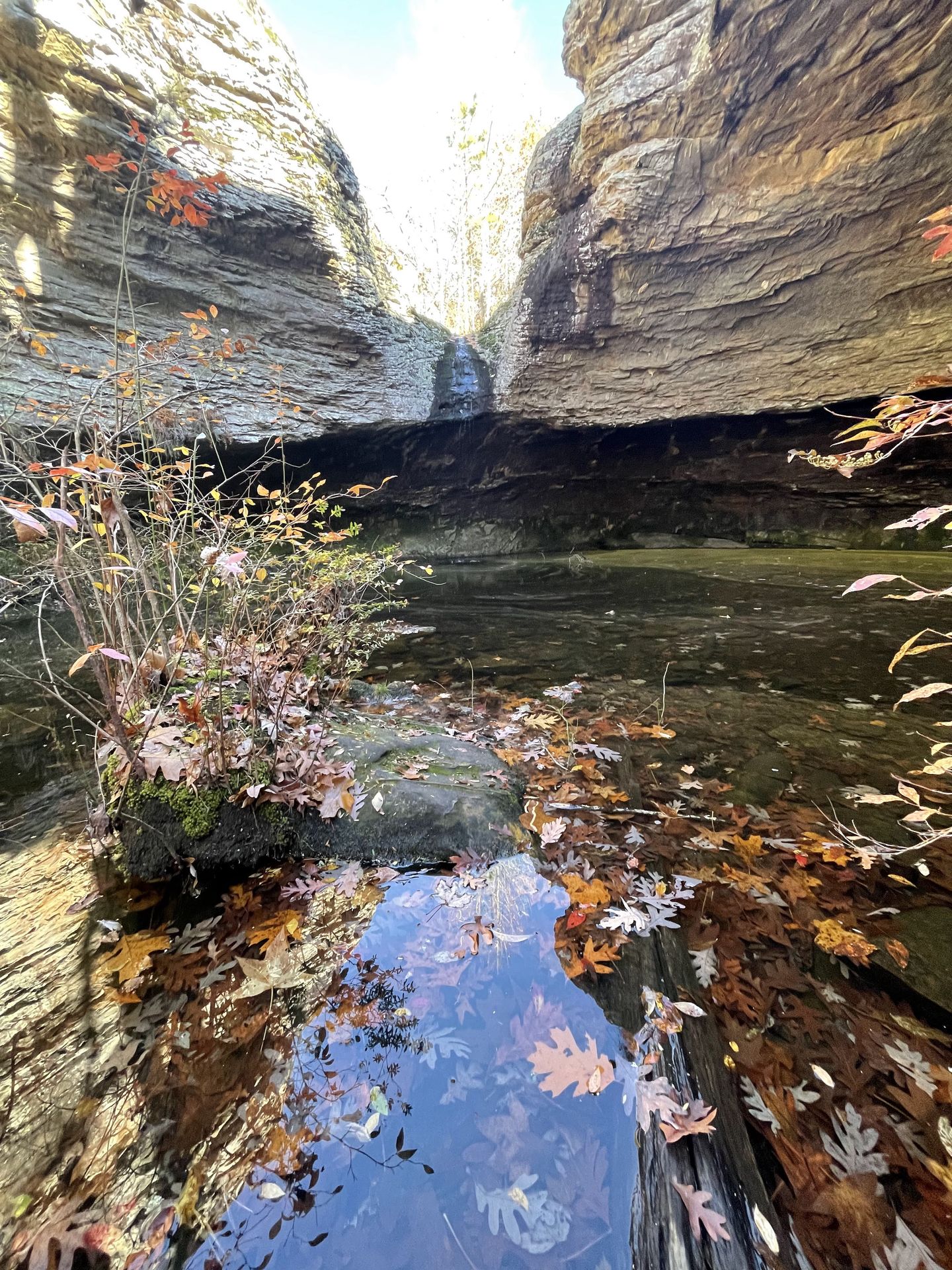
Pam’s Grotto
- 0.8 miles.
- 206 feet of elevation gain.
- Rated moderate.
- Out and back.
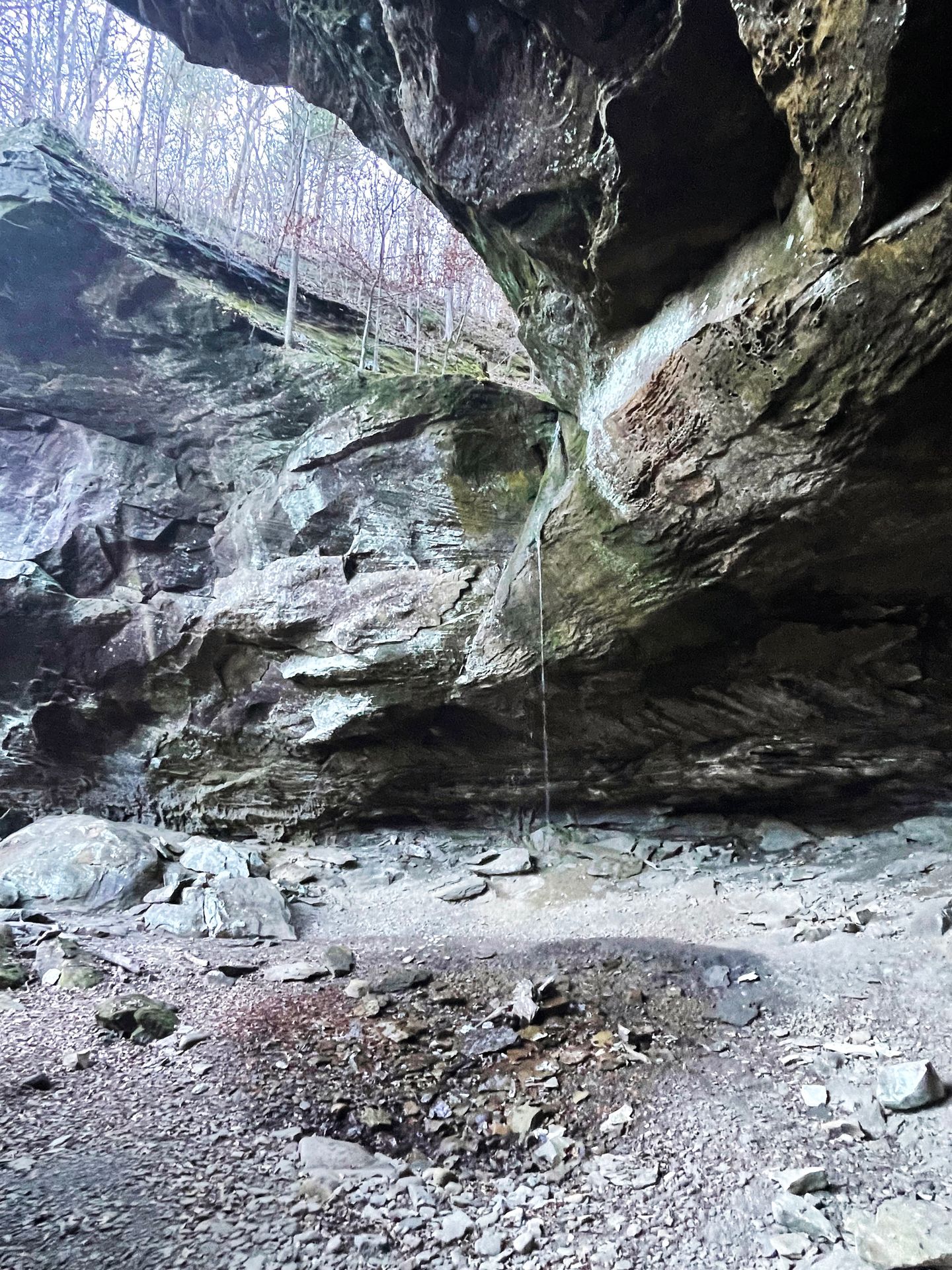
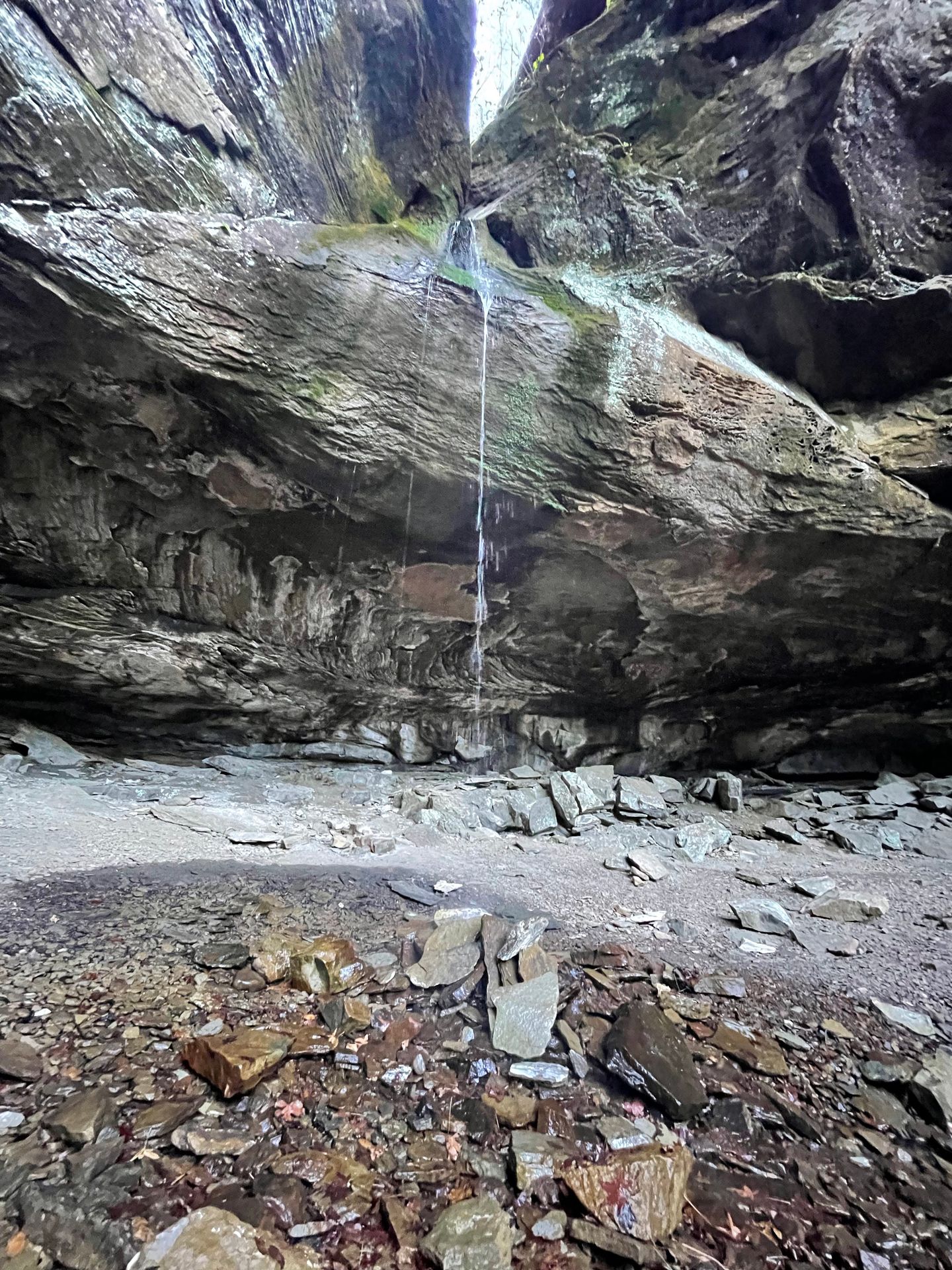
Pam’s Grotto is a short hike that leads to a giant grotto with a waterfall dropping in a column from above. This trailhead is a bit hard to find, as it is not well marked and there is no real parking. Be sure to save the location on offline maps before visiting.
When you arrive, there are a couple of spots to park on the shoulder of the road across from the trailhead. Look for arrows on the trees to find the trail entrance. After you find the trailhead, the trail is reasonably well marked. You will climb up a bit and then follow along a rock face. When you get close to the grotto, you will climb over some boulders to get down to the waterfall.
The waterfall flow will vary depending on recent rainfall. It was only a trickle during my visit but it was still a beautiful spot and I had it all to myself.
Richland Creek Recreation Area
Richland Creek is an area within Ozark-St. Francis National Forest that is especially known for waterfalls. Note that the area is remote and that most of the roads are unpaved, so plan carefully if visiting this area.
Fuzzybutt Falls
- 2.1 miles.
- 232 feet of elevation gain.
- Out and back.
- Rated easy.
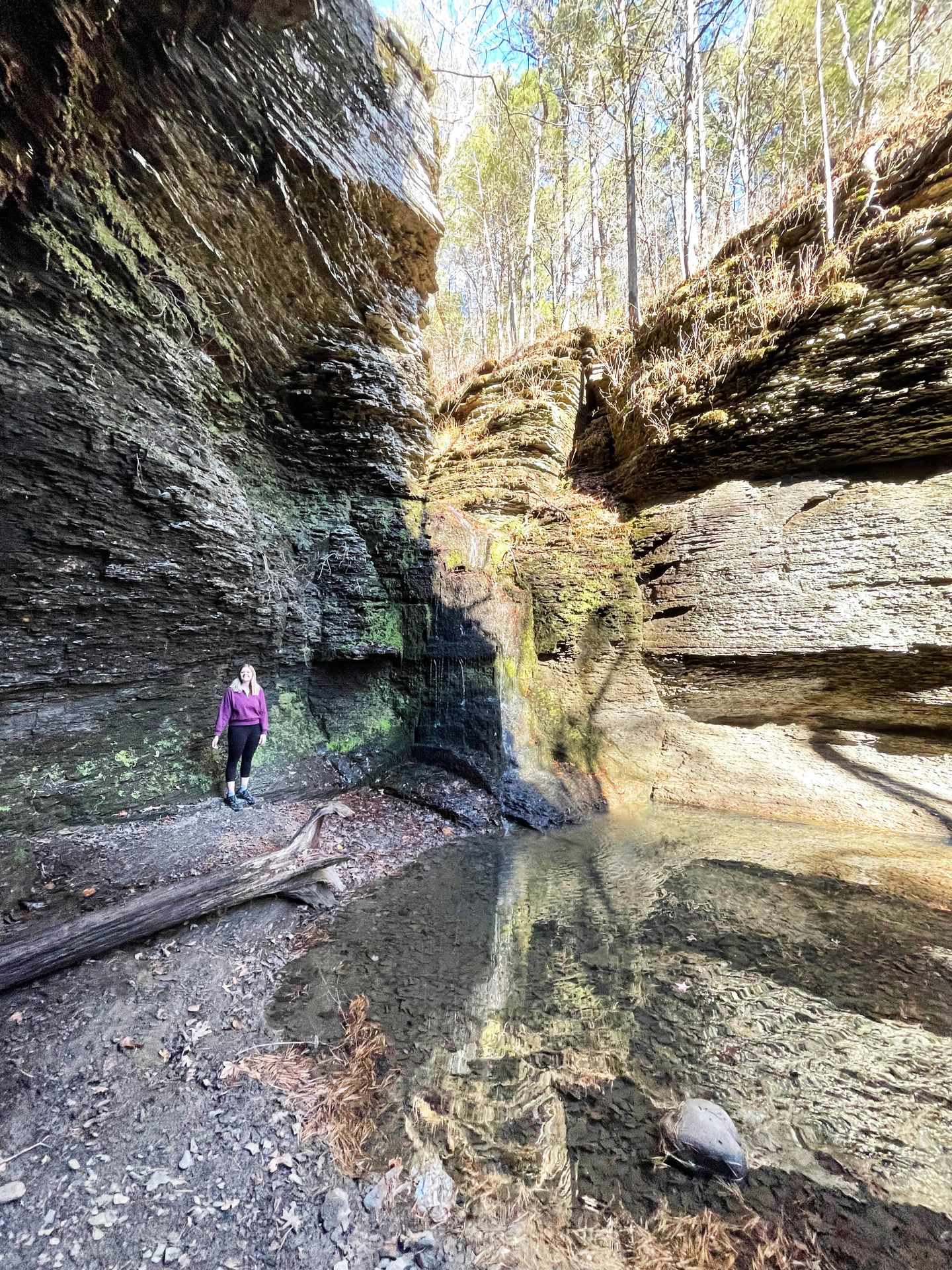
Fuzzy Butt Falls is a 2.1 mile trail located in the Richland Creek Recreation Area. The trail is mostly forested with little elevation, and leads to a gorgeous waterfall inside of a grotto.
There is not much parking at the trailhead, just a few spots on each side of the bridge. There is also no cell reception in the area, so be sure to download offline maps on both AllTrails and Google Maps. The trailhead is not really marked but there is a green marking spray painted on a tree and an opening. Be prepared for the trail to be muddy and to share with horses.
The trail is mostly flat and includes one area where you can walk out on rocks and see a small waterfall in the path of the river. When you reach the grotto, you’ll see impressive rock walls that lead back to a waterfall falling down a rock face covered in fuzzy moss.
The waterfall was only trickling when I visited, but is more impressive after rainfall. There is a pool of water under the waterfall and seemingly disappears into the ground and even had some little fish inside when I visited.
Other Hikes and Things To See in Richland Creek:
- Twin Falls: 5.5 miles. Leads to an amazing view of two waterfalls side by side with a rock in the center.
- Six Finger Falls: A quick stop right off the road with amazing layered rocks.
- Falling Water Falls: A beautiful waterfall that feeds into a popular swimming hole in the summer.
- Drive the entire Falling Water Scenic Drive and enjoy beautiful river views along the way.
Buffalo National River
The Buffalo National River was established in 1972 and is one of the few remaining undammed rivers in the lower 48 states. The park is free to enter and offers river rafting, camping and miles of trails. It’s an incredible place to visit to get in touch with nature, admire massive rocky bluffs and even see a herd of elk.
Centerpoint to Goat Bluff
- 5.9 miles.
- 1,076 feet of elevation gain.
- Rated moderate.
- Out and back.
The Centerpoint to Goat Bluff trail is a 5.9 mile hike located in Buffalo National River. Goal Bluff is the tallest sheer bluff between the Rocky and Appalachian Mountains, making it an incredible sight to witness.
You will lose elevation as you hike to the viewpoint, so you’ll be hiking back up on your way out. The trail begins in a forest and you’ll hike over some creek washes and rocky areas. The trail is mostly uneventful until the last half mile when you’ll begin to see rock faces.
When you reach the valley, white rocky faces extend up above and you’ll have an amazing view of the Buffalo River in the valley down below. There is plenty of room to spread out when you reach the viewpoint and you’ll see little rock arches and interesting formations along the way. Be sure to be careful as there are some steep drop offs.
The Goal Trail gets its name due to the goats that could be seen along the way. Domesticated goats were either released or escaped from pioneers and their feral descendants still roam the area today. I personally didn't see any!
The parking lot is a bit limited here so you might want to arrive early to get a spot. Also be sure to bring plenty of water, you’ll need it as you climb back out. There is a long incline towards the middle of the hike and the trail may be muddy if it has rained recently.
Other Things To Do Nearby:
- Lost Valley Trail: 2.3 miles and leads to a cave and a waterfall.
- Alum cove: 1.2 mile trail with a large natural bridge and beautiful waterfall.
- Grand Canyon of Arkansas: A quick stop with an observation tower overlooking a small canyon.
- Boxley Valley Historic District: You can see a herd of elk here in the morning or evening.
- Raft or kayak along the Buffalo River.
Thanks for Reading!


Let's stay in touch!
Join the Lost with Lydia email list to get monthly travel guides and tips!