7 Days in New Hampshire and Vermont: The Perfect New England Fall Road Trip
July 8, 2024
If you’re looking for the best New England fall road trip itinerary, you’re in the right place! If you're dreaming of vibrant fall foliage, tasting Vermont maple syrup and summiting mountains with incredible views, this itinerary has you covered.
This itinerary suggests the best things to do, places to stay and more for a week long road trip in New Hampshire and Vermont. If you have less time, I recommend choosing one state to focus on. While you could visit these areas much faster, I recommend at least 2-3 days in each so you can have a full experience, plus have some buffer time for bad weather or unexpected traffic. You could also easily spend a week or longer in just one of these states.
My philosophy is that you should still travel no matter how little time you have. But if you are short on time, I recommend focusing on one area instead of spending a ton of your time in the car.
This is based on my experience spending several weeks in New England in Fall 2022.
New Hampshire vs. Vermont
If you have less time and are trying to pick between New Hampshire and Vermont for a fall trip, here are my thoughts!
The New Hampshire White Mountains are the best for hiking. There are so many incredible hiking trails there, at all levels. In my opinion, hiking is the best way to experience the fall colors.
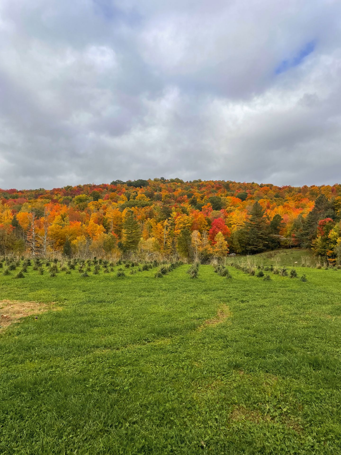
Vermont is superior if you’re looking for quaint small towns and farms. Stowe and Woodstock are exactly what I think of when I think of a New England small town in the fall. Plus, visiting local farms such Baird Farm and Morse Farm is really special.
When it comes to scenic drives, New Hampshire has more mountain vistas while Vermont has more idyllic farm settings and rolling pastures. Ranking the drives really comes down to personal preference as both are beautiful.
In terms of crowds, I found both to be quite busy, but the worst crowds were in Stowe. The traffic in Stowe gets really backed up. This also happens in the New Hampshire White Mountains, but the numerous hiking opportunities in the New Hampshire White Mountains offer you more chances to escape the crowds. No matter where you are, you’ll want to add some buffer time for traffic.
In the end, I personally preferred New Hampshire because I loved the hiking trails so much. But I also spent more time in New Hampshire, so a longer trip to Vermont in the future could change my mind! It really comes down to personal preference and both are worth visiting.
When is Peak Foliage in New Hampshire and Vermont?
The exact timing of peak foliage in Vermont and New Hampshire will change year to year, so it’s hard to plan a trip perfectly around the leaves. Typically, foliage changes first in higher elevation areas and reaches the valleys a little later. You likely won’t be able to predict the perfect time before you book your travels, so I recommend choosing anytime between the last week of September and the first two weeks of October.
Check out the foliage trackers for Vermont and New Hampshire as your trip is approaching to see what areas will be the best. If seeing the leaves in peak is your top priority, try to book refundable stays and stay flexible. But in my opinion, you can’t go wrong even if you’re not there on the exact day of peak. Foliage may look slightly different on the opposite side of the mountain or a street over. Not to mention that lighting and time of day will make a difference as well. Anytime during these few weeks, you can usually find some beautiful leaves if you keep looking.
In 2022, peak foliage in most of these areas occurred around October 5th - 12th. I explored from September 24th - October 10th and enjoyed beautiful foliage in various areas for the entire time.
This itinerary includes several hiking trails and one trail in particular that is quite difficult. If you’re new to hiking, check out my beginner hiking guide!
New England Road Trip: 7 Day Itinerary
Road Trip Overview:
- Day One: Fly into Boston, drive 2.5 hours to the New Hampshire White Mountains
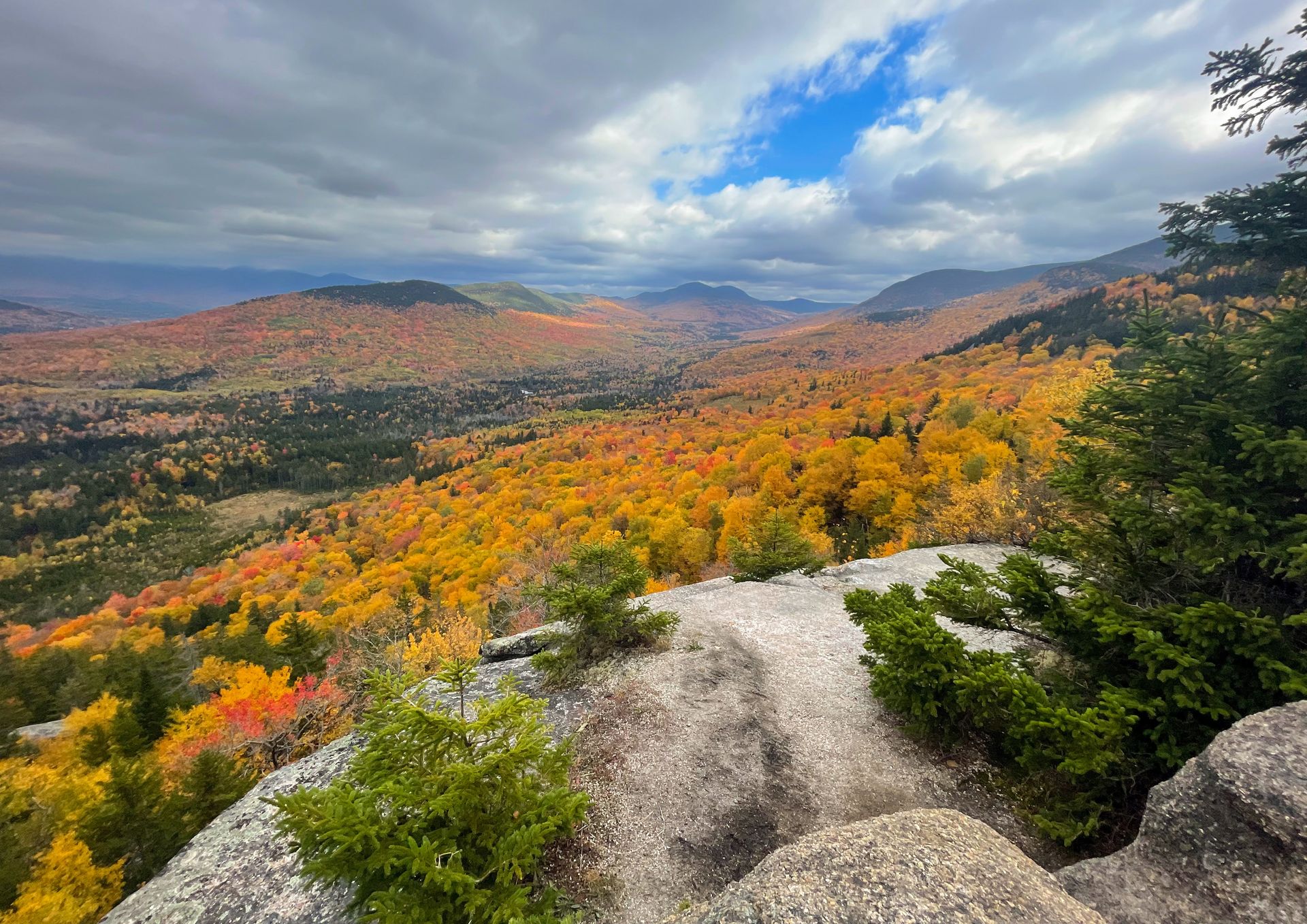
- Day Two: Hike Artist's Bluff, drive the Kancamagus Highway, drive to the tallest peak in New Hampshire.
- Day Three: Hike an epic, but challenging trail in New Hampshire.
- Day Four: Hike one or two shorter trails in the White Mountains and then drive to Vermont to continue your road trip.
- Day Five: Explore destinations around Stowe.
- Day Six: Tour a maple syrup farm, visit the second tallest Vermont peak and explore Woodstock.
- Day Seven: Drive back to Boston to complete your trip.
If you have less time, check out my 5-day version of this itinerary.
New England Road Trip Map
Use this map to visualize the road trip route: each day is a different color!
Day One
Fly into Boston and drive to New Hampshire
On day one, I recommend flying into Boston, renting a car and making your way to the New Hampshire White Mountains. Depending on where you’re staying, the drive will likely be two to two and a half hours. You may also want to stop at a grocery store and stock up on snacks and meals for hiking and traveling.
Where to Stay in the New Hampshire White Mountains
There are several great hotels and Airbnbs in Lincoln, Conway and the surrounding towns, so you can’t really go wrong. I personally love the Lincoln area to be centrally located between the Kancamagus Highway, Artist’s Bluff, Mt Lafayette and other popular trails.
In Lincoln, check out the Holiday Inn Express & Suites for a great, standard stay. For something more unique, check out the Wilderness Inn Bed & Breakfast.
You can also look for accommodations in the Thornton and Woodstock area, just south of Lincoln. Check out the Lumen Nature Retreat if you like glamping. They offer A-frame tents and safari tents with all of the amenities you could need.
I stayed in this modern cabin in Thornton and loved that it was right next to the river, was pet friendly and had fast wifi for us to work remotely.
As for food in this area, I really enjoyed StrEatz, Gypsy Cafe and White Mountain Bagel Co.
Day Two
Hike to an iconic view, take a scenic drive with stops along the way and drive to the tallest peak in New Hampshire.
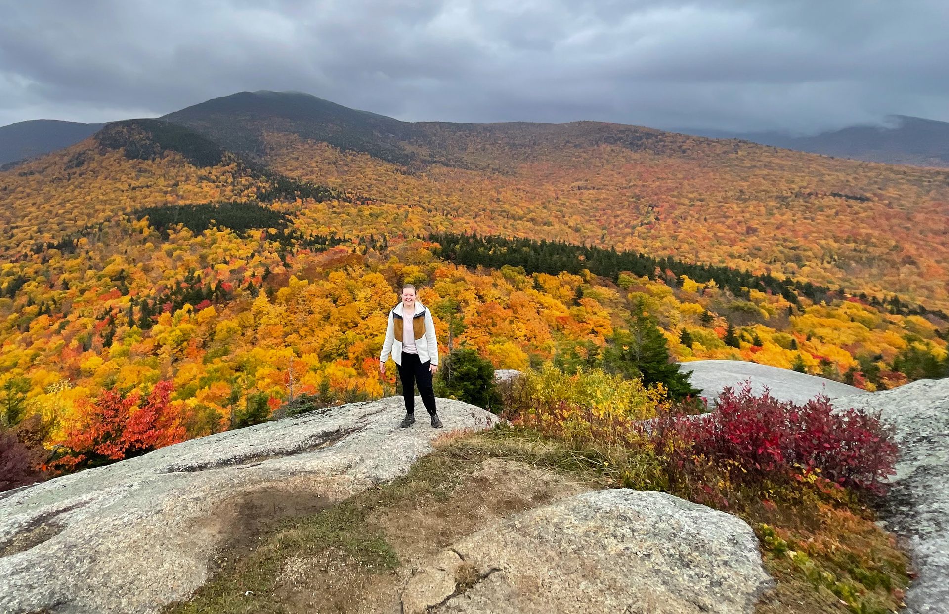
Artist’s Bluff at Sunrise
Artist’s Bluff is an iconic trail that leads to a view of Echo Lake perfectly framed with the surrounding mountains. When the foliage is at its peak, expect a sea of red, orange and yellow leaves.
Artist’s Bluff is extremely popular so do not expect to have it to yourself. There is a lot of room at the peak, but the crowds during peak times will make you feel like you’re at a concert instead of on a hike.
Personally, I only recommend going at sunrise on a weekday. It wasn’t too packed when I visited for sunrise. Based on the photos and videos I’ve seen, I really don’t think it would be enjoyable during the day or at sunset while the leaves are at their peak.
The hike to reach Artist’s Bluff can be done in about a half mile if you park at the Cannon Mountain RV Park. If you would like to see some more views, I highly recommend doing the 1.5 mile loop trail that includes Bald Mountain.
Start at lot 4, the main parking lot, and go counterclockwise to see Artist’s Bluff first. About a half mile from Artist’s Bluff, climb up on Bald Mountain for additional views of the surrounding area. This is a higher viewpoint where you won't see the lake, but you’ll still have an expansive view of fall colors.
The trails to both Artist’s Bluff and Bald Mountain include climbing over tree roots and some rock scrambling. Climbing to Bald Mountain is harder than Artist’s Bluff. Make sure you have proper hiking shoes and plenty of water. If you are coming for sunrise or sunset, be sure to bring a headlamp.
Artist’s Bluff is crowded but it’s popular for a reason! If it’s your first time in New Hampshire for the fall, this is definitely a spot that should be on your list.
For a complete list of the best day hikes in the White Mountains, check out my White Mountains hiking guide.
Drive the Kancamagus Highway
Begins 20 minutes from Artist’s Bluff
The Kancamagus Highway is a 35 mile stretch of road that connects the towns of Lincoln and Conway. This scenic drive is the perfect way to see fall foliage and take in a variety of views!
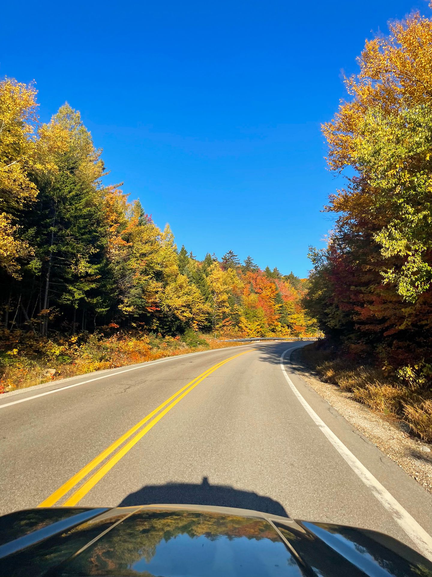
The road has a mix of scenic stops and short hikes, as well as longer hikes if you have time. I recommend spending a half day stopping at a variety of views and doing a few of the trails.
Note that there is a $5 fee for parking at the various viewpoints, or you can display your America the Beautiful pass. You should also know that drones are not allowed to land within a quarter mile of the road or within any forest protection area. Finally, be sure to obey the no parking signs.
Pro Tip: Download the Guide Along Audio tour of the Kancamagus Highway to learn about stops along the way while you're driving!
There is little cell reception on the Kancamagus Highway, so download offlines maps ahead of time and go in with a plan. I also saw a moose during one drive on the Kancamagus! Keep an eye out for wildlife, especially during sunrise, sunset and at night.
Here are the best stops to make from Lincoln to Conway (West to East):
-
Lincoln Wood Suspension Bridge: Walk out onto the suspension bridge for beautiful views of the East Branch Pemigewasset River and the surrounding trees. Many longer trails begin here too.
-
Otter Rocks: This is a quick stop where you can have a picnic or enjoy the mini waterfalls in the river.
-
Hancock Overlook: Hancock Overlook is right at an epic hairpin turn in the road and is a great place to watch the sunset.
-
Panoramic Overlook: This is an unmarked overlook located about a half mile from the Hancock Overlook. It’s another great place for sunset but parking is limited.
-
Pemigewasset Overlook: This beautiful overlook has a covered area and a bit more parking than the previous two. It’s another overlook that faces Southwest for sunset.
-
CL Graham Wangan: This overlook faces northeast, making it perfect for sunrise. It is probably my favorite overlook because of the beautiful mountain and fall foliage views it offers.
-
Lily Pond: This is a quick stop to see a beautiful pond. You’ll walk on a short path through some trees and the lake will reveal itself. It’s a beautiful place to capture reflections and look for wildlife.
-
Sugar Hill Scenic Overlook: This is another beautiful overlook that faces Northeast for sunrise.
-
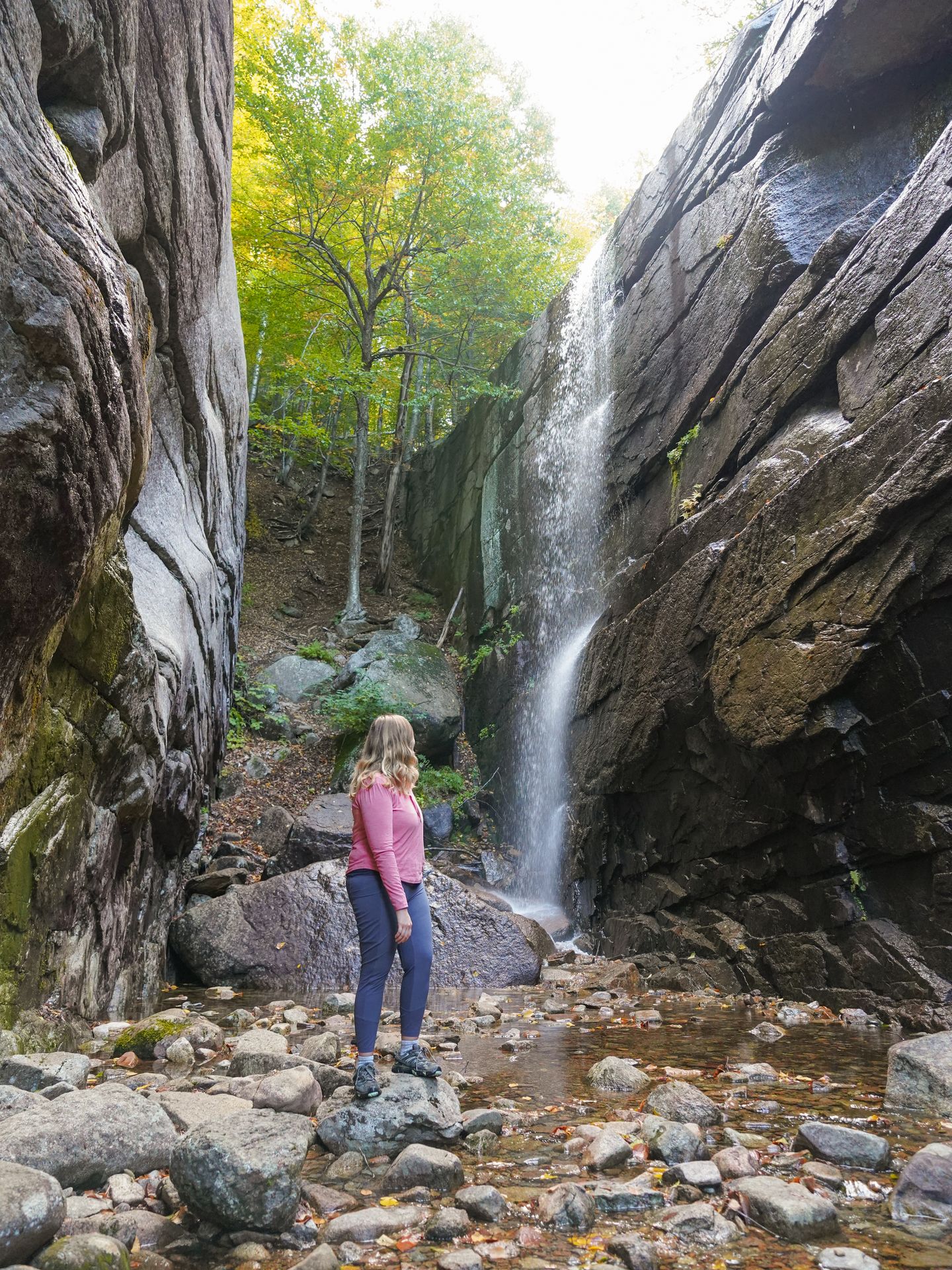
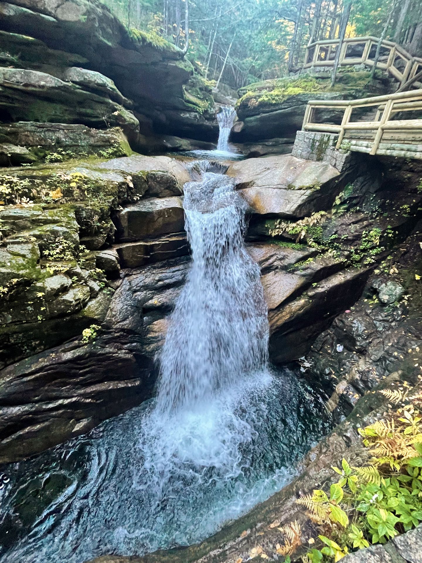
Sabbaday Falls: This short and easy trail is definitely worth your time, but expect crowds during peak times. You’ll hike an easy 0.7 mile trail to reach a unique waterfall. The water flows through a narrow gorge area, turns a seemingly right angle and is a vibrant blue color.
-
Bear Notch Road: For a less crowded experience, take the Bear Notch Road spur to see some additional overlooks. There are three overlooks that offer beautiful viewpoints.
-
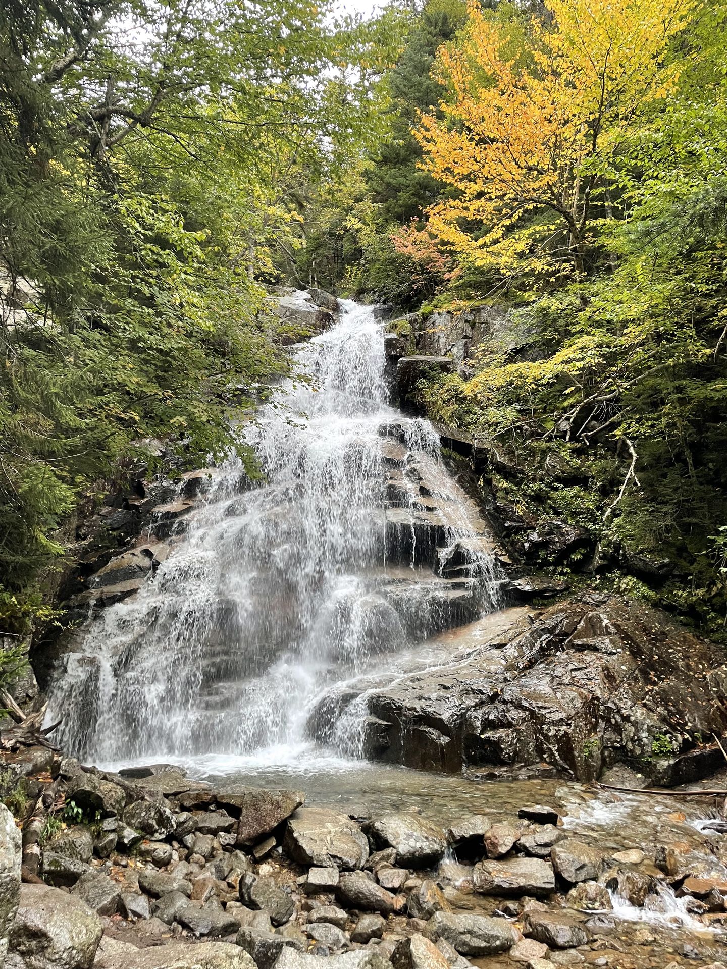
Champney Falls: If you’re up for a slightly longer hike, Champney Falls is definitely worth doing. This is a 3 mile moderate hike that has 682 feet of elevation gain. After a walk through the forest, you’ll reach two waterfalls. You’ll discover the more interesting waterfall when you walk past the first waterfall and enter an area with towering rock faces. You may need to walk over some wet rocks to reach it, so be sure to watch your step. The waterfall flows down a seemingly straight wall of rock and it’s really neat to see it up close.
-
Rocky Gorge and Lower Falls: These are quick but beautiful areas where you can see how water has carved away at rocks in the gorge. Rocky gorge has a bridge and a larger waterfall, while Lower Falls features a smaller waterfall.
-
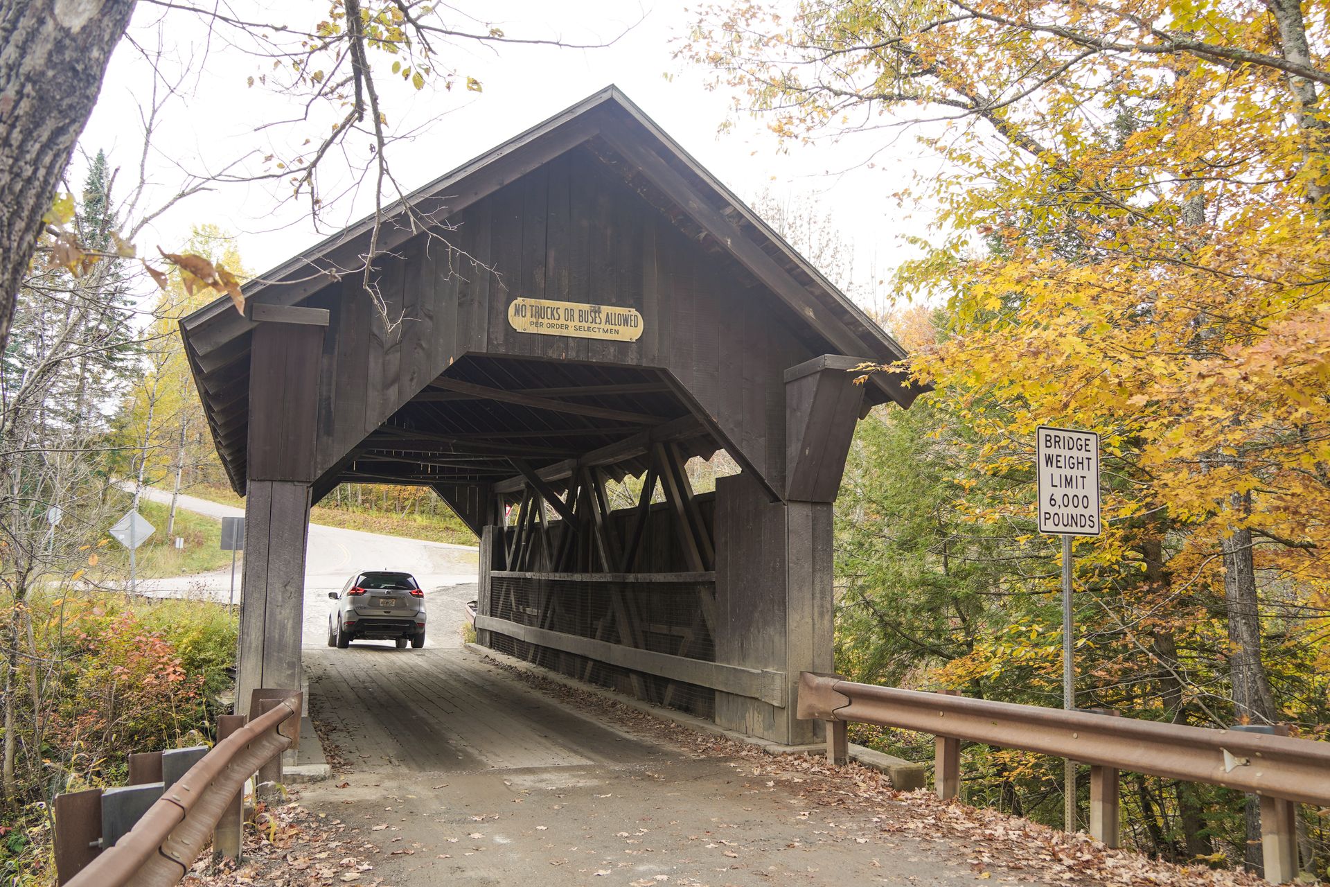
Albany Covered Bridge and the Boulder Loop Trail: Boulder Loop is a 3 mile moderate hike that leads to some amazing views. The trail has a little over 900 feet of elevation gain and will take you past some large boulders and through the forest before reaching a fantastic view. It’s a great viewpoint to enjoy expansive views of fall foliage.
Note that you can park at two different parking lots for the Boulder Loop, either before or after the covered bridge. The Albany Covered Bridge is a classic covered bridge that was first constructed in 1858. It’s worth a quick stop even if you’re not planning on hiking the Boulder Loop.
For this itinerary, I recommend choosing between the Champney Falls trail and the Boulder Loop trail so that you have enough time to reach Mt. Washington.
Cheese Louise
Cheese Louise is a grilled cheese restaurant right at the end of the Kancamagus Highway as you’re reaching Conway! This makes it the perfect spot to grab some lunch.
They serve up some unique and delicious grilled cheese options along with hearty tomato soup. I really enjoyed the Godmother grilled cheese which includes pesto, tomatoes and balsamic reduction.
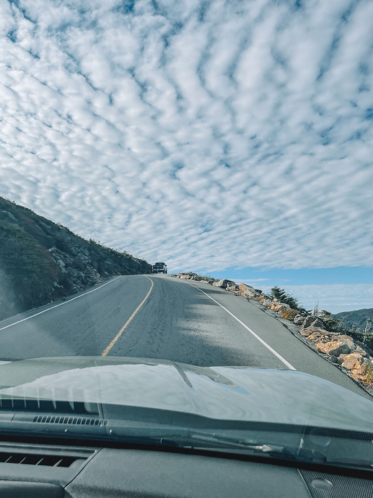
Mt Washington
Located 45 minutes from Cheese Louise
Mount Washington is the highest point in New Hampshire and there are several ways to reach the top! If you don’t have enough time to hike, I highly recommend driving to the top.
The road is quite historic. It first opened in 1861 to the use of horse drawn carriages and is one of America’s oldest man-made attractions. The road has stood the test of time and continues to be improved as necessary.
The drive up is not for those afraid of heights. The road is very steep at times and there are some areas with drop offs. At one point, you reach a grade of 22%. Importantly, you’ll need to put your car in low gear while driving back down so as not to overheat your brakes.
There are multiple viewpoints where you can take a break before reaching the top. At the top, you’ll enjoy incredible views (on a clear day). There are also some gift shops, a museum and a cafe.
Weather can be unpredictable at the top. Mount Washington often experiences high winds; it is known for the fastest surface wind recorded in the Northern and Western Hemispheres was recorded there in 1934 at 231 mph.
There is a driving tour app so you can learn about the road during the drive. Plus, you’ll get the famous bumper sticker that reads “This Car Climbed Mt. Washington.”
During peak times, driving to the top of Mt. Washington typically costs $45 for the car and driver, plus $20 for each additional passenger. It took us 30 minutes of driving each way and we spent an hour at the top.
Other ways to reach the top of Mt. Washington include taking the Cog Railway, going on a guided tour or hiking. The Cog Railway is more expensive than driving to the top but provides a unique experience.
There are multiple hiking trails to reach the top, but you can get there in the shortest distance on the Tuckerman and Lion’s Head trails. This hike is 7.4 miles with 4,242 feet of elevation gain.
No matter how you visit, Mt. Washington is definitely worth exploring on a clear day.
Day Three
Hike an epic, but challenging trail in New Hampshire
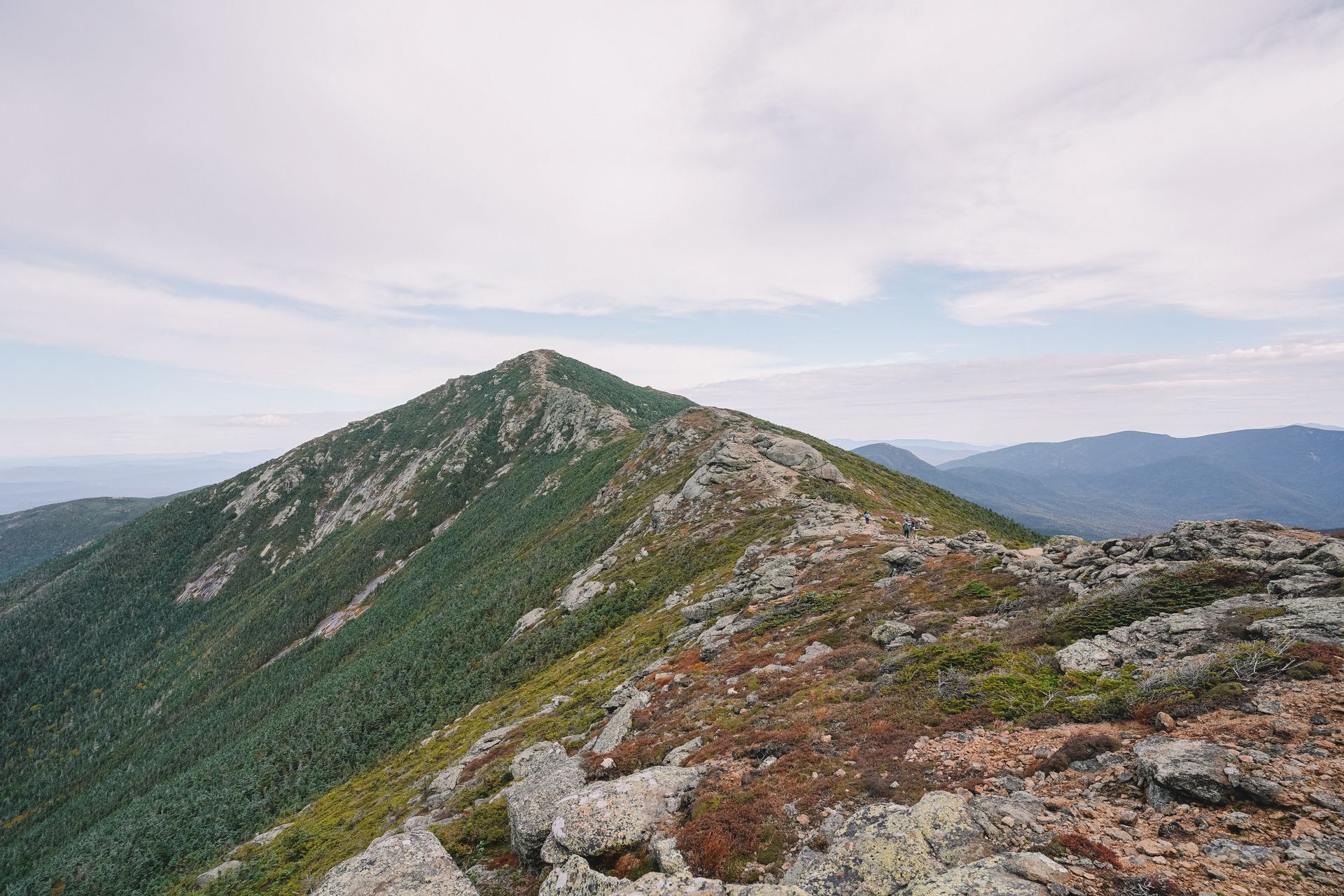
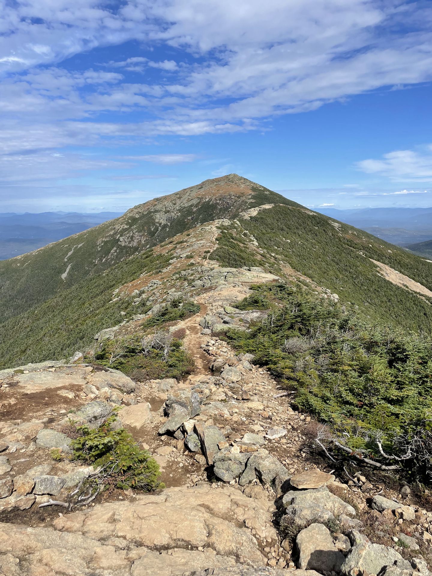
Hike the Mount Lafayette and Franconia Ridge Trail
If you’re up for a challenging hike, I highly recommend the hike to Franconia Ridge and Mount Lafayette. This 9 mile loop trail is one of the most popular hikes in New Hampshire for good reason.
Note that the weather on these mountains varies drastically in the fall. I hiked it on a nice, clear day, but there was snow, ice and intense wind just one day prior. Always check the forecast before climbing a peak (I recommend looking at mountain-forecast.com). Also make sure you’re prepared for different conditions with layers, microspikes and the rest of the 10 essentials for this challenging hike.
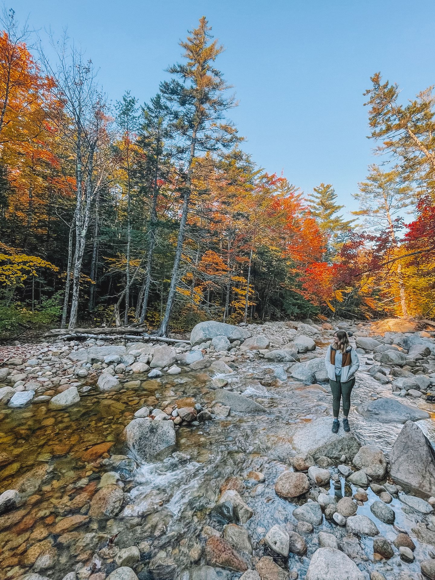
I recommend going counterclockwise to hike up the steepest area on the Falling Water Trail.
On the Falling Water Trail, you’ll see some beautiful waterfalls and do a few river crossings. There is a lot of rock scrambling on this trail and some areas get slippery with water. You also may have to get your feet wet on a couple of the river crossings. I recommend trekking poles for balance.
After 2.8 miles, you’ll climb out of the forest onto Haystack Peak and be rewarded with incredible views of the surrounding mountains. From there, you’ll hike another 1.5 miles along the ridge and reach the peaks of Lincoln and Mount Lafayette. Both Mount Lafayette and Mount Lincoln have an elevation of over 4,000 feet.
The entire ridge hike has incredible views. There are a few rock scrambling areas but it is not as difficult as the forest portions of the hike (in my opinion).
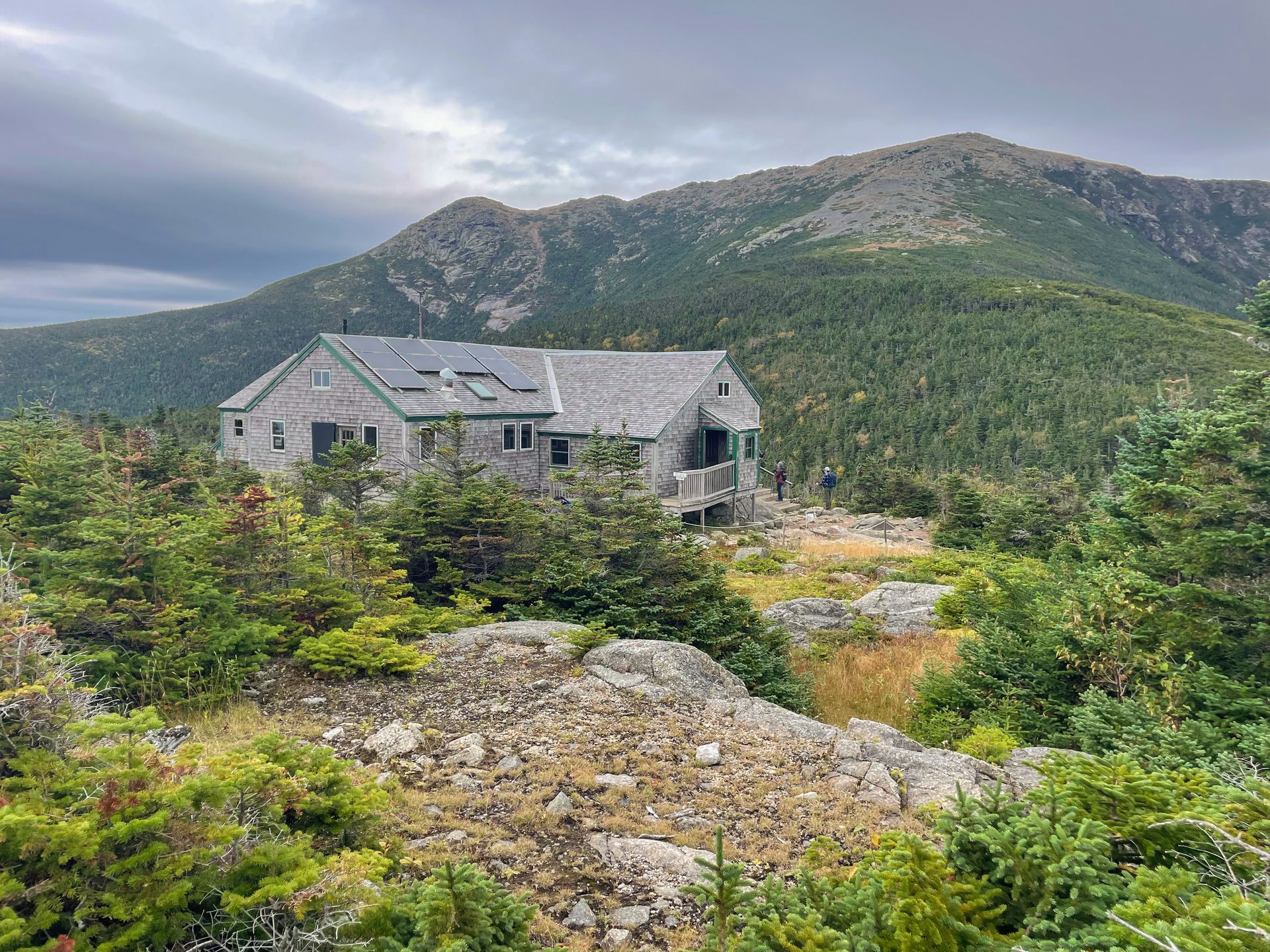
As you ascend down the last peak, you’ll see the Greenleaf Hut in the distance. This is such a nice treat on this long hike! The hut offers overnight lodging, bathrooms, food and drink. I enjoyed soup, bread and coffee before continuing my descent. Bring cash to purchase food (they also take venmo but service is spotty). You can also refill your water here for free.
The hike down from Greenleaf Hut was a bit harder than I thought it would be. There are several rocky areas and some can be quite slippery. If you’re not used to hiking in the area, expect it to take longer than you think.
Overall, this hike is challenging but incredibly rewarding. If you’re an experienced hiker who wants a difficult hike, this is a must-do on your trip to the New Hampshire White Mountains.
Day Four
Hike one or two shorter trails in the White Mountains and then drive to Vermont to continue your road trip
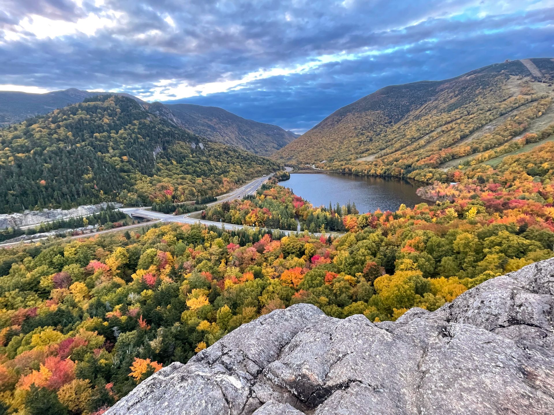
Mount Willard
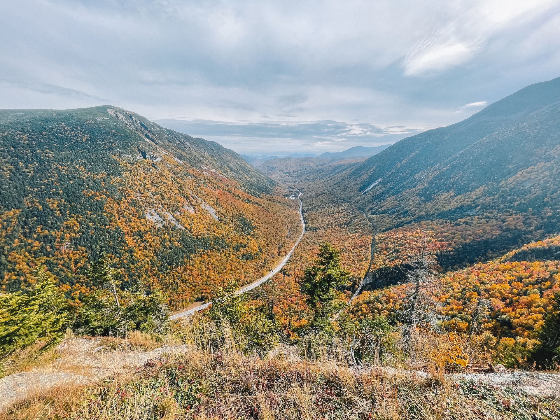
Mount Willard popular trail leads to a beautiful view of a narrow valley between two mountains, yellow foliage and Crawford Notch Road.
The trail begins at the Crawford Notch Train Depot, so expect crowds if the train is about to leave. The trailhead is on the opposite side of the tracks. Make sure you pay attention to signage and/or download the map on AllTrails, as some miss hikers the left turn and hike the wrong trail.
The trail is 3.1 miles with 895 feet of elevation gain. You will hike up in the forest along a stream (some areas may be slippery) until you reach the viewpoint. The end is quite beautiful and there is a nice amount of space to spread out, have a snack and enjoy the views.
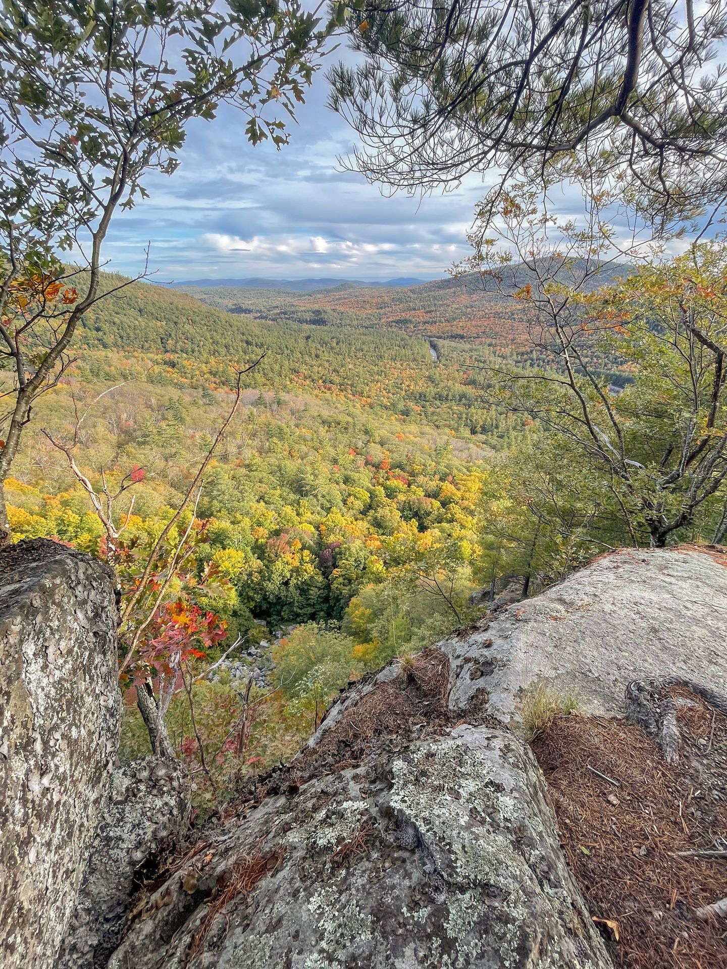
North and Middle Sugarloaf Peaks
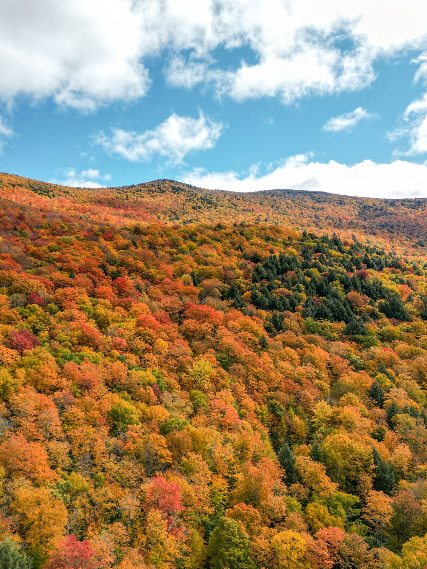
The North and Middle Sugarloaf Peaks are a great place to summit two peaks with expansive views during peak foliage.
The total trail is 3.3 miles with a little over 1,000 feet of elevation gain. If you want the hike to be slightly shorter, I recommend only doing the Middle Sugarloaf Peak. Like Mount Willard, most of the trail is the forest and you won’t get many views until the end. But the views are incredible at the top and this was one of my favorite places to see fall foliage at its peak.
Nichol’s Ledge
About an hour and 20 minutes from Mt Willard and the Sugarloaf Peaks
Begin your drive to Stowe, Vermont (located a little under 2 hours from the Sugarloaf Trailhead). However, I recommend a detour to hike to the top of Nichol’s Ledge along the way.
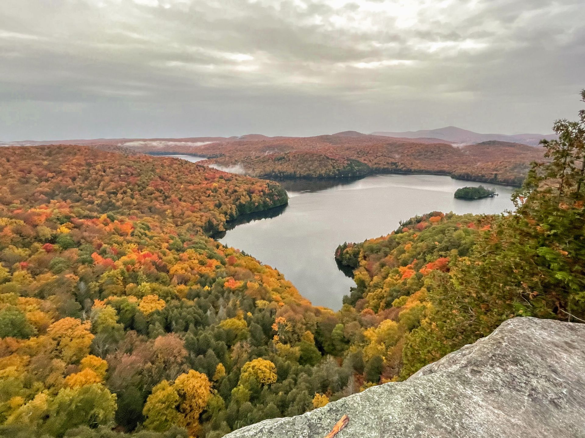
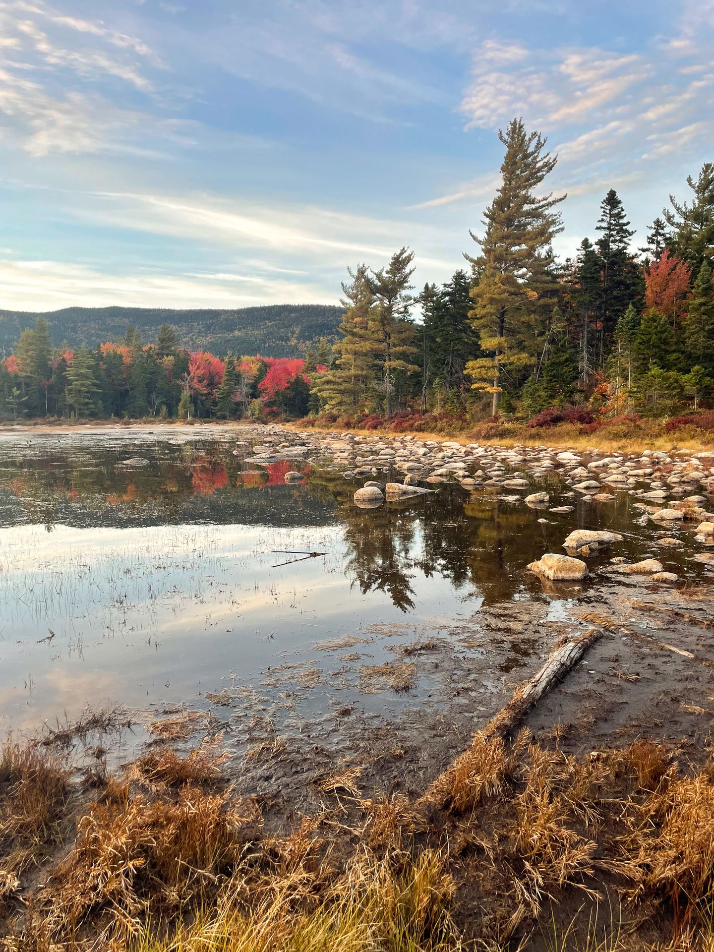
Nichol’s Ledge is rated easy and just over a half mile with 242 feet of elevation gain. This quick trail leads to a stunning view of Nichols Pond surrounded by rolling hills. Especially when the foliage is at its peak, this is such a beautiful view.
Note the parking lot is small and this may be crowded during peak times. Also make sure to avoid Town Hwy 58 when driving here if you do not have a 4x4 vehicle.
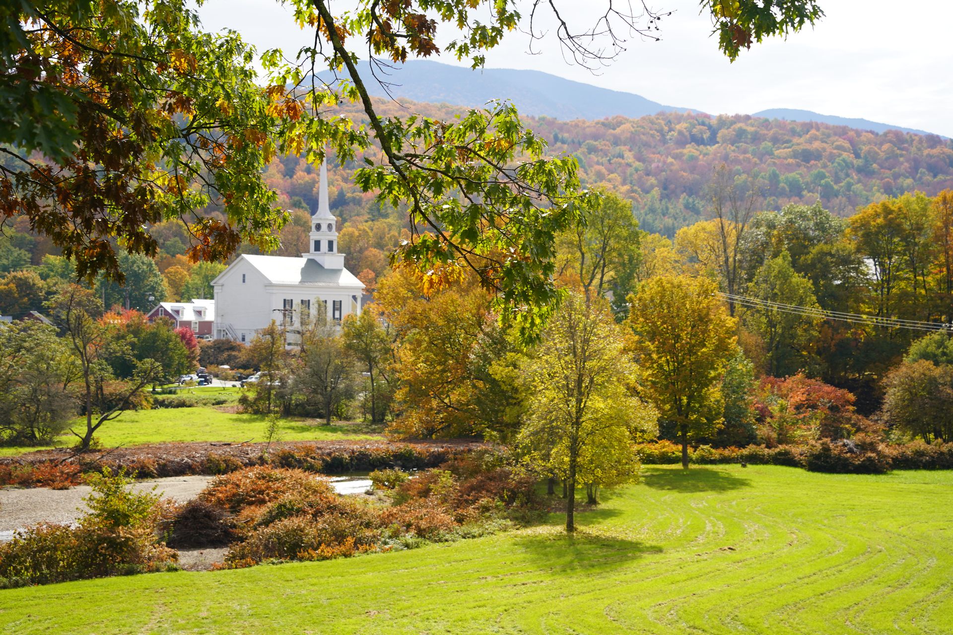
Explore Downtown Stowe
45 Minutes from Nichol’s Ledge
Arrive in downtown Stowe and explore a bit before or after checking into your hotel. Be sure to take in the view of the Stowe Community Church from Salon Salon!
If it’s still daylight, it’s worth taking a walk on the Stowe Recreation Path. If you’re looking for dinner downtown, check out Harrison’s or Plate (reservations are recommended).
Where to Stay in Stowe
Stowe has several great hotels and Airbnbs to choose from, but it is a small town that receives a ton of visitors in the fall. It is best to book early and expect some places to be expensive.
For a more affordable hotel that is still super chic and in a great location, check out the Field Guide Lodge. They have well-designed rooms and are within walking distance of downtown Stowe.
If you want to be in the center of downtown Stowe, check out Green Mountain Inn. This historic hotel has welcomed guests since 1833 and also has a nice restaurant.
Another place to stay near town is the Timberholm Inn. This cozy lodge offers outdoor amenities such as a fire pit and a hot tub and is the perfect place to stay if you’re looking for peace and quiet.
There are also some great Airbnbs nearby. Check out this studio apartment above a coffee roaster, this cabin in nature near Stowe or this beautiful home within walking distance of downtown Stowe.
Day Five
Road trip to various destinations surrounding Stowe
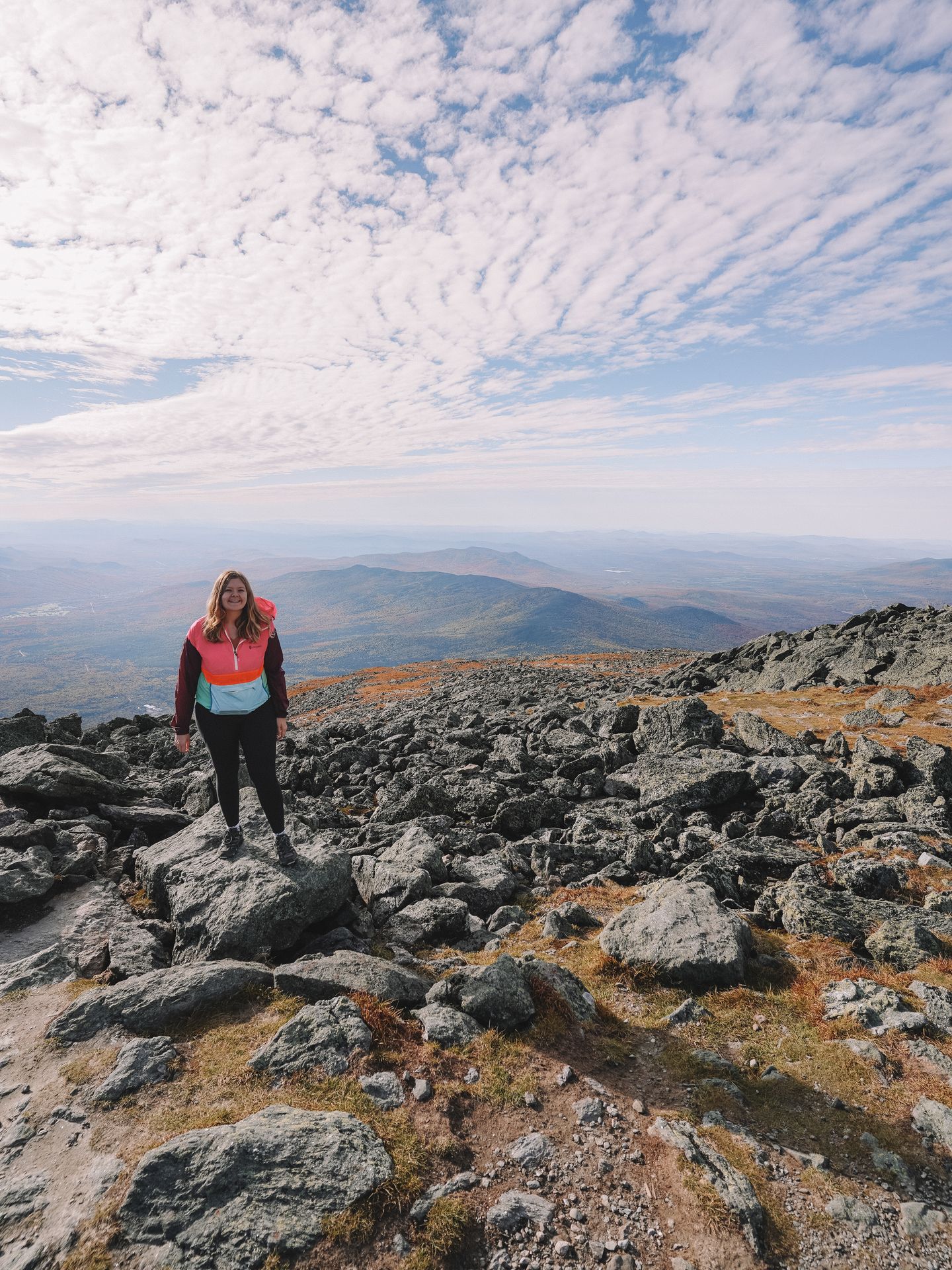
Mt Mansfield
Spend your first full day in Vermont exploring the various sights around Stowe.
If it’s a clear day, start by driving to the top of Mt Mansfield (you can hike instead if you have time!). This is a great thing to do earlier in the day to beat the crowds. I tried to go an hour before closing and they had already sold all the remaining spots for the day.
Mt Mansfield is the highest point in Vermont and offers amazing views of the Green Mountains. The road to the top is 4.5 miles, unpaved and includes some hairpin turns. Note that to actually reach the summit from the Auto Road, you’ll need to hike about 3 miles round trip from the parking area to the peak.
There is no food or drink at the top, so pack a picnic and take in the views. Another option is to take the gondola to the top. To reach the peak from the gondola, there is a shorter but more difficult trail to reach the peak. You would follow along the Cliff Trail and climb over boulders along the way.
No matter how you reach the top, Mt Mansfield is an epic peak that offers beautiful views of the surrounding Green Mountains.
Ben and Jerry’s Headquarters
25 Minutes from Mt Mansfield
After Mt Mansfield, I recommend driving south to Ben and Jerry’s and then making your way back north towards Stowe with these various stops. Cold Hollow Cider Mill is difficult to turn into if you’re coming from the North.
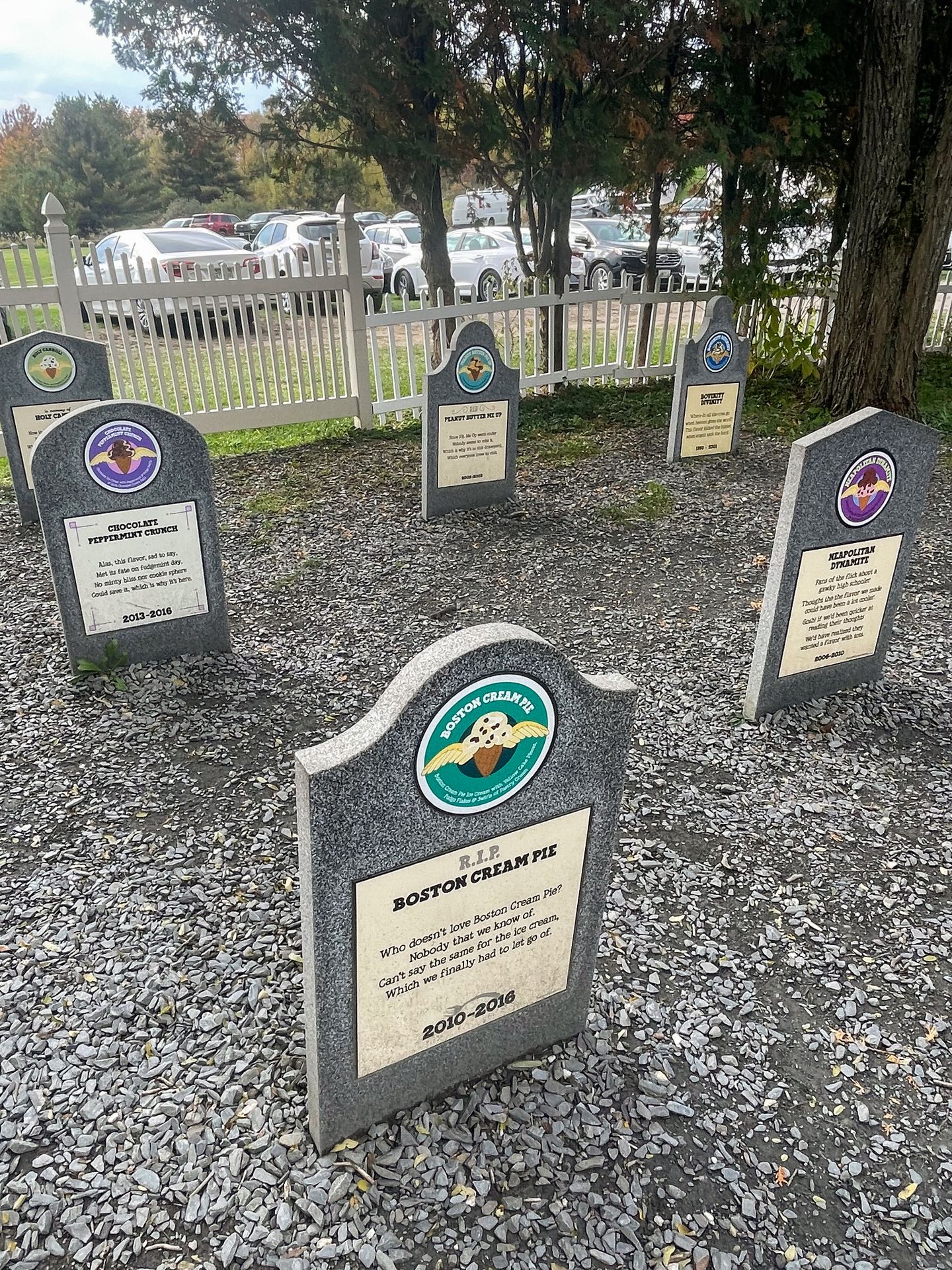
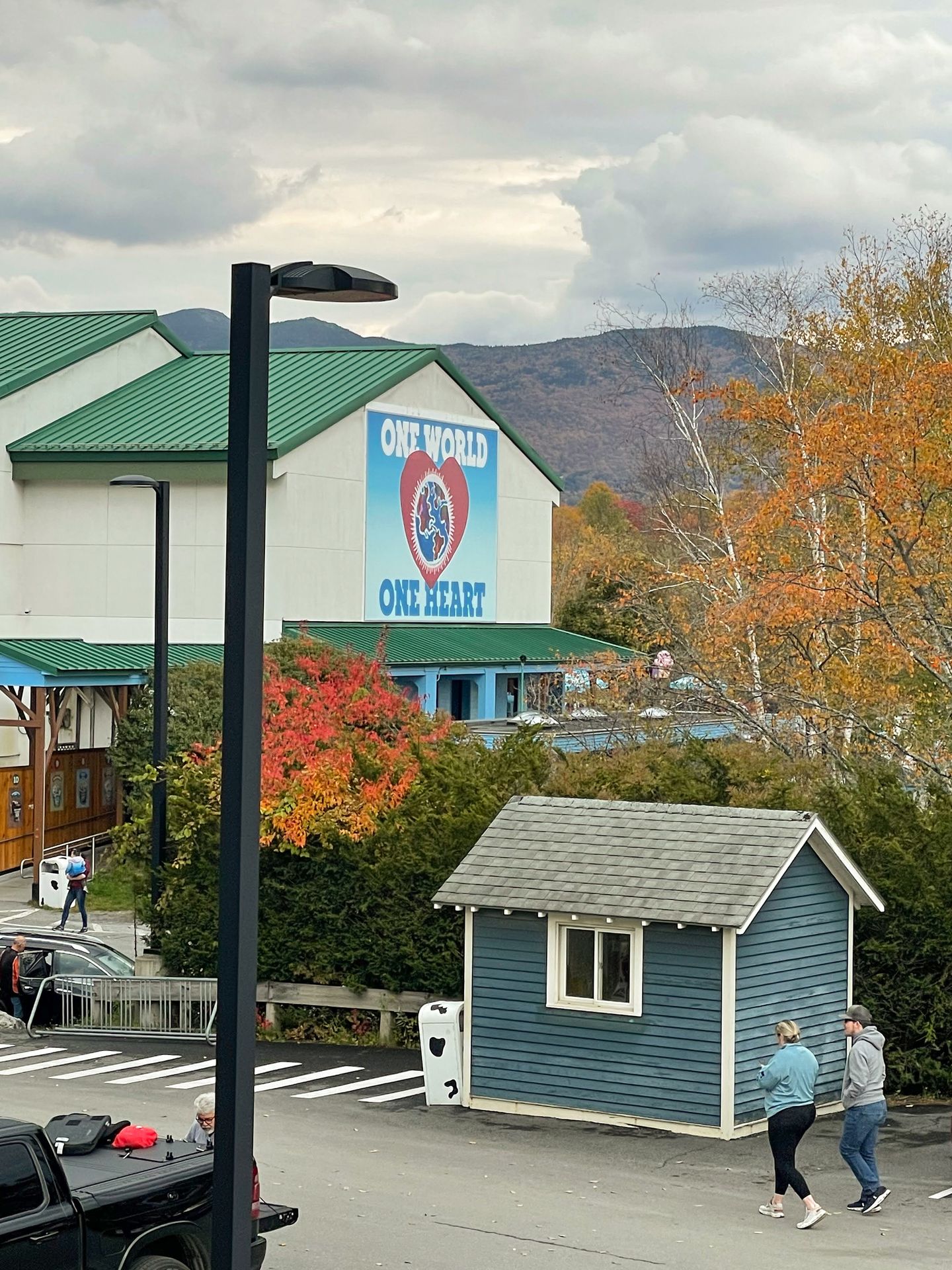
Ben and Jerry’s Ice Cream is headquartered in Vermont and you can tour the factory, enjoy some ice cream and see their flavor graveyard. If you would like to tour the factory, you need to reserve a ticket in advance. Tickets are released every Tuesday for the following Tuesday-Sunday and sell out during busy times.
If you don’t snag a tour ticket, it’s still worth seeing their flavor graveyard. There are humorous gravestones honoring their retired ice cream flavors throughout the years. They also have ice cream scoops and gifts for sale with no tickets required.
Cold Hollow Cider Mill
5 Minutes from Ben and Jerry’s
Cold Hollow Cider Mill is a must for apple cider donuts and apple cider. They serve the best apple cider and cider donuts I’ve ever had! You can sample their cold cider for free and purchase hot cider, donuts and many more goodies. You’ll find a wide variety of jams, salsas and many more snacks and gifts.
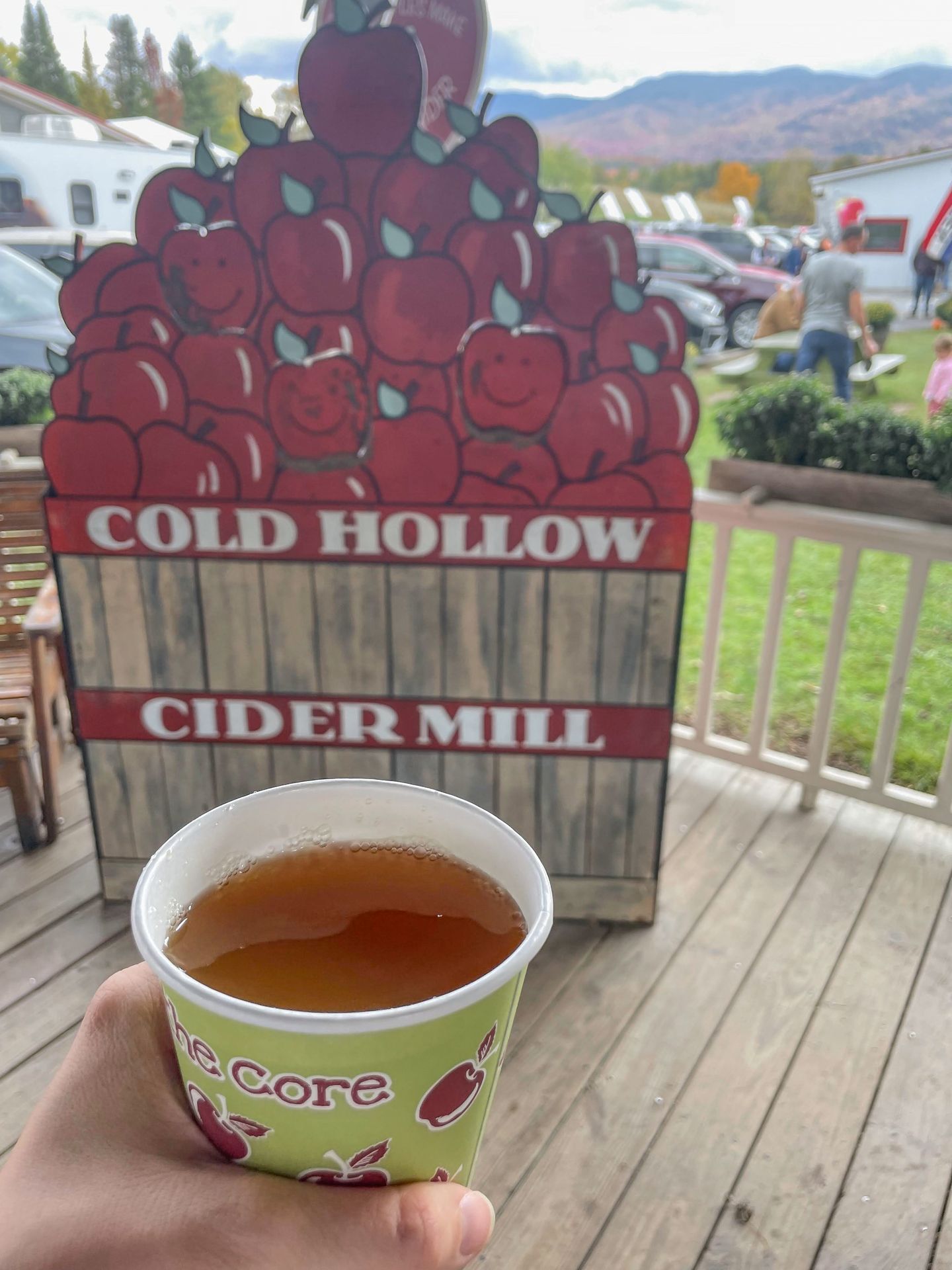
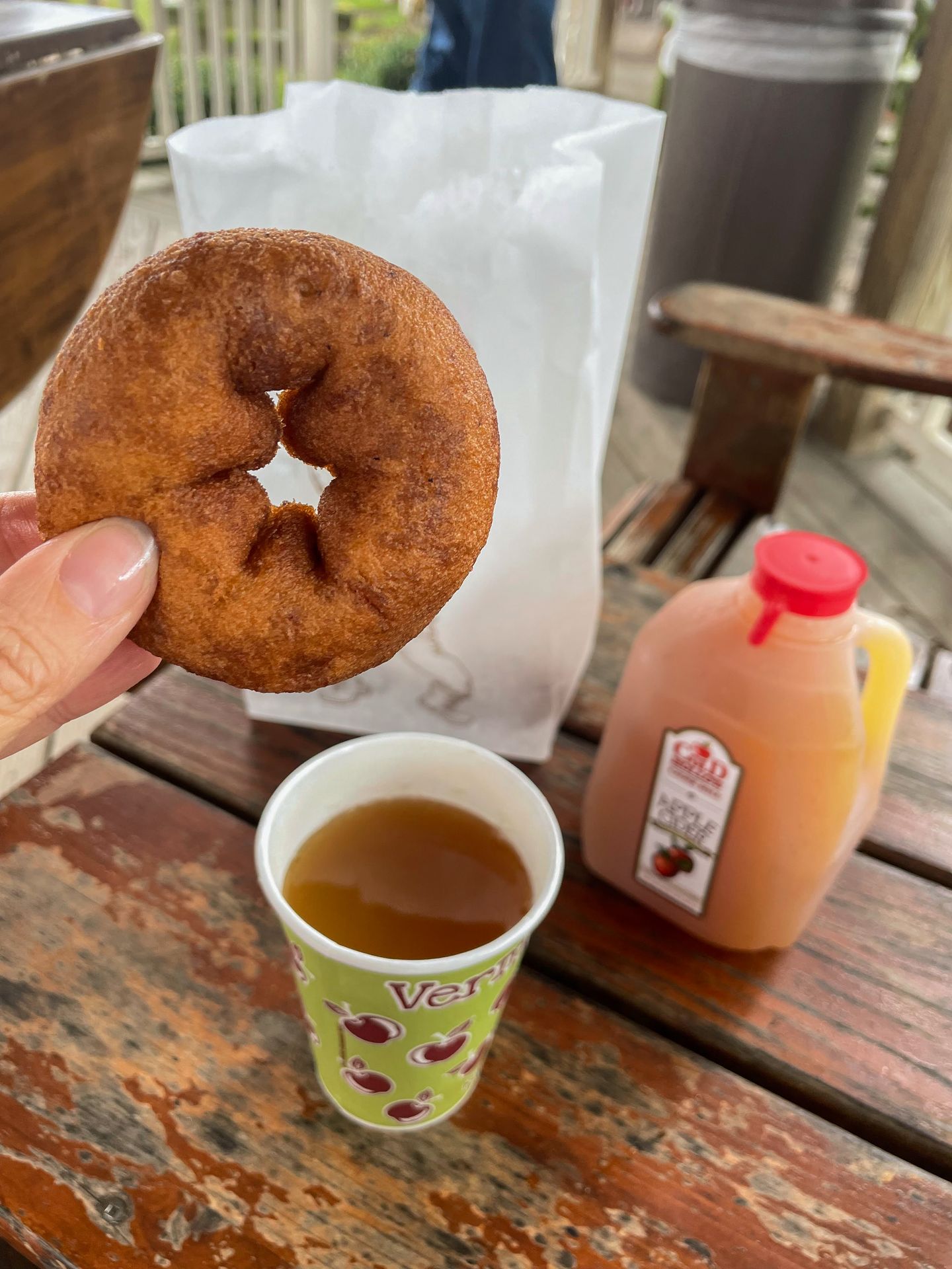
Along with cider and donut shop, they have a farm to table restaurant that serves great breakfast and lunch options. Here you can enjoy breakfast sandwiches, hard cider, paninis and more.
Gold Brook Covered Bridge
10 Minutes from Cold Hollow Cider Mill
The Gold Brook Covered Bridge is a scenic stop with some sad history. It is also known as “Emily’s Bridge” and is said to be quite haunted. According to legend, a girl named Emily was supposed to meet her partner here to elope in the mid-1800s. When he didn’t show, she took her own life here.
It is said that there have been claw-like marks on the side of cars and strange voices inside the tunnel. The bridge was featured on Most Terrifying Places in America in 2018.
Moss Glen Falls
20 Minutes from Gold Brook Covered Bridge
Moss Glen Falls is a scenic waterfall that can be reached via a short, quarter mile hike. There is limited parking and this is a popular spot, so allow some buffer time.
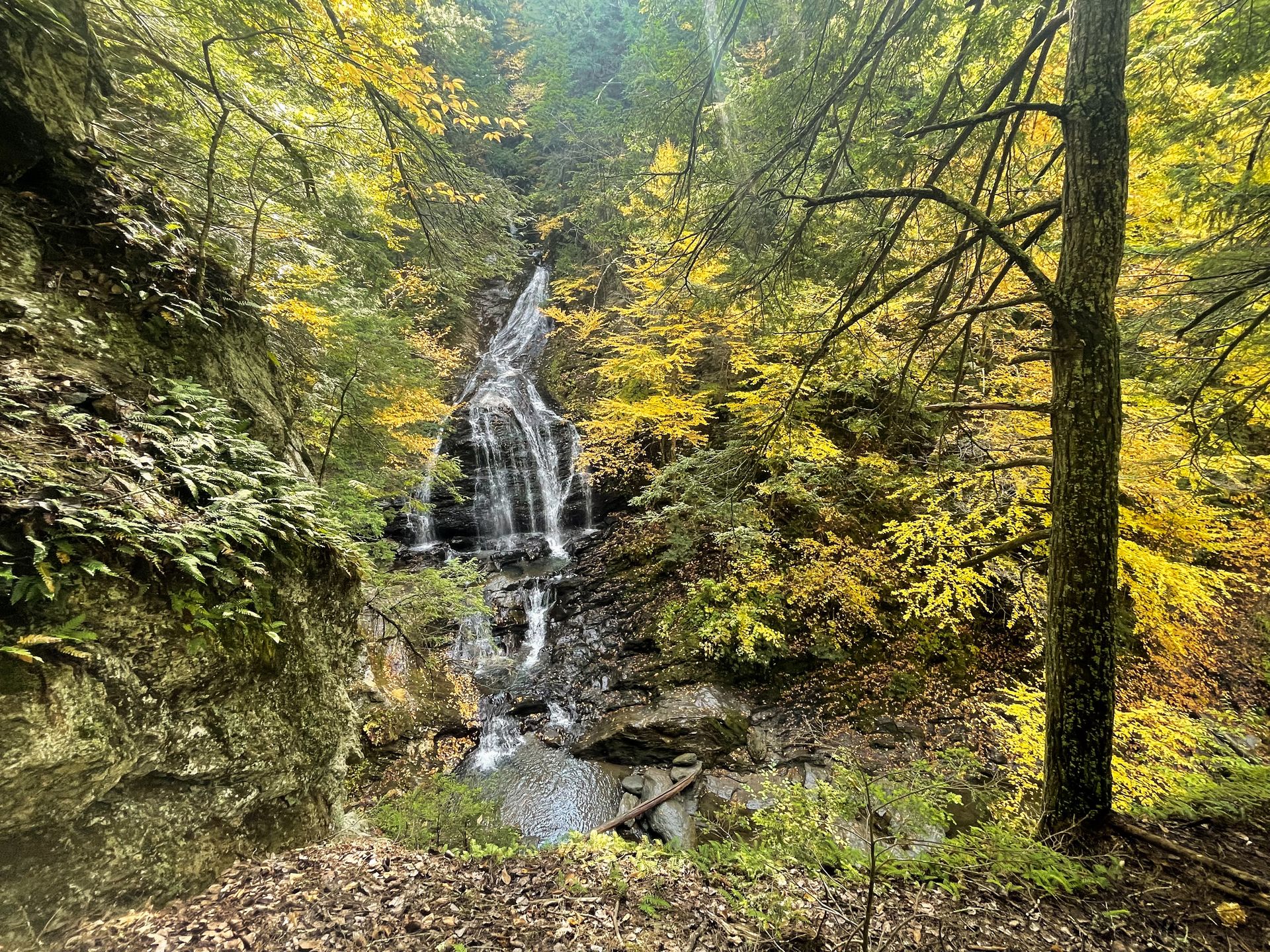
The hike begins on a flat, boardwalk trail and then you will climb a short hill to reach the falls. Be sure to stay on the trail to help protect vegetation.
The trail may be muddy and a bit slippery in areas, I recommend wearing good shoes!
Percy Farm Corn Maze
15 Minutes from Moss Glen Falls
If it’s still open for the day, test your navigation skills at the Percy Farm Corn Maze! Nothing says “fall” like a corn maze and this one is extra fun because it can be challenging to navigate.
The maze sits on about 8 acres, is dog friendly and a lot of fun. They give instructions to call them for help if you find yourself unable to find your way out. It took us just under 45 minutes to find our way out!
While you’re in the maze, you’ll get to take in some beautiful views of Mt Mansfield in the distance.
Idletyme Brewing Company
2 Minutes from Percy Farm Corn Maze
Idletyme Brewing Company is a great place for dinner if you enjoy breweries! I enjoyed their brewski sampler which allows you to try 10 beers. My favorite was the Sour Blue.
To eat, I enjoyed the gouda soup and their soft pretzel. This is a popular place but we were able to get a seat outside around 5:15 PM (they have heaters!). If you’re eating later, make a reservation or be prepared to wait.
Day Six
Check out your hotel and head to another area of Vermont for the next day of your trip. Tour a maple syrup farm, go to Killington Peak and explore Woodstock.
Baird Farm
An hour and 45 minutes from Stowe
Vermont is known for its maple syrup for good reason. They produce the most maple syrup in the country by far with over 2.5 million gallons produced in 2022. Therefore, one of the most iconic things you can do in Vermont is tour a maple syrup farm.
I highly recommend a tour of Baird Farm! They are a family-owned business with a 560-acre farm in Chittenden, Vermont. They offer free tours that include a walk to their maple trees and a tour of the sugarhouse. Make sure you make a reservation in advance!
I learned SO much on my tour with Jacob. We got to see a small portion of the 100+ miles of collection tubes, see how the syrup is filtered and try 7 different types of syrups. I was especially impressed with their infusions and loved the mint infused syrup.
Baird Farm is located a little under 2 hours from Stowe and less than an hour from Woodstock and Killington Peak. I highly recommend including it on your Vermont itinerary! A tour of a sugarbush is worth it in Vermont whether you go here or not, but I recommend supporting a small business if possible.
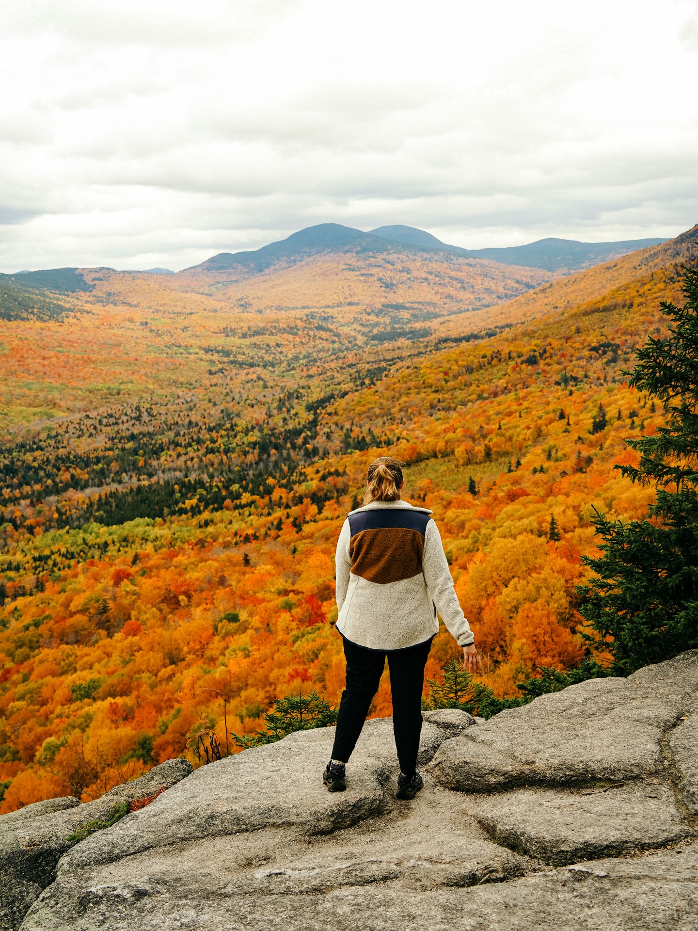
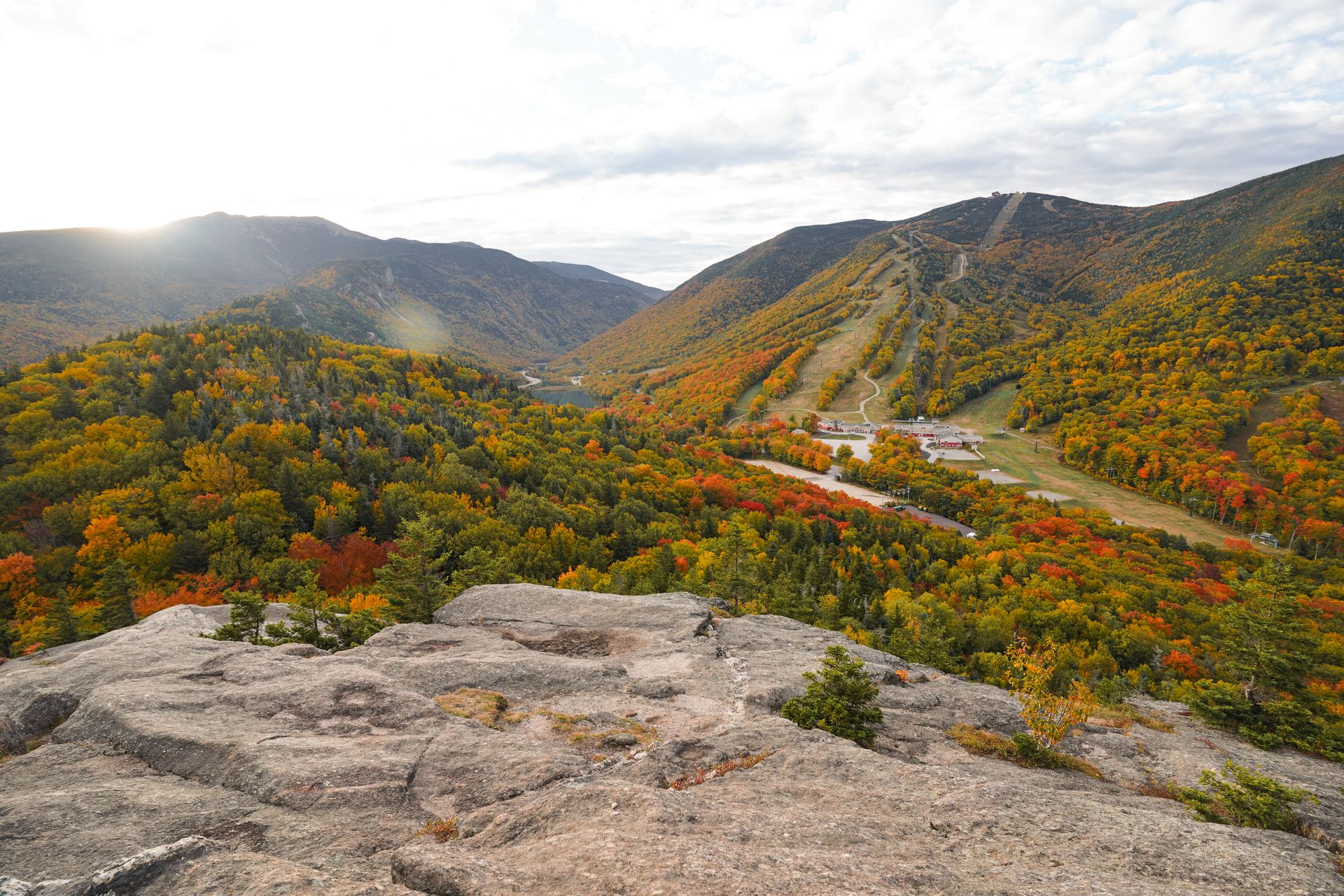
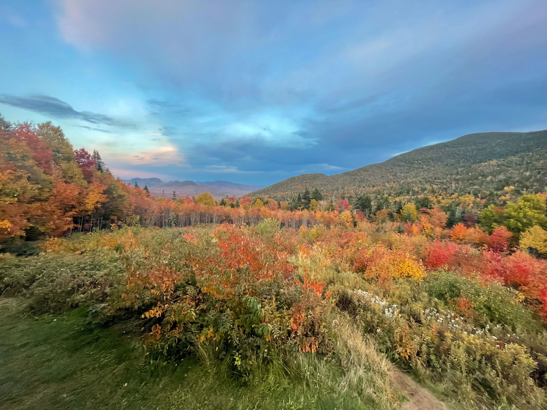
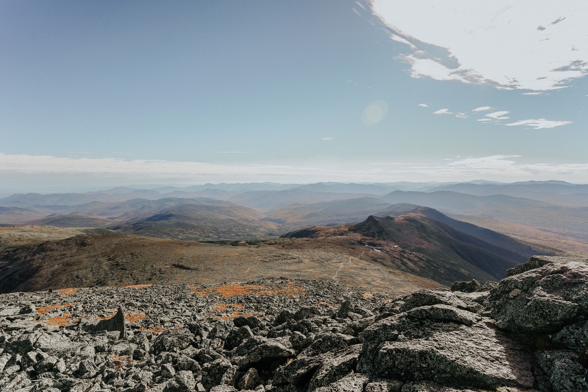
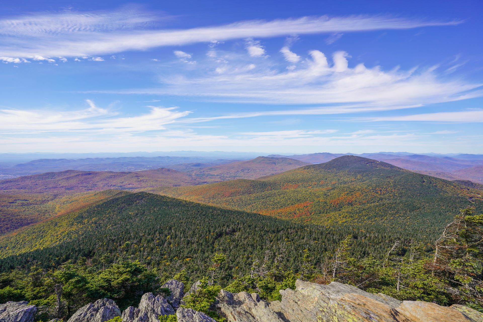
Killington Peak
30 Minutes from Baird Farm
Hike or take the gondola to the second tallest peak in Vermont for stunning views, especially during peak foliage! I actually did both the hike and gondola ride.
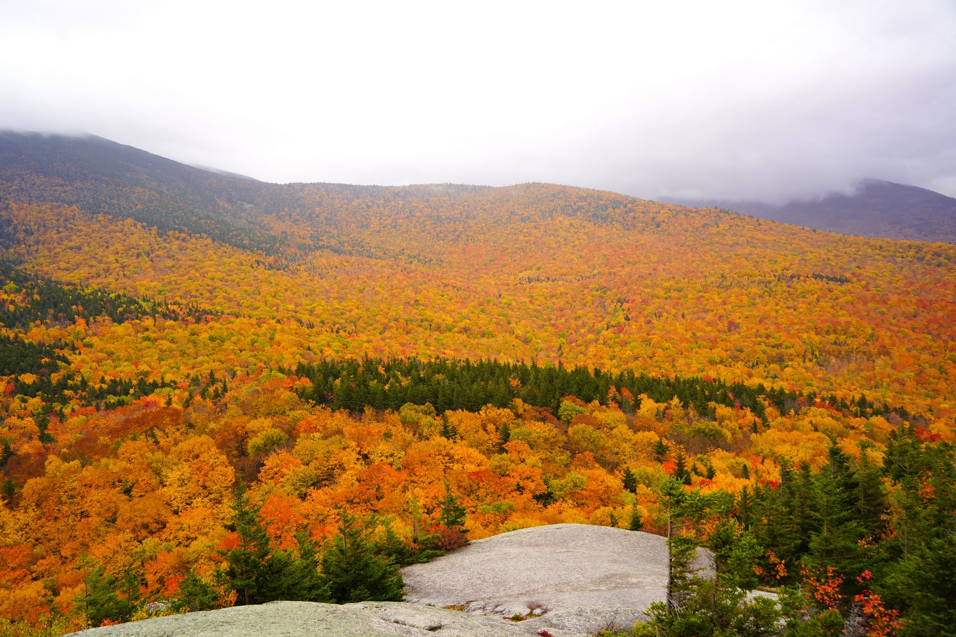
There are a few different trails that can lead you to the peak. I hiked it via the Bucklin Trail. This path is 7.2 miles, has over 2,400 feet of elevation gain and is rated hard. It starts flat for the first couple miles, and then gets very steep.
The trail is pretty straightforward until the last bit which includes a short section of rock scrambling. The hike is mostly in the forest and you won’t see expansive views until the end. When I reached the top, the peak was completely socked in with fog and we couldn’t see anything.
When we reached the bottom, we realized that the weather had cleared and we could now see the peak. Therefore, we decided to pay and take the gondola back up to see the view. It was worth it to take in the expansive views! Prices are cheaper if you pay for your gondola tickets online instead of upon arrival. I paid $27 per person.
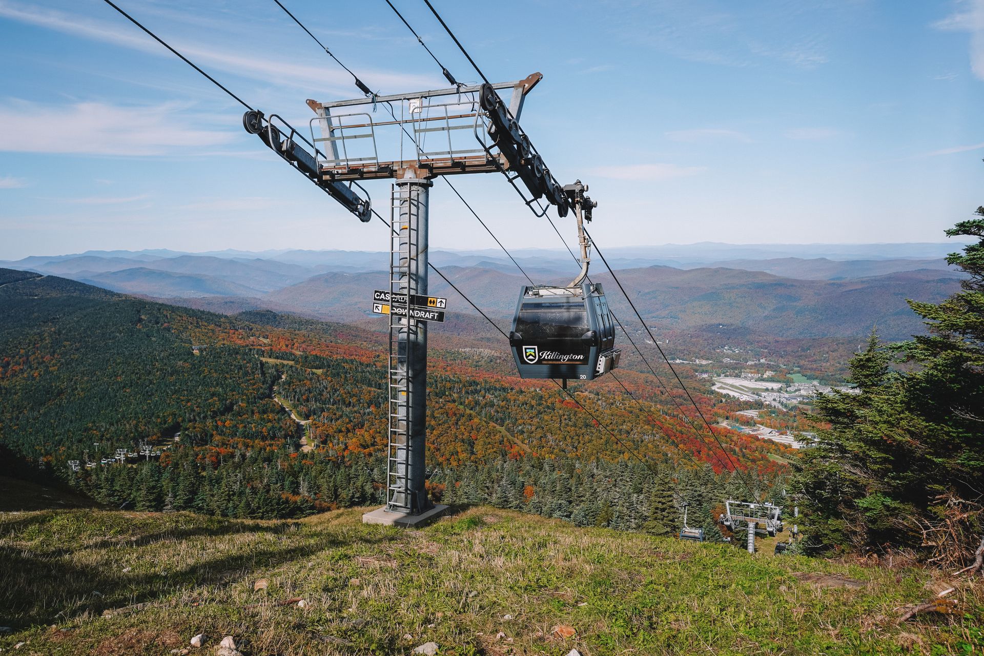
Kilington is a ski resort by winter and a popular place for mountain bikers and hikers in the summer. The top of the mountain typically has a snack shack, a restaurant and restrooms. You will see views as soon as you exit the gondola, but to get the best views, you should hike about 0.1 miles from the gondola to summit the peak. The trail includes some rocks, so I recommend proper hiking shoes.
No matter how you reach the top, it’s worth seeing Killington Peak on a clear day! You can see views for miles and it’s especially beautiful during the fall.
Explore Woodstock
30 Minutes from the Killington Peak gondola
After Baird Farm and Killington Peak, make your way east to Woodstock to spend the rest of your day.
If Mont Vert Cafe is still open, it’s a great place to grab lunch, coffee and pastries. If you’re in the mood for a treat, try a Maple Cremee from Woodstock Scoops!
A maple creemee is a Vermont speciality: maple-flavored soft serve ice cream. Even if you aren’t a huge maple syrup fan, it’s worth trying one! Many places also have the option to add crumbled maple sprinkles or swirl the maple ice cream with another flavor. Make sure you have a maple creemee before leaving Vermont!
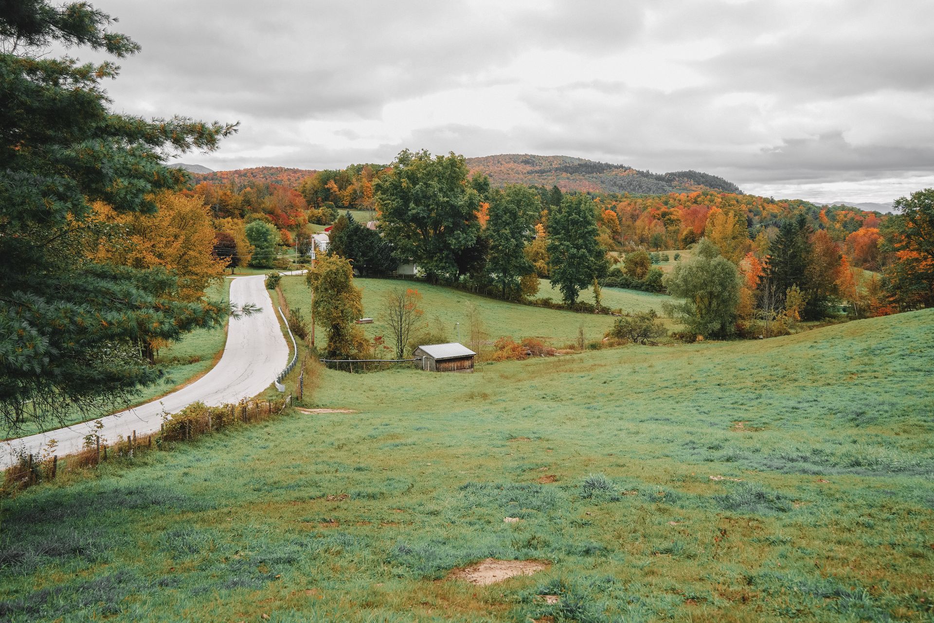
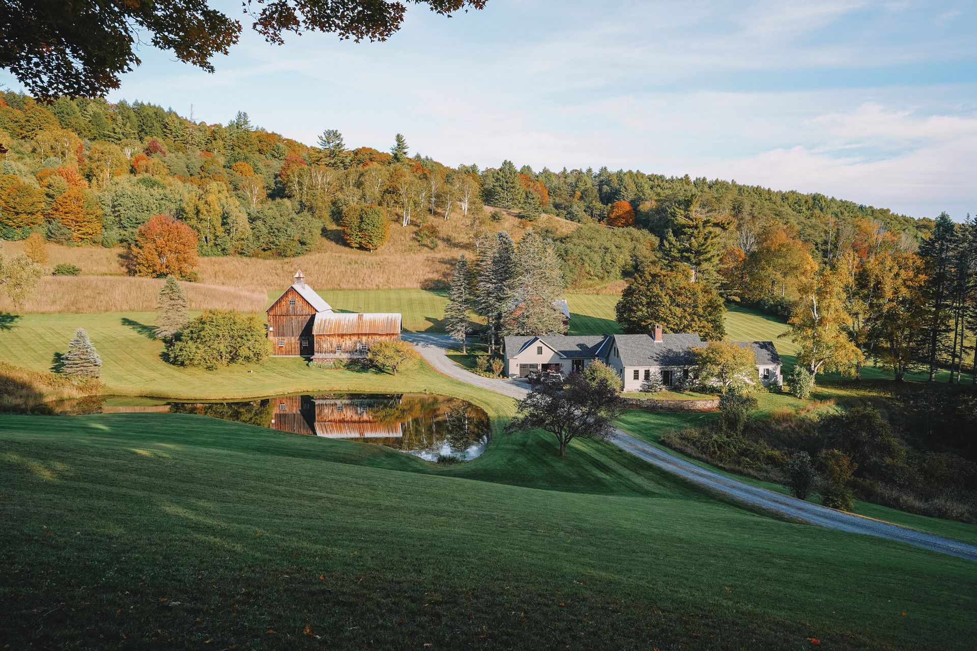
2024 Update: Due to high crowd levels at the Sleepy Hollow Farm, the town of Pomfret will be closing the road off to non-residents from September 25 - October 16. Enjoy my photo and focus on the other beautiful places around Woodstock.
The most iconic spot in Woodstock is the Sleepy Hollow Farm. This picturesque farm is a private home that photographers love, especially during the fall. It’s a beautiful spot because it’s surrounded by rolling hills, has a reflective lake and a rustic barn. The quaint farm tells a story of the idyllic farm life you may imagine when you think of Vermont. This is an especially nice place for photos at sunset or sunrise.
This location is super popular so expect crowds. It’s located on a one way road and you’ll want to make sure to respect parking signs. This is also private property (currently owned by Aerosmith guitarist Joe Perry), so avoid walking onto the driveway and stay on the road. The address is 3429 Cloudland Rd, Woodstock VT 05091.
Another beautiful spot in Woodstock is the Middle Covered Bridge. If you have enough time, it’s worth walking around downtown and enjoying the various shops as well.
Where to Stay in Woodstock
If you’re looking for an affordable stay in the heart of Woodstock, check out The Shire or The Vesper. The Shire is a cozy hotel that includes some rooms with river views.
The Vesper is a bed & breakfast that is beautifully decorated and family owned. Both of these hotels are within walking distance of restaurants and shops in downtown Woodstock.
If you’re looking for something more quiet, look for a home outside of town. Check out this cozy cabin with mountain views and a firepit, or this rustic cabin right next to a stream.
Day Seven
Drive back to Boston from Vermont
On your final day in New England, make your way back to Boston to catch your flight. Boston is located two and a half hours from Woodstock.
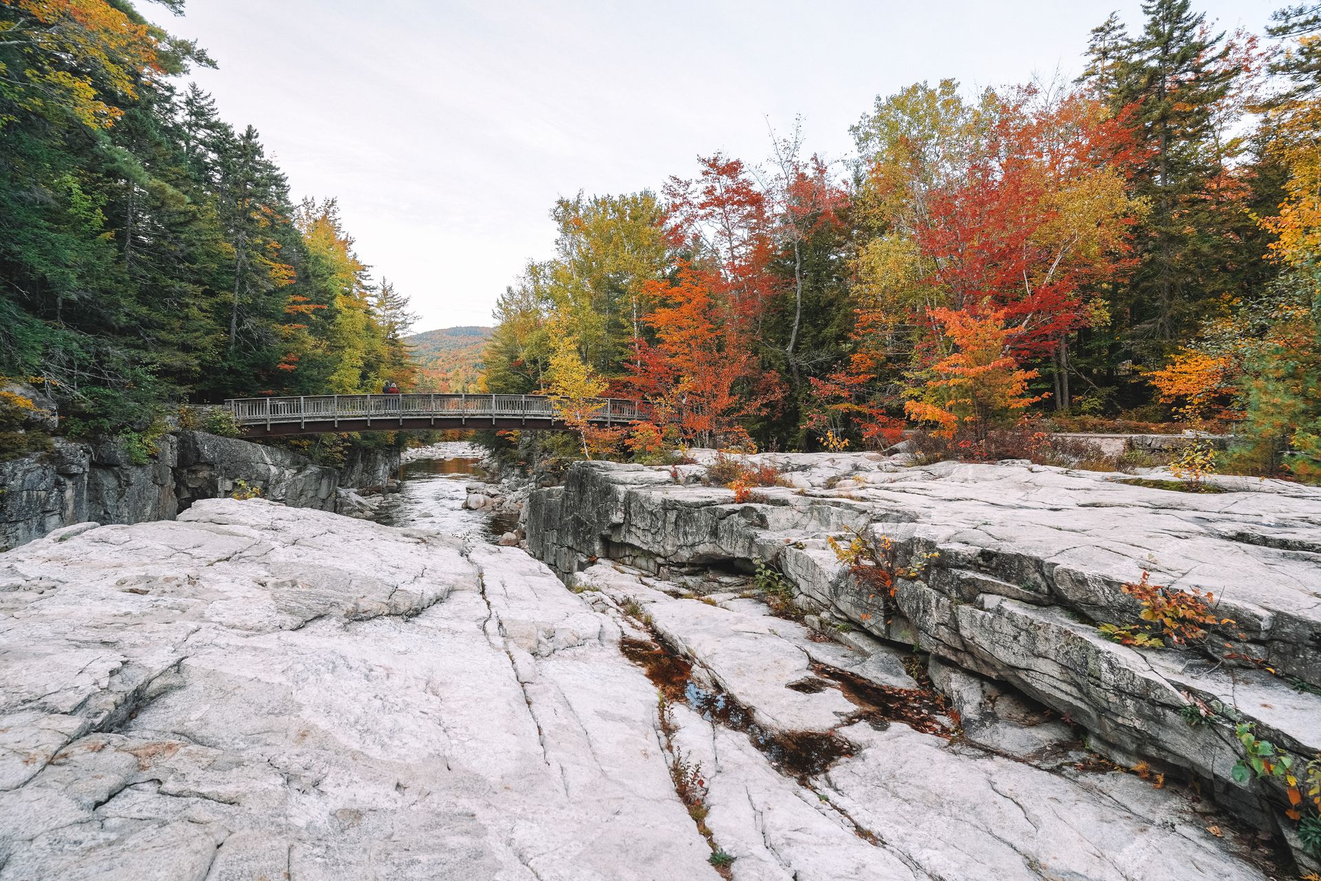
A great stop to make along the way is the Quechee Gorge. If you’re short on time, you can get a great view from the bridge on Woodstock Road. If you have more time, there are some nice hiking trails here.
Another stop you can make is at Gould Hill Farm. Enjoy their apple cider donuts and locally-made ice cream, or take home a souvenir from their farm store.
Final Thoughts
A fall road trip through New Hampshire and Vermont should be on everyone’s bucket list! But even if you miss peak foliage, this area is worth exploring year round. I hope this helps you plan your trip and get some New England travel inspiration.
For more New England Travel Guides, check out these blogs:
- A Guide to Driving the Kanc Highway
- An Epic 10 Day New England Road Trip
- How to Spend One Day in Boston
- The Best Hiking Trails in Acadia National Park
- The Best Day Hikes in the New Hampshire White Mountains
- The Best Things To Do in the New Hampshire White Mountains
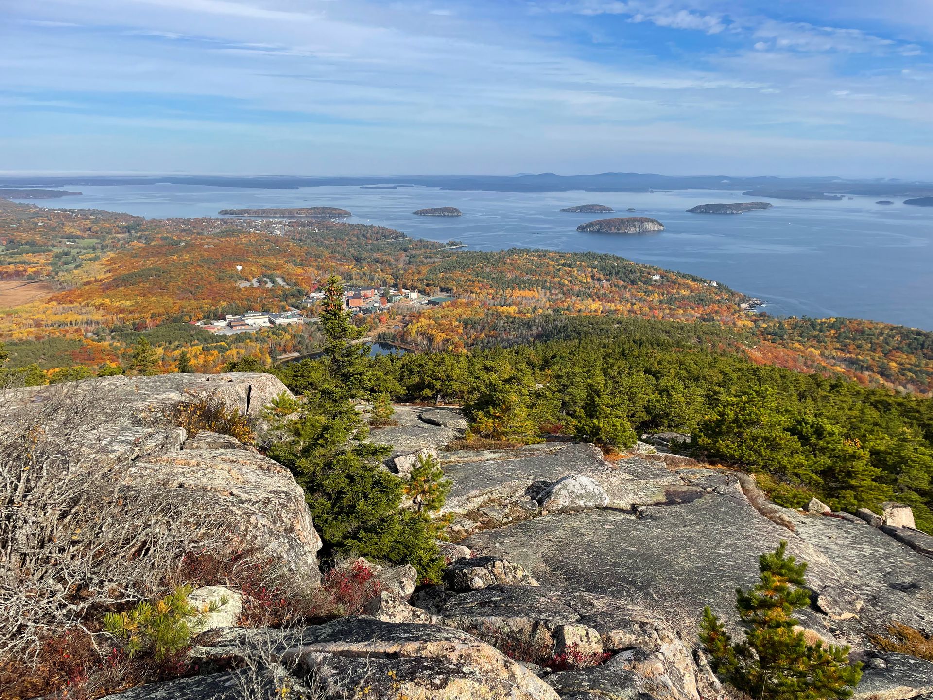
- A Fall Guide for Acadia National Park
- The Perfect Day Trip to Connecticut
- The Perfect 5 Day New England Road Trip
- How to Spend 1 Day in Rhode Island
Thanks for Reading!


Let's stay in touch!
Join the Lost with Lydia email list to get monthly travel guides and tips!