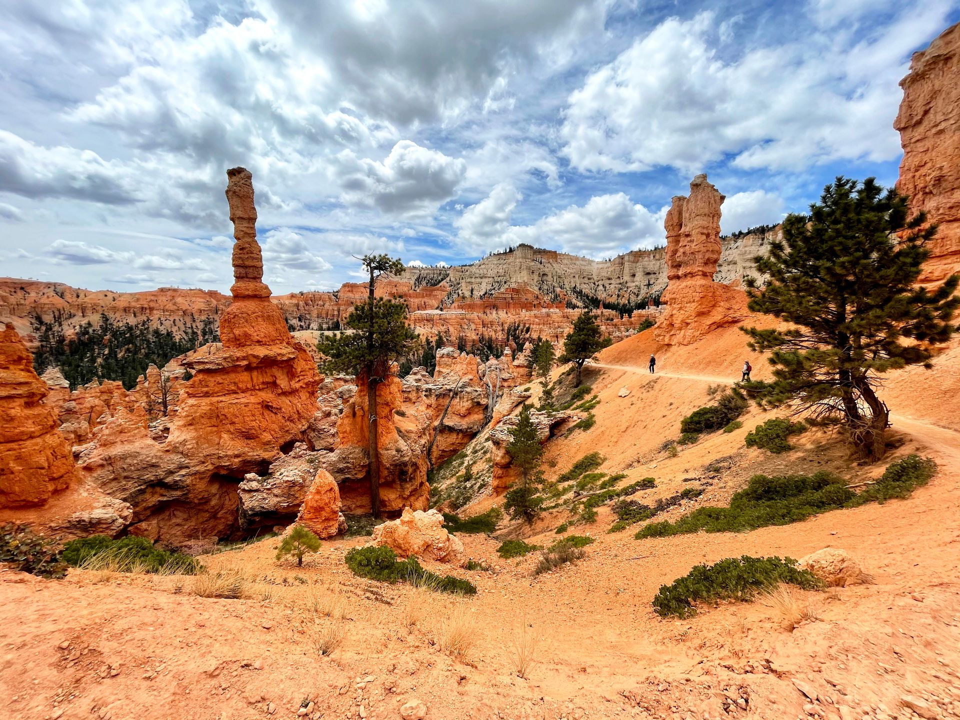
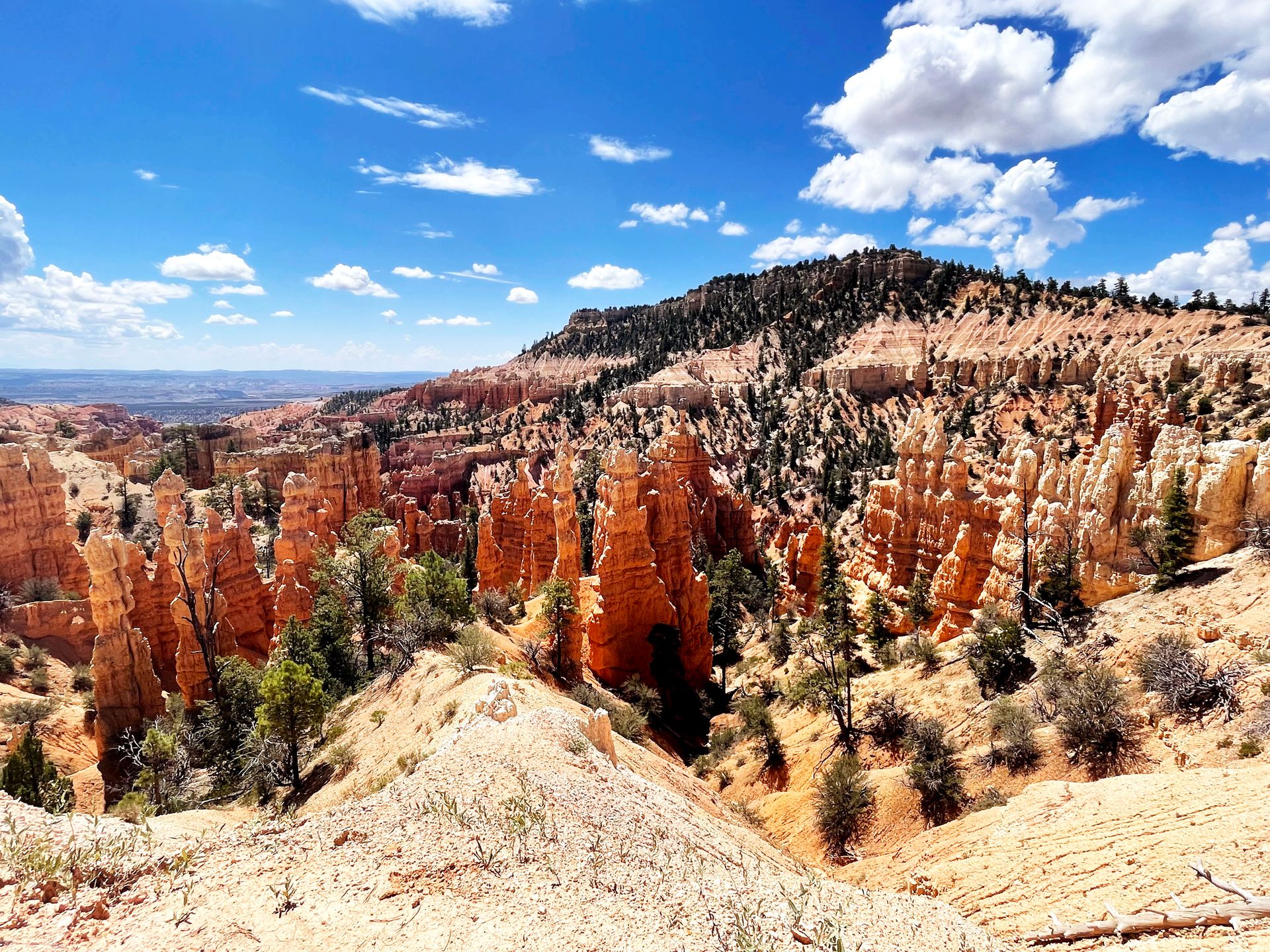
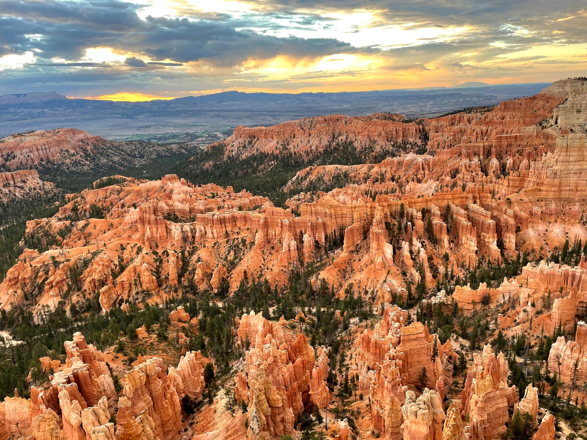
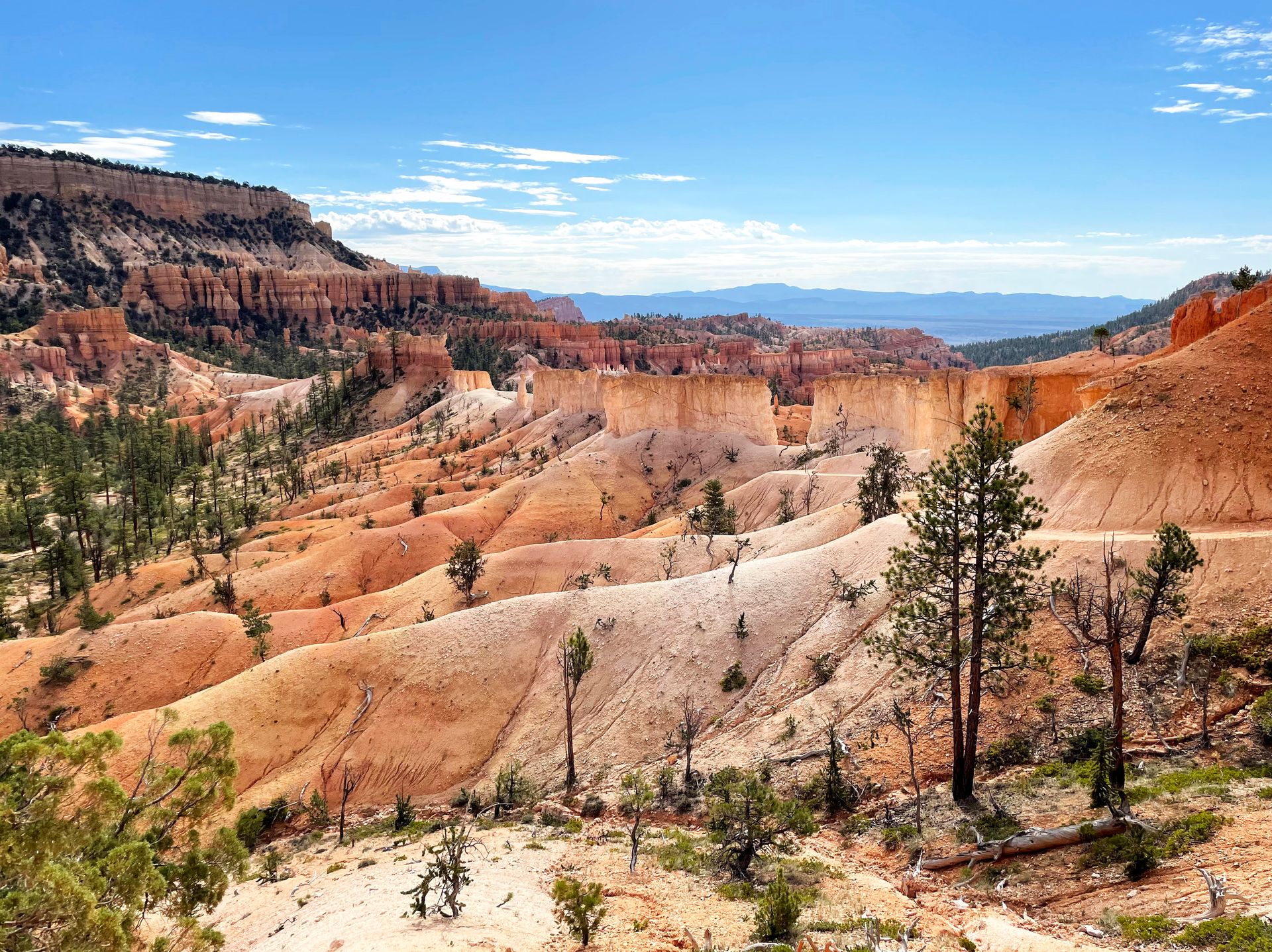
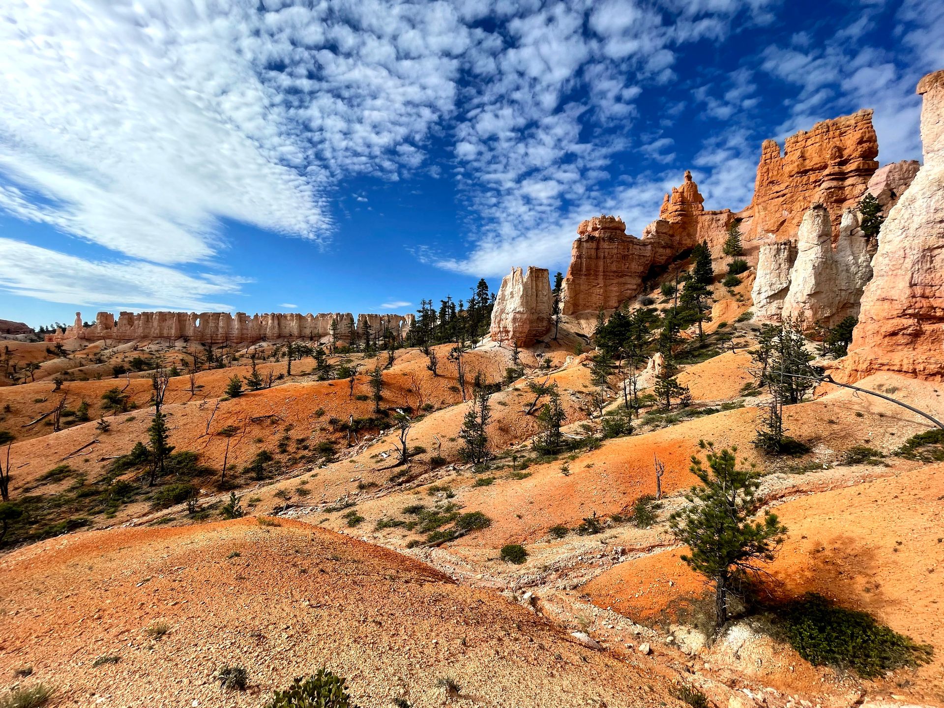
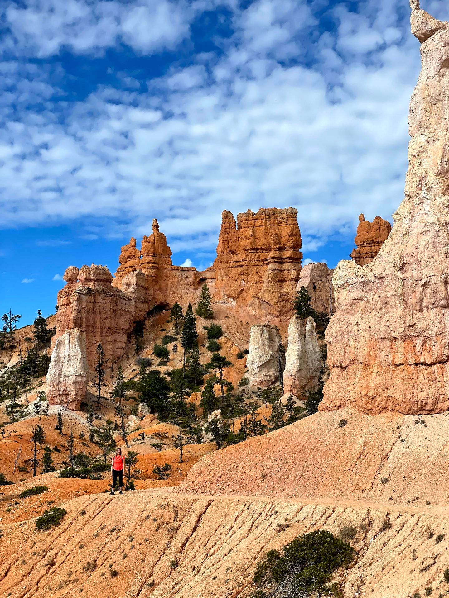
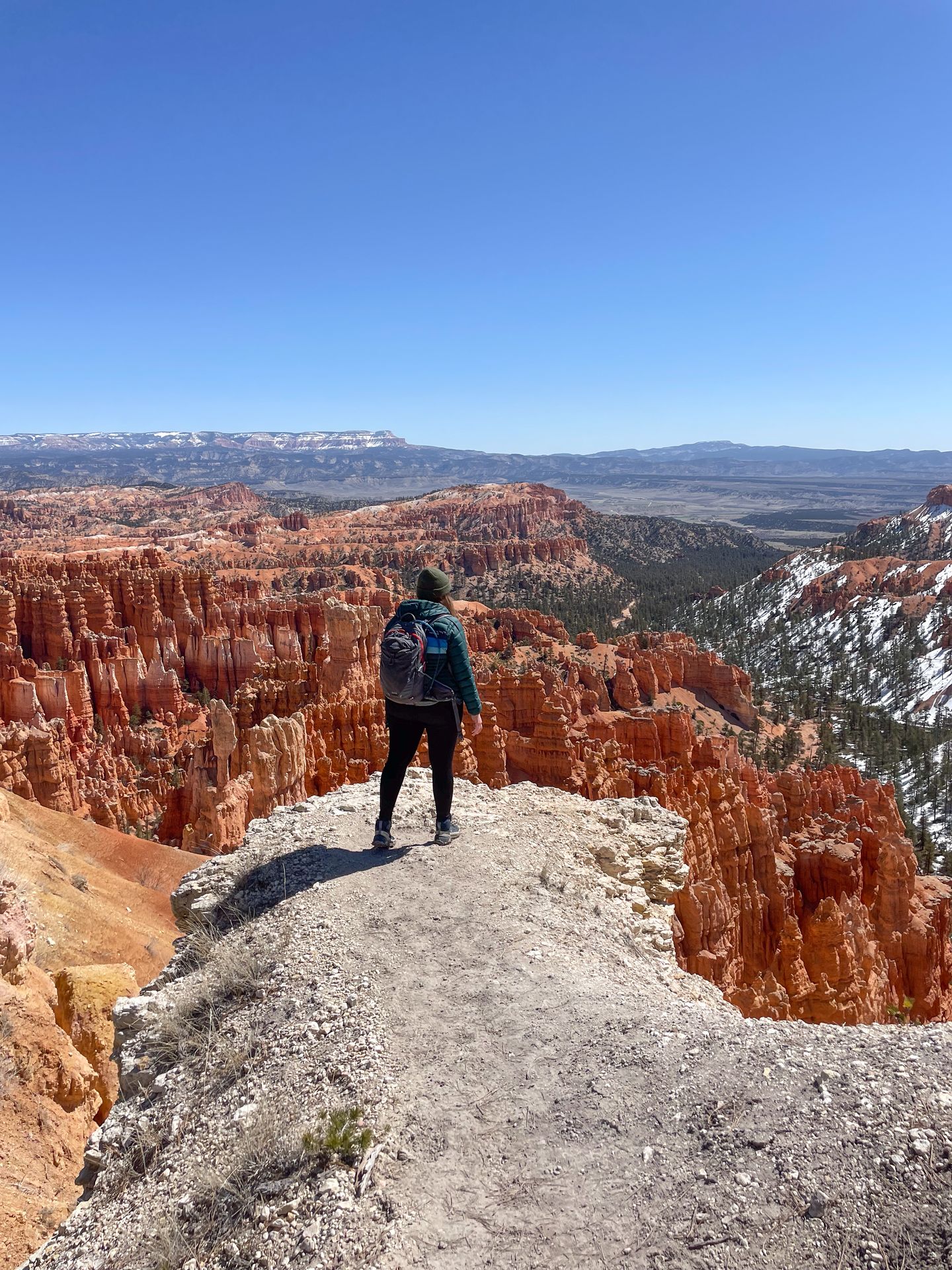
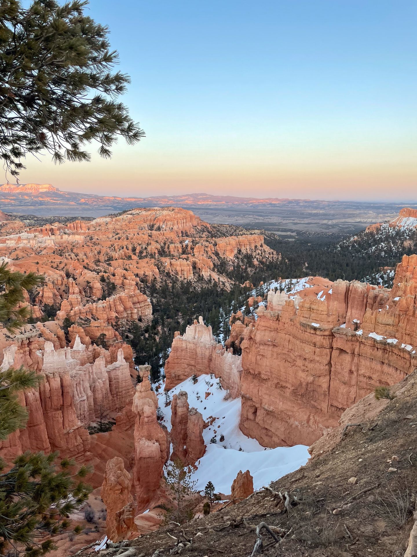
Bryce Canyon National Park is home to the largest concentration of hoodoos in the world. Gaze over one of the many viewpoints overlooking the Amphitheater and you will see an incredible display of orange hoodoos, all unique and different. The overlooks are fantastic, but in my opinion the best way to experience Bryce Canyon is by hiking down between the hoodoos and seeing them up close.
Please make it a priority to Leave No Trace when exploring the outdoors. This includes leaving nothing behind, respecting wildlife, minimizing campfire impacts, respecting those around you, planning ahead and traveling on durable surfaces. For more details, read about the seven principles at lnt.org.
What is a hoodoo?
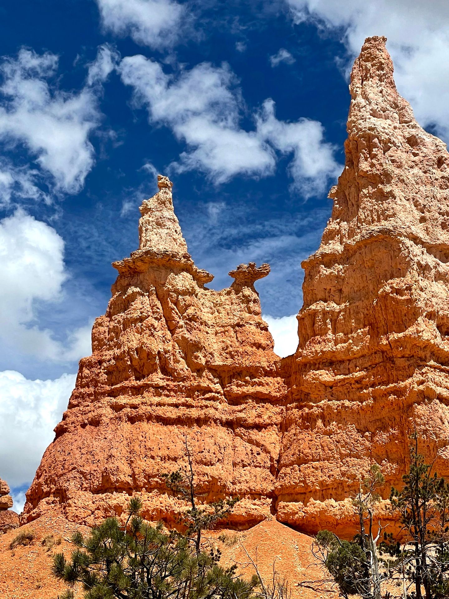
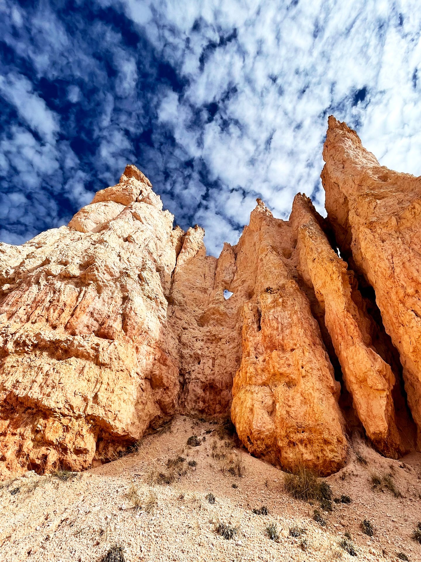
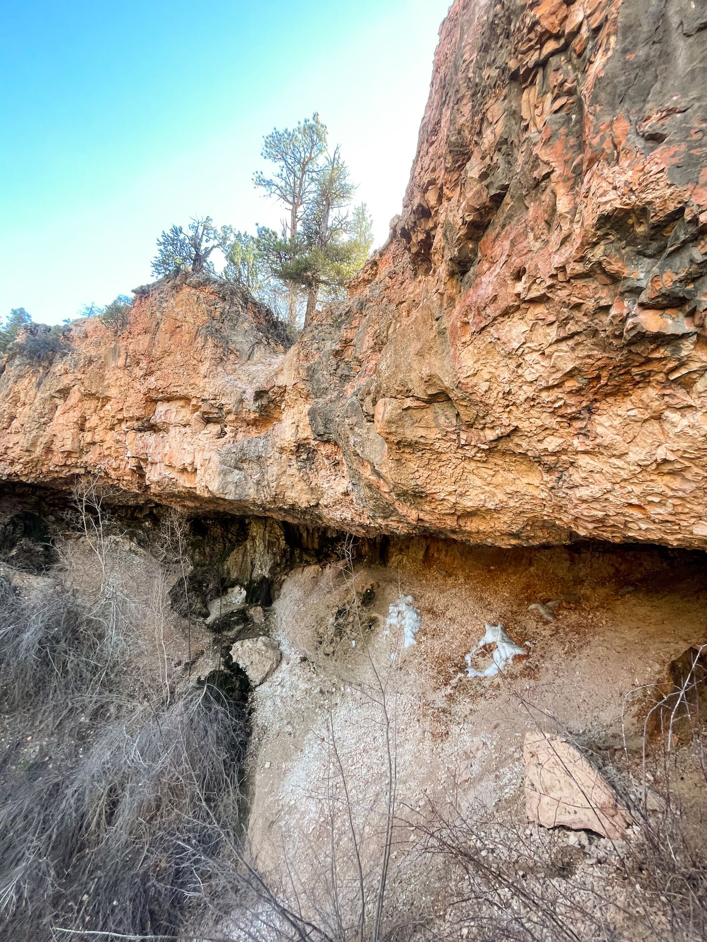
A hoodoo is a tall, thin spire of rock that is created by erosion. In Bryce, the erosion of the hoodoos is caused by water seeping its way into the cracks of the rocks, freezing and expanding.
The hoodoos continue to erode today. The average rate of erosion is measured at 2 - 4 feet every 100 years. While some change is inevitable, humans can help preserve the hoodoos by staying on the trail system. Just walking up to the base of a hoodoo will shorten its lifespan.
What to Bring While Hiking in Bryce
- Plenty of water. Always be prepared with water while hiking. The park service recommends 1 quart per 2 - 3 hours of hiking for each person.
- Layers. Bryce Canyon has the highest elevation of Utah’s national parks, meaning the weather can change quickly. In the summer months, be prepared for both hot sunshine and cooler temperatures.
- Comfortable hiking shoes or boots. The hikes I discuss require a lot of ups and downs on dusty trails, so you should have shoes with good traction and ankle support.
- Sunscreen, sunglasses and a hat. Many parts of these trails are highly exposed, be sure to protect yourself from the sun.
- Snacks. Bring along snacks so that you can maintain your energy while hiking.
- First aid kit. It is always good practice to carry first aid while hiking. Be prepared with bandaids, moleskin and other essentials.
Things to Know Before Hiking in Bryce
- If you can’t get a parking spot, a free shuttle is offered from April to October to the park’s most popular trailheads. Note that it does not go to Fairyland Point, where I began the Fairyland Loop hike. While the shuttle is a great option, I was able to get parking everywhere when visiting Bryce in May and July.
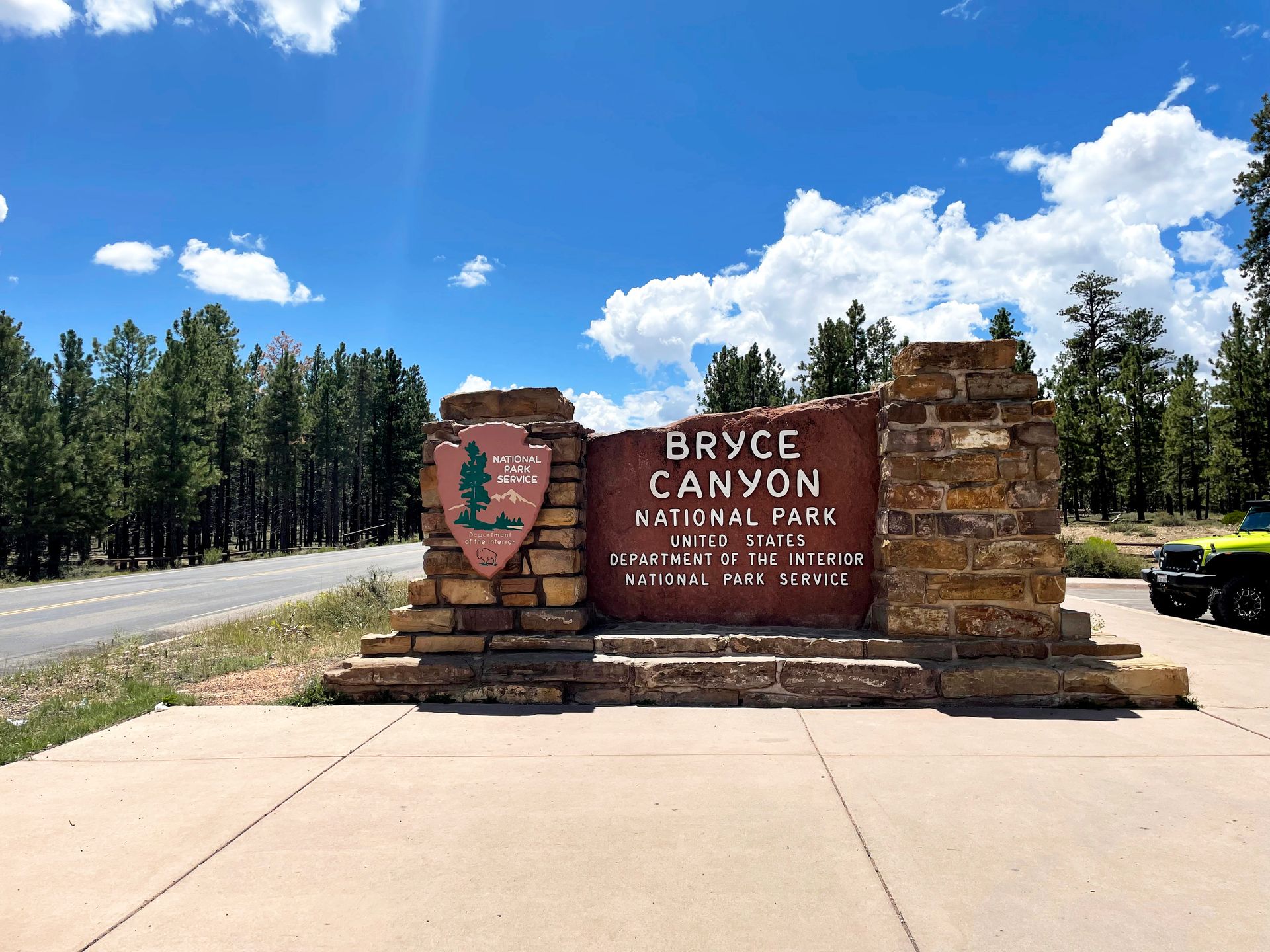
- Admission to Bryce Canyon costs $35 for a private vehicle or is included with the America the Beautiful pass ($80 for entry to all US national parks for one year).
- Bryce is a canyon, so many of the trails begin with a descent and end with a climb. Know your limits and be sure to save enough energy to climb back up.
- Lightning is a common year-round danger in Bryce, especially during summer storms. Seek shelter immediately if you can hear thunder.
- Be sure to check the National Park website or visitor center for trail conditions before hiking. Portions of trails often close due to rock and mudslides.
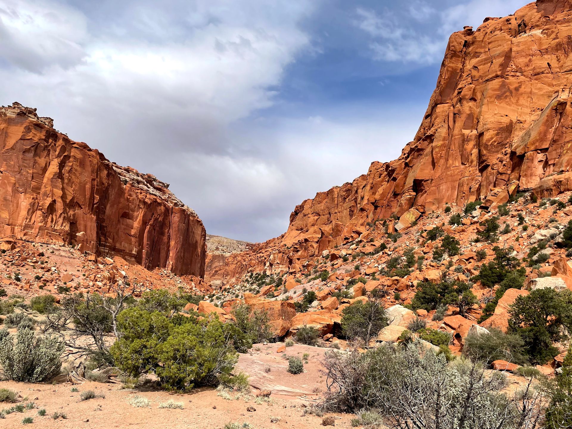
Are you visiting Capitol Reef in addition to Bryce? Check out my blog on how to spend one perfect day in Capitol Reef National Park.
When To Visit Bryce Canyon
October - May
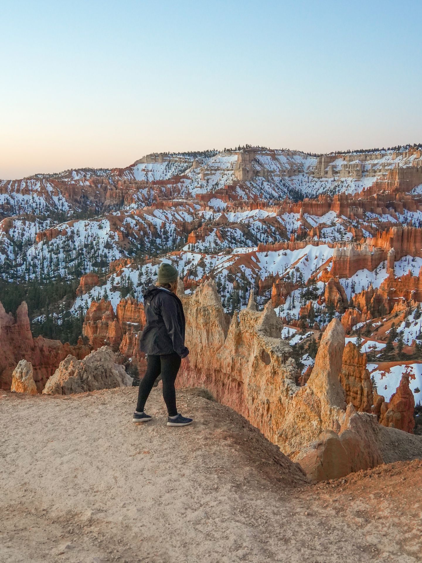
Bryce remains open year round, but winter brings freezing temperatures and storms. There are typically freezing temperatures every night from October to May, with the heaviest snow from December to February. If you don’t mind braving the cold, Bryce is beautiful when it’s dusted in snow and there will be very little crowds.
July - August
July and August are monsoon season in Utah and there are often thunderstorms in the afternoon. Hike early and be off the trails by the afternoon, and seek shelter immediately if there is any lightning nearby.
June or September
June and September are arguably the best times to visit Bryce Canyon in terms of weather. Both months have mild temperatures and the chance of thunderstorms is lower.
I have visited Bryce in April, May and July and had great weather each time. In July, I had to make sure to be off the trails before an afternoon thunderstorm. In April, there was still snow and ice in some areas.
The Best Day Hikes in Bryce Canyon
This blog post covers the details on the best hikes in Bryce Canyon National Park!
The Figure Eight Trail
Starting Point: Sunset Point
Mileage: 6.4 miles
Elevation Gain: 1,631 feet
As of this writing, the Wall Street side of the Navajo Loop Trail is closed. It is expected to open around Memorial Weekend 2024. Check the national park website for the most up-to-date information.
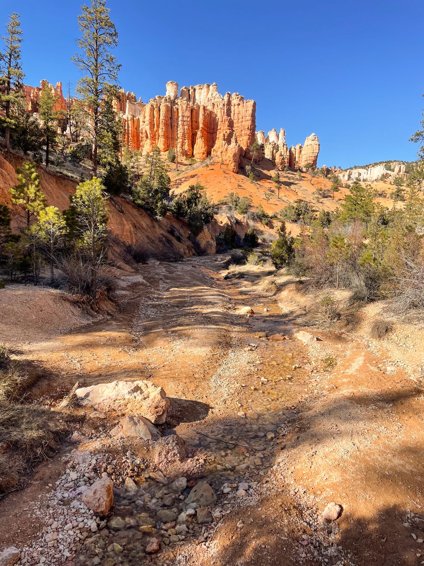
The Figure Eight Trail refers to the combination of three trails: Queen’s Garden, Peekaboo Loop and Navajo Loop. This trail is incredible and if you only have time for one hike, this is what I recommend. It is easily one of the best Bryce Canyon hikes.
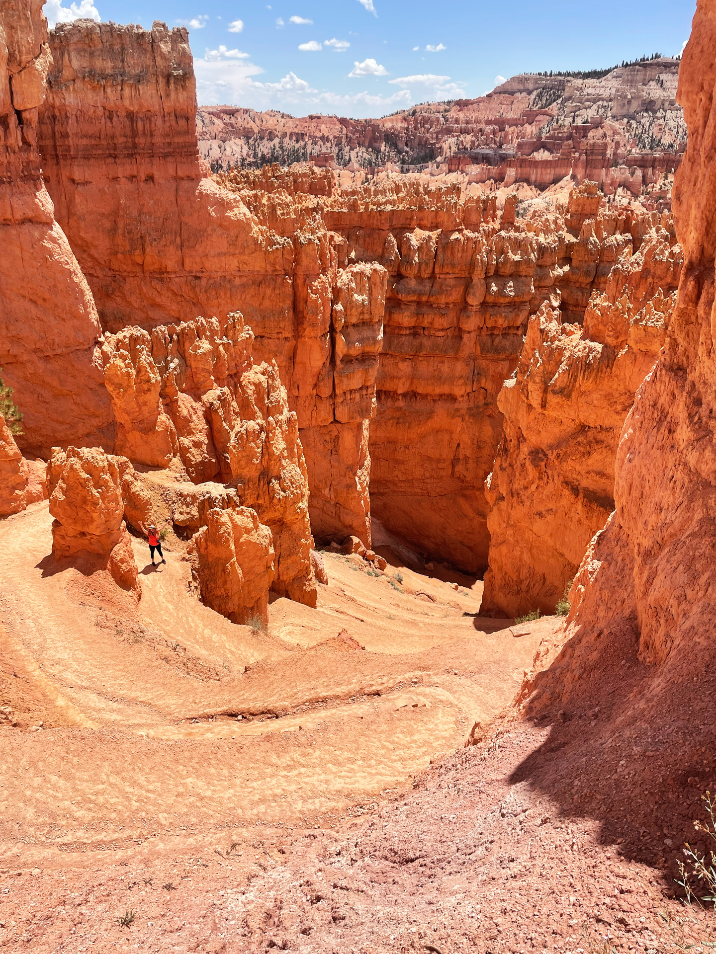
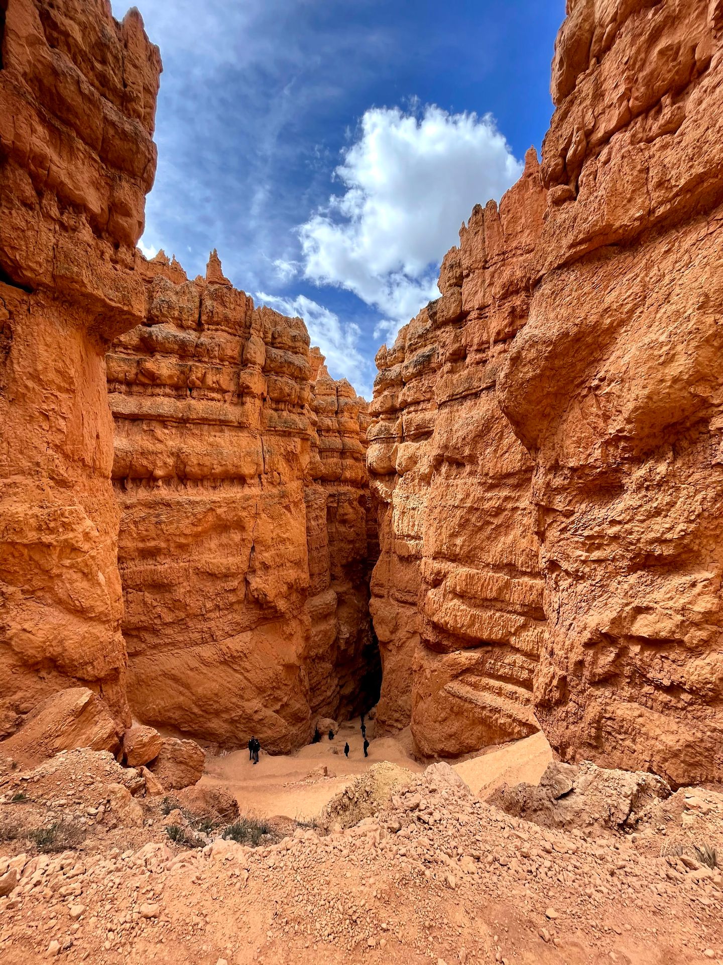
I recommend starting at Sunset Point and hiking down the iconic Wall Street. You could also begin at Sunrise Point or Bryce Point, but hiking down Wall Street will allow you to climb down in the steepest area so that your climb back up (via Queen’s Garden) will be more gradual.
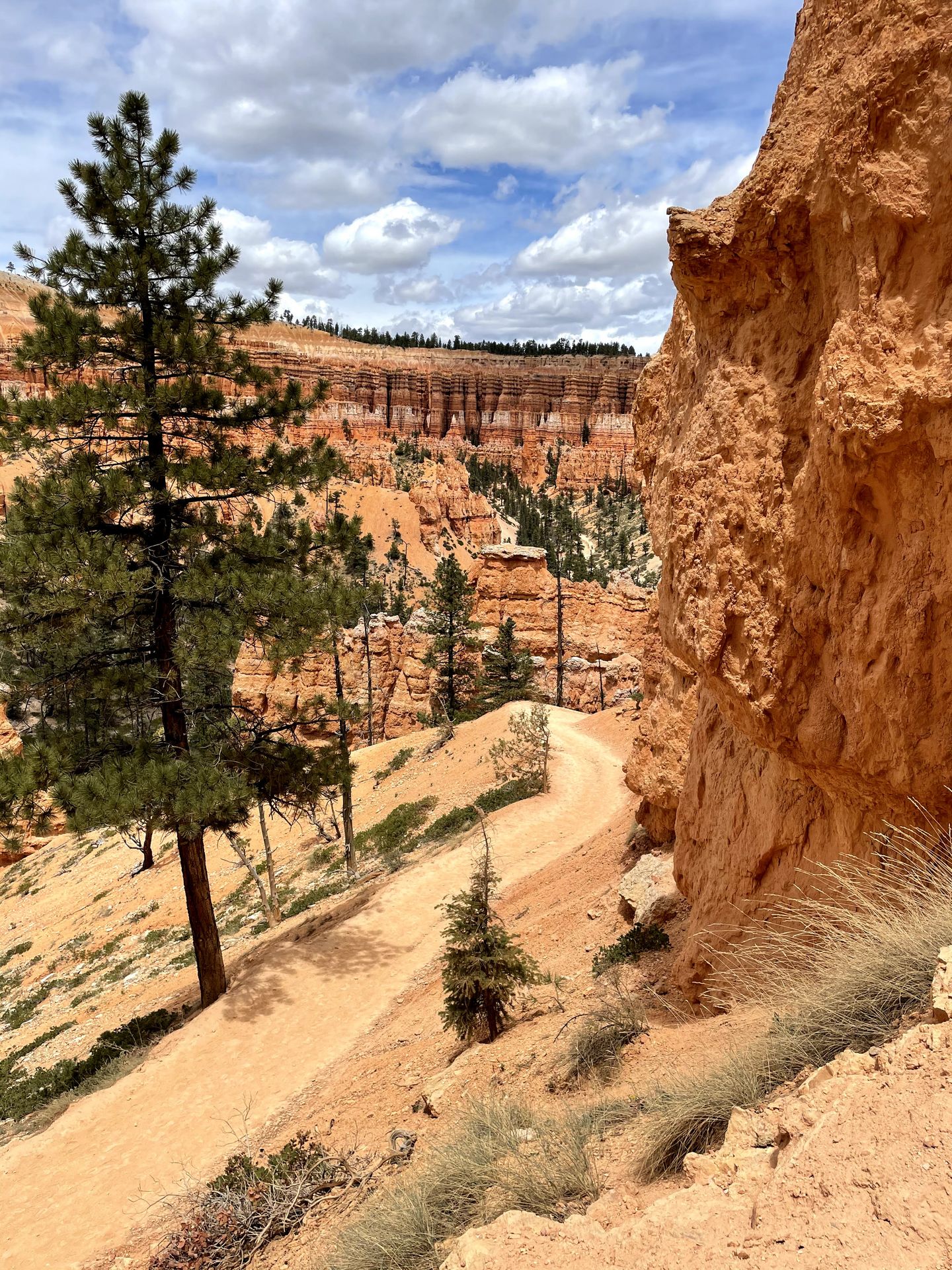
Hiking down Wall Street is an experience in itself. Iconic switchbacks descend down into the canyon steeply and the rocks become more narrow as you climb down. After you conquer Wall Street, the trail levels out on the canyon floor and you will begin to see trees scattered around the hoodoos. When you reach a fork in the trail after 0.8 miles, go to the right and hike about 0.2 miles until you reach the Peekaboo Loop Trail.
The Peekaboo Trail is a loop that will take you through several ups and downs with incredible views along the way. I hiked the loop clockwise, which allows for a slightly more gradual climb up and you will save the very best views for the second half of the loop.
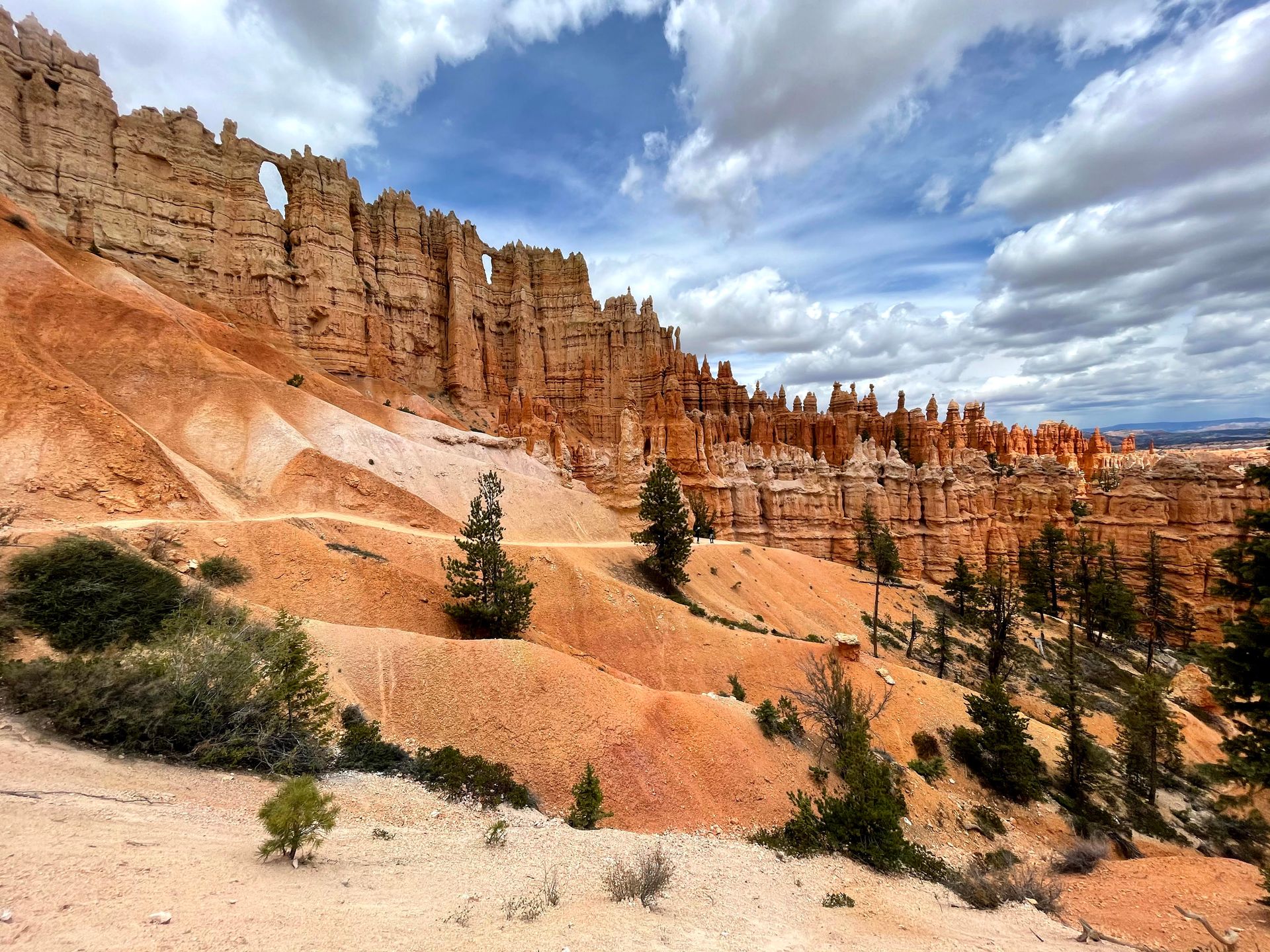
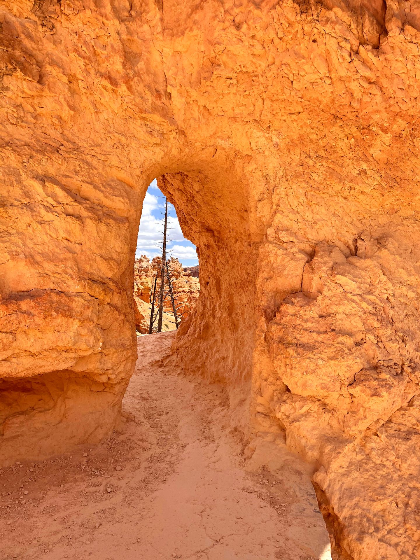
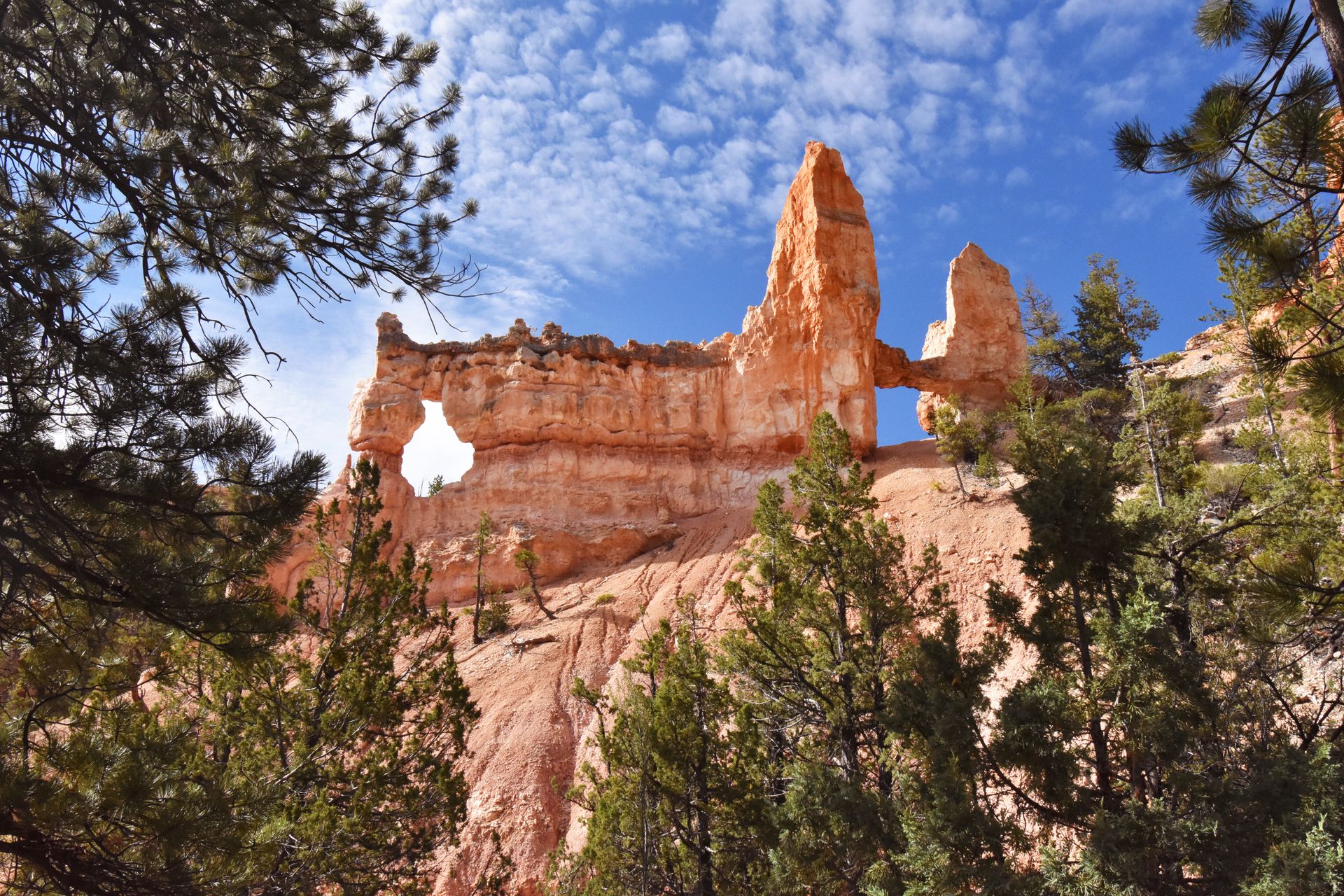
I love this trail because there are multiple mini rock tunnels where you will one side of a cliff face and exit another. One of the best parts of the trail was walking by the Wall of Windows. There are two huge “windows” in the cliff that have been created by erosion. There are also a few instances of switchbacks on this trail that wind down between canyon walls much like Wall Street.
The Peekaboo trail is dusty and steep at times. It is more difficult than the Navajo and Queen’s Garden trails, but also much less crowded. There is also a restroom right off of the trail about halfway through the Peekaboo Loop.
After the Peekaboo Loop, join back to the Queen’s Garden Trail and continue the last two miles of the hike. The climb back up is gradual but slowly gets steeper in these last two miles. Be sure to take a short spur trail to see Queen Victoria around the 5 mile mark, this hoodoo looks remarkably similar to the Queen Victoria statue in London. Then at 5.5 miles, see if you can spot ET Hoodoo, a rock resembling ET’s head.
When you reach the top, take the rim trail about a half mile to meet back up to your original starting point of Sunset Point. The entire trail is full of beauty and the perfect way to experience Bryce Canyon.
Fairyland Loop
Starting Point: Fairyland Point
Mileage: 8.0 miles
Elevation Gain: 1,716 feet
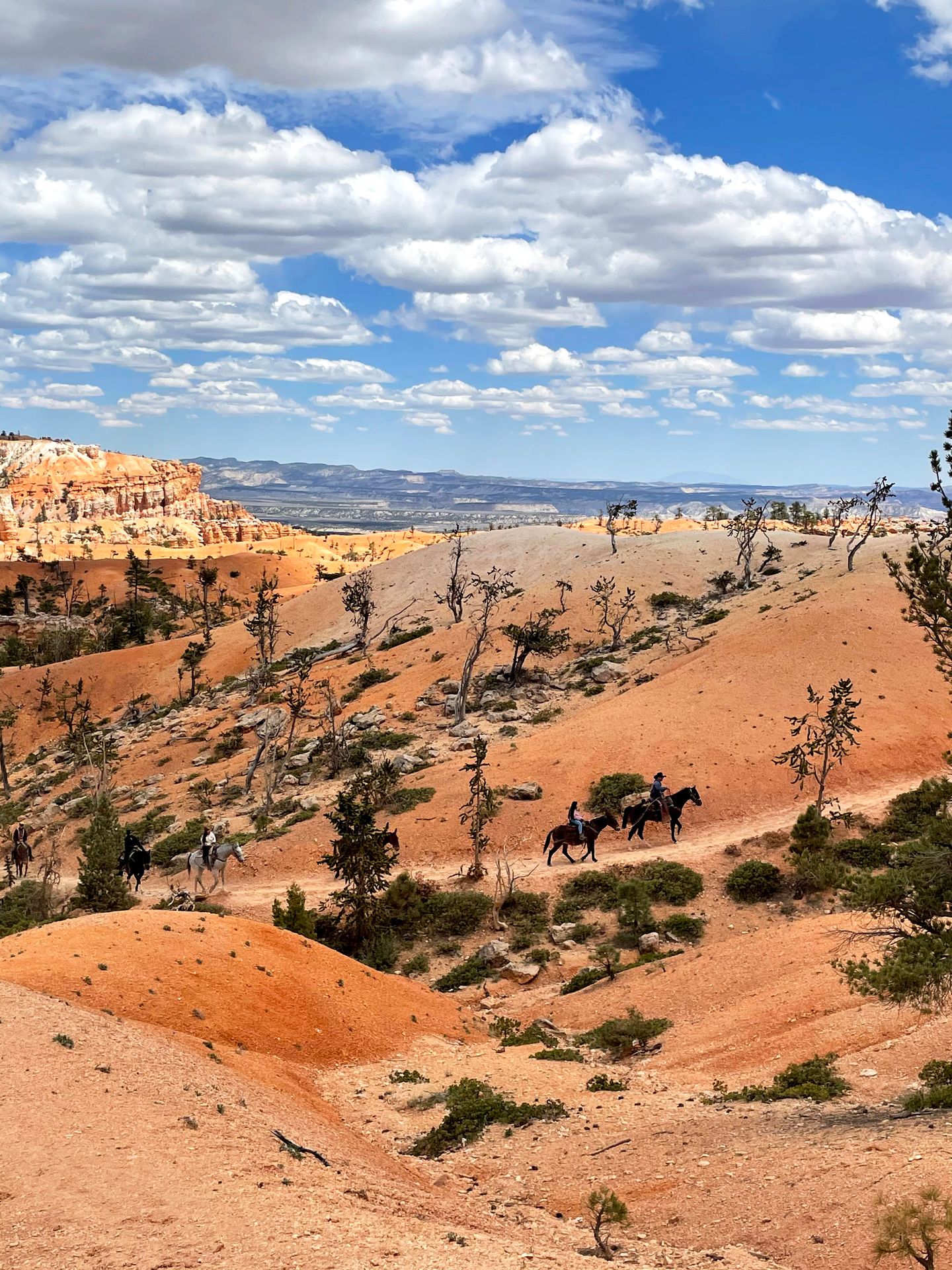
The Fairyland Loop trail is an amazing trail if you’re looking for a less crowded hike that is a little more challenging. The trail has the youngest hoodoos in the park and offers spectacular views throughout the journey.
I began the trail at Fairyland Point, which is outside of the Bryce Canyon fee gate. There is limited parking here, so arrive early to claim a spot. You can also reach the beginning from the Rim Trail near Sunrise Point. If you start from Sunrise Point, it adds about 0.4 miles to the hike.
I hiked the trail counterclockwise in order to climb down the steeper portion and have a more gradual climb back up. The first two and a half miles are along the rim trail, which is paved but has a steady incline. You will pass the North Campground along the rim, which is a great opportunity to use a restroom before entering the canyon.
When you enter the canyon, you will descend about 900 feet in two and a half miles. This first portion on the trail has a lot of smooth orange hills. If you hike in this direction, the best hoodoo views are in the second half of the hike. It’s a slow build with views that get better and better as you go. There are still some hoodoos though! You will pass the China Wall as you descend, which is a wall of hoodoos atop a ridge that may remind you of the Great Wall of China.
Another notable stop is the Tower Bridge, which you will find when you arrive at the canyon floor. There is a short spur trail to this iconic rock formation and it’s a great spot to sit under shaded trees and take a break. The rock bears a striking resemblance to the Tower Bridge in London!
After Tower Bridge, there are some ups and downs as you begin to slowly make your way back up to the rim of the canyon. You will cross some washes as you weave up and down among orange hoodoos. Another famous rock formation you’ll pass is the Boat Mesa - a large rock that rises above the Fairyland Canyon to an elevation of 8,073 feet.
The Fairyland Loop was a fantastic trail, but one thing I missed were the orange rock tunnels present on the Figure Eight Trail. Overall, I still highly recommend the Fairyland Loop if you want to take a less trafficked path.
Navajo Loop and Queen's Garden Trail
Starting Point: Sunset Point
Mileage: 3.0 miles
Elevation Gain: 652 feet
The Navajo Loop and Queen’s Garden Trail is a shorter version of the Figure Eight Trail, and is the most popular trail inside the park. It leads you down to the canyon floor on the iconic Wall Street and back up through the Queen's Garden, which is full of neat rock formations.
You will hike down on the Navajo Trail and back up on the Queen's Garden Trail for a 3-mile round trip hike. It's a great trail to give you a great taste of the park if you're short on time.
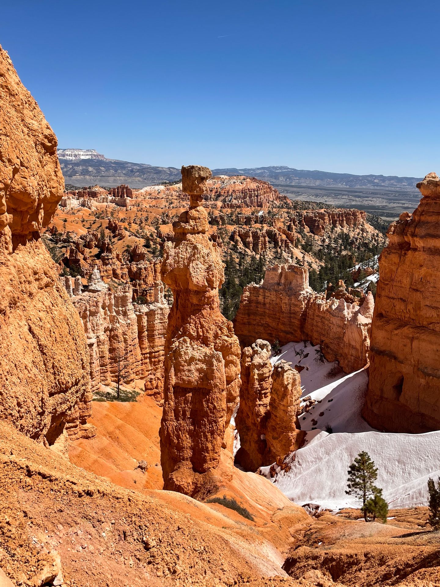
Stops on the trail include Two Bridges, a fantastic view of Thor's Hammer and all of the neat formations on the Queen's Garden, such as Queen Victoria and ET.
Mossy Cave, Turret Arch and Little Windows Trail
Starting Point: Mossy Cave Trailhead
Mileage: 0.9 miles
Elevation Gain: 121 feet
The Mossy Cave trail is located outside of the main area of the park. It's about a 15 minute drive from the Bryce Amphitheater. For such a short trail, is really packs a punch!
The trail begins along the Tropic Ditch, a canal built in the late 1800's by early settlers to divert water. It always feels special to see water like this in the desert!
After a couple bridges over the stream, the path forks in two directions. To the right, you can see Tropic Ditch Falls. The waterfall flow depends on a lot on time of year. Sometimes it is flowing hard, but it was only a trickle when I visited.
The other direction leads to you to the Mossy Cave. It's a beautiful and large cave opening that has clumps of green moss. In addition to the cave, stream and waterfall, the trail has views of beautiful hoodoo formations, including some window formations. This is a great family-friendly trail that makes a quick add-on to your trip to Bryce Canyon.
Rim Trail
Starting Point: Varies (I recommend Inspiration Point)
Mileage: Varies (up to 10.7 miles)
Elevation Gain: Varies (up to 1,587 feet)
The Bryce Canyon Rim Trail is a great way to see the canyon from various angles. The entire trail is 10.7 miles, but you can do as little or as much as you'd like. The portion between Sunrise Point and Sunset Point is the only paved section of this trail and the easiest. It's a great accessible option to enjoy the hoodoo views.
If you're up for more of a challenge, I recommend going between Inspiration Point and Sunrise Point (or continue to hike the entire thing). There is a bit of elevation change, but it's a take in spectacular views from above.
Bristlecone Loop Trail
Starting Point: Rainbow Point
Mileage: 1 mile
Elevation Gain: 88 feet

If you drive the entire Bryce Canyon Scenic Drive and/or you're looking for a quieter trail in the park, the Bristlecone Loop trail is a great option! This trail is in the highest portion of the park, so it will likely be colder than other areas. It might also have a lot more snow if you're visiting in the spring, winter or fall.
The special part of this hike is that you'll get to see bristlecone pine trees that up to 1,000 years old! You'll also get to take in expansive views that reach 100's of miles.
Fun Fact: Bristlecone pine trees smell like butterscotch! Give them a sniff!
Which trail is best for you?
My favorite: The Figure Eight Trail has the most “bang for your buck” because it has incredible views the entire time, many iconic rock formations and has the perfect amount of challenge to be a rewarding day hike.
Hard and off the Beaten Path: Fairyland Loop. This trail will have a lot less crowds than the trails in the main amphitheater section of the park.
Easy and off the beaten path: Mossy Cave. This fun trail is much different than other trails in the park. It's fun to see water in the desert!
Iconic if you're short on time: The Navajo and Queen's Garden Loop. This epic trail will allow you to walk among the hoodoos and see some of the best of the park.
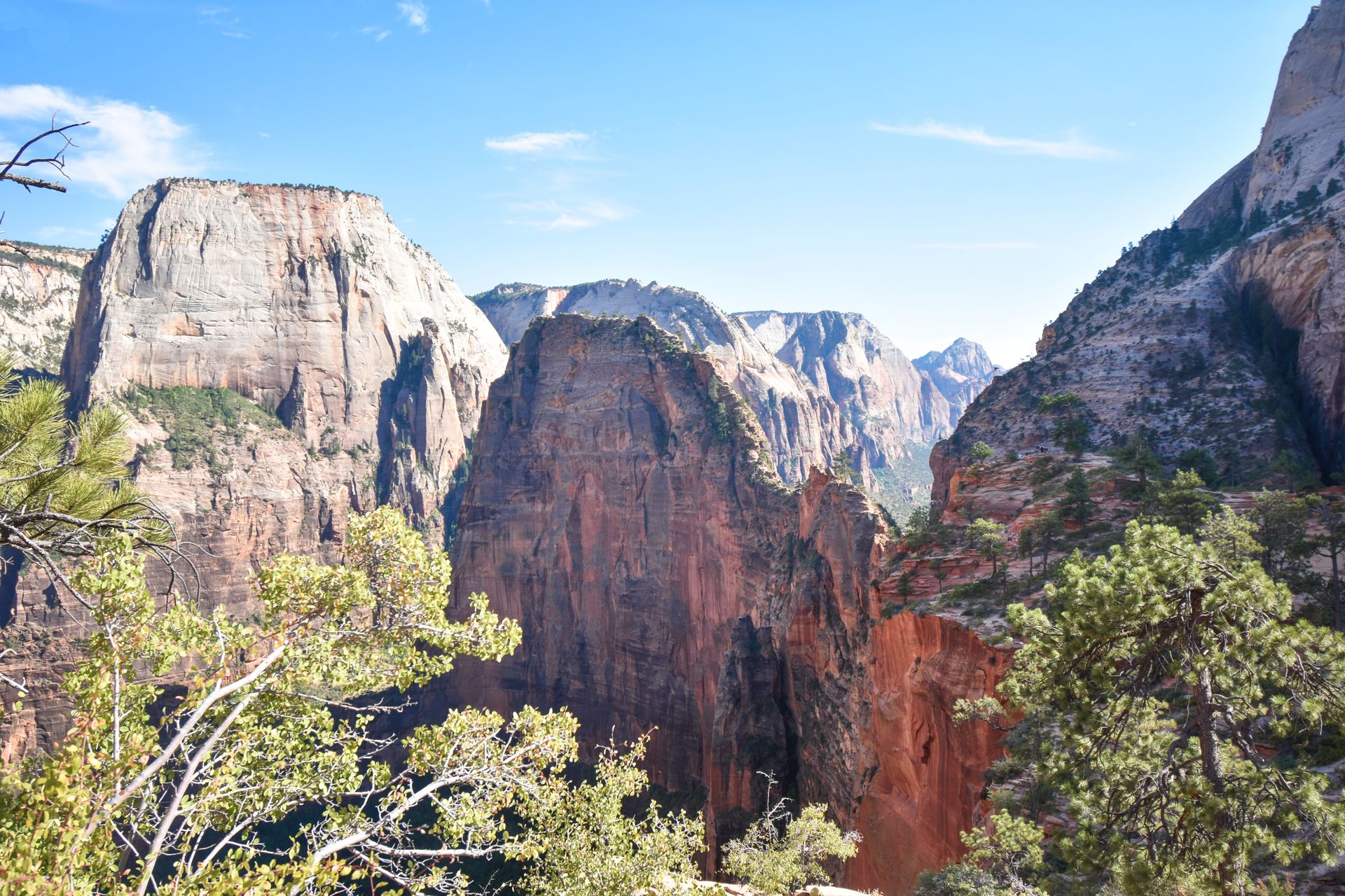
Are you visiting Zion National Park during your time in Utah? Check out my Zion blog post for the perfect two day itinerary.
Final Thoughts
I hope this guide helps you plan out the perfect Bryce itinerary if you have limited time. Bryce is an incredibly beautiful park that deserves a spot on your Utah road trip!
For more guides on the Utah Mighty Five, check out these blogs:
- An Epic Mighty 5 Road Trip Itinerary
- How to Spend 2 Days in Zion
- The Best Things To Do in Bryce Canyon
- How to Spend One Day in Capitol Reef
- How to Spend 3 Days in Moab
Thanks for Reading!


Let's stay in touch!
Join the Lost with Lydia email list to get monthly travel guides and tips!