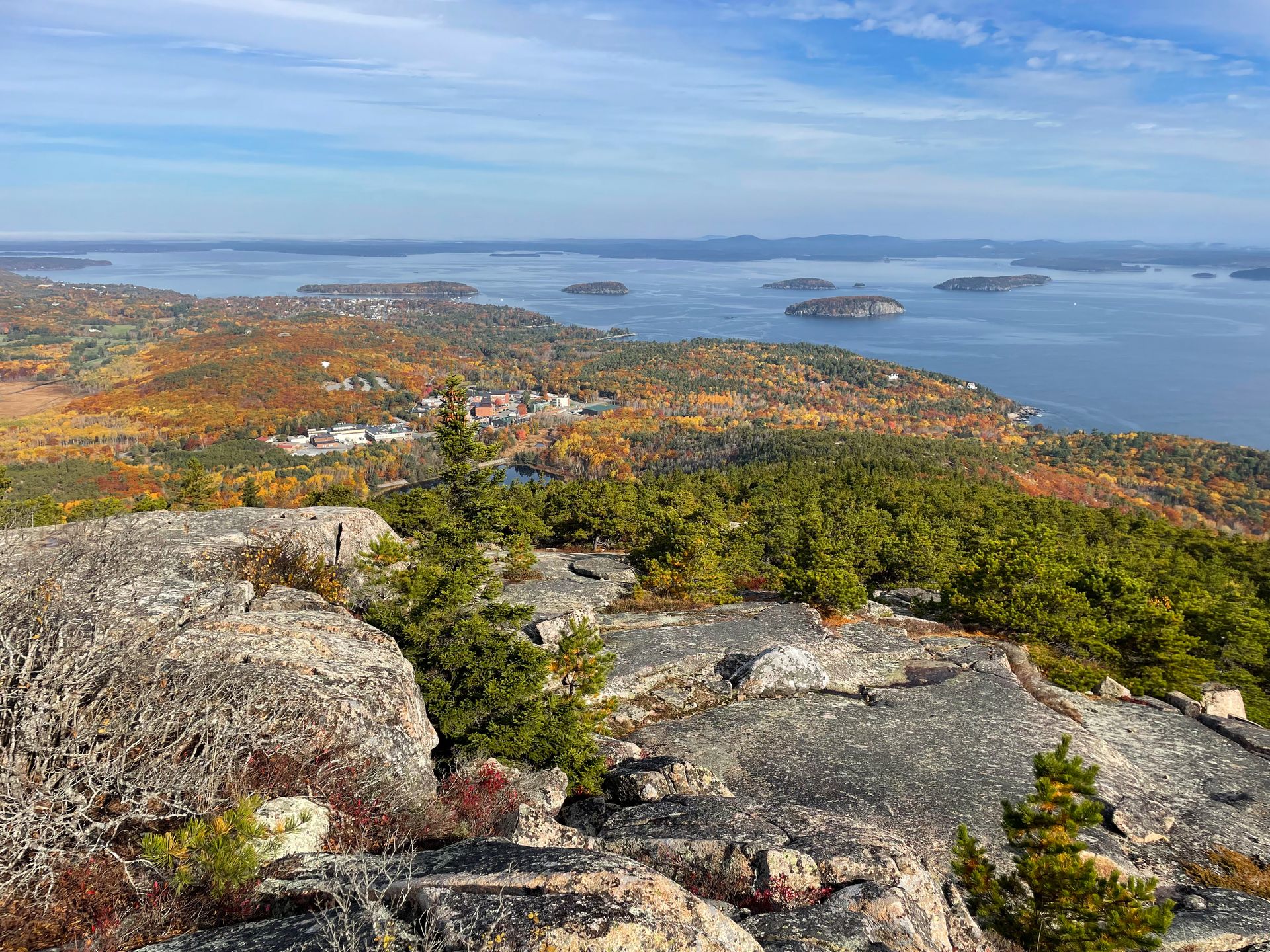
If you’re wondering about the best hikes in US national parks, keep reading! National parks protect some of the best hiking trails in the United States. Throughout the national park system, you’ll find trails of every difficulty. From paved paths to steep ascents, there is something for everyone.
I am continually blown away by how nice national park trails tend to be. They take the time to make the trails feel very natural, and they are designed to withstand erosion, handle foot traffic, and stand the test of time. Plus, you can usually find detailed information about each trail on the national park websites, or by talking to a ranger, which is helpful for accessibility.
I’m an avid national park traveler and hiker, and I’ve almost been to all 63 US national parks, so I’m sharing this list with those experiences in mind. As I revisit the parks, I’ll continue to update this guide. This list includes trails that range from easy to difficult.
How to be Prepared for National Park Hiking
If you’re new to hiking, here are some tips to ensure that you stay safe and come prepared.
- Please make it a priority to leave no trace. That includes packing out all of your trash, coming prepared with proper gear, never approaching or feeding wildlife, and traveling on durable terrain.
- Make sure you’re able to navigate without cell reception. I recommend using AllTrails, which allows you to download offline maps if you pay for their service. You can also sometimes ask for a detailed paper map from a park ranger.
- Wear comfortable hiking shoes with good traction. The right shoes will vary by person, so I recommend trying some on in person before your trip.
- A few hiking essentials that you should carry include plenty of water, plenty of food, layers, a light source, sun protection, a first aid kit, and a multi-tool.
- Check the weather forecast ahead of time and plan accordingly. In high altitude parks, such as Rocky Mountain, afternoon thunderstorms are very common in the summer, and the lightning in exposed areas is very dangerous, so you should start a long hike early in the morning.
- Some of these hikes require special permits or reservations. Make sure to check on that before heading out.
19 of the Best Hikes in US National Parks
After visiting all 63 national parks, these are my favorite hikes! In order to spread out the love, I decided to only include one hike per each park. But it’s hard to choose, so I’ll also list several honorable mentions. I’ll continue to update this list as I revisit the parks and go on more hikes, and finish visiting my last two national parks.
1. Observation Point via East Mesa Trail, Zion, UT
7 miles, 705 feet of elevation gain, rated moderate
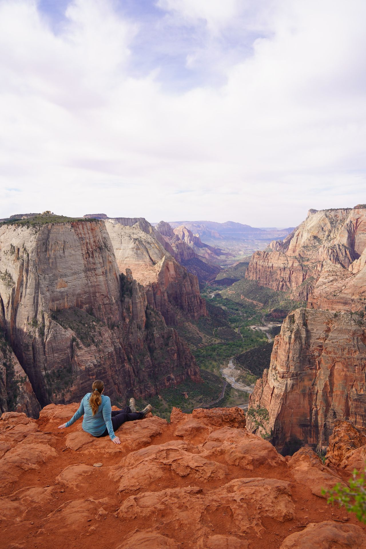
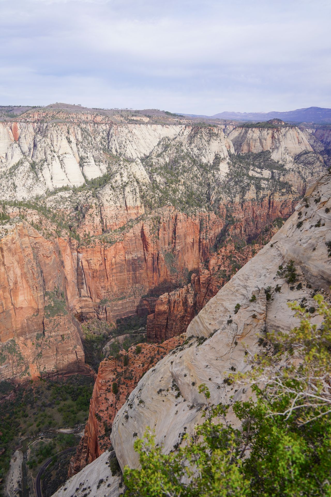
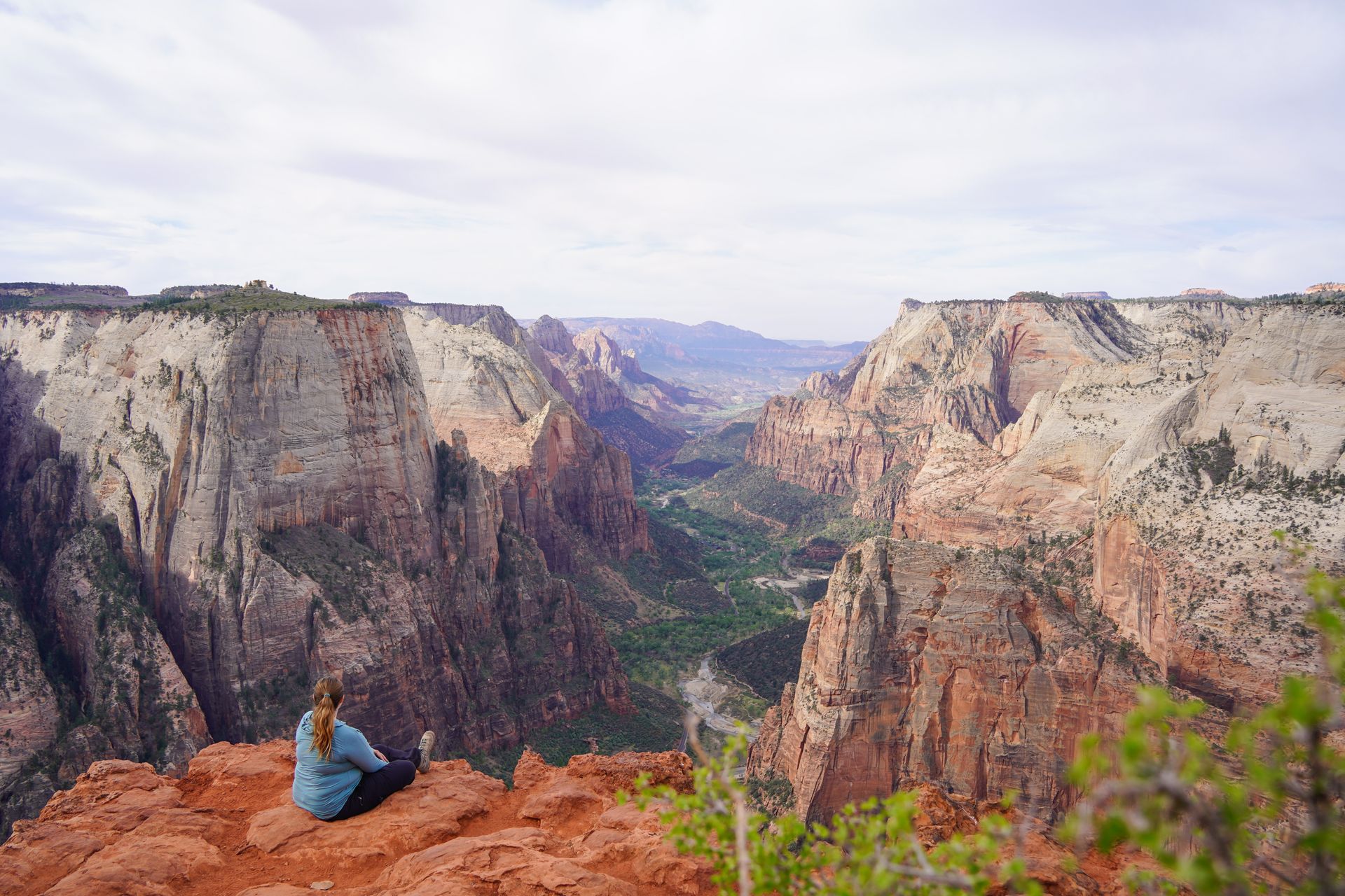
There are a lot of EPIC trails in Zion, but I had to pick this one because I think it offers the single best view in the park. Observation Point looks over the Zion Canyon, so you’ll be able to admire Angel’s Landing from above. Plus, while the trail is a little long, it’s relatively easy.
The trail is wide and the slope is gradual, but there is very little shade on this hike. Make sure you’re prepared with sun protection and plenty of water. I recommend a hat, sunglasses, sunscreen, and electrolytes.
Pro Tip: Summers are very hot in Zion. The best times to visit are the spring and the fall.
The parking for the East Mesa Trail is a bit challenging. You’ll need a high clearance vehicle to reach the trailhead, and the road conditions can vary on the season. The road can be much worse in wet conditions. Plus, there are a limited number of spots available. However, you also have the option to take a shuttle. Zion Ponderosa Ranch Resort offers a shuttle to the trailhead. The shuttle costs $7, and it’s best to book ahead of time.
Zion has so many incredible hikes! Honorable mentions in this park include Angel’s Landing, The Narrows, and The Subway.
2. Emerald Lake, Rocky Mountain, CO
3.3 miles, 715 feet of elevation gain, rated moderate
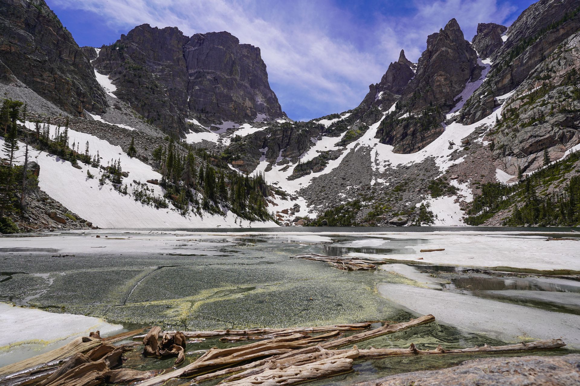
Emerald Lake is an iconic Rocky Mountain hike that leads you to past four different lakes. Bear Lake is right at the trailhead, and you’ll pass Nymph Lake and Dream Lake on your way to Emerald. Emerald Lake is beautifully framed by the mountains above, and the trail is a gradual climb that isn’t overly steep.
Pro Tip: This hike may have lingering snow into June. If there is snow present, microspikes are a huge help.
Rocky Mountain requires a reservation to enter at certain times between the end of May and mid-October. This hike is located off of the Bear Lake Corridor, which you’ll need to select when making your reservation.
Even if you have a reservation, the parking lot for this hike fills up. Luckily, you have the option to take a shuttle to get around the various trailheads in the Bear Lake Corridor. This shuttle is free and runs every 10-15 minutes.
Rocky Mountain National Park sits at a high altitude, and afternoon thunderstorms are common. It’s best to hike in the morning to avoid this. You should also bring plenty of water and take it slow if you’re not used to hiking at this altitude.
Rocky Mountain has so many incredible hikes! Honorable mentions in this park include Sky Pond, Lake Haiyaha, and Bluebird Lake.
Read my summer itinerary for Rocky Mountain National Park
3. Maple Pass, North Cascades, WA
6.8 miles, 2,168 feet of elevation gain, rated hard
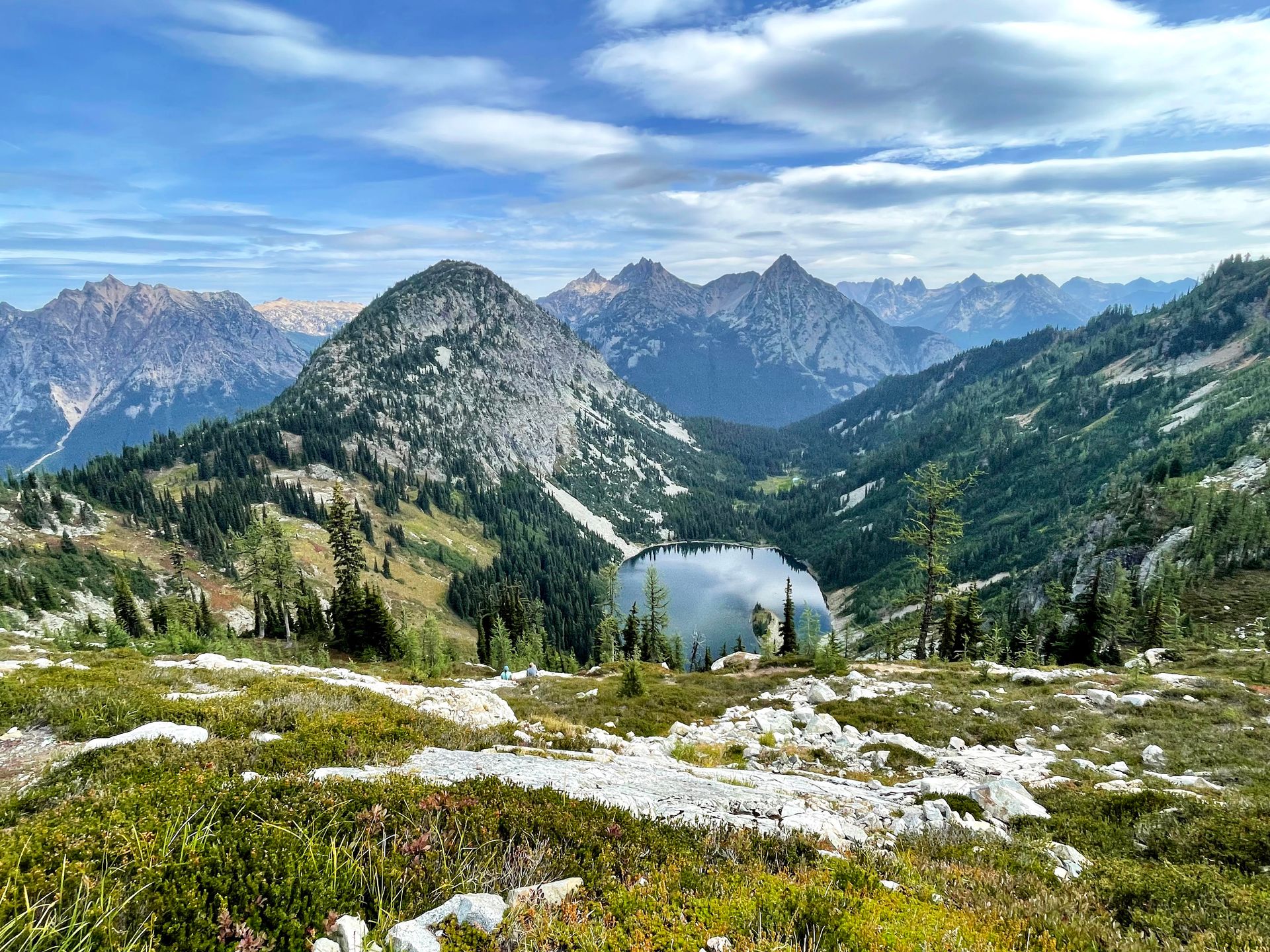
Maple Pass offers some of my favorite views inside of a US national park! The trail has stunning views the entire time, and you’ll be admiring an alpine lake surrounded by mountains for much of the trail. You’ll hike around the small lake from above, so you’ll get to enjoy the view from many angles.
The trail is a loop, and I went counterclockwise so that I could have a more gradual ascent. You also have the option to take a Spur Trail to see the lake that the main trail admires from afar.
The last half mile to the top of the trail is the steepest section going up, but there is no difficult rock scrambling. You will get the best view of Lake Ann right before reaching the top, and at the top you’ll get the best view of the surrounding mountain ranges. You will also see a sign for North Cascades National Park boundary near the top, as a lot of the hike is actually within a national forest.
Arrive early to get a parking spot, as this trail is very popular. It’s also a stunning place to see golden larches in the fall.
Read my guide to North Cascades National Park
4. Figure Eight Trail, Bryce Canyon, UT
6.4 miles, 1,479 feet of elevation gain, rated hard
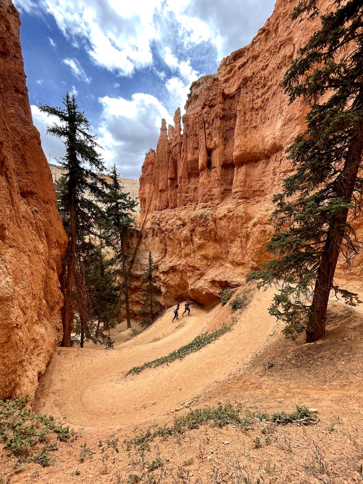
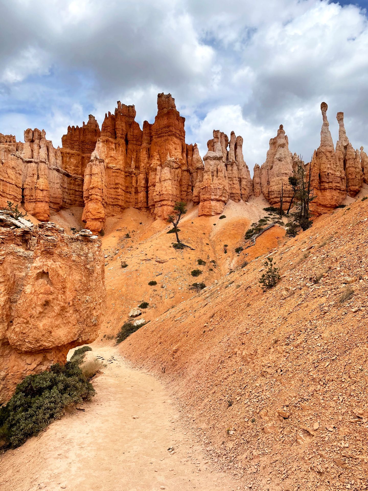
This route in Bryce Canyon combines several of the most ironic areas in the park - Queen’s Garden, Wall Street, and the Peekaboo Loop.
As the name suggests, this hike combines trails to create a Figure Eight pattern. It’s essentially connecting two different loop hikes, and allows you to see the highlights of the park.
I recommend starting at Sunset Point and hiking down the iconic Wall Street. You could also begin at Sunrise Point or Bryce Point, but hiking down Wall Street will allow you to climb down in the steepest area so that your climb back up (via Queen’s Garden) will be more gradual.
Pro Tip: Check the weather forecast ahead of time, and make sure you finish hiking before afternoon thunderstorms (common during the summer monsoon season). These storms have led to flash flooding, and rescues, on these trails.
Hiking down Wall Street is an experience in itself. Iconic switchbacks descend down into the canyon steeply and the rocks become more narrow as you climb down.
The Peekaboo Trail is a loop that will take you through several ups and downs with incredible views along the way. I hiked the loop clockwise, which allows for a slightly more gradual climb up and you will save the very best views for the second half of the loop.
There are so many epic views along this trail, and I especially loved all of the rock tunnels.
Depending on your time and interests, you can also enjoy a shorter version of this trail. The Queen’s Garden and Navajo Loop is a 3-mile route that has amazing views of hoodoos.
Read about the best hikes in Bryce Canyon
5. Precipice Loop, Acadia, ME
2.7 miles, 1,000 feet of elevation gain, rated hard
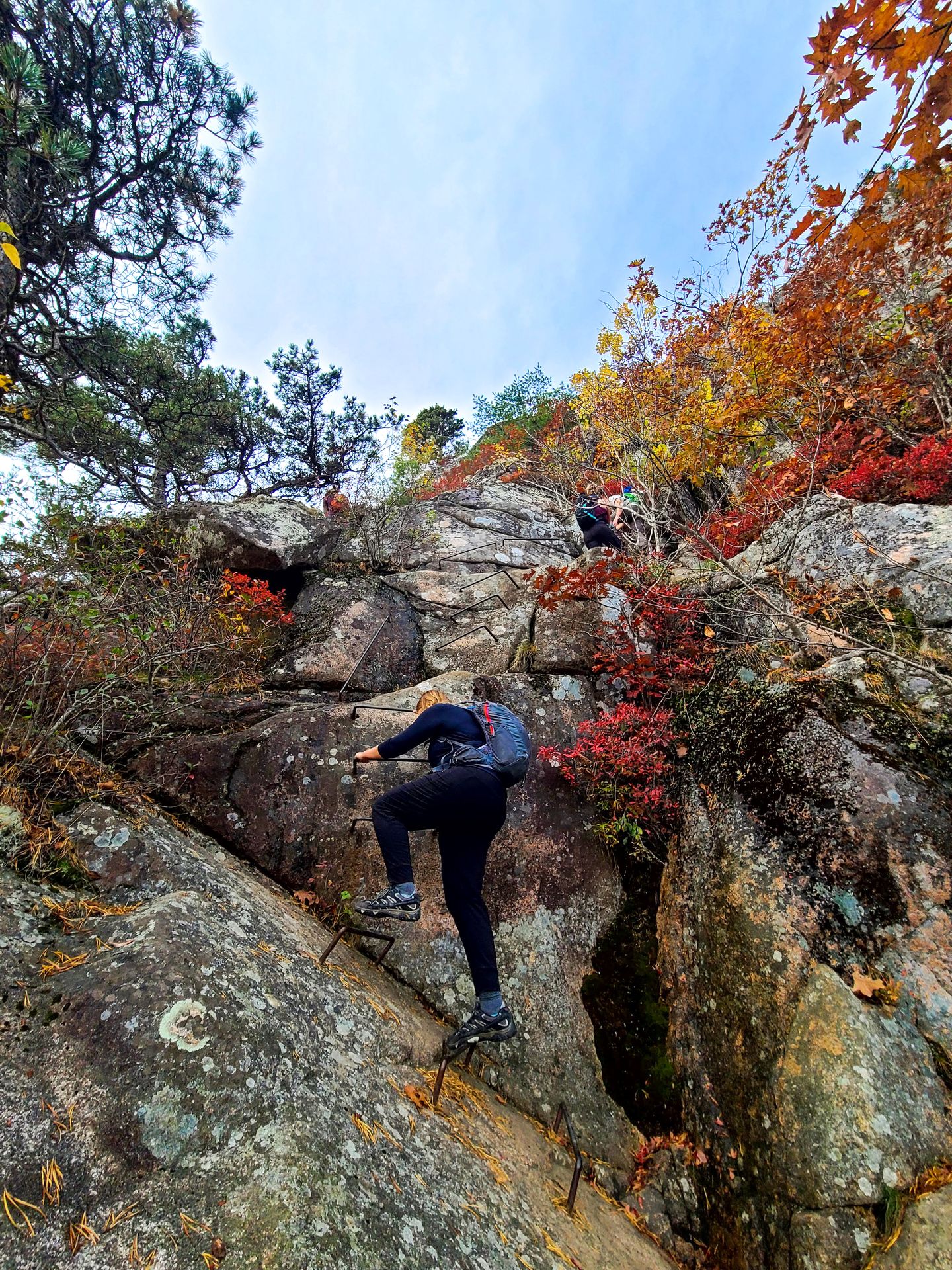
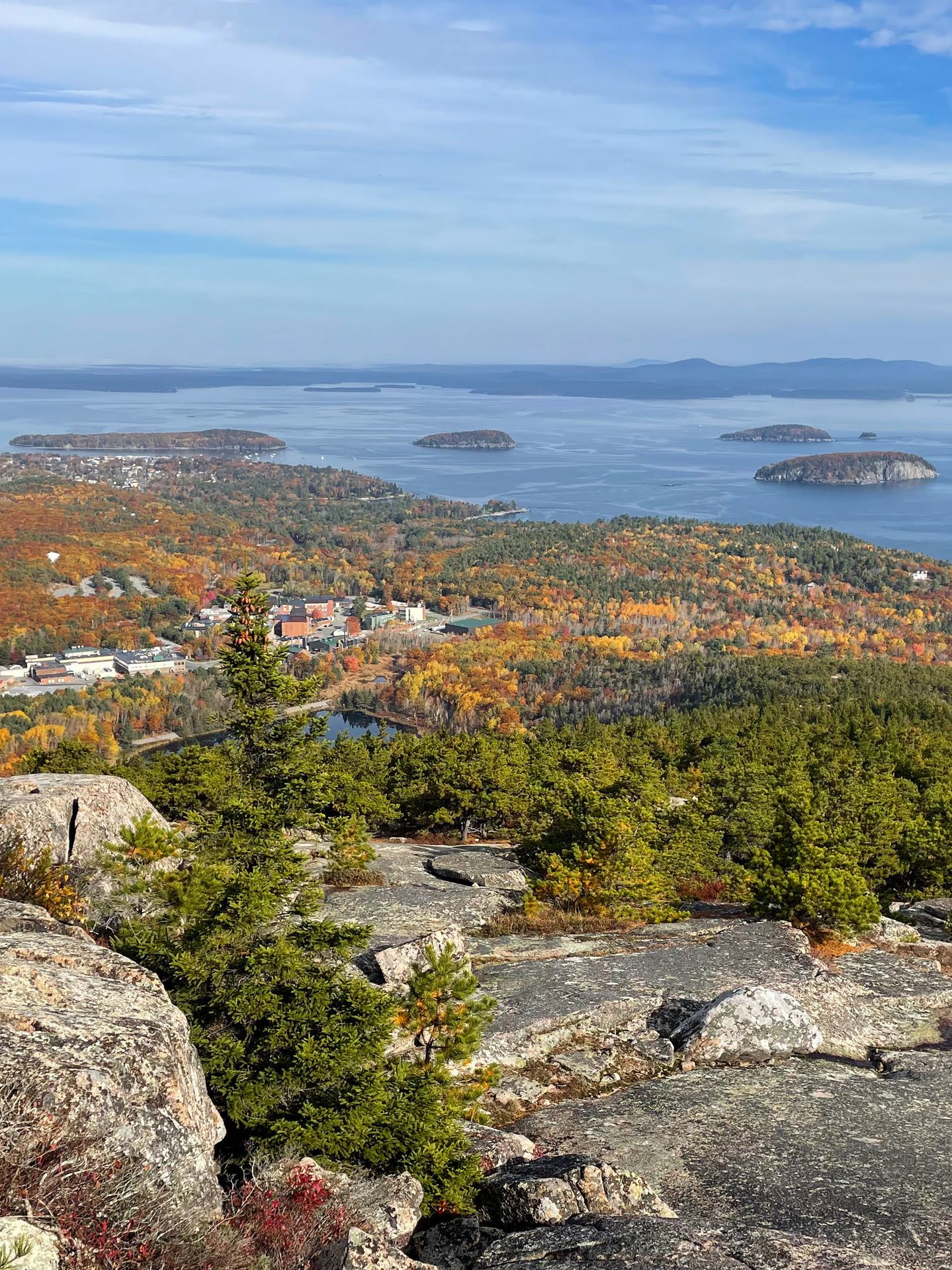
The Precipice Trail is a thrilling hike that involves climbing up ladder rungs on the edge of a cliff. The hike involves a series of ladders and narrow ledges, and you should probably skip this if you’re afraid of heights.
The very start of the trail has a little “test” section where you’ll need to climb up two rungs and pull yourself over an awkward area. It’s a good test, as I felt like it was harder than anything on the trail.
This is a hike where you should only hike up the ladders. Two way traffic would get quite tedious and dangerous. After reaching the top, you can hike down via the Orange and Black Path, which doesn’t have ladders.
The view at the top of Champlain Mountain is amazing, and I found this to be an incredibly rewarding, and memorable hike.
Pro Tip: This trail closes part of the year due to Peregrine Falcon nesting, so check ahead of time if it will be open for your visit.
This trail is not for everyone. If you’re interested in an easier version, the Beehive Trail is a great place to start. It also has ladder rungs, but much fewer.
Read about the best hikes in Acadia National Park
6. Delta Lake, Grand Teton, WY
7.6 miles, 2,296 feet of elevation gain, rated hard
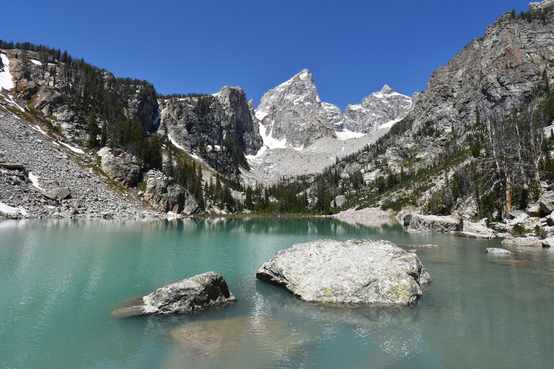
If you’re up for a challenge, Delta Lake offers a magnificent view in Grand Teton National Park. This is an intense trail, so only attempt it if you're prepared. There is a lot of climbing, some route finding, and a rock scramble as you approach the lake. You should also hike with bear spray while you’re exploring Grand Teton.
Much of the hike has amazing views as you hike up long switchbacks, and is gradual. When you are about three quarters of the way to the top, you’ll step off the main trail at the end of a switchback and continue on an unmaintained trail.
The last push to the lake is steep, and involves climbing up loose rocks. It’s helpful to have trekking poles, especially for climbing back down.
The lake is a brilliant green color, and it’s framed by the tallest peak in the park. It’s the perfect spot to take a dip, enjoy lunch, and take in the views.
Read my itinerary for Grand Teton National Park
7, Guadalupe Peak, Guadalupe Mountains, TX
8.4 miles, 2,949 feet of elevation gain, rated hard
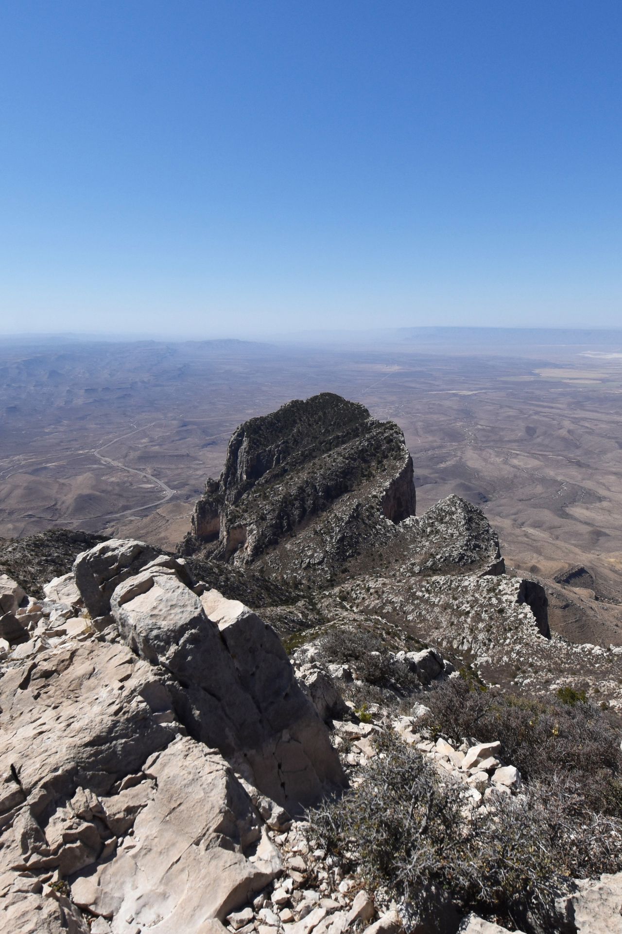
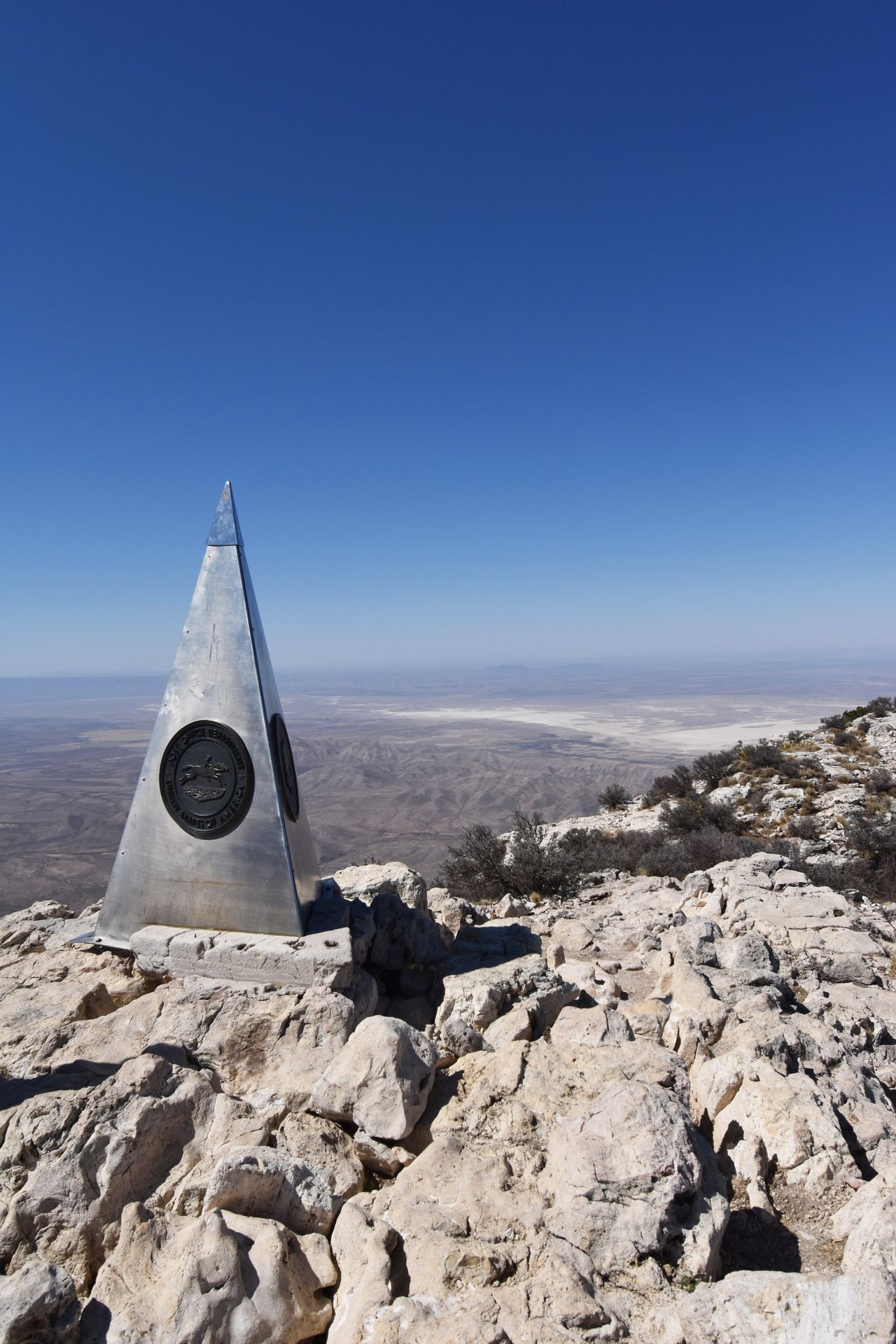
Guadalupe Peak is the tallest point in Texas! To reach this gem, complete with 360-views, you’ll be climbing up a steep trail. The hike to Guadalupe Peak is 8.4 miles round trip, and gains almost 3,000 feet of elevation gain.
You’ll want to make sure that you bring plenty of water and sun protection, as there is little to no shade on the trail. There is a practically endless series of switchbacks as you climb towards the top, but there are lots of incredible views along the way.
At the top of the peak, you’ll see a stainless steel pyramid. This pyramid was placed by American Airlines in 1958, commemorating the 100th anniversary of a nearby Stagecoach route. There is also a U.S. Postal service tribute and a Boy Scouts of America logo on the structure.
There is plenty of space to spread out at the top. Bring a packed lunch or a treat to enjoy at the top, you’ve earned it!
Read my guide to Guadalupe Mountains National Park
8. Harding Icefield, Kenai Fjords, AK
8.9 miles, 3,244 feet of elevation gain, rated hard
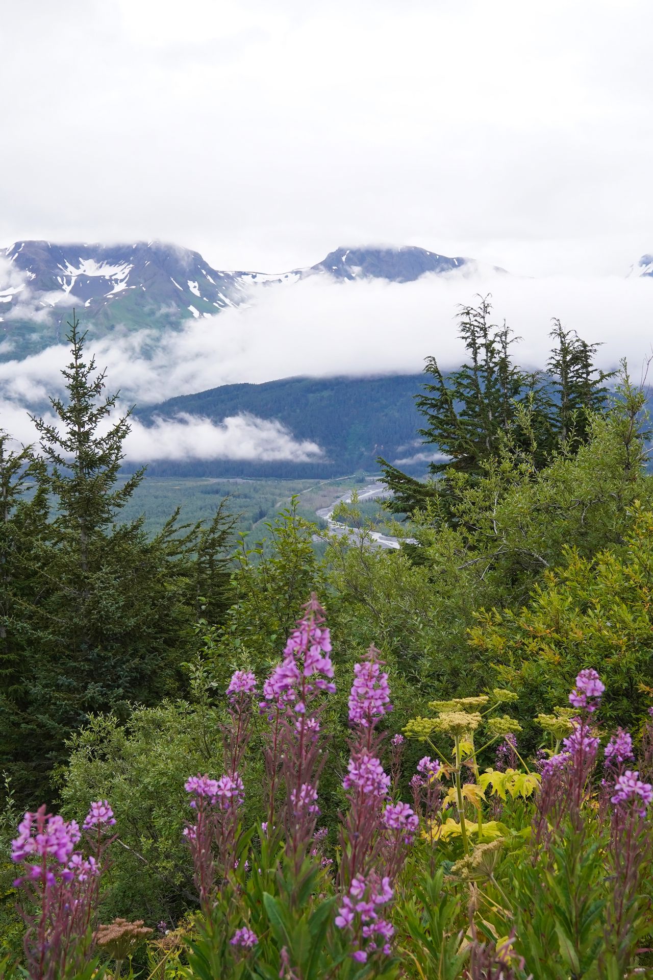
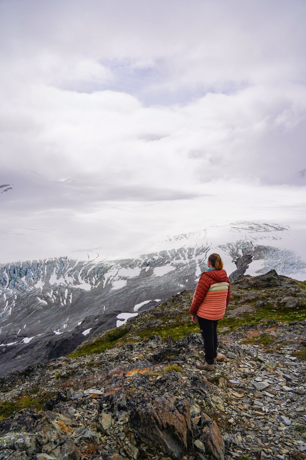
The Harding Icefield trail leads to a view looking over a massive icefield that feeds about 40 glaciers. The hike also has incredible views of Exit Glacier, mountains, wildflowers, and more.
The ascent of this trail is steep at times, but the views make up for it. At the top, you might be hiking over snowdrifts, so it’s helpful to bring microspikes. The weather at the top can be unpredictable - you might have fog, rain, or snow - so come prepared with layers.
If you don’t want to hike to the top, there is a pretty incredible view of the Exit Glacier two thirds of the way up. You also enjoy views of Exit Glacier on a much easier and shorter trail, leaving from the same trailhead.
Read my guide to Seward, Alaska
9. Fern Canyon, Redwoods, CA
1.2 miles, 124 feet of elevation gain, rated easy
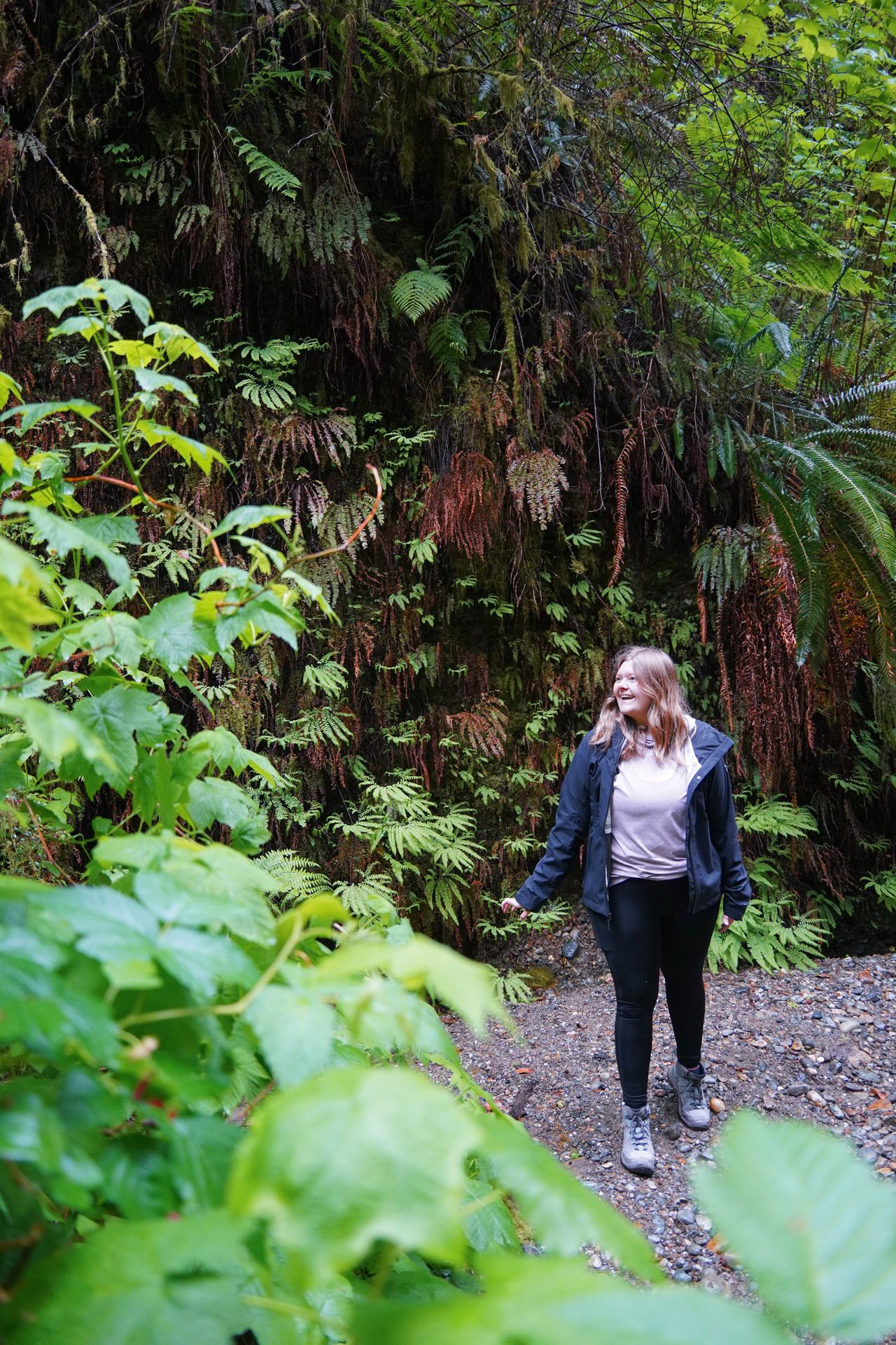
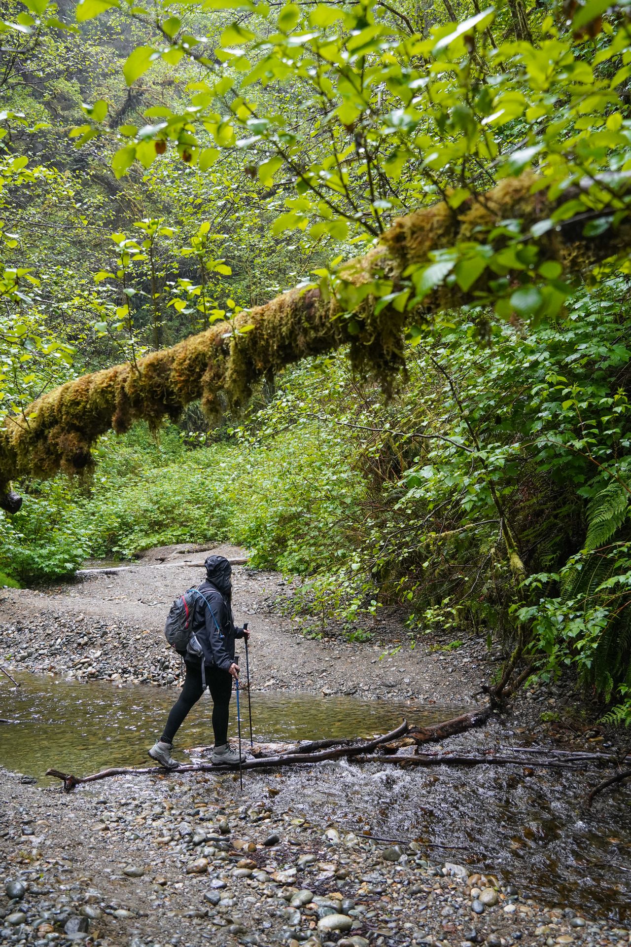
Fern Canyon feels like Jurassic Park! In fact, this was actually a filming location for The Lost World: Jurassic Park. This enchanting trail leads you through a lush canyon covered in ferns.
A reservation is required to drive to this trailhead between mid-May and mid-September. The road to reach the trail is a bit intense. It’s windy, narrow, and full of potholes. There are also a couple river crossings.
You can make this hike into a loop and experience a forest full of tall trees in addition to the misty canyon. The forested section of the loop has a bit of elevation gain, but nothing major.
However, the canyon-portion of the trail is the most unique part. You’ll be following along a stream and will need to navigate river crossings along the way. You’ll likely need to get your feet wet, but may be able to balance on logs for most of it.
Each bend in the canyon brings a new magical view full of mossy logs, bright green ferns and lots of greenery. I felt like I was living inside of a storybook. I also had some misty weather when I hiked this (in April), which just added to the mood.
Read my itinerary for Redwood National Park
10. Iceberg Lake, Glacier, MT
9.7 miles, 1,453 feet of elevation gain, rated moderate
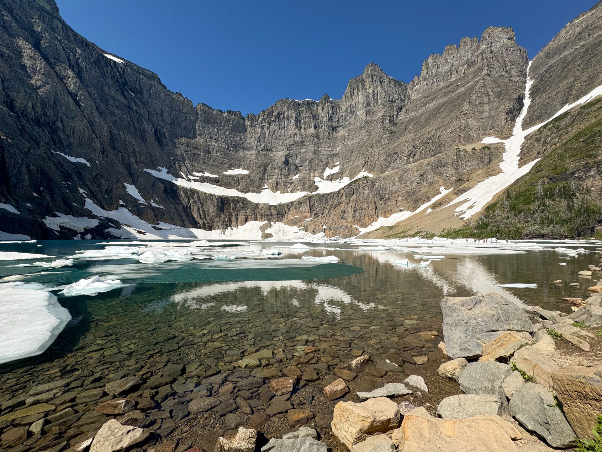
Iceberg Lake is a stunning trail in the Many Glacier section of Glacier National Park. The hike leads to an alpine lake where it’s common to see lots of iceberg floating in the water. The icebergs break off from nearby glaciers. The lake sits in the shadow of mountain peaks, so the ice chunks often linger for most of the summer.
The trail itself offers really beautiful views on your way to the lake. The hike is long, but the elevation gain is gradual. You’ll be hiking in and out of meadows and forests, and will have some lovely views. When I did this hike in mid-July, I also got to enjoy a multitude of wildflowers. Despite frigid temperatures, I also saw many people swimming in the lake.
Glacier is my favorite national park, and it has a lot of incredible hikes. Other amazing trails include the Highline Trail, Grinnell Glacier, and Hidden Lake.
Read my guide to Glacier National Park
11. Fiery Furnace, Arches, UT
2.2 miles, 508 feet of elevation gain, rated hard
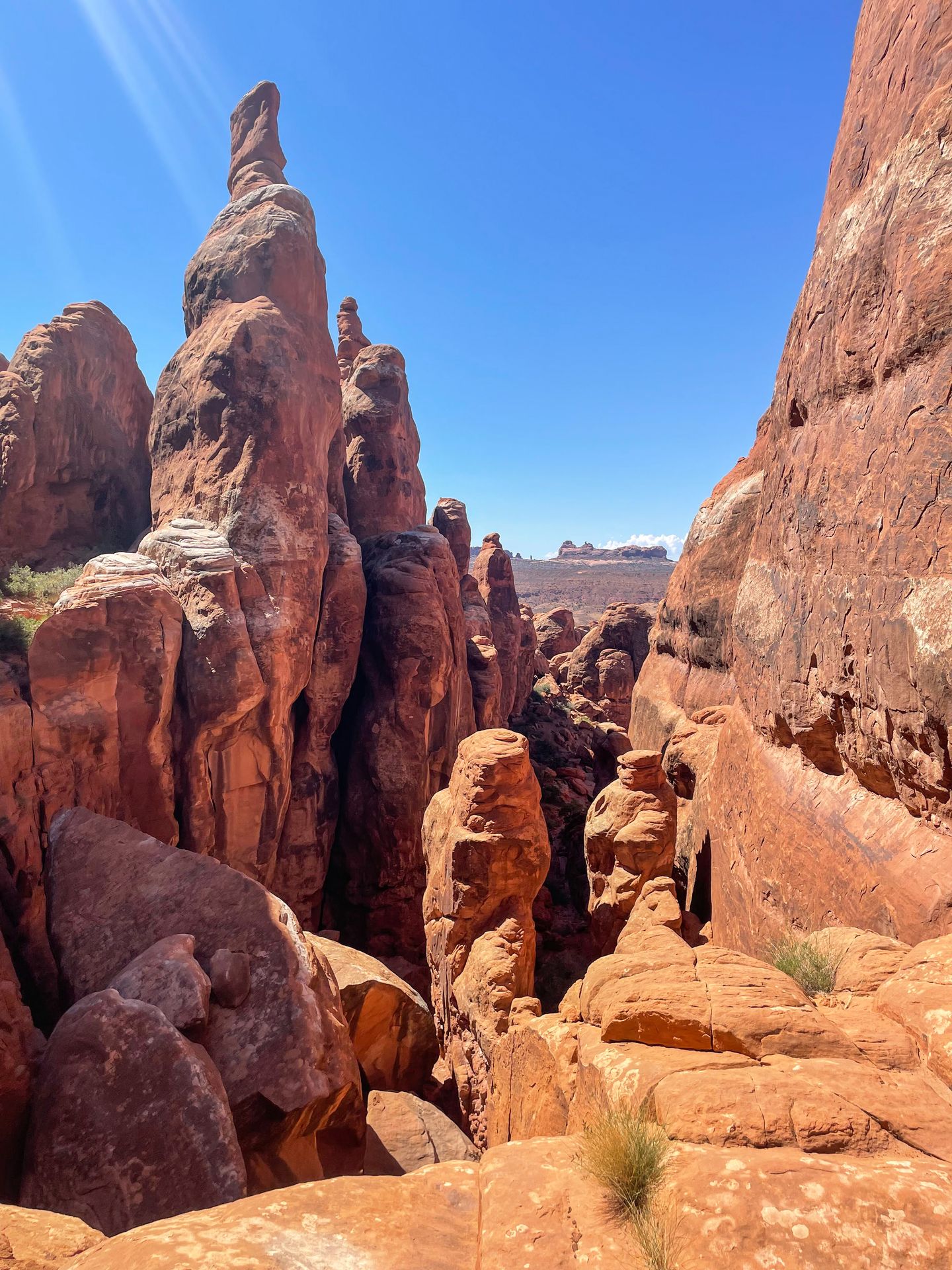
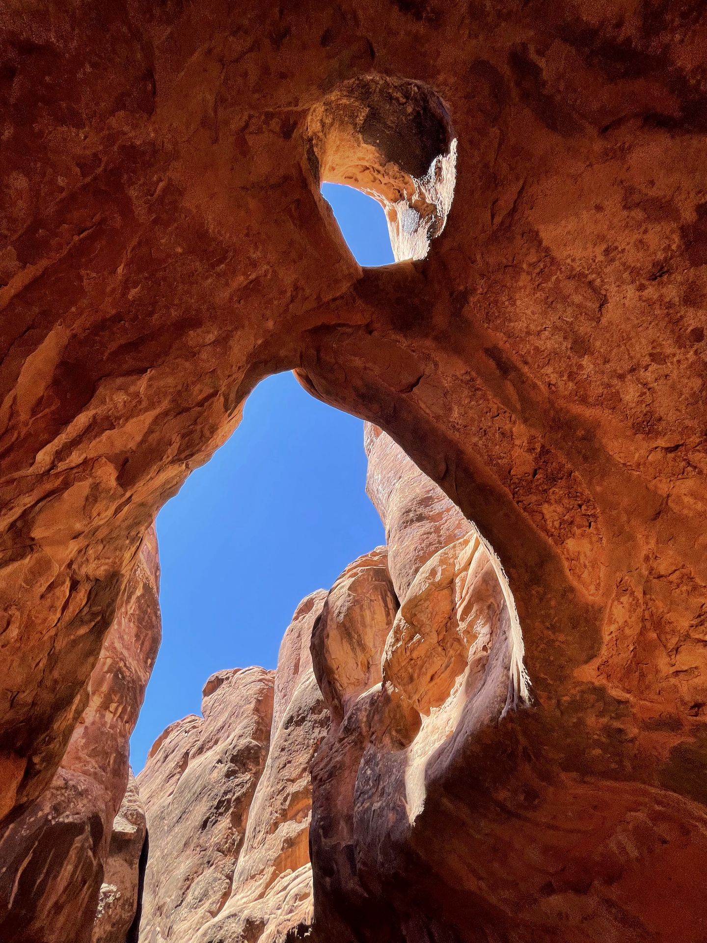
If you’re up for a route-finding challenge, Fiery Furnace is a rewarding adventure inside of Arches. You’ll need a permit to embark on this journey, and they can be hard to get. They go on sale a week in advance, and all visitors will have to attend an in-person orientation. You also have the option to go on a ranger-led tour through Fiery Furnace.
Fiery Furnace involves navigating through narrow passageways, rock scrambling and stumbling upon dead ends. There is a loose route marked with tiny arrows, but you can explore freely. There are some really unique arches hidden away in the dead ends.
Pro Tip: Take extra care to not disturb any cryptobiotic soil crust while you’re on this trail and exploring any desert areas.
I only recommend Fiery Furnace to experienced hikers. Other amazing trails in Arches include Devil’s Garden and Delicate Arch.
12. Notch Trail, Badlands, SD
1.2 miles, 118 feet of elevation gain, rated moderate
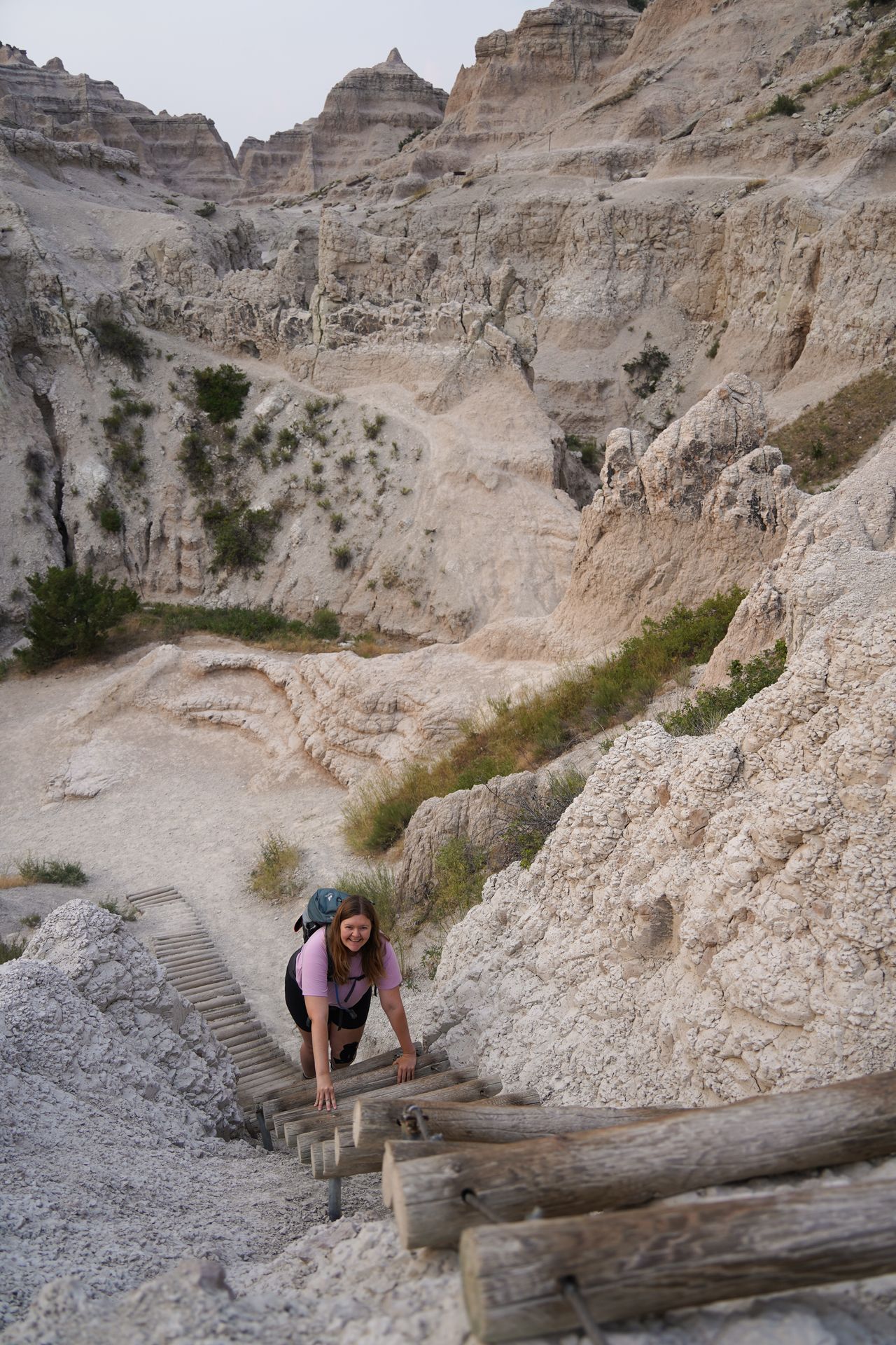
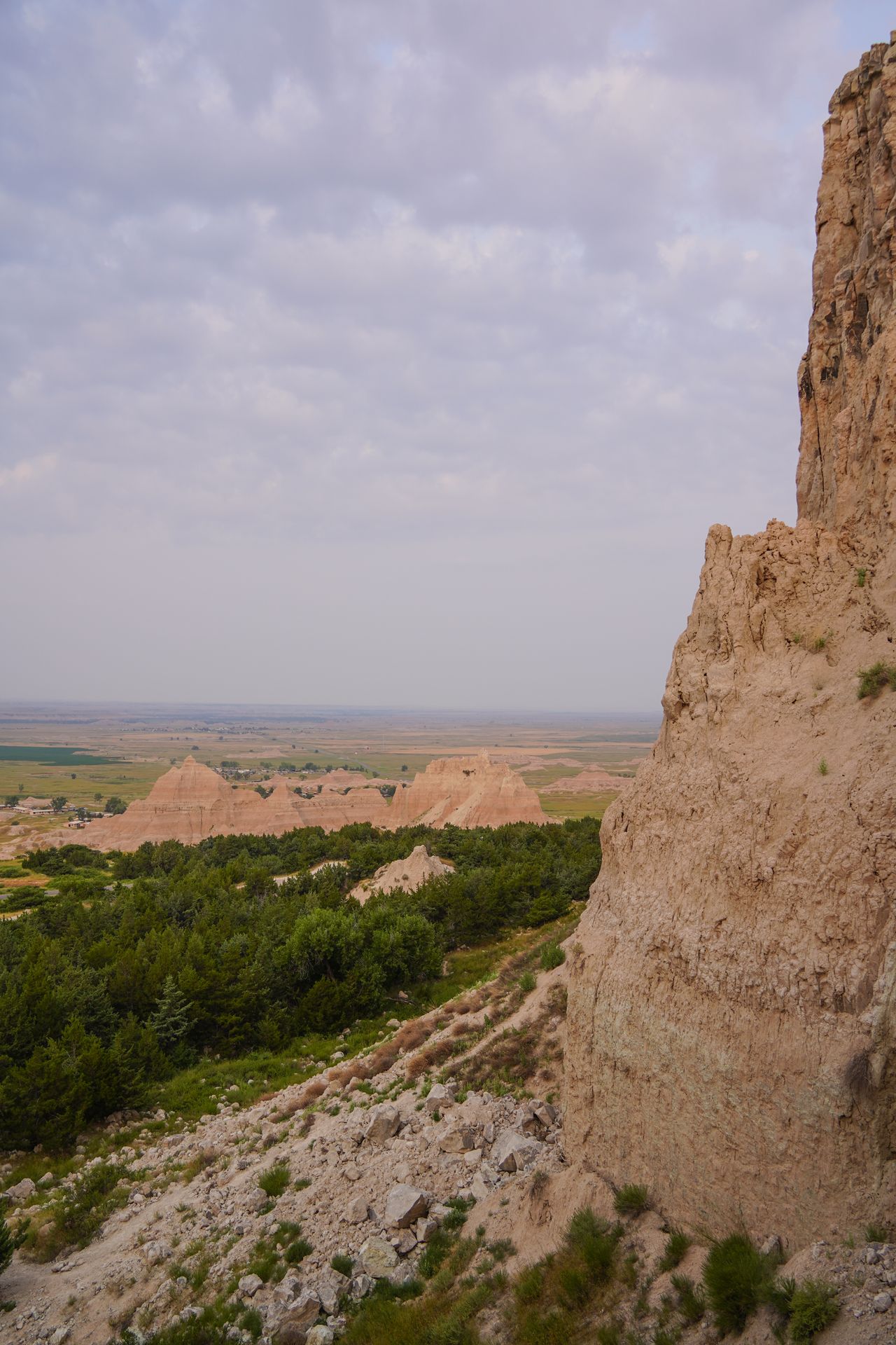
This Notch trail has a unique element - a 25-foot ladder made of rope and wooden beams. You’ll need to climb up, and back down, the ladder in the middle of the trail. At the hike’s terminus, you’ll get to enjoy an amazing view overlooking the badlands landscapes.
The ladder can create a choke point on the trail, so I recommend getting an early start. From the same parking lot, you can also hike the Window and Door Trails, which are both less than a mile and rated easy.
Read my itinerary for the Badlands and the Black Hills
13. Wasson Peak loop, Saguaro, AZ
7.8 miles, 1,853 feet of elevation gain, rated moderate
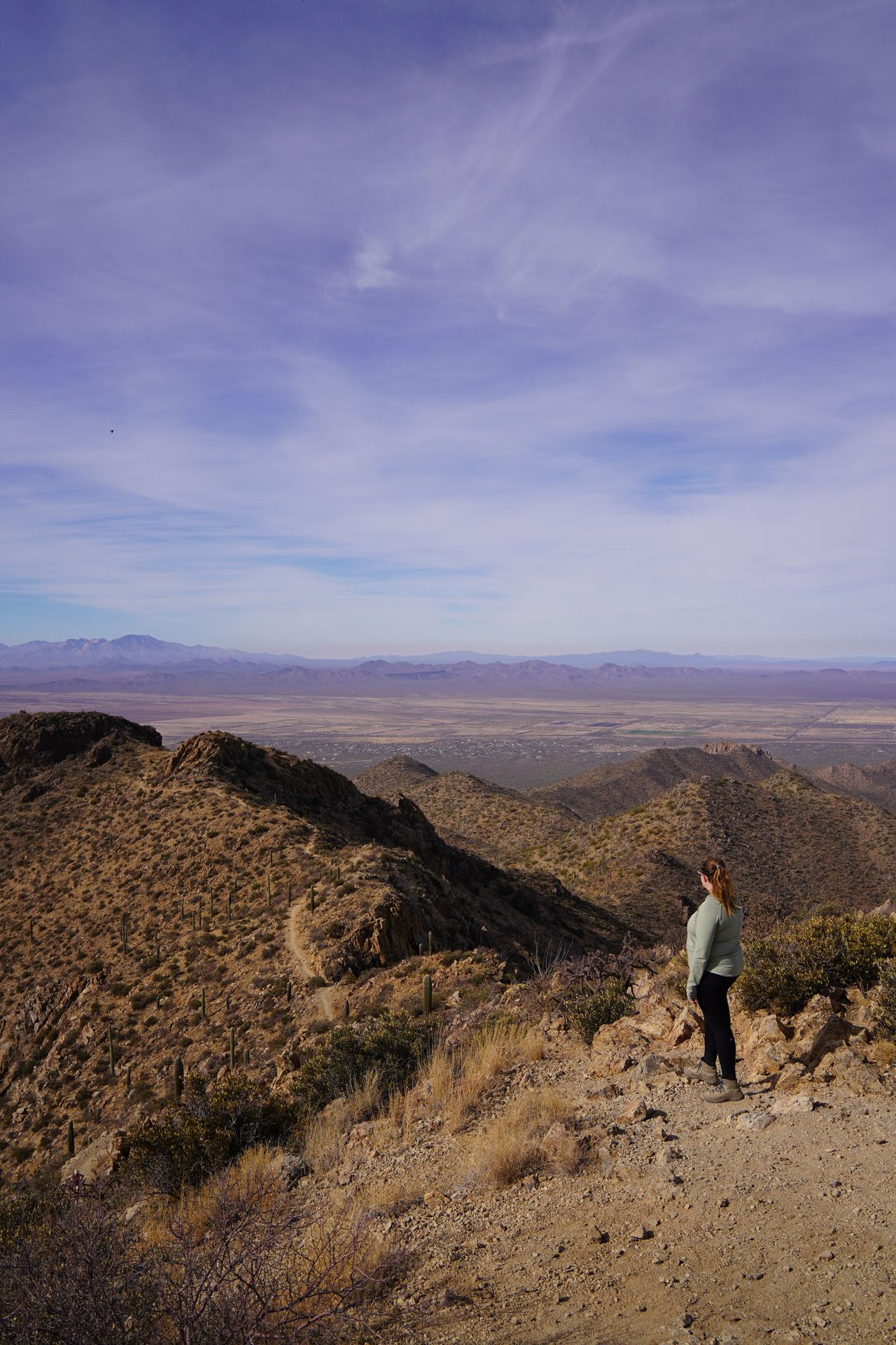
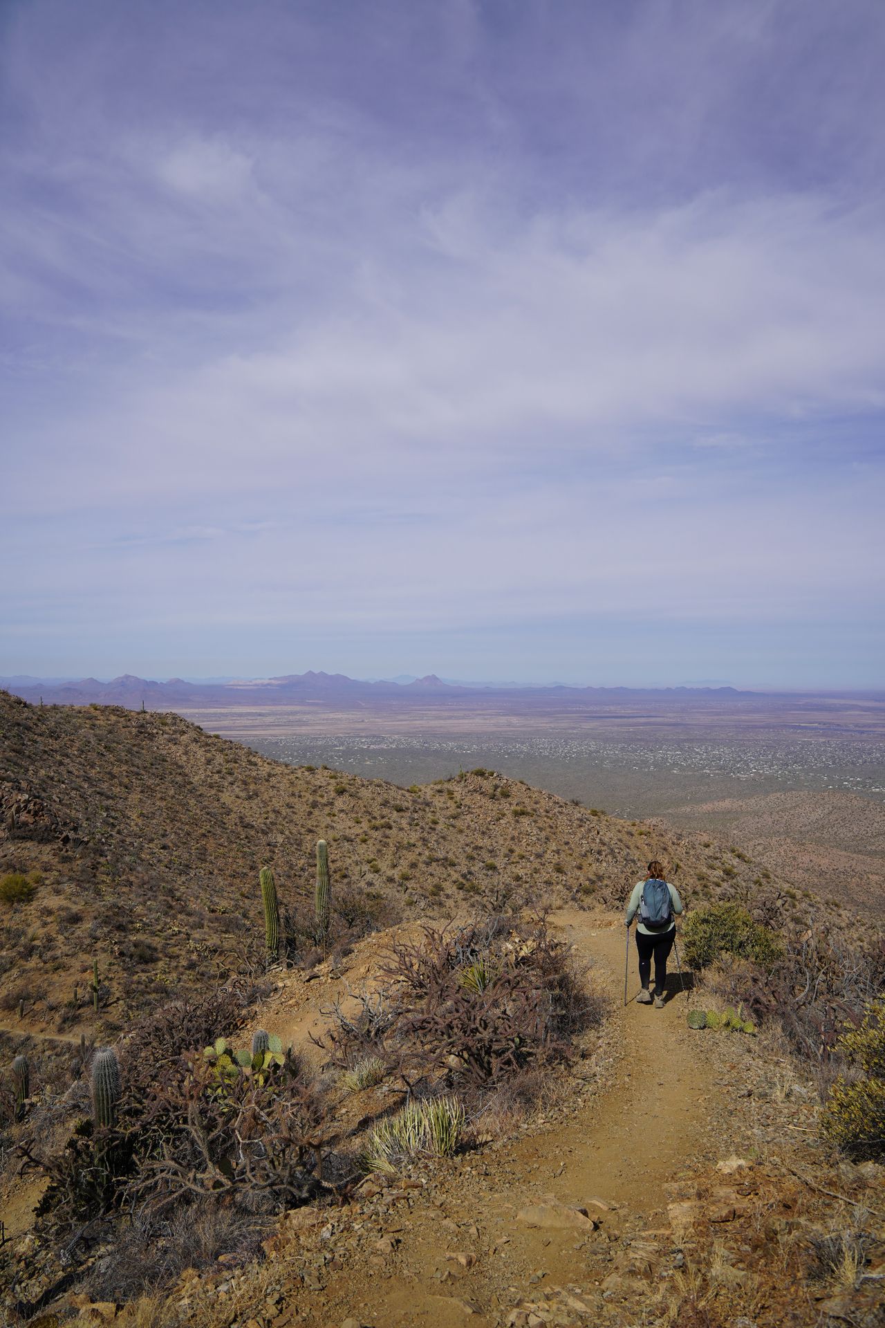
Wasson Peak is an epic hike in the West Side of Saguaro National Park. This is the highest point in the Tucson Mountains, at 4,687 feet.
Wasson Peak can be reached on a couple of different trails and can be done as a loop, or as an out-and-back trail. I hiked a loop that went up the King Canyon Trail, and down the Hugh Norris, Sendero Esperanza and Gould Mine trails. There are wonderful views (pretty much the entire time) of saguaro cacti and the surrounding mountains.
The trail is a little steep at times, and it doesn’t have much shade. Be prepared with sun protection, and for the potential of high winds at the top.
Read my itinerary for Saguaro National Park
14. Ram Head Trail, US Virgin Islands
2.7 miles, 370 feet of elevation gain, rated moderate
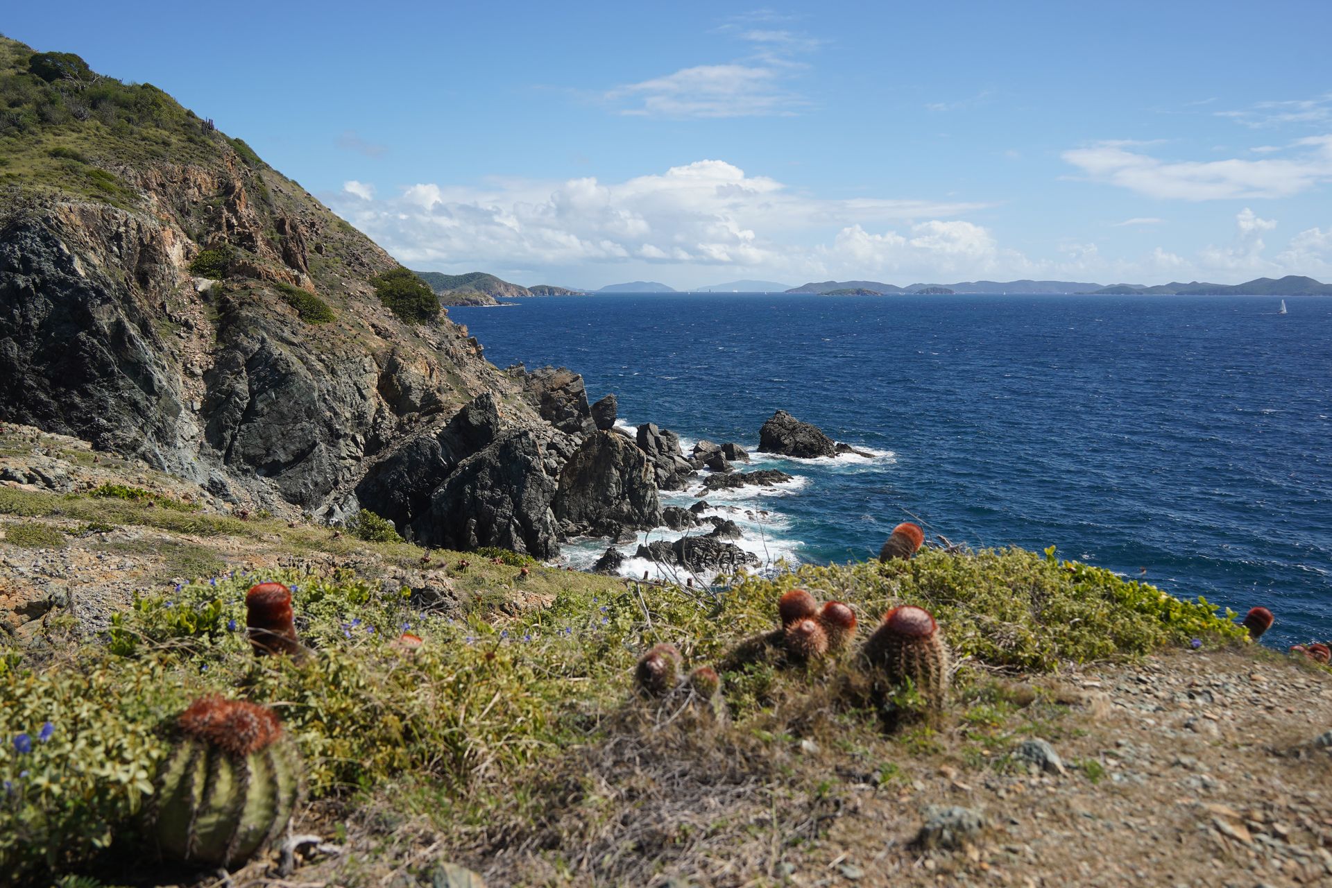
Ram Head is one of the best hikes in US Virgin Islands National Park. The hike offers amazing views of the ocean, with beach access and lots of healthy cacti along the way. The hike is gradual and not overly steep, and has a rewarding view at the end. You’ll be able to see for miles into the ocean, and see other islands in the distance.
The top of the hike has a dark history, as it’s the spot where a group of enslaved people committed mass suicide after several months of a successful uprising throughout the island. Take a moment to learn about this history when you visit.
You have the opportunity to cool off at Saltpond Beach after your hike, as it’s right along the trail. This is great for a hot and humid day.
15. Potato Harbor, Channel Islands, CA
5.3 miles, 629 feet of elevation gain, rated moderate
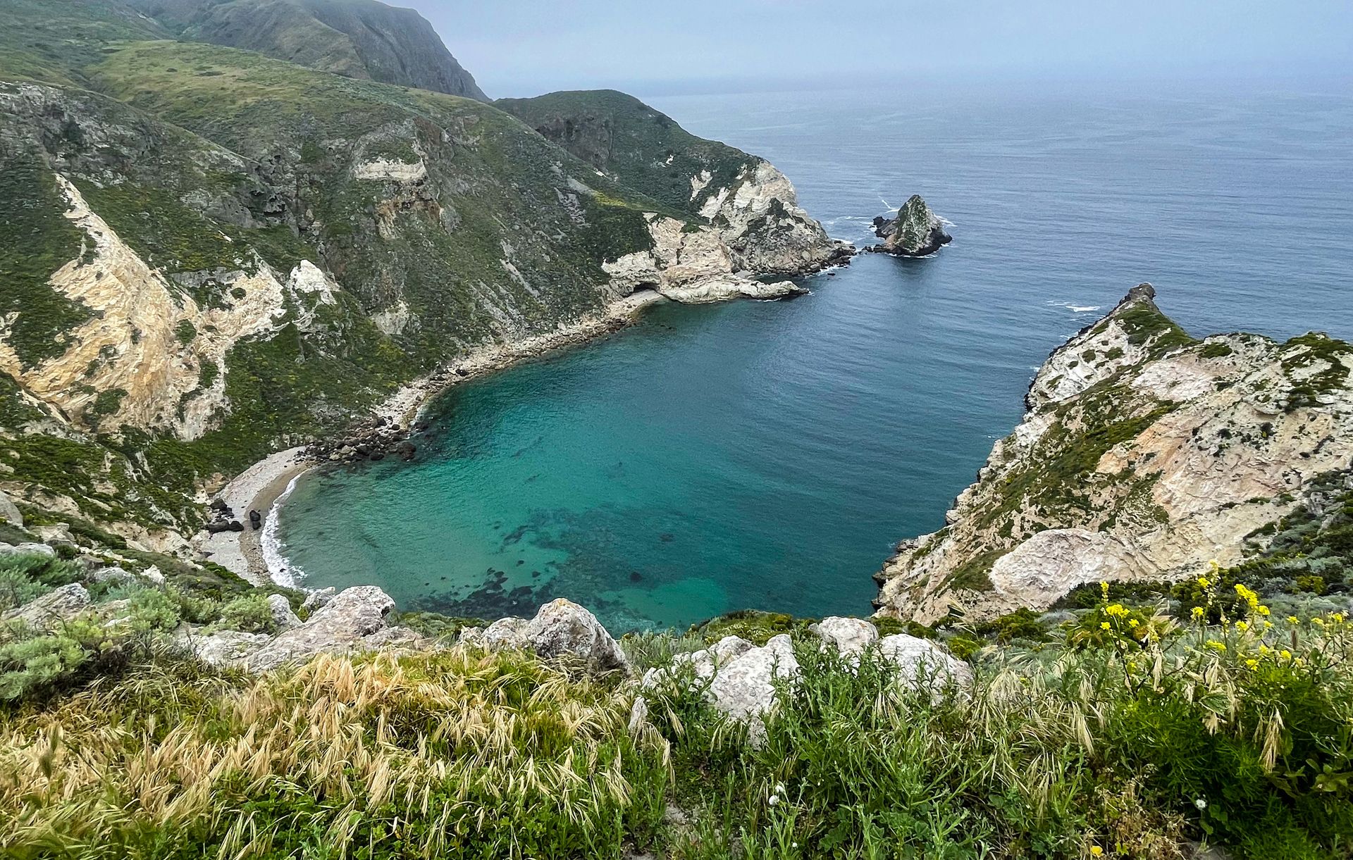
Potato Harbor offers a stunning view of, you guessed it, a potato shaped harbor, on Santa Cruz Island. Keep in mind that all of the Channel Islands require a ferry to reach, and you’ll want to book it ahead of time. Santa Cruz is the most popular island to visit, and makes for a wonderful day trip or camping trip.
The Potato Harbor trail is a little over 5 miles and has epic views of the island and ocean along the way. You’ll have many chances to admire the rocky coastline of the island, and look for sea caves, from high above.
Plus, the color of the water is a brilliant, clear blue. This hike is perfect to enjoy on a day trip to Santa Cruz Island. If you’ll also be kayaking on your day trip, you might just have time to hike to Cavern Point, which also has amazing views.
Read my guide to Santa Cruz Island
16. Waimoku Falls via Pipiwai Trail, Haleakalā, HI
3.6 miles, 849 feet of elevation gain, rated moderate

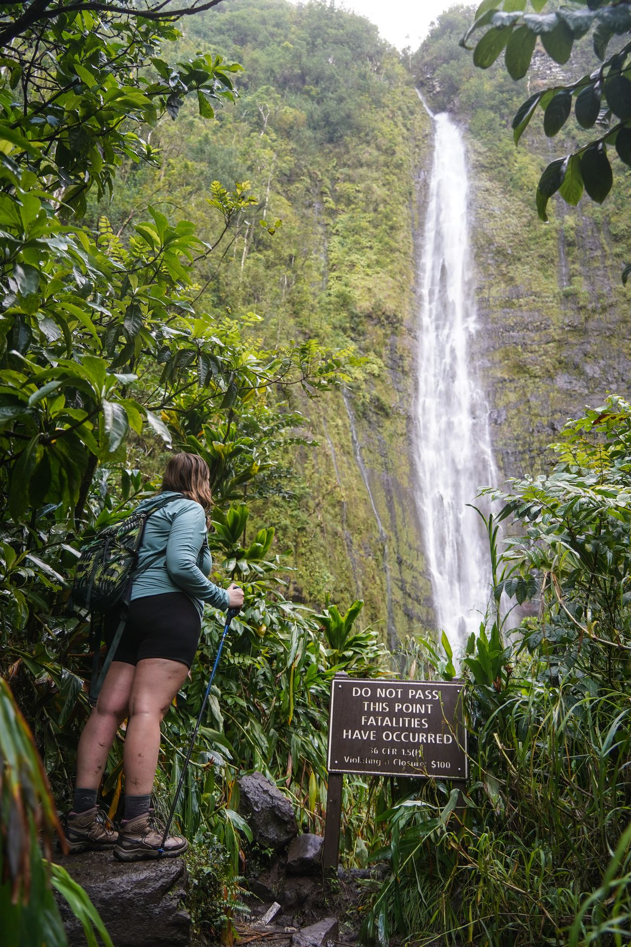
Waimoku Falls is a rewarding hike in Haleakalā that leads to a massive waterfall, a bamboo forest, and more views along the way. Waimoku Falls is 400 feet high, and quite an impressive sight. During the hike, you’ll also pass a massive banyan tree, other waterfalls, and interesting rocks.
To reach this trail, you’ll drive to the end of the Road to Hana. There is another road coming from the opposite side of the island too, but it’s rough and not recommended. If possible, I recommend staying in Hana for the night, and starting this trail early the next day. It’s a great way to avoid the crowds and will give you enough time to enjoy the many stops along the iconic Road to Hana.
If you’re also visiting the summit district of Haleakala, there are epic trails up there as well. I really enjoyed the Sliding Sands Trail.
Read my guide to Haleakalā National Park
17. Mist Falls, Kings Canyon, CA
8 miles, 908 feet of elevation gain, rated moderate
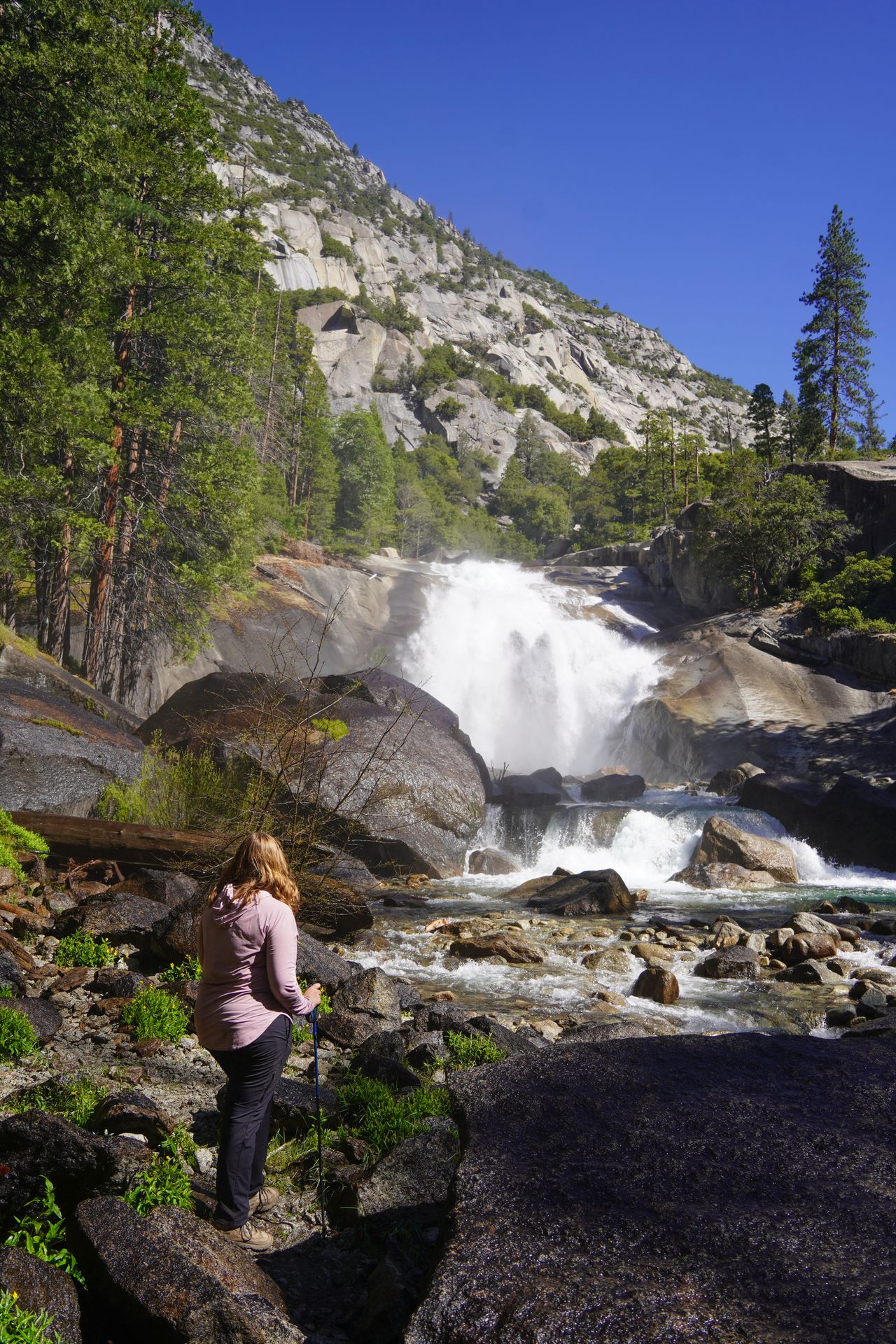
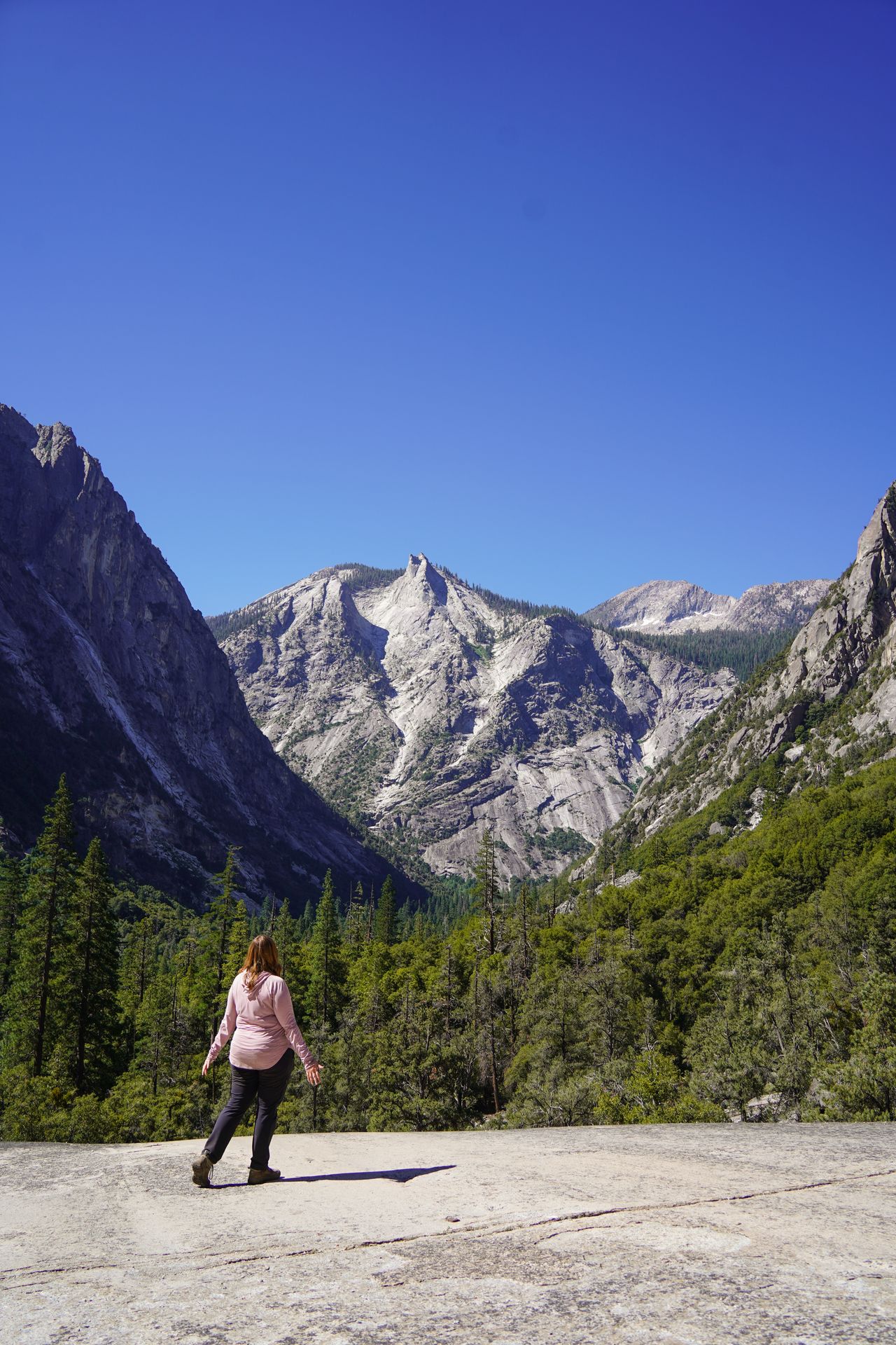
Mist Falls is an epic waterfall trail located at Roads End in Kings Canyon National Park. The hike is 7.5 miles, but there are also longer backpacking routes leaving from the same spot.
Mist Falls is beautiful, but the canyon views along the way are even better. You’ll get to admire towering walls of white granite that curve into the narrow valley.
Bears are seen on this trail, so be aware. There is also minimal shade, so bring sun protection. Mosquitoes can be bad as well, so bring your insect repellent.
Read my itinerary for Sequoia and Kings Canyon
18. Sol Duc Falls, Olympic, WA
1.8 miles, 262 feet of elevation gain, rated easy
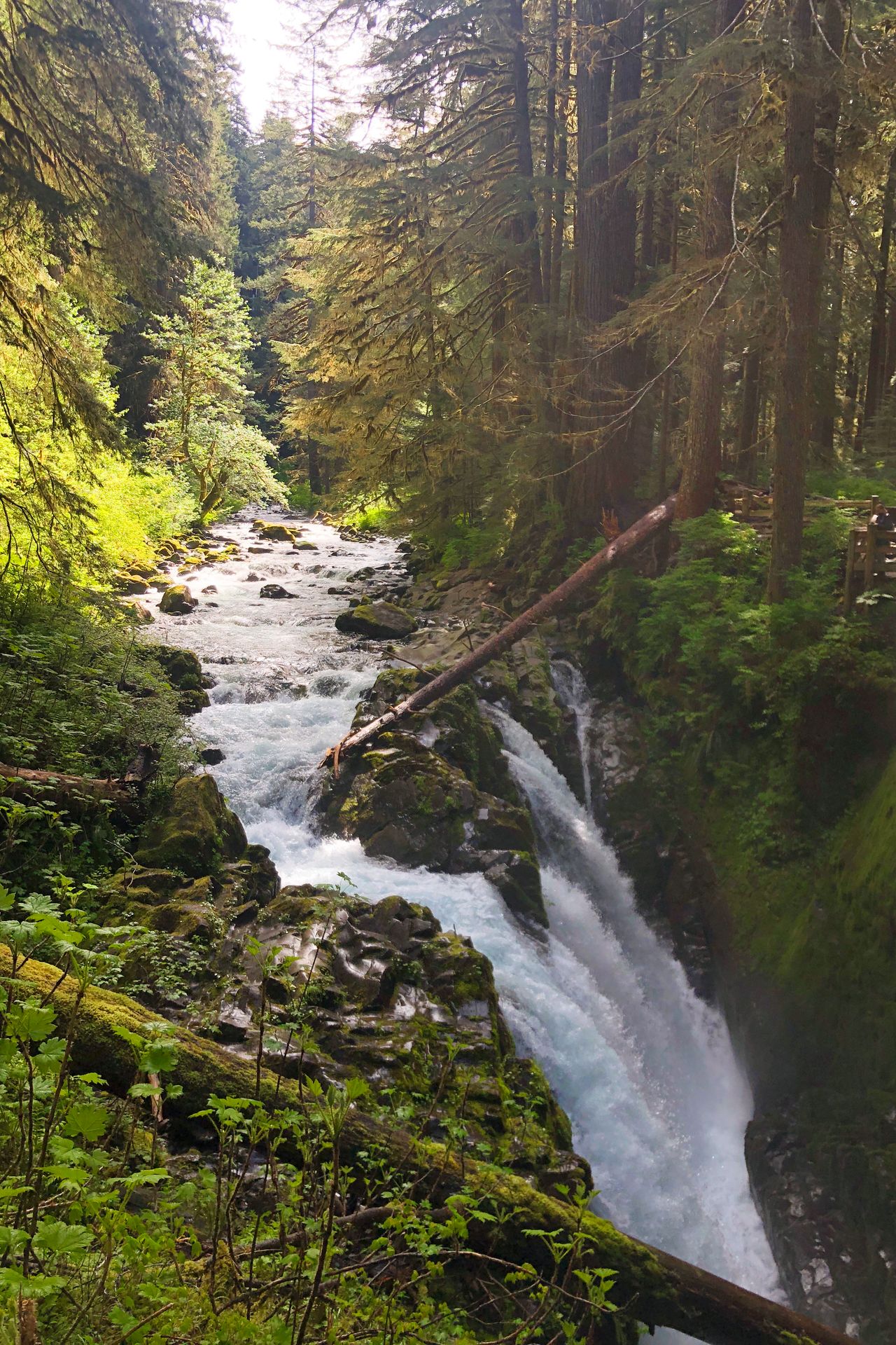
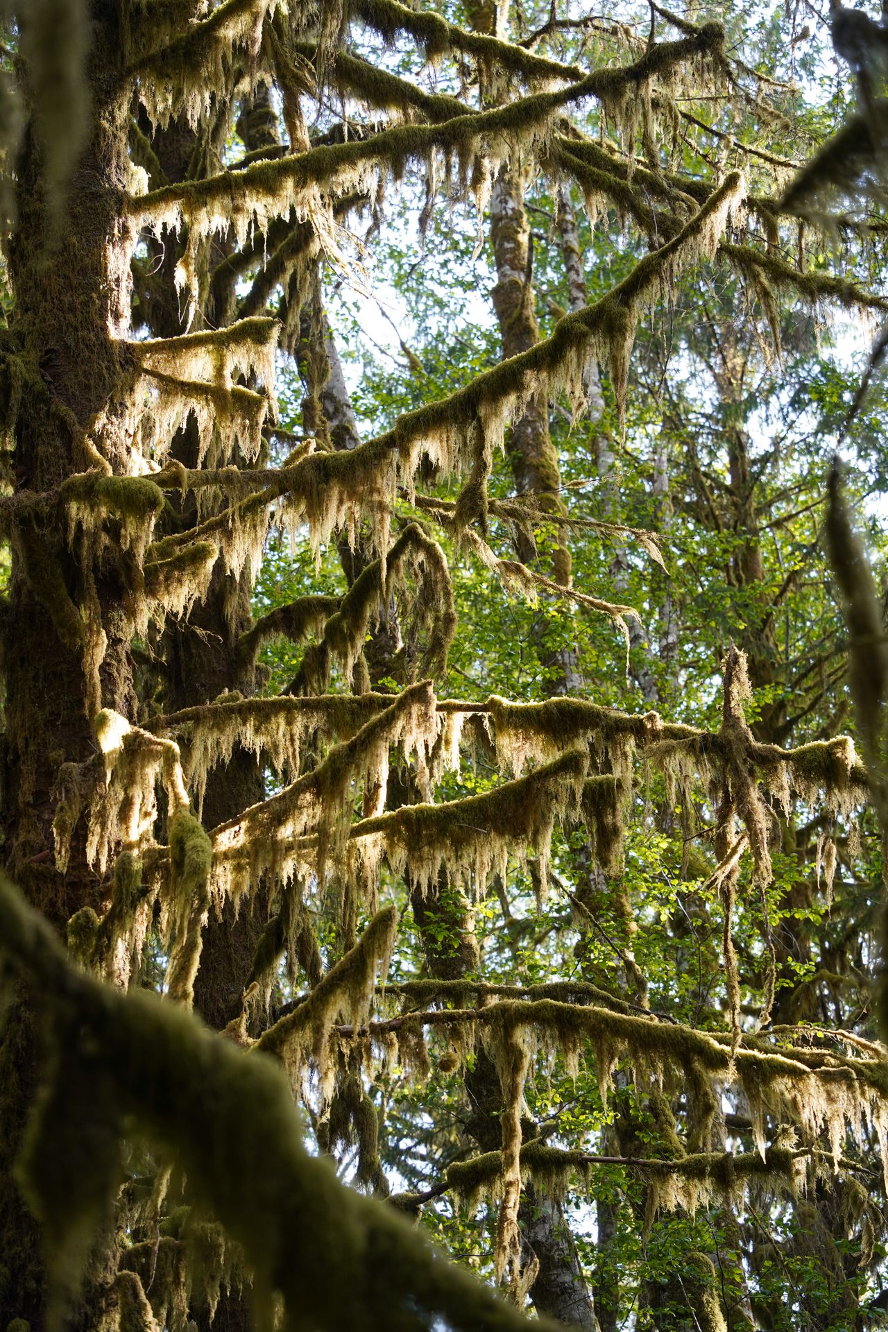
Sol Duc Falls is a lush waterfall that does a dramatic bend, and splits into three separate streams. The unique waterfall is surrounded by ferns and moss, and is an iconic sight in Olympic National Park.
You can reach the waterfall via a 1.8 mile trail, or you can add on more views by taking the Sol Duc River loop trail.
Please be careful and stay on the trail - people have died from climbing out onto the rocks at the top of the falls.
Other famous trails in Olympic are Hoh Rainforest, Marymere Falls, and Hurricane Hill. This park has a wonderful amount of variety.
Read my itinerary for Olympic National Park
19. Condor Gulch and High Peaks Loop, Pinnacles, CA
5.4 miles, 1,633 feet of elevation gain, rated hard
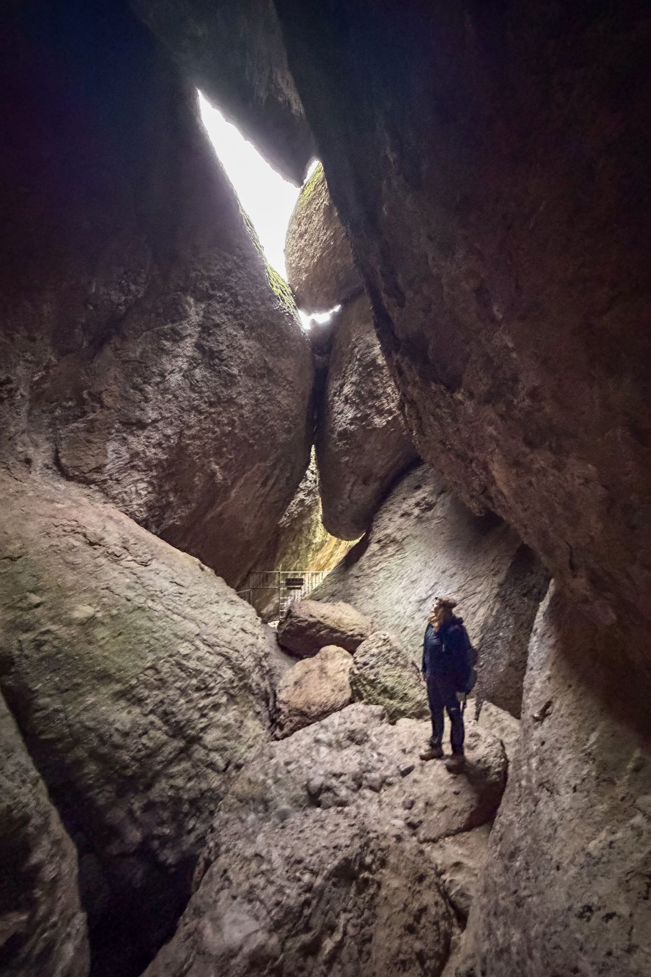
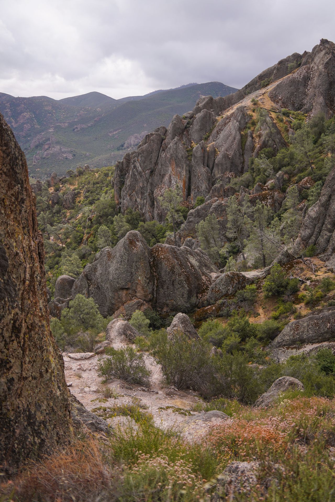
Combining the Condor Gulch, High Peaks, and Bear Gulch Cave trails is an amazing way to experience the best of Pinnacles National Park. You’ll enjoy mountain views, traverse through a cave, and have a great chance to see the famous California condors.
The High Peaks Trail has some exposed sections where you’ll be traversing a rock face that has steps carved into it. There are railings to hold onto, but this can be scary if you’re afraid of heights.
When you make it to Bear Gulch Cave, you’ll want a headlamp or flashlight to see where you’re going. The cave can be quite dark.
This trail is full of variety, and has so many amazing views. If you don’t want to do something this long, you can also pick and choose shorter versions of this route.
Honorable Mentions
- Highline Trail, Glacier, MT
- Ledges Trail, Cuyahoga Valley, OH
- Lower Sauma Ridge Trail, National Park of American Samoa
- The Subway, Zion, UT
- The Narrows, Zion, UT
- Moro Rock, Sequoia, CA
- Sky Pond, Rocky Mountain, CO
- Devil’s Garden, Arches, UT
- Greenstone Ridge Trail, Isle Royale, MI
Final Thoughts
I hope this guide gives you some amazing hikes to add to your bucket list! No matter what your hiking ability is, there are so many great ones in our national parks. Happy hiking!
For more national park hiking guides, check out these blog posts:
- The Best National Parks for Hiking
- The Best Hikes in Acadia National Park
- The Best Hikes in Bryce Canyon National Park
- The Best Hikes in Indiana Dunes
- An Epic Itinerary for Glacier National Park
- How to Spend 2 Days in Zion National Park
- How to Spend 2 Days in Rocky Mountain National Park
- The Best Things To Do in North Cascades National Park
- How to Spend 3 Days in Sequoia and Kings Canyon National Parks
- The Best US National Park Road Trips
Thanks for Reading!


Let's stay in touch!
Join the Lost with Lydia email list to get monthly travel guides and tips!